
NHC now has high risk of tropical cyclone development in western Gulf
20 minutes ago
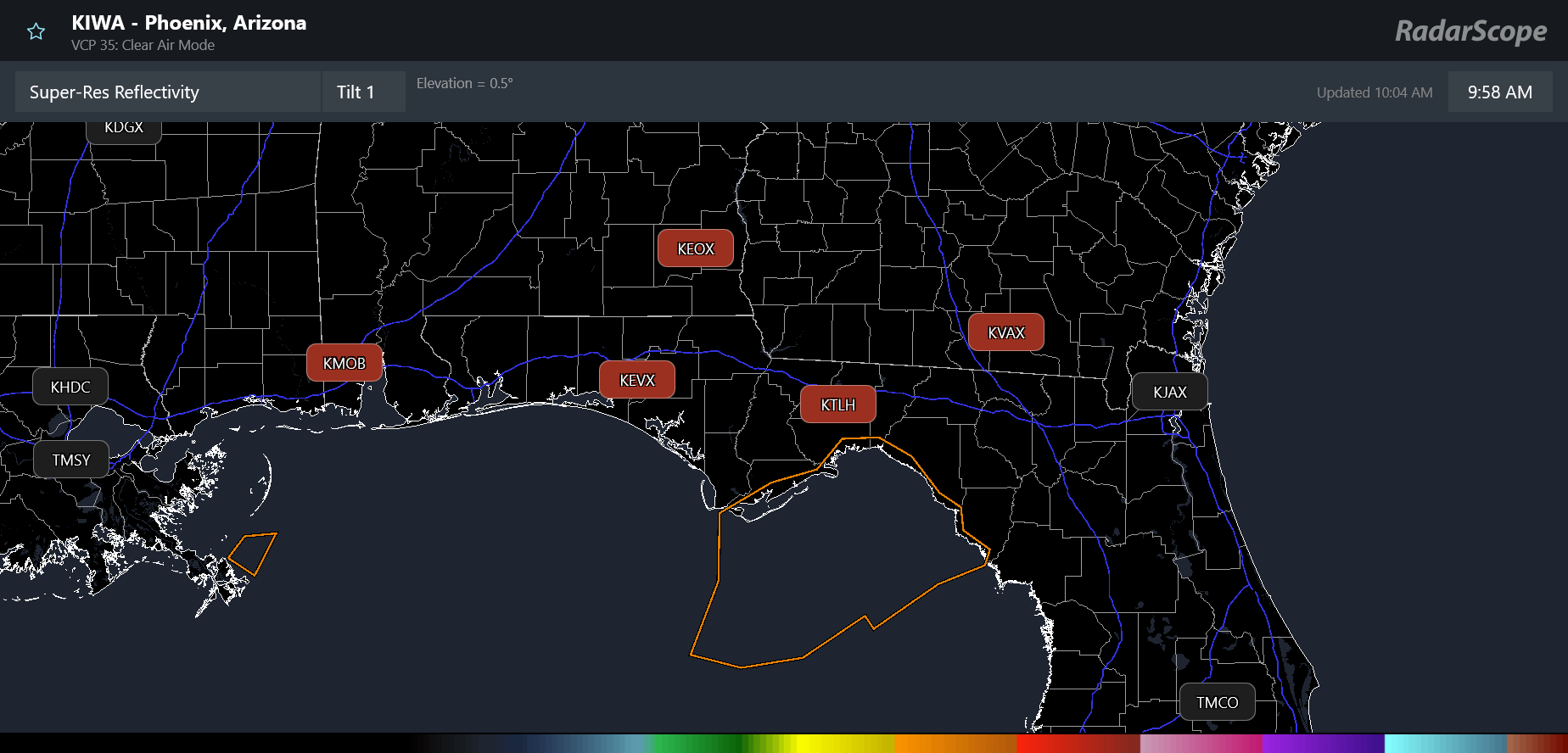
We are now in day 3 of the NWS comms issues along the Gulf Coast, after day 2 saw a fairly active day of storms with a number of flash flood and special marine warnings in the region, as well as a tornado warning near Mobile. Flash flooding was reported in Foley, AL and more than 6” of rain fell just northwest of Dothan, AL.
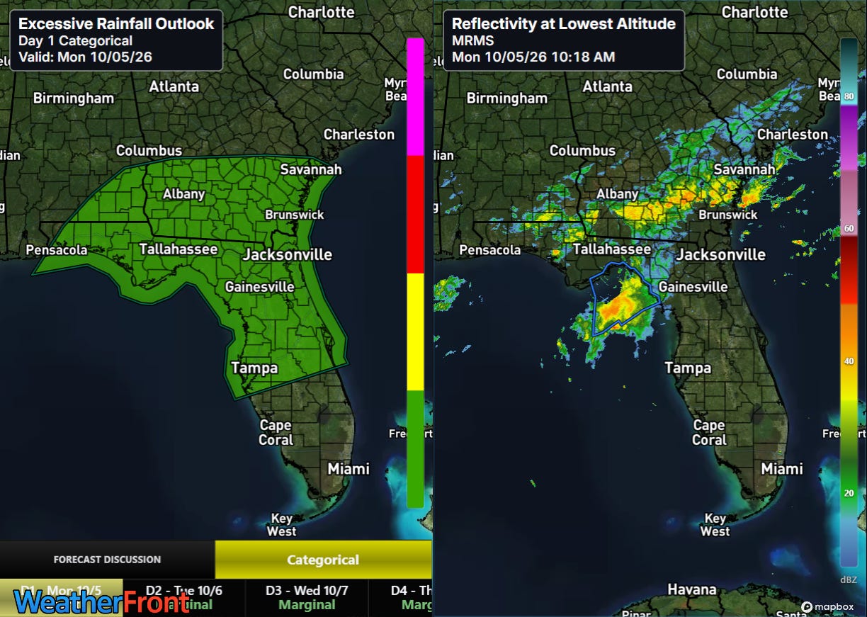
While the missing radar data (again, the issue is the data is not being disseminated due to the comms outage, the radars are operating) certainly impacts the ability to see low level features and details in storms across the impacted area, the MRMS radar mosaic (above right) has enough data from longer range radars to be able to depict the storm coverage — and we can see that much of the activity has shifted farther east toward the Southeast coast. A special marine warning is currently in effect for the Big Bend region, but overall thunderstorm activity will be lesser today and there is only a marginal risk of flash flooding as shown above left.
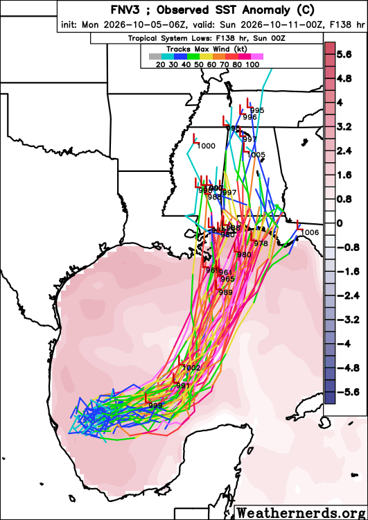
Hopefully this outage will not persist much longer, because unfortunately the models trended more bullish overnight with the system that NHC is monitoring in the western Gulf. The Google DeepMind AI guidance is particularly intense, with nearly all members developing the system and many making it a significant hurricane as it moves toward the central Gulf Coast later this week.
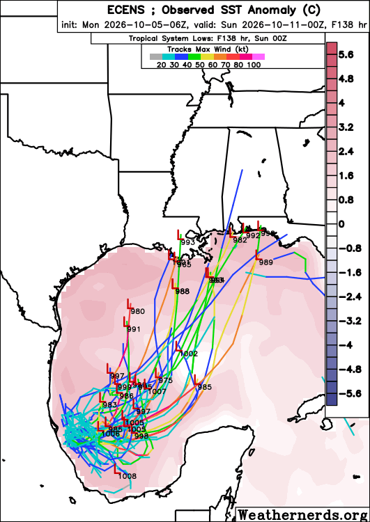
As I have discussed in posts this season, while the GDM AI guidance has set itself apart for track accuracy once a system develops, like all of the models currently it does still have struggles with genesis of a system and the forecast evolution before a system is well defined. In this situation, the top-of-the-line physics based modeling system, the European ensemble, is not as bullish as the GDM guidance — but still most members do show an organized system and a number of members have a solution similar to the GDM.
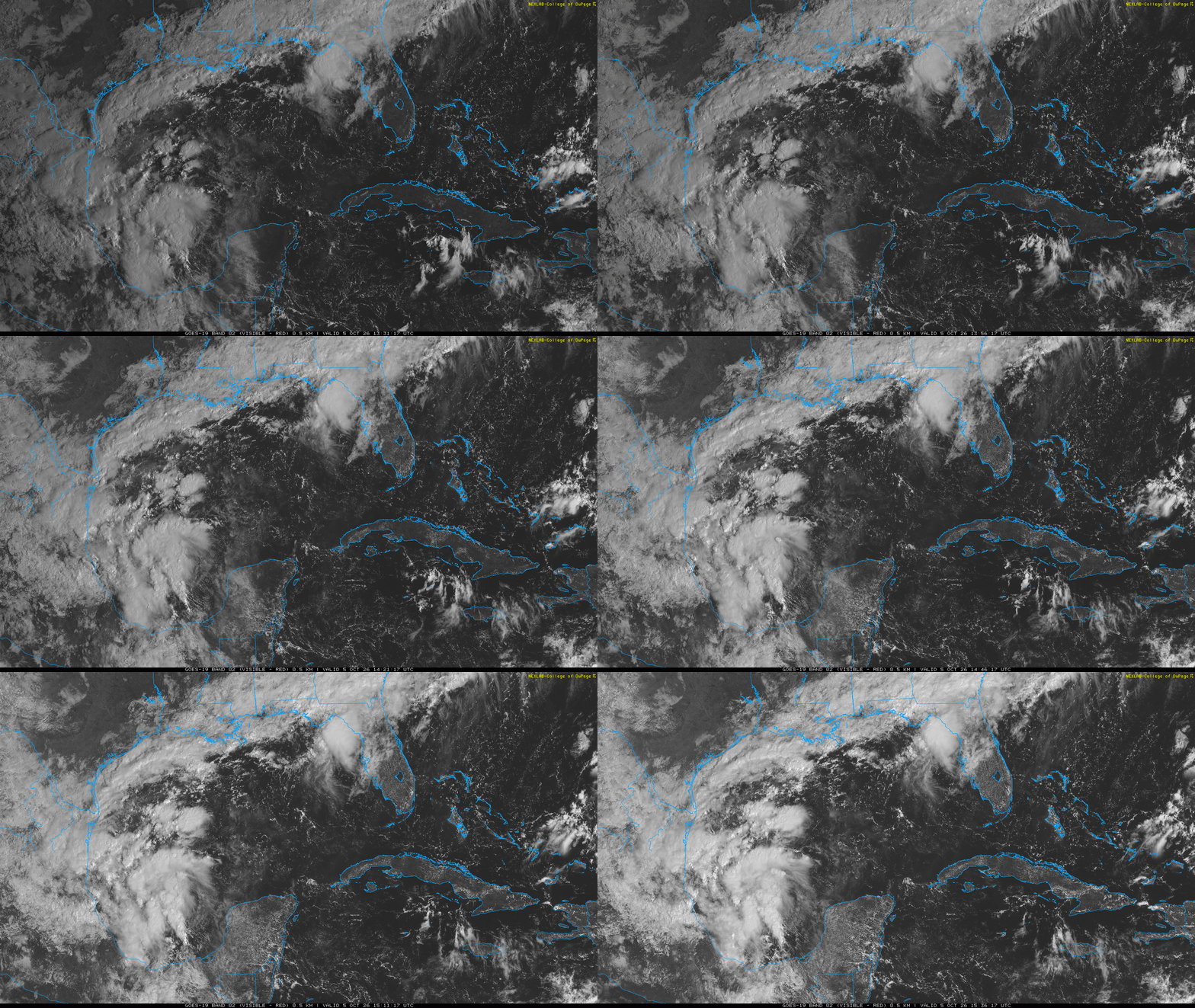
The area of disturbed weather has flared up in the last 24 hours, with clusters of thunderstorms across the southwestern Gulf of Mexico. NHC has increased the probability of development to 70 percent.
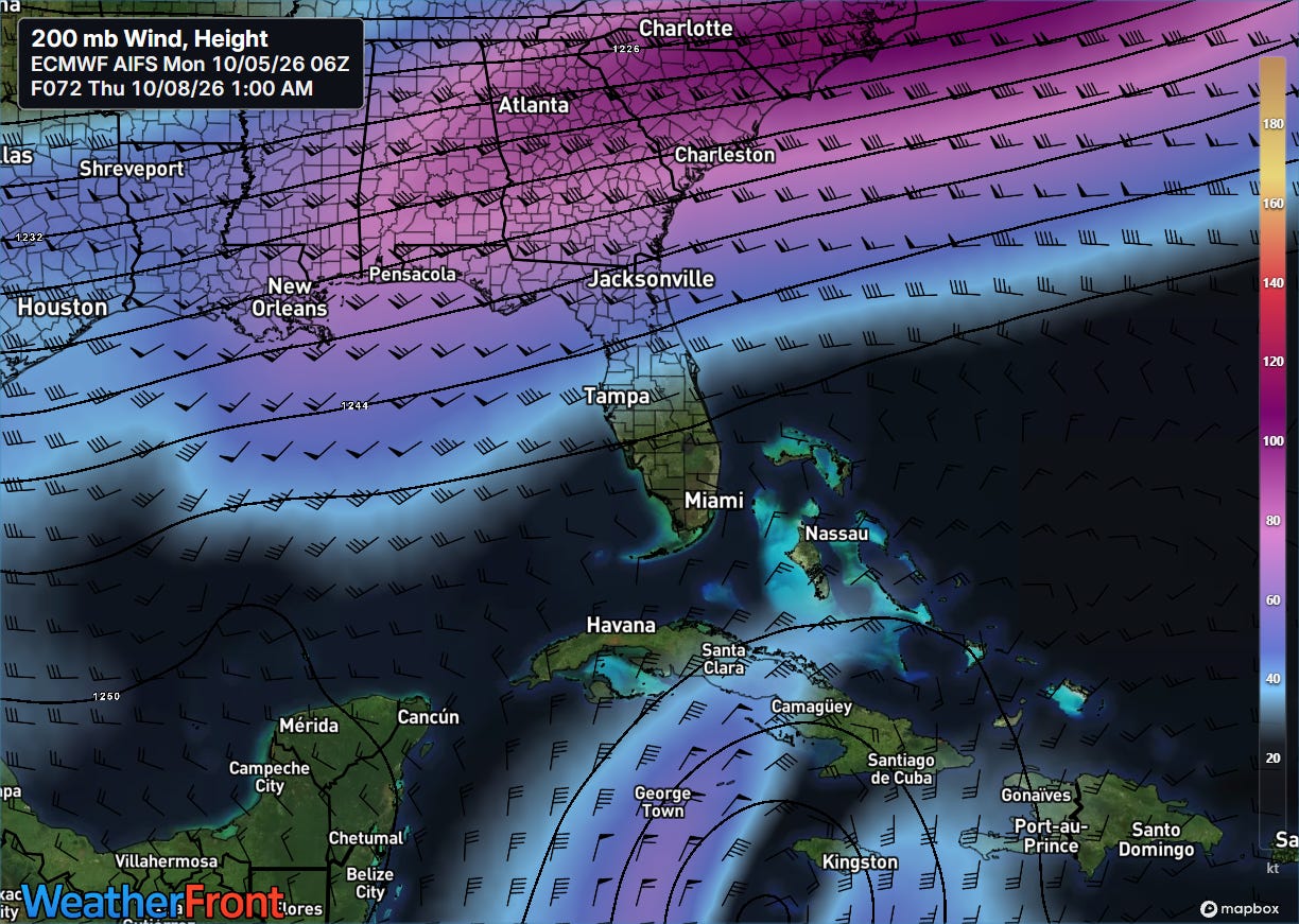
Looking at forecast upper level winds for later in the week, the more bullish model forecasts appear to be keying on the idea of the developing tropical cyclone becoming embedded in the right entrance region of an upper level maximum in the jetstream over the Southeast US. This is an area favored for intense thunderstorm development and reduced wind shear. Many intensifying Gulf tropical cyclones in the fall develop in such a jet stream pattern, so this solution is very plausible. However, there would also be more hostile conditions nearby, and a developing system in the eastern Pacific could also have negative impacts on the evolving Gulf system — so a less intense outcome is certainly still very much on the table. Obviously, this will be a situation that will bear close monitoring this week.
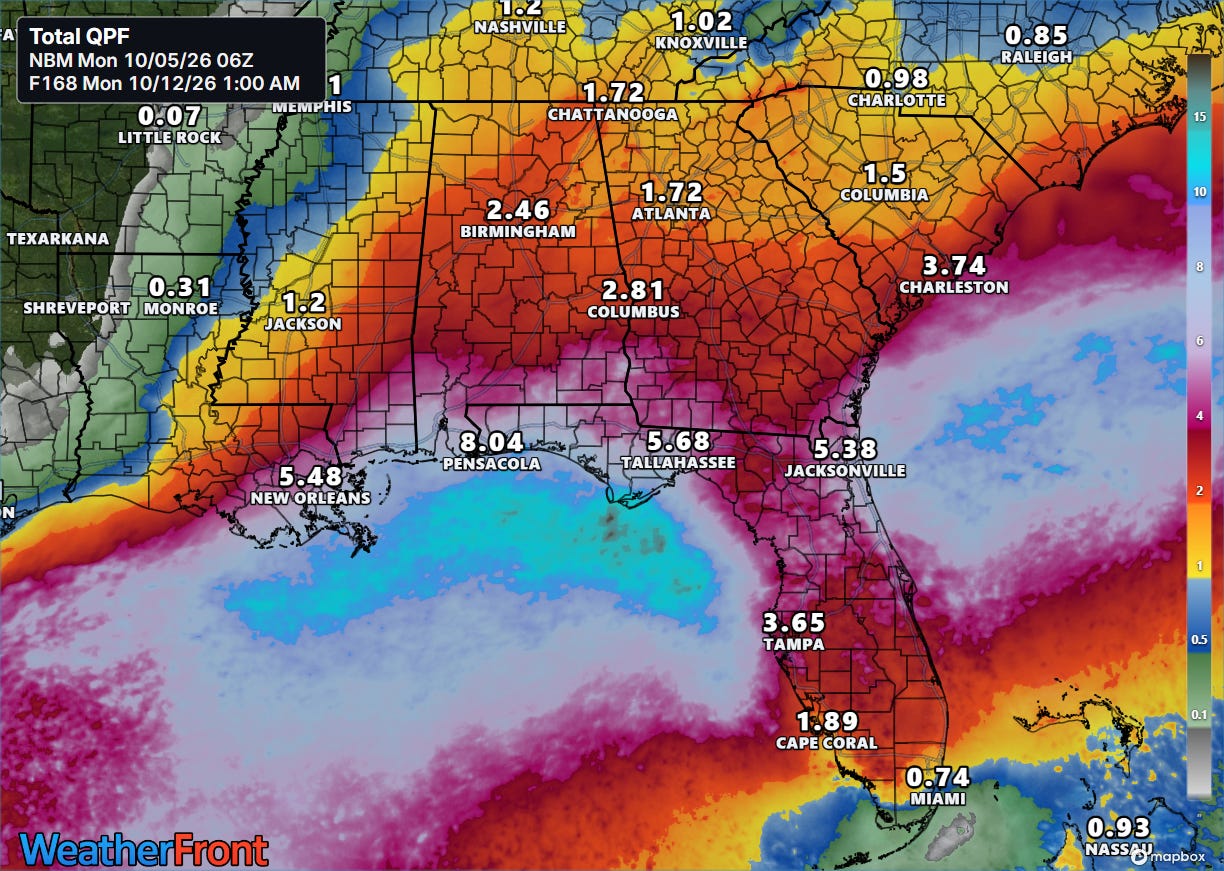
At a minimum, more heavy rainfall and potential flash flooding appears likely for the central Gulf Coast and Southeast during the latter half of the week and into the weekend.
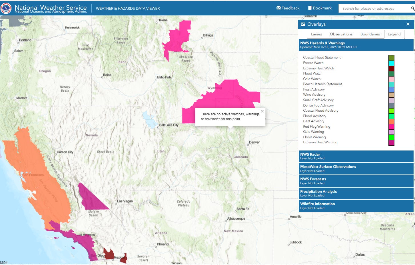
Meanwhile, the western United States will continue to deal with potential record heat much of this week, with extreme heat warnings and heat advisories in effect for large parts of California. Red flag warnings for increased fire danger concerns are in place today for parts of the Northern Rockies.


Leave a comment