
NWS comms issues in region resolved
8 minutes ago
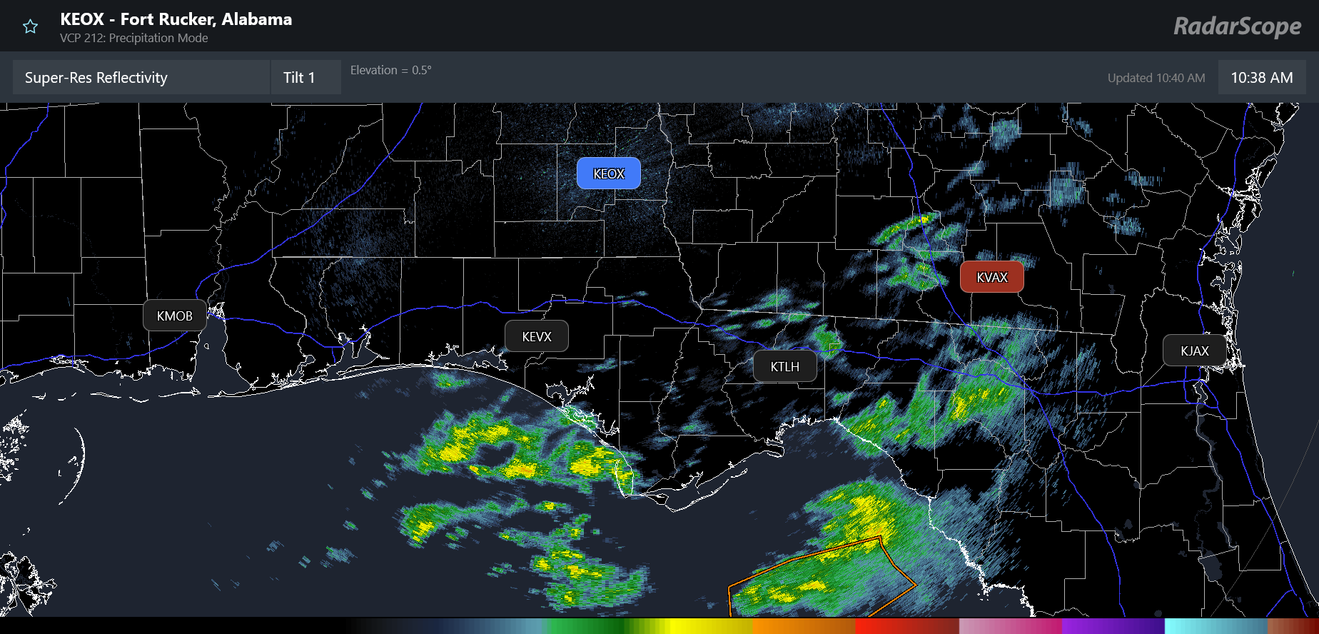
Starting off today with the good news that the NWS communications outage that was impacting NWS services and the availability of key radar data along the Gulf Coast was fixed yesterday afternoon after about a 60 hour outage. On the RadarScope image above you can see that KVAX is still red though — apparently the Moody AFB radar is suffering an actual hardware outage.
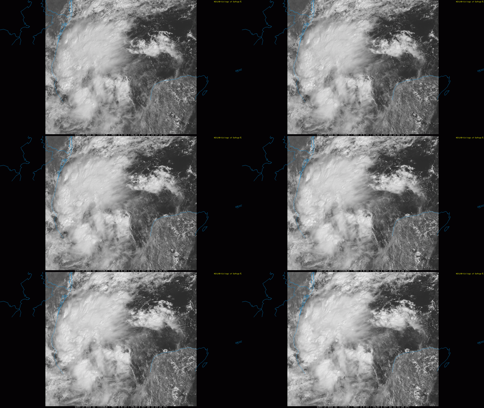
It is a good thing that this issue has been resolved, because it is appearing increasingly likely that the central and eastern Gulf Coast will be facing a high impact weather event later this week, courtesy of this evolving tropical disturbance in the western Gulf of Mexico. The system has been showing increasing signs of organization in the last 12 to 18 hours, and NHC is now giving it a 90% probability of becoming a tropical depression or storm within the next 48 hours.
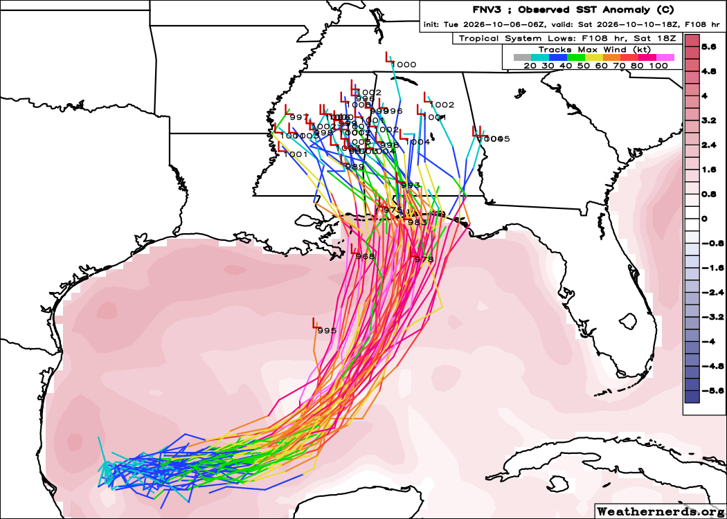
There continues to be a fair amount of uncertainty in the model guidance about how this system will develop. The AI based guidance (latest Google DeepMind shown above) continues to be more bullish with most members showing a significant hurricane impacting the central Gulf Coast region sometime late in the week.
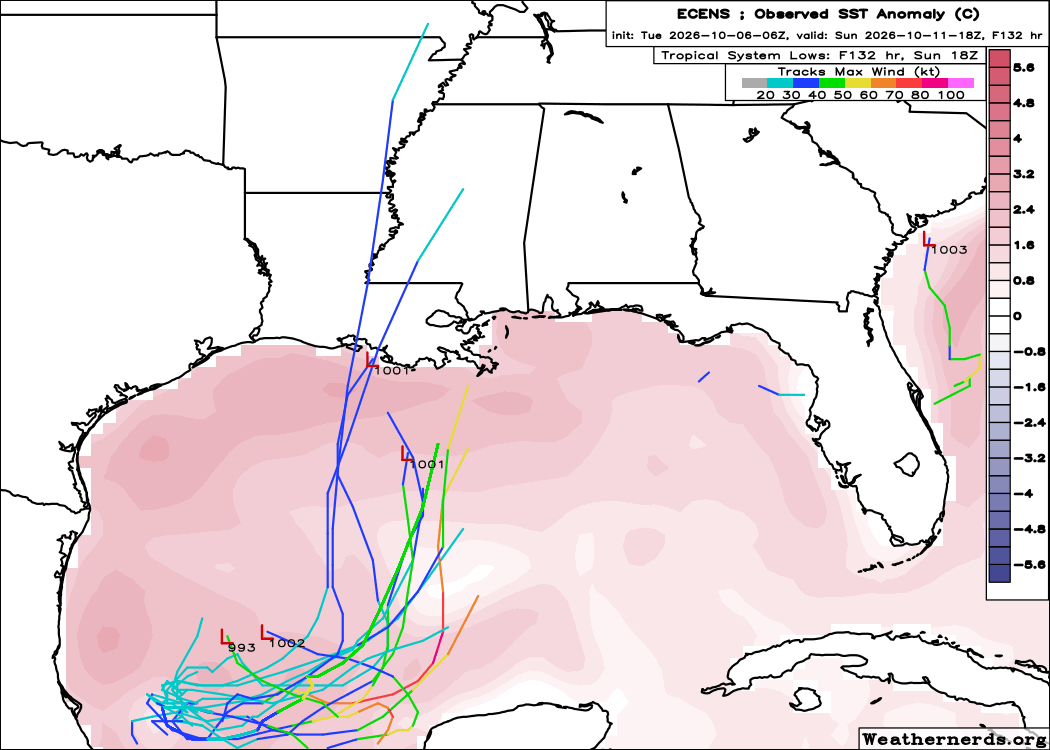
The physical based models (European ensemble shown above) are much less aggressive, showing a weaker system with track farther west toward eastern Louisiana or the Mississippi Coast.
The main difference appears to be in how rapidly the system develops — the AI models have a quicker developing system which “feels” more of the upper level flow sooner, allowing a farther east track into a more favorable environment provided by the upper level jet stream configuration I discussed yesterday. The physical models are slower to develop the system resulting in the storm tracking farther west in a less favorable environment. The recent satellite and observation trends show that the system does seem to be coming together relatively quickly, which would seem to support the AI solutions — but there is a lot of shear over the northern Gulf currently that could be an issue so I am not ready to fully buy off on the most aggressive forecasts.
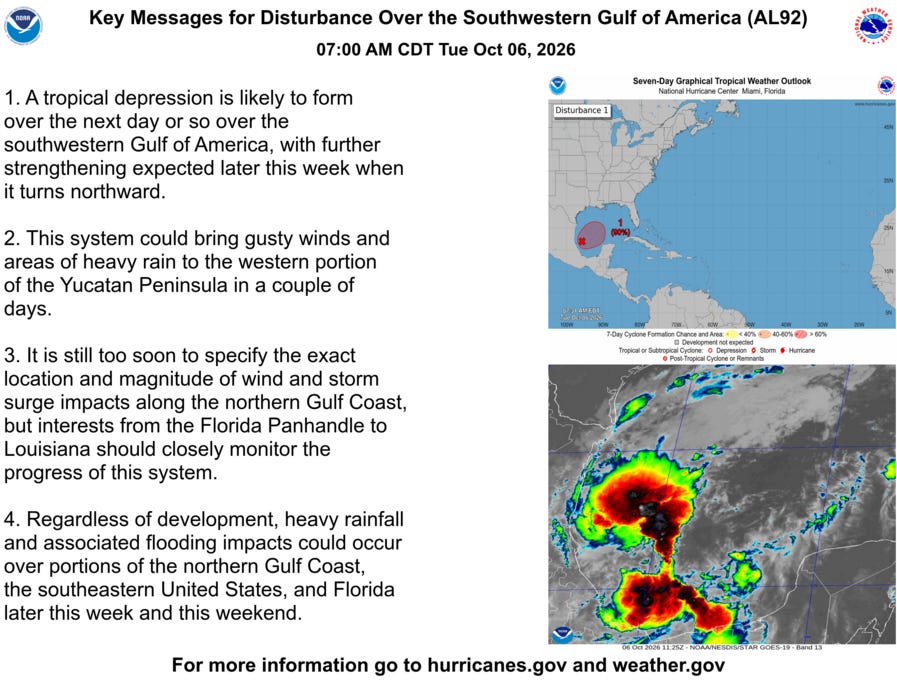
Regardless of exact intensity, it seems likely that at a minimum a strong tropical storm will impact parts of the northern Gulf Coast late in the week with gusty winds and heavy rainfall that will likely produce flooding. If the stronger side of forecasts end up evolving, a higher end event with significant storm surge and intense winds is possible. One thing to note is that even if a more intense hurricane evolves over the Gulf, it is possible it could undergo some weakening before landfall as it encounters stronger upper level wind shear near the coast.
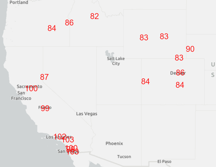
Meanwhile, the western United States will continue to deal with record heat, both numerous record highs (forecast records maxes shown above) and even more numerous record warm minimum temperatures. Numerous records were set again on Monday, including 84F at Cheyenne, 97F at San Diego, 88F at Salt Lake City, 87F at Denver, 104F at Downtown LA, and 101F at LAX Airport. The 101F at LAX was the third consecutive day of 101F or higher — only once has there been a period of 4 consecutive days with a high of 100F or higher (September 1963).
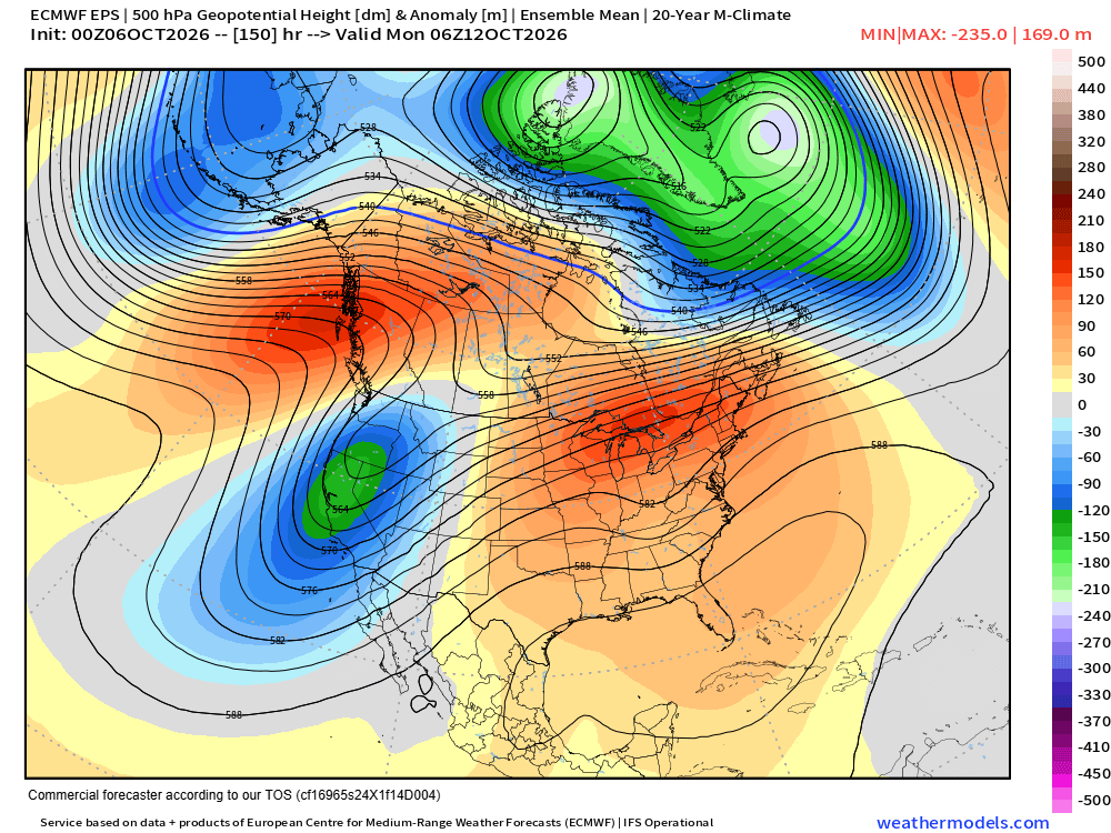
The unusually hot weather pattern in the western United States does look as if it will come to at least a temporary end by this weekend as the strong middle and upper level high pressure area will be replaced by a strong trough of low pressure. This system will likely once again steer at least tropical moisture into the Southwest US — and potentially more organized remnants of an eastern Pacific tropical system. More to come on that in the next few days.
I will be providing occasional updates about all of this between newsletters via social media, Substack Notes and Substack Chat (paid subscriber benefit).


Leave a comment