
Climate and weather factors combined with astronomical peak tides to produce all-time water levels
14 minutes ago
Thanks for your patience this week as I am traveling. Sharing a quick evening post on a couple of items, first a recap of the coastal flooding on both coasts.
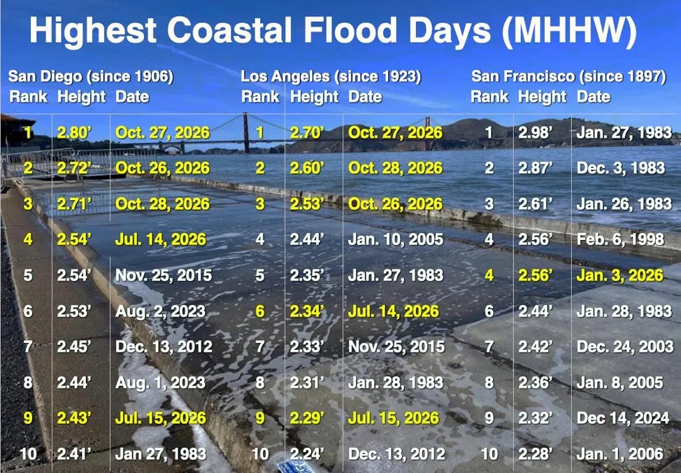
Thanks to Dr. Jeff Masters (who is sharing incredible content about all of this on his great BlueSky feed) for this table of top 10 highest tide levels at San Diego, LA, and San Francisco, showing that the prior 3 days have seen the three highest tidal floods on record for both San Diego and Los Angeles. Both sites have now seen 5 of their top 10 levels happen in the last four months, primarily due to unusually warm sea surface temperatures and Kelvin wave phenomena related to El Nino. While the flooding has not been as severe farther north, San Francisco did set an October record with the flooding earlier this week.
My colleague Chris Gloninger posted an excellent short video today sharing how the worst is likely yet to come along the California coast, as NOAA tidal projections suggest that the monthly high tidal cycles in late November and December will be significantly higher than these most recent levels.
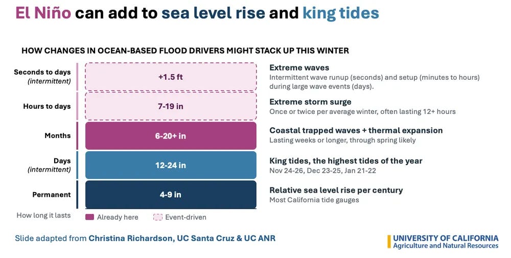
Again, the flood events this week occurred during relatively benign weather, and are a result of a combination of climate factors including long term global warming. If high winds and waves accompany either of the upcoming high astronomical tidal cycles, we could be looking at a coastal flood event with major societal impacts well beyond what have already been seen.
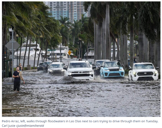
Meanwhile, on the other coast, the astronomical high King Tides have been accompanied by strong onshore winds along the Southeast coast. Miami tidal level exceeded major flood stage on two consecutive days for the first time ever.
The peak water levels this week were similar to levels seen in hurricanes Wilma and Irene, and the highest non-hurricane related tide level ever recorded at the Virginia Key gauge since it was installed in 1994.
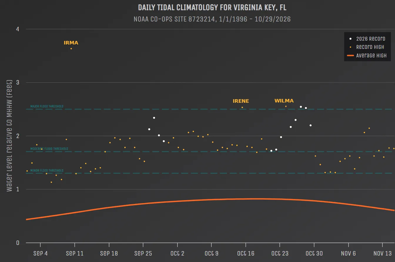
Hurricane Irma holds the record level, about a foot higher than what was observed Tuesday.
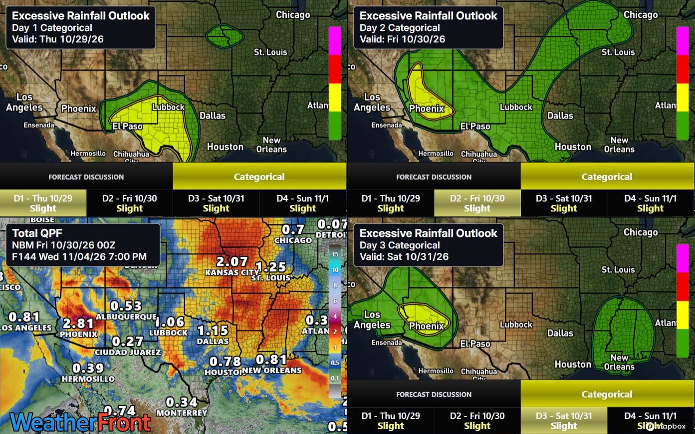
As we head toward the weekend, a wet weather pattern will evolve across much of the western and middle parts of the country, bringing additional flooding risks to parts of the Southwest and beneficial rains to the Mid-South.
FYI: I will be traveling this upcoming week for work I am doing for an educational project, as well as a few days of vacation. I plan to make some occasional posts, but the frequency will be less than usual.


Leave a Reply