
Record flood crest continues moving down the San Juan River, but will also bring beneficial water to Lake Powell
4 minutes ago
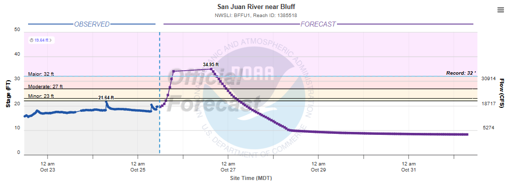
The historic flood moving down the San Juan River in the Four Corners region is approaching the region around Bluff, UT this morning, where it is expected to rapidly push water levels to a record level later today. All of the upstream gauges on the river from Farmington to Shiprock, NM were taken out of commission by the flood, so I am guessing that is adding a challenge to the river forecast here. Assuming the river does reach the forecast crest of 35’, it would easily break the previous record of 32’ set in 1927.

The flooding is devastating communities and homes in the Four Corners region and and the Native American nations along the San Juan and other tributaries and streams in the region. KOB-TV in Albuquerque yesterday reported that thousands of homes and buildings are thought to have been impacted by flooding, and that as many as 300 people may have need to have been rescued in San Juan County, NM since the flooding began.
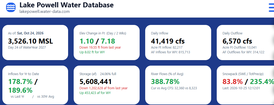
While the flooding is obviously horrible, one benefit is that all of this water will eventually make it into Lake Powell, one of the major reservoirs along the Colorado River that has been at historically low levels due to multiyear drought. Lake Powell has already risen 7’ in the last 2 weeks due to all of the heavy rainfall in the region, and Colorado River flows are running nearly 4 times their normal levels for this time of year.
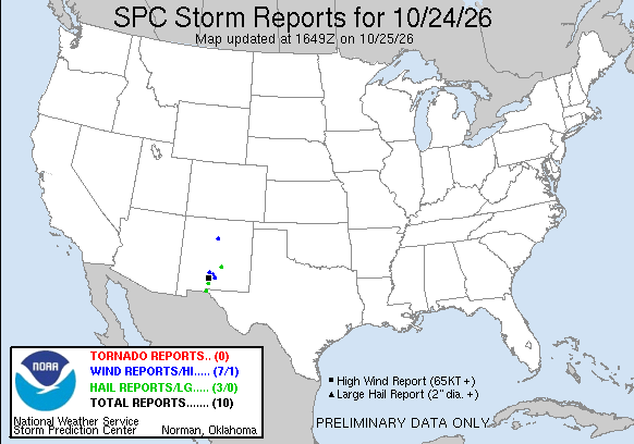
The weather system responsible for the flooding continued to produce thunderstorms with severe weather and some flash flooding on Saturday. A rare tornado was reported to have touched down and caused damage in the city of Santa Fe Saturday evening — local officials told the Albuquerque Journal they were not aware of a tornado ever occurring in the city before.
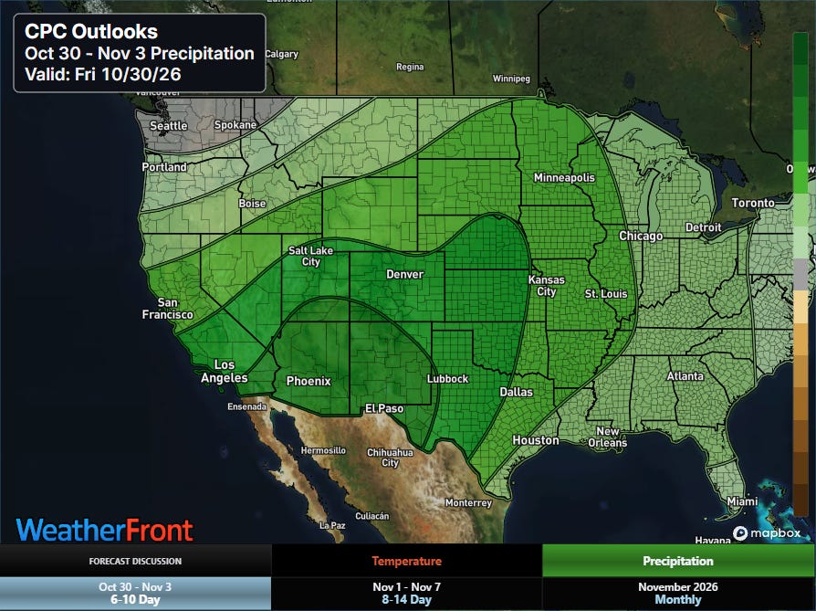
While the weather will gradually quiet down in the region into early week, a new strong trough of upper level low pressure is expected to evolve along the West Coast late in the week, bringing a return of active weather to the Southwest by next weekend.
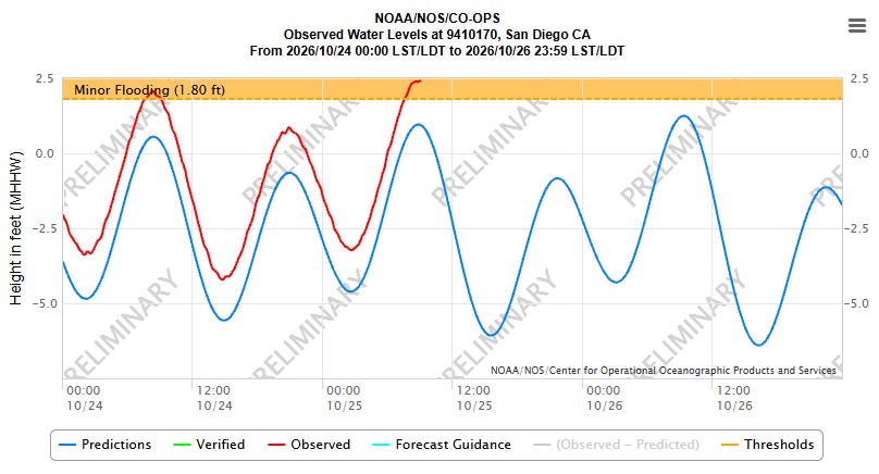
The other big weather story this weekend is ongoing coastal flooding along both coasts due to a combination of astronomical high King Tides and meteorological factors. On the West Coast, water levels are abnormally high due to the ongoing strong El Nino, and as a result water levels are expected to approach record high levels during the highest tidal cycles the next few days. Coastal flood warnings and advisories are in effect for much of the California coast.
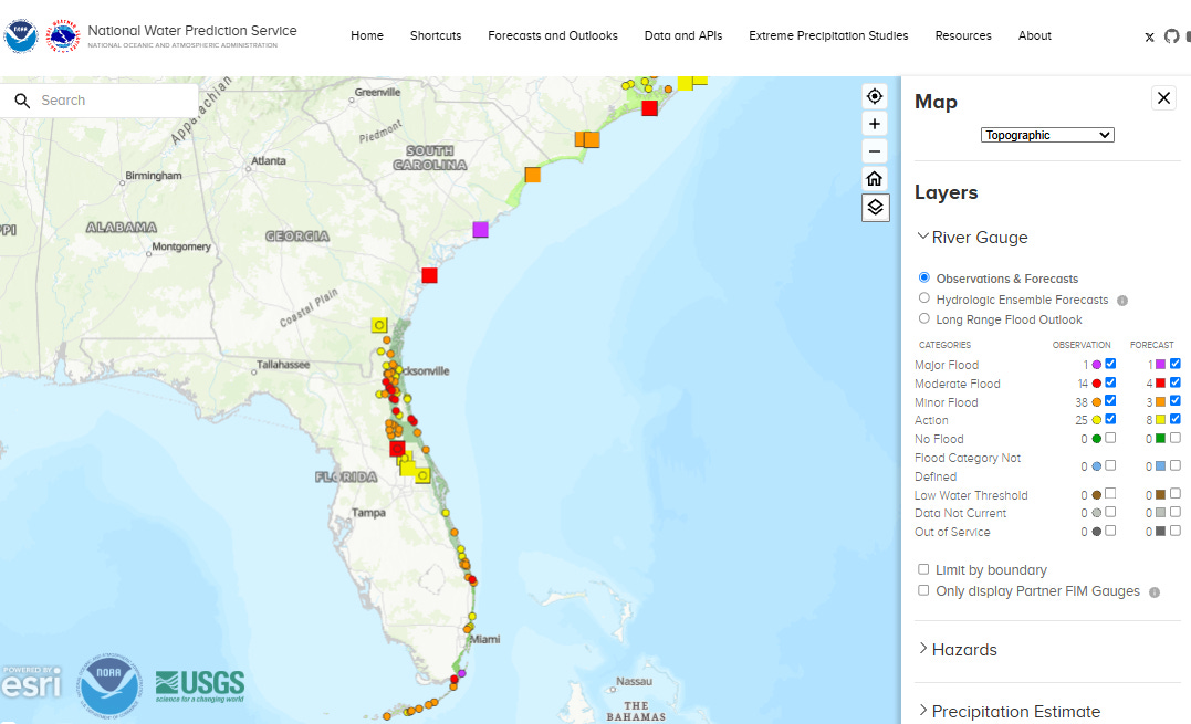
Along the Southeast coast, widespread minor to moderate and localized major coastal flooding occurred with this morning’s high tide — a combination of the King Tides and strong onshore winds between building high pressure to the north and an area of low pressure near the Bahamas.
This event will continue for the next several days as astronomical tides peak and strong northeast winds continue, particularly across Florida. Major beach erosion, serious rip currents, and strong winds are also anticipated along the coast in addition to the coastal flooding.
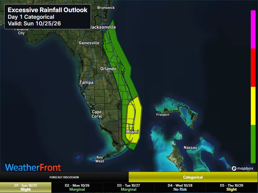
The flooding risks in south Florida could also be amplified over the next couple of days as showers and storms moving off the Atlantic will cause localized heavy rainfall.
FYI: I will be traveling this upcoming week for work I am doing for an educational project, as well as a few days of vacation. I plan to make some occasional posts, but the frequency will be less than usual.


Leave a Reply