
Wet pattern looks to return to the Southwest later next week
11 minutes ago
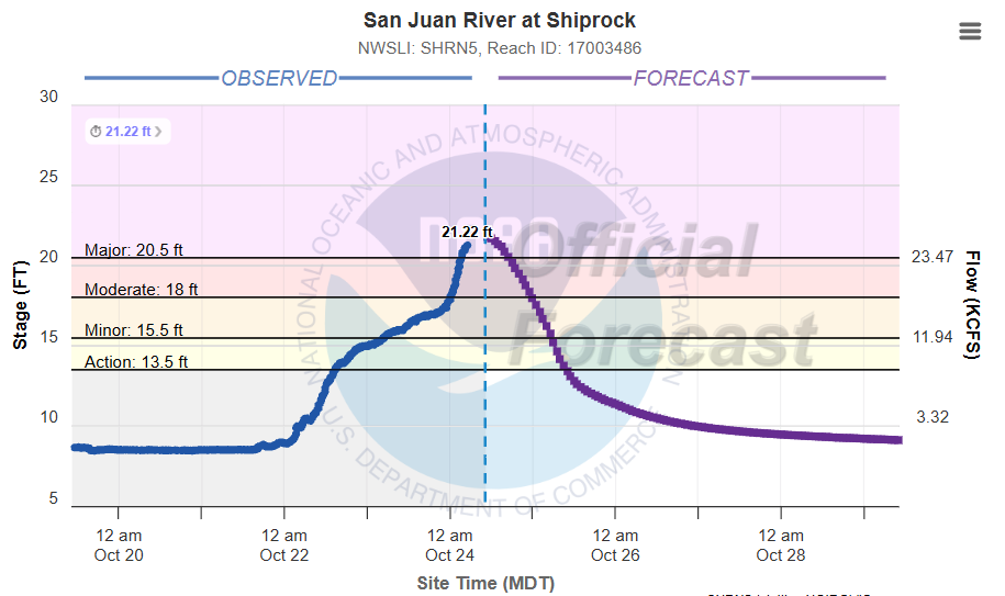
Starting off this morning with an update on the historic ongoing flooding in the Four Corners region. The San Juan River at Shiprock, NM is cresting this morning in major flood, a bit below yesterday’s forecast crest but several feet above the prior highest crest of 14.5’ reached in May 2005.
The river gauge upstream on the San Juan at Farmington, NM appears to have failed yesterday as the river was rising rapidly and was 2 feet above its prior record. The gauge on the Animas River which flows into the San Juan at Farmington also failed, so we are not sure how high exactly the river levels reached in the area reached. NWS Albuquerque senior hydrologist said in a briefing yesterday afternoon, “The river really hasn’t flooded like this since they built Navajo Dam to try to keep it under control. We are getting reports of widespread devastation throughout the town, and I’ve seen some of the photos — it is truly remarkable what’s happening.”
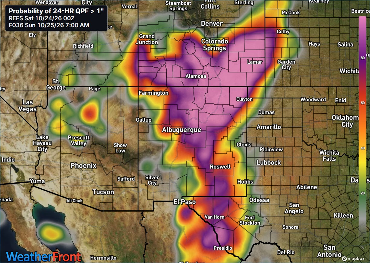
Additional showers and thunderstorms with heavy rainfall are expected across parts of southern Colorado and northern New Mexico today, but as of now are expected to remain scattered enough to allow river levels to continue to fall in areas where the main flood wave has passed.
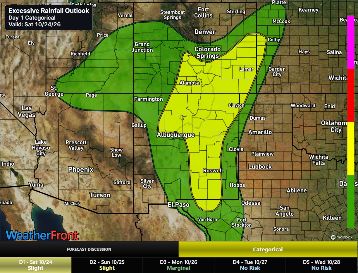
Given the wet antecedent conditions and high water levels in the region, flash flooding is a concern in areas where heavier showers and storms move through.
Scattered severe storms are also expected this afternoon and evening, with large hail and potentially a couple of tornadoes the primary risks.
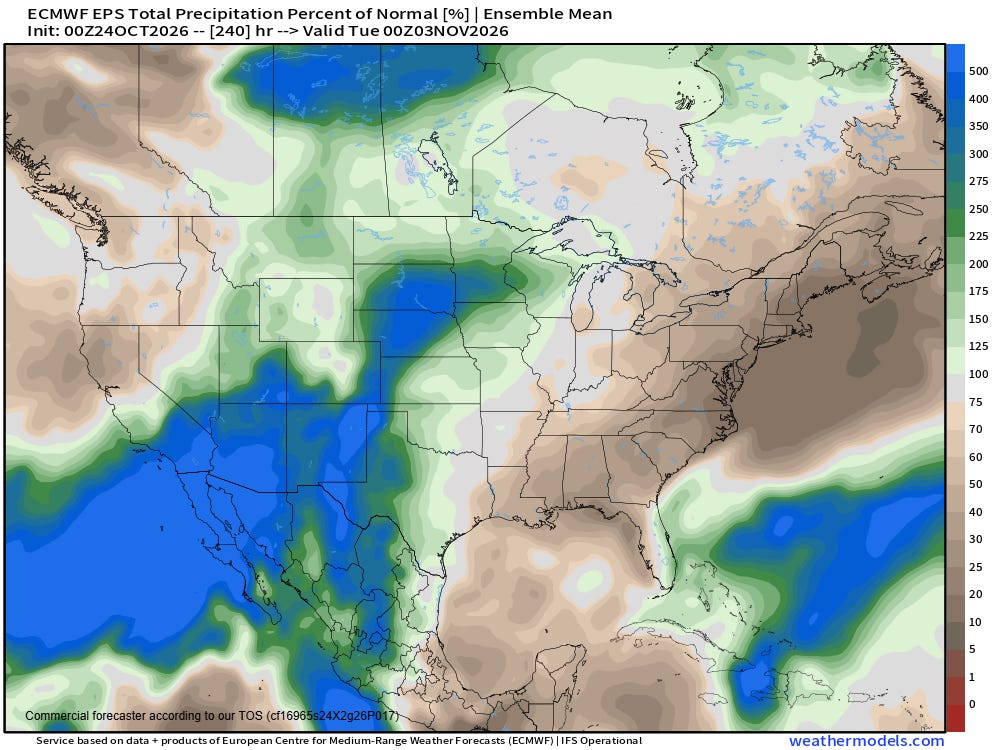
While things will be drying out into early next week, the reprieve looks temporary as another trough of low pressure is expected to set up along the West Coast and bring well above normal precipitation in the Southwest late next week into early the following week. The record El Nino certainly seems to already be rearing its head fully as far as enhancing the stormy pattern in this region.
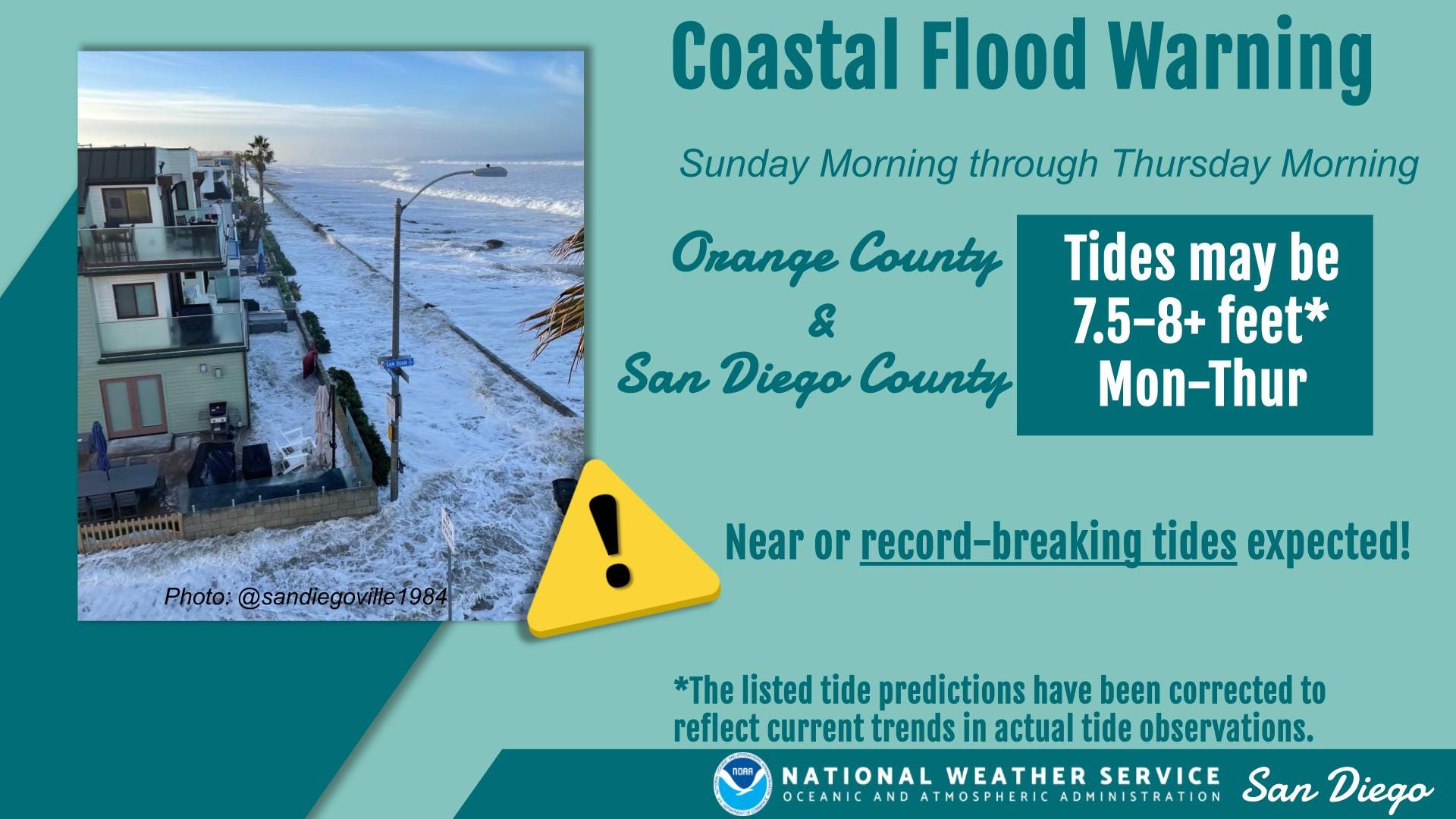
I talked in yesterday afternoon’s newsletter about the anticipated serious coastal flooding along the Southeast coast due to the combination of astronomical King Tides, strong onshore winds and (in south Florida) heavy rainfall. High astronomical tides combined with elevated water levels due to El Nino are also expected to cause coastal flooding along the California coast — particularly in southern California where record water levels are possible and coastal flood warnings are in effect.
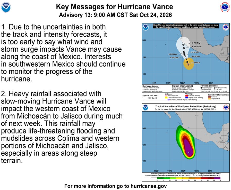
Hurricane Vance is also a feature of interest in the Pacific, as it meanders off the southwest coast of Mexico with maximum sustained winds of 105 mph. Hurricane forecasts in the eastern Pacific have been a particular issue in the last few weeks as weak steering currents and leftover pools of cooler sea surface temperatures have made track and intensity forecasts extra challenging. Vance is no exception as it has been tough to gauge its intensity trends — for now it is going through a weakening phase as it moves over cooler waters but is expected to rebound in a couple of days. Regardless, as of now it looks as if it should stay offshore for at least the next several days.


Leave a Reply