
San Juan River at Pagosa Springs, CO forecast to approach record and exceed levels of recent serious floods
I want to start off this update on the potential serious flood situation evolving in the Southwest by sharing this excellent blog post from my colleague Dr. Russ Schumacher about last week’s heavy rainfall and flood event in the region. Russ is the Colorado state climatologist, and he does an incredible job of giving some of the science behind the event and contextualizing the magnitude of the rainfall in the southern part of his state.
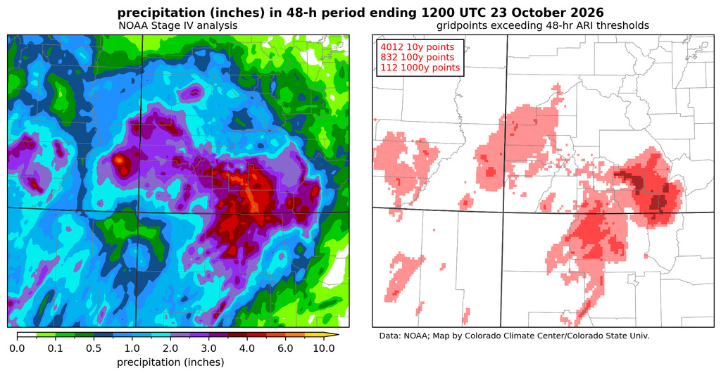
I strongly encourage you to read the entire post, but I want to highlight his analysis of the rainfall above that shows that for large parts of the San Juan Valley in southern Colorado the 2-day rainfall ending October 23 was a 1% exceedance event, and for many areas was a .1% (so-called 1 in 1000 year event).
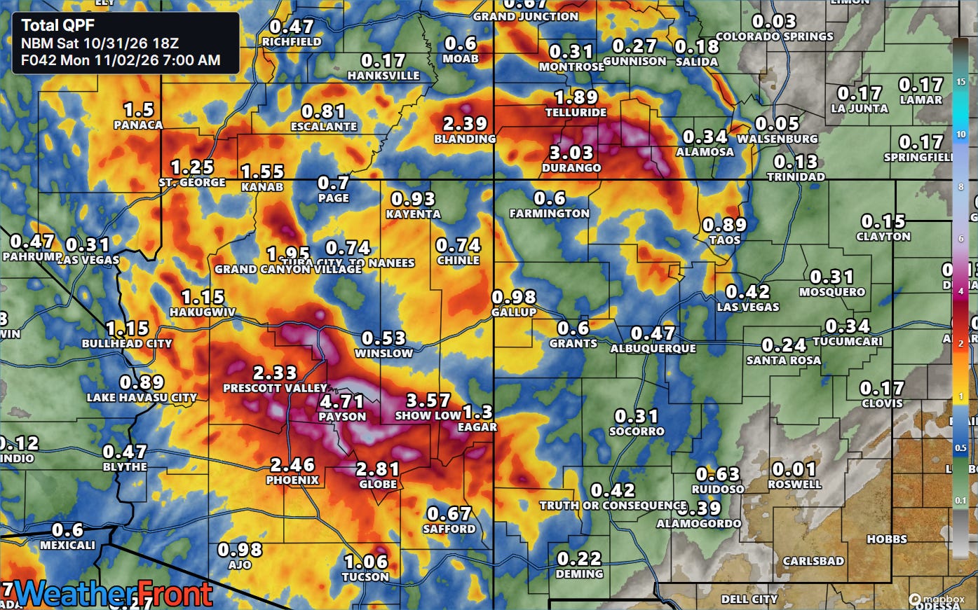
Turning to the event currently evolving over the Southwest this weekend, we can see that while the extent of extremely heavy rainfall is not as currently forecast to be as widespread in southwest Colorado as last week’s, for some areas from Durango and Telluride to west of Alamosa, similar precipitation amounts are forecast. Additionally, widespread very heavy rainfall is forecast for central parts of Arizona, particularly the higher elevations north and northeast of Phoenix.
While some snow will fall at the highest elevations in the Four Corners region, this will be a warm storm system and hence much of the precipitation will fall as rain. Given the extremely wet antecedent conditions from last week’s extreme rainfall and ongoing rains over the last several weeks, large amounts of rapid runoff are expected.
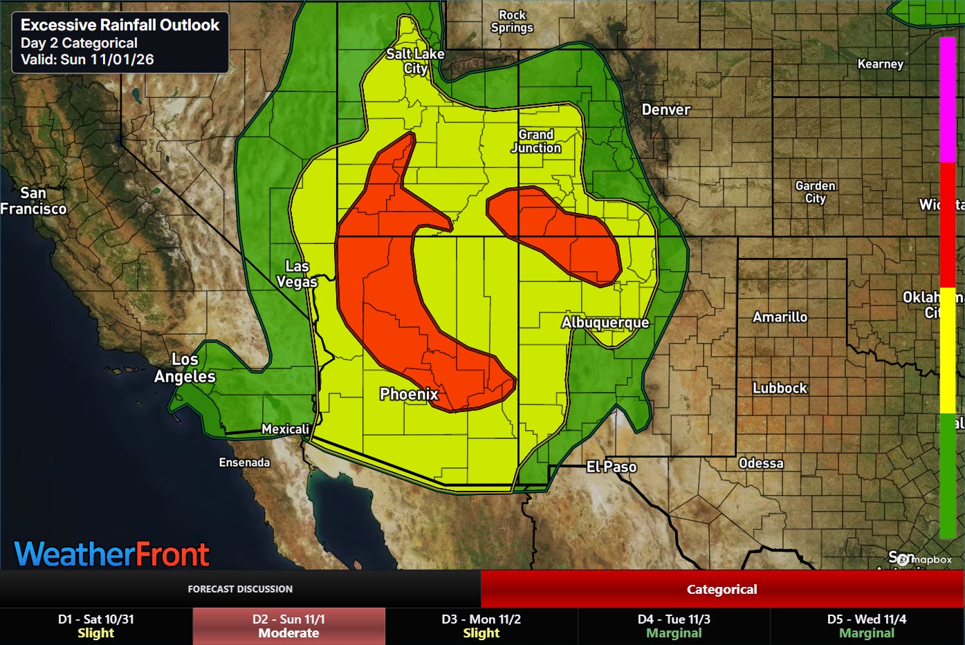
As a result, significant flash flooding is anticipated where the heaviest rainfall intersects the most vulnerable areas.
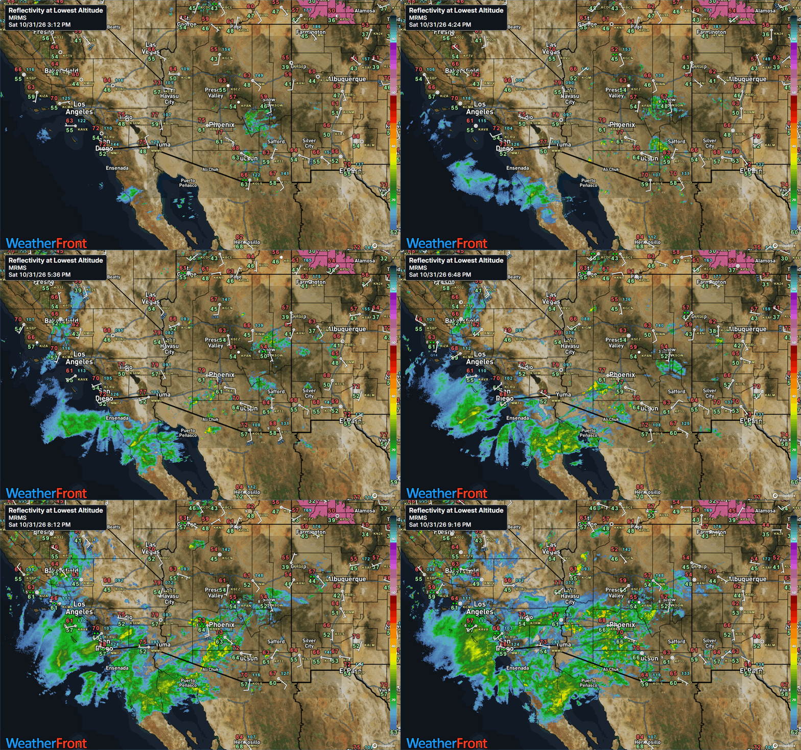
Heavy rain showers have been expanding over southern California and Arizona the last several hours, and this trend will continue with an increasing risk for localized flash flooding issues. The flooding risk will expand northeast and increase overnight and into Sunday as the responsible storm system moves east.
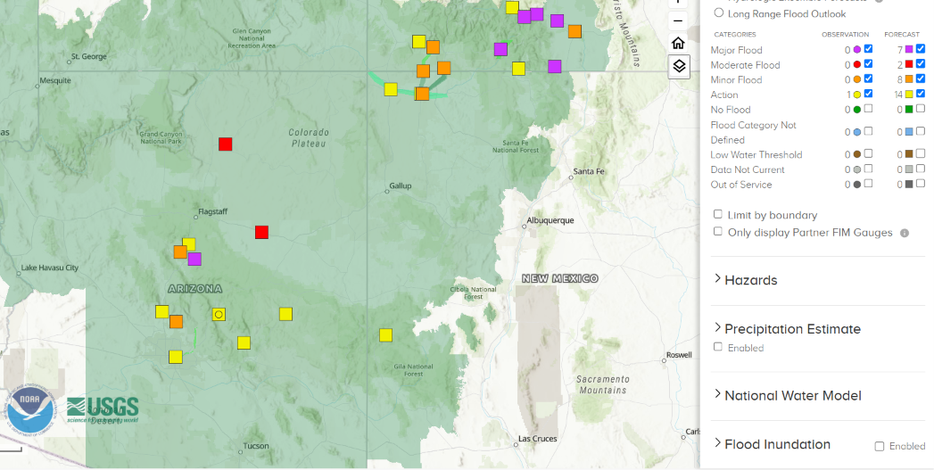
In addition to flash flooding, significant river flooding is anticipated again with this event, particularly in southern Colorado where several gauges are forecast to rise to near record levels.
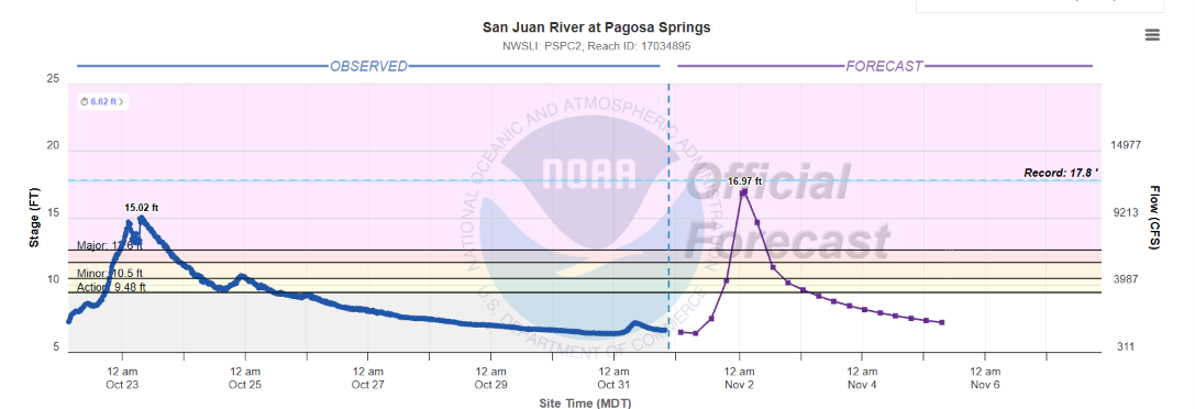
This includes the San Juan River at Pagosa Springs, CO, which has seen major flooding three different times since last October and is forecast to exceed all of those floods with a crest near 17’ Monday morning.
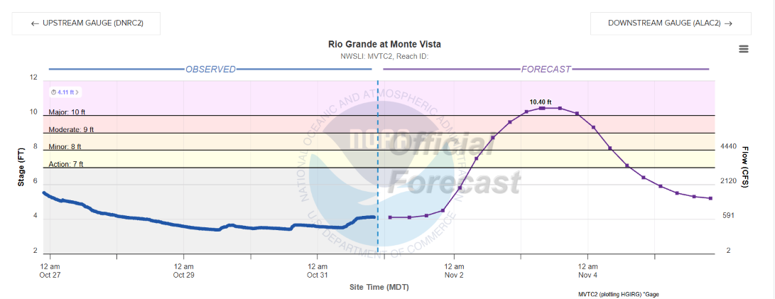
The Rio Grande at Monte Vista, CO is forecast to crest on Tuesday at more than 2’ above its previous highest crest (8’ in June 1949). Downstream at Alamosa, the forecast crest is just below the record of 10.6’ (also in June 1949).
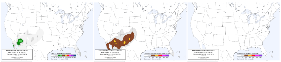
While severe weather is not expected to be as widespread or impactful across the Southwest as with the system last week, a few severe storms will be possible into Sunday as shown by the Nadocast AI system. Damaging winds will be the main risk but a couple of tornadoes are possible, mainly in Arizona.
FYI: I will still be traveling through Monday, but will attempt to share updates about this ongoing situation through social media posts, Substack notes and chat (paid subscriber benefit).


Leave a Reply