
Record floods hit rivers in Arizona and southwest Colorado
just now
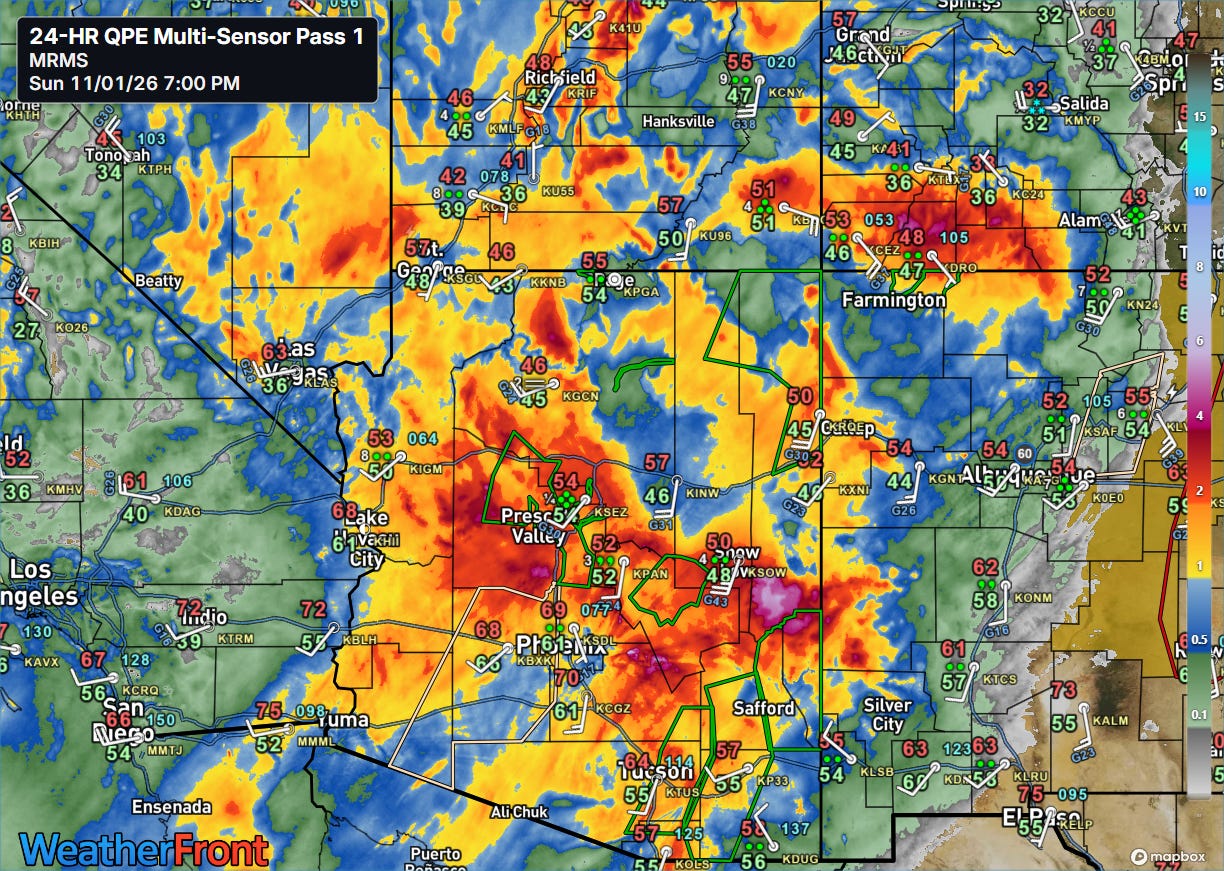
Just a little more than a week after historic flooding devastated parts of the Four Corners region — particularly the San Juan River basin — another major rainfall event is pummelling the region. In the last 24 hours, widespread heavy rainfall of up to 5” has hit much of central and northern Arizona, as well as the higher elevations of southwest Colorado.
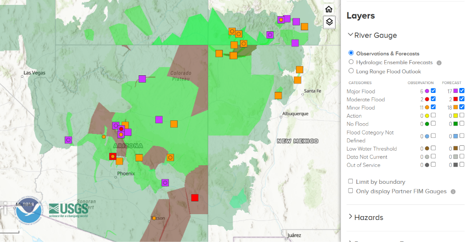
Flash flooding has been an issue in parts of Arizona, and a number of river gauges are currently in major flood or expected to reach major flood stage overnight into Monday.
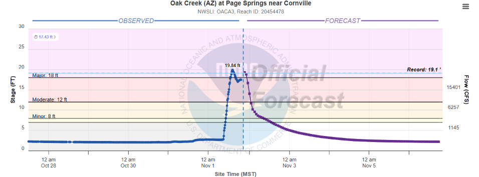
This includes the stream that runs through Sedona, AZ — Oak Creek. The river crested above flood stage on the Sedona gauge and just downstream at Page Springs hit a record (records go back to at least 1964). Flooding impacted homes and other buildings in the region resulting in evacuations and water rescues.
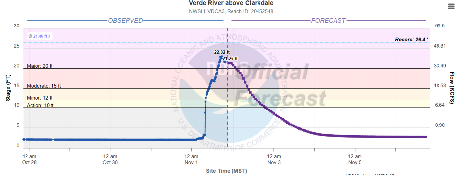
Oak Creek runs into the Verde River, which recently crested at its second highest level ever near Clarkdale (record was set in 1993, records go back to the early 1900s). Per NWS impact statements, numerous homes have likely been flooded with this river level. Evacuations were ordered in the area around Camp Verde.
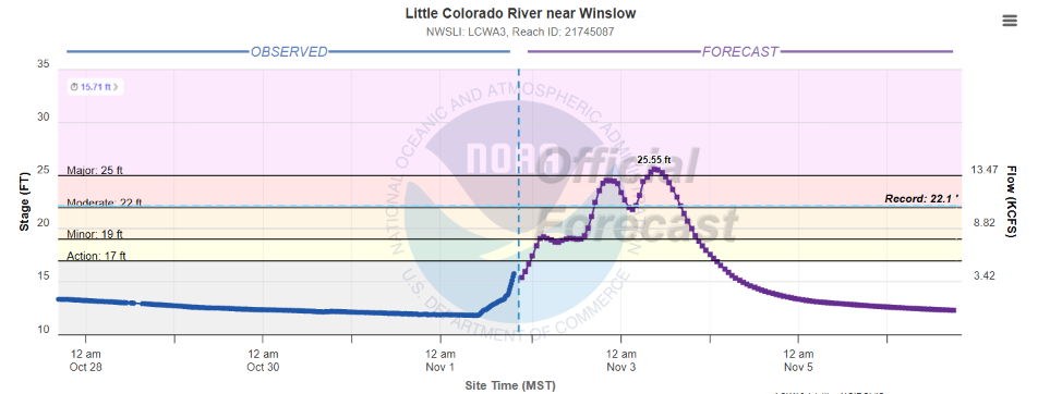
The Little Colorado River near Winslow, AZ is forecast to reach a final crest of 25.55 feet on Tuesday. This would be more than 3’ above the prior record (about 25 years of records at this gauge) — and critically per the NWS would exceed a levee in the region causing “major flooding of portions of Winslow including Ames Acres and Bushman Acres.”
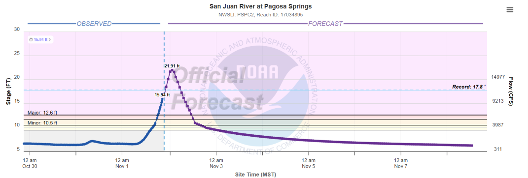
Farther northeast, the San Juan River at Pagosa Springs, CO is once again blasting up this evening, reaching major flood stage for the fourth time since last October. The river is forecast to crest overnight at an incredible 4’ above the record set in 1911 — and about 6 to 7 feet above the recent major floods.
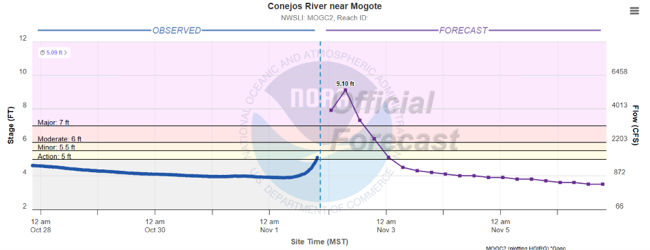
The Conejos River in southwest Colorado is also forecast to crest above the record set in 1911.
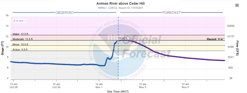
The Animas River at Cedar Hill, CO just exceeded its old record set in 1949 — but is about a half a foot below the recent late October crest. Mandatory evacuations have been ordered in the southwest Colorado region due to the historic river flooding expected.
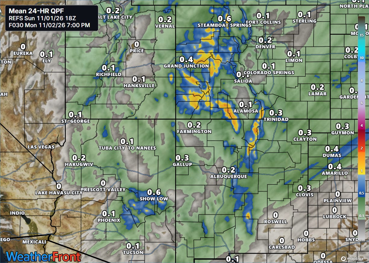
Bands of heavy rain showers are still ongoing this evening, but will begin to taper from the west overnight. Additional rainfall amounts of 1-2” are possible in higher elevations of Colorado and New Mexico, with heavy snow at the highest elevations.
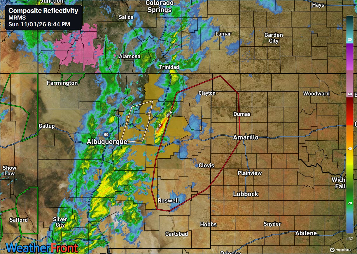
A few severe thunderstorms have occurred across New Mexico late today, and a new severe thunderstorm or tornado watch is expected for parts of eastern New Mexico and the Texas Panhandle soon.
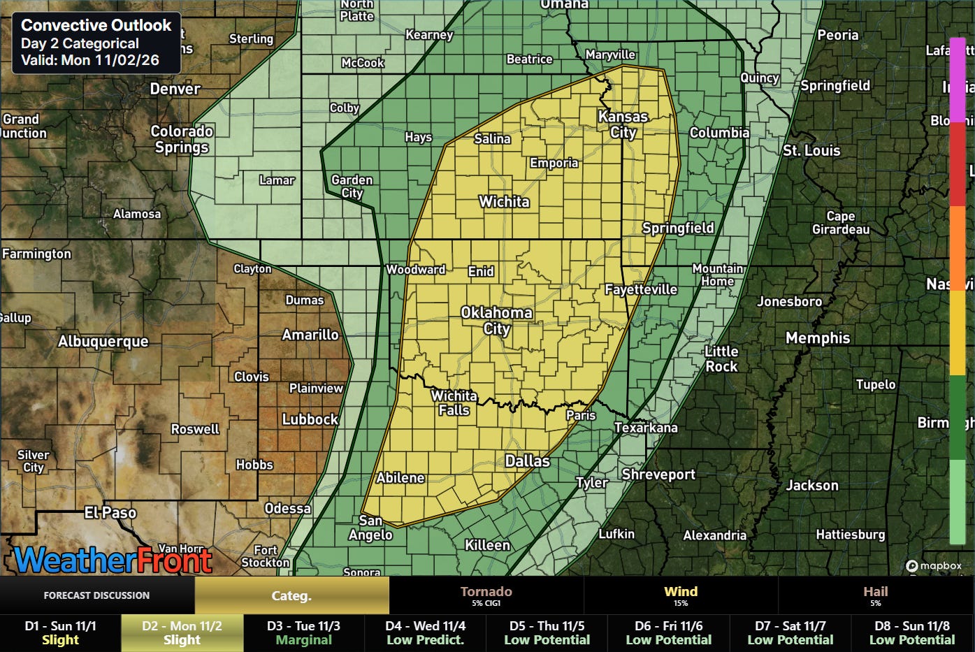
The severe weather risk with this system will shift east on Monday.
FYI: I will still be traveling through Monday, but will attempt to share updates about this ongoing situation through social media posts, Substack notes and chat (paid subscriber benefit).


Leave a Reply