And for a change, some good news from the federal science world
Apr 15, 2026
Happy hump day! Tons of weather to talk about today, but I so rarely have a piece of good news to share when it comes to the federal science world that I want to take advantage of the chance to share one today. The National Science Foundation earlier this week announced the 2026 recipients of fellowships through its Graduate Research Fellowships Program (GRFP). In an exciting reversal from 2025, this year’s GRFP awardees totals 2599 new fellows, a record number and nearly double last year’s 1500 fellows.
A former fellowship program officer told Science, “my take is that the STEM community’s activism around last year’s cuts appears to have had significant positive impacts on this year’s class.” While there continues to be a lot to be concerned about with regard to federal science, and particularly weather and climate programs, this is one of a number of recent developments showing that advocacy by the scientific community and public can pay positive dividends.
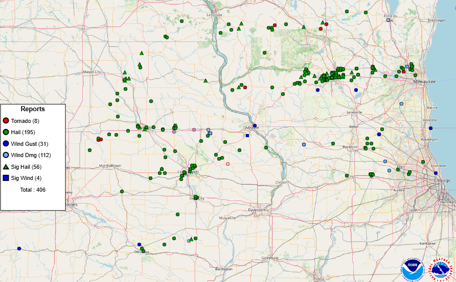
Tuesday was a very busy day of severe weather with over 400 reports of severe weather, and once again the upper Midwest was the main area impacted.
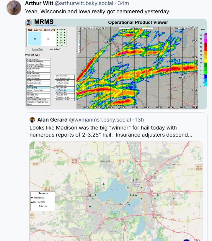
Multiple supercell severe storms moved across the region with more than 50 reports of very large (greater than 2” diameter) hail as shown by the MRMS hail swath produce above from my colleague Arthur Witt. The Madison, WI metro area was particularly impacted with more than a dozen reports of hail from 2 to 3.5” in diameter. Several tornadoes occurred as well, with the most intense tornado likely being near Union Center, WI (halfway between Madison and La Crosse) where a number of homes and businesses were damaged or destroyed and drone video and radar data suggest a rather intense tornado. Luckily, no injuries were reported.
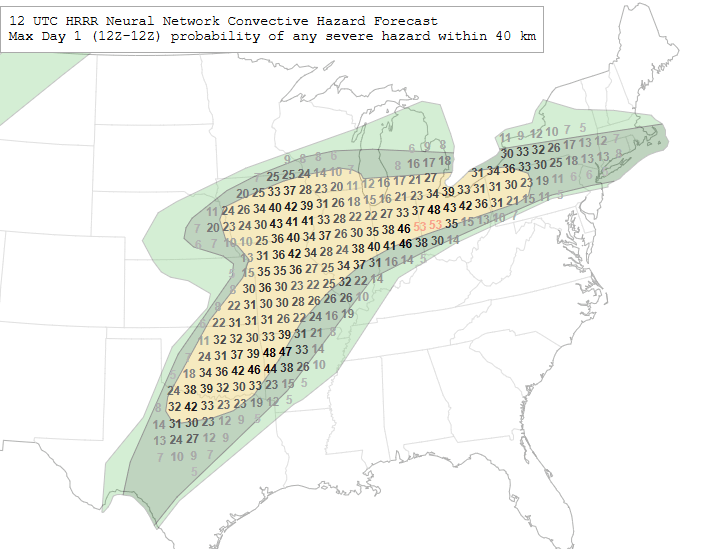
For today, a large area from the Southern Plains to the Great Lakes will see a combination of rather unstable air and moderate wind shear to support a broad area of severe weather potential. The Storm Prediction Center has a slight (level 2 of 5) risk as shown by the yellow area above. The NCAR day 1 AI severe probabilities based on the High Resolution Rapid Refresh are overlaid, and hint at some potential “hotspots” within the broader area across central and eastern Oklahoma, Iowa and the middle Ohio Valley.

The storms of the last couple of days have also brought heavy rainfall to the upper Mississippi Valley and lower Great Lakes regions, and with more heavy rain producing storms today, a slight (level 2 of 4) risk of flash flooding is in place in this region.
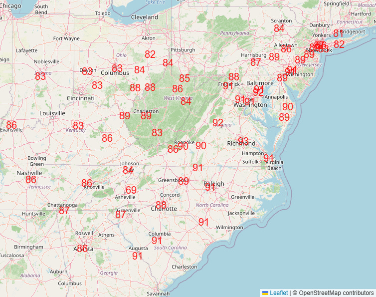
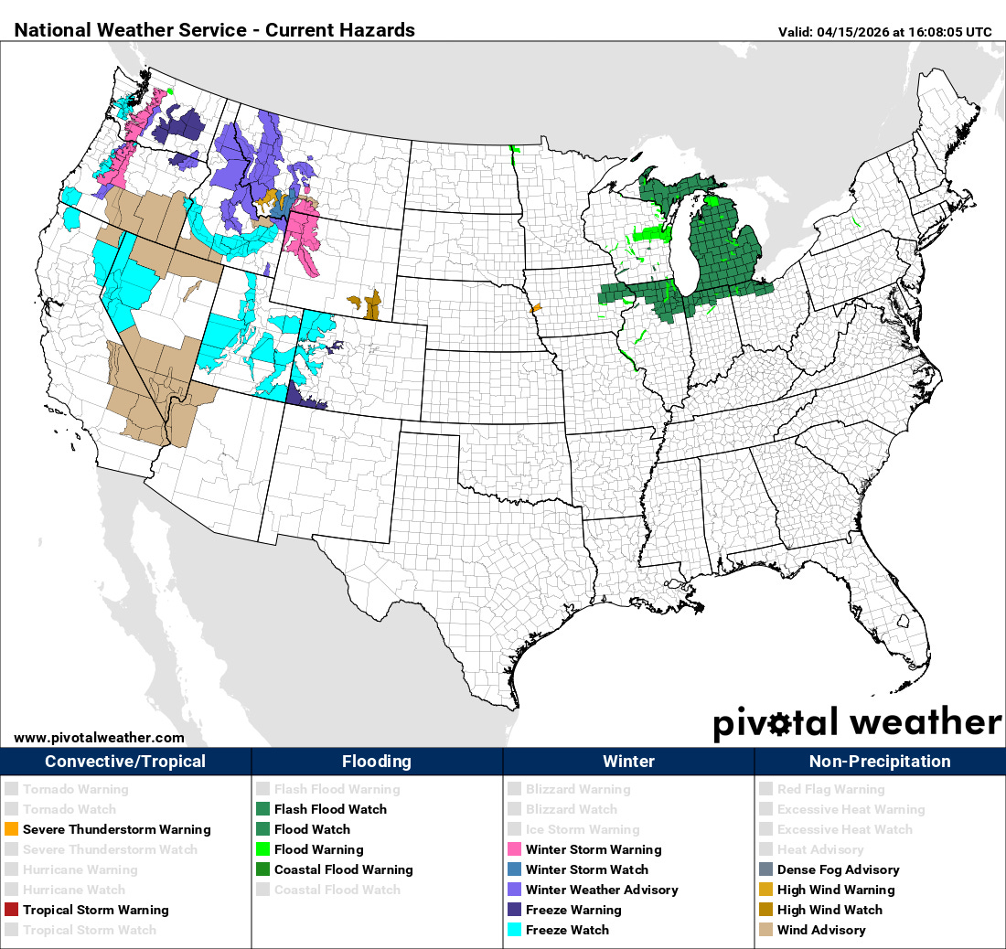
Another big weather story today will be the record heat over much of the East, with high temperatures in the 80s and 90s expected to be widespread this afternoon after numerous locations likely set record warm minimum temperatures this morning. The record heat will combine with breezy weather and ongoing significant drought to result in elevated wildfire conditions as well, particularly from the southern Appalachians into the Mid-Atlantic.
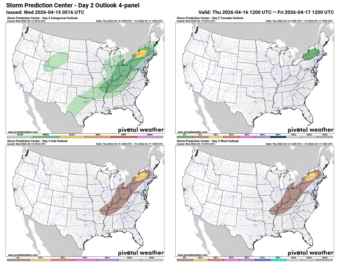
Thursday will see a bit of a lull in the severe weather activity, although a risk will continue from the Ohio Valley through the Northeast. The greatest risk (level 2 of 5) looks to be in parts of upstate New York where the upper level disturbance responsible for today’s severe weather could focus a risk of a few supercell severe storms with large hail, damaging wind and possibly a tornado.
By Friday, a much stronger and larger upper level trough of low pressure will begin to move east from the northern Rockies toward the Midwest, and combined with unusually high levels of moisture and instability will result in the potential for a very active day and evening of severe thunderstorms from the southern Plains to the upper Mississippi Valley. This system could also result in a particularly elevated fire weather situation across parts of the southern Rockies and Plains regions as strong westerly winds and relative humidity values below 10% are expected to the west of a dryline that will be moving east toward the I-35 corridor.
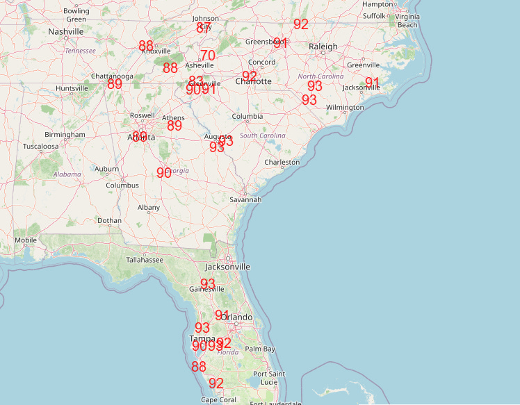
Record warmth is expected to continue across the Southeast through the rest of the week (NWS forecast record highs for Saturday above), before the system responsible for the severe weather Friday finally pushes a cold front into the region later this weekend, bringing cooler weather for the start of next week.
The upper level trough of low pressure that will move into the central and eastern US later this week will first bring some active weather to the West the next couple of days, with high elevation snowfall across parts of the Northwest, and windy, colder conditions across the Great Basin and Intermountain West.
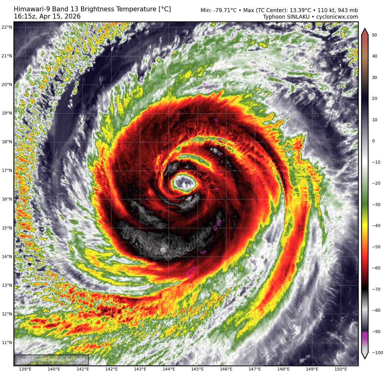
Finally, Sinlaku remains a large, powerful typhoon to the northwest of Tinian and Saipan in the Northern Mariana Islands, with maximum sustained winds of 125 mph. Outer bands of the typhoon continue to impact those islands as it slowly pulls away to the northwest. Local officials are reporting that significant damage has occurred on Tinian and Saipan — the scope of the damage will likely not come for another day or two until people can venture safely outside again.

Leave a comment