Severe weather looks to become increasingly active into this weekend across the central US
Apr 22, 2026
Good evening, most of my posts the next few days will be in the evening as I will be volunteering at the Chevron Championship LPGA tournament in Houston through this weekend, keeping much of my daylight hours busy.

Wildfires have continued to become an increasingly seriously issue across the Southeast in the last 24 hours, with more than 50 homes destroyed by an expanding wildfire over southeast Georgia and additional wildfires burning across northern Florida. The state of Georgia declared its first ever state issued burn ban for more than 90 counties in southern Georgia where drought conditions are most severe.

Unfortunately, conditions generally look dry across this region for the next week, although some change in the weather pattern should bring helpful rainfall from showers and thunderstorms to other parts of the drought stricken Southeast by early next week.
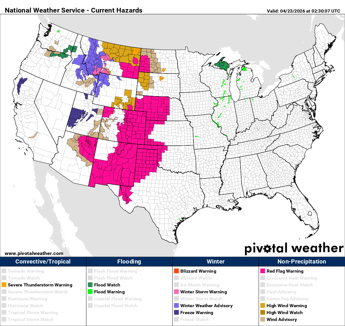
Wildfire danger is also a significant concern across the central United States this evening, with red flag warnings in effect as gusty southerly winds and generally dry conditions persist — and some particularly intense wind gusts are being produced by some scattered severe thunderstorms over the Dakotas. Elevated to critical fire weather conditions are expected across much of these same areas on Thursday — and active fire weather conditions are expected to persist especially across the southern High Plains and Rockies into early next week.
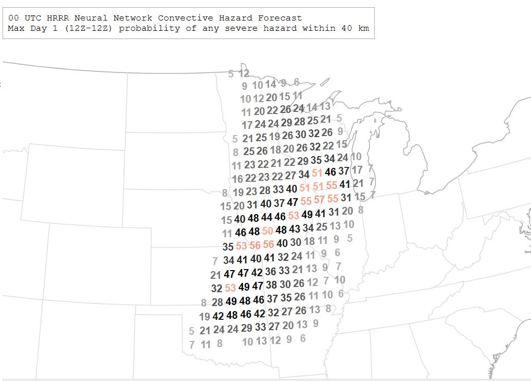
Along with the fire weather concerns, severe weather chances will begin ramping up across the central United States starting on Thursday, with a broad area from Oklahoma northeast to the upper Midwest under a risk of severe storms Thursday afternoon and evening as an upper level weather system impacts the region. Damaging winds, large hail and a few tornadoes are all possible with the most intense storms.
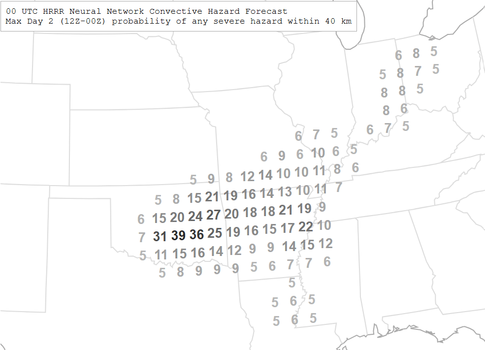
The cold front associated with this weather system will push slowly southeast Friday, shifting the severe weather risk accordingly.
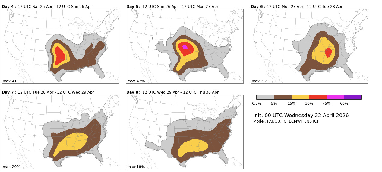
An active period of severe weather is expected this weekend into the first part of next week as a series of disturbances move through an active jet stream that will be slowly shifting south with time. A couple of strong disturbances combining with a very unstable atmosphere look prime to produce some potent severe storms this weekend across the central and southern Plains as shown by the NCAR AI severe weather probabilities based on the European ensemble model (Saturday and Sunday forecasts the two upper left hand maps above). The risk should become more focused along Interstate 20 corridor in the south central and southeast states by the middle of next week.

Leave a comment