Springfield, MO area pummeled by hail up to softball size
Apr 28, 2026
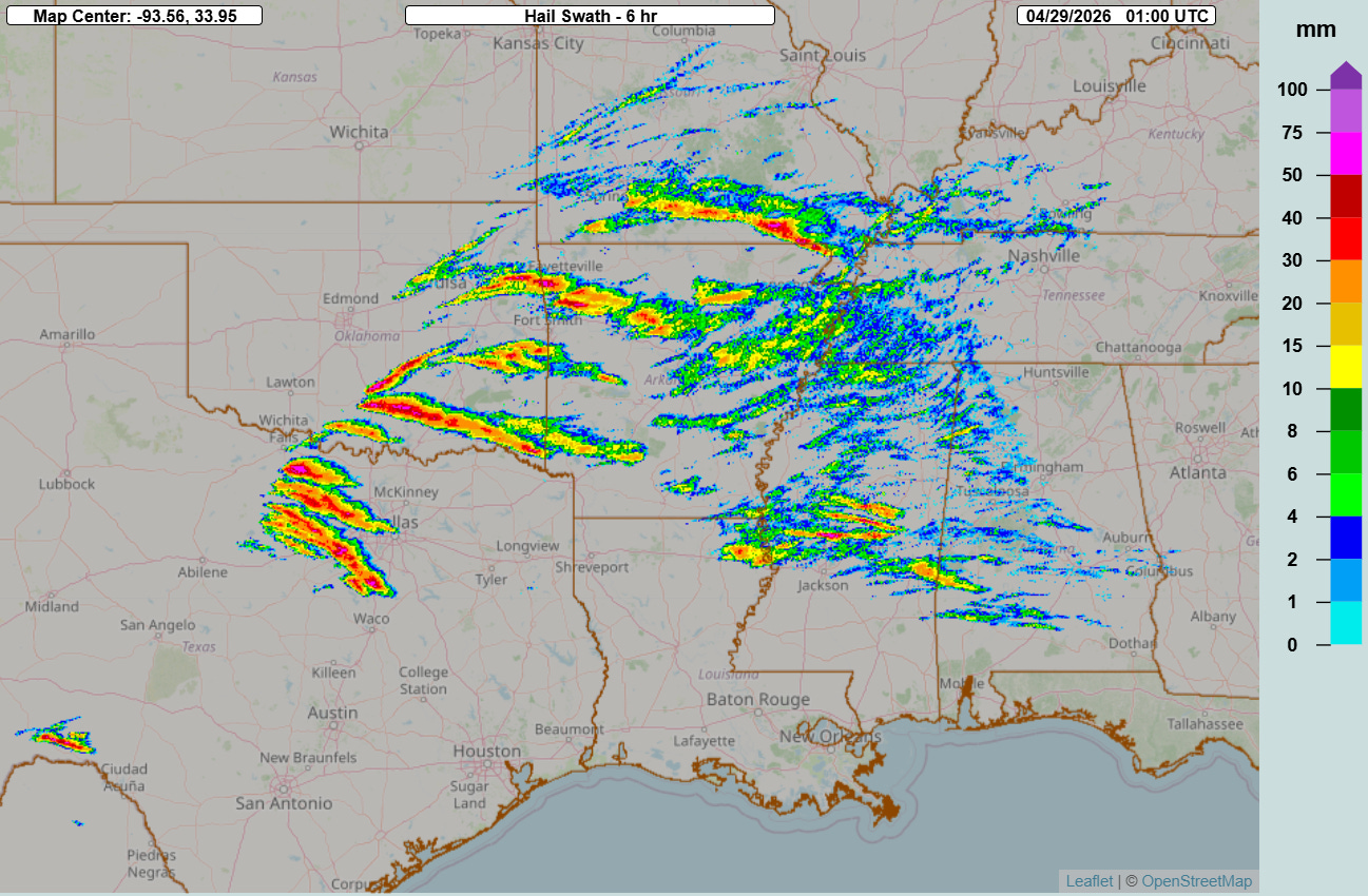
Today was another busy day of severe weather, and once again very large hail was a big issue. This graphic from the NSSL Multi-radar Multi-sensor System (MRMS) shows the swaths of maximum estimated hail size over the 6 hours ending at 8 pm CT, and clearly shows the path of a number of supercell storms producing very large hail from areas of southern Missouri down to the Interstate 20 corridor.
Under the proper environmental conditions, supercell thunderstorms can “split” into two separate storms, with one storm turning and moving more to left and the other moving more to the right. In general, the left moving storm is typically a prolific hail producer, while the right moving storm tends to have a greater tornado potential. Late this morning, a left moving supercell thunderstorm moved across southwest Missouri including the Springfield metro area, producing a swath of very large hail up to softball sized (4”).

Major impacts occurred across the region, including numerous Missouri Highway Patrol vehicles suffering serious damage (picture above courtesy MHP) and the death of an emu and serious injury to a rhea at the Dickerson Park Zoo.
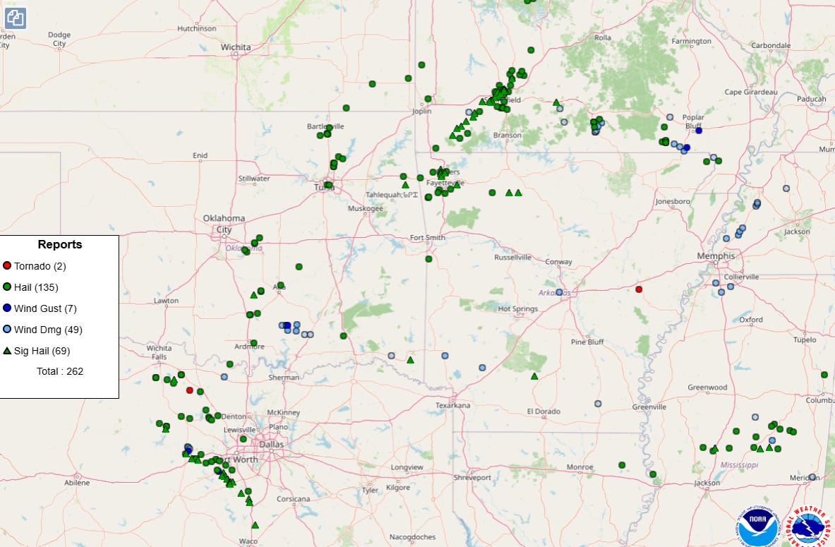
The swath of giant hail associated with this left moving storm is very apparent on the Storm Prediction Center severe weather report map, as well as a swath of significant hail from a southeast moving supercell in the area west and southwest of Fort Worth. Hail up to 3” in diameter also fell in parts of central Mississippi.
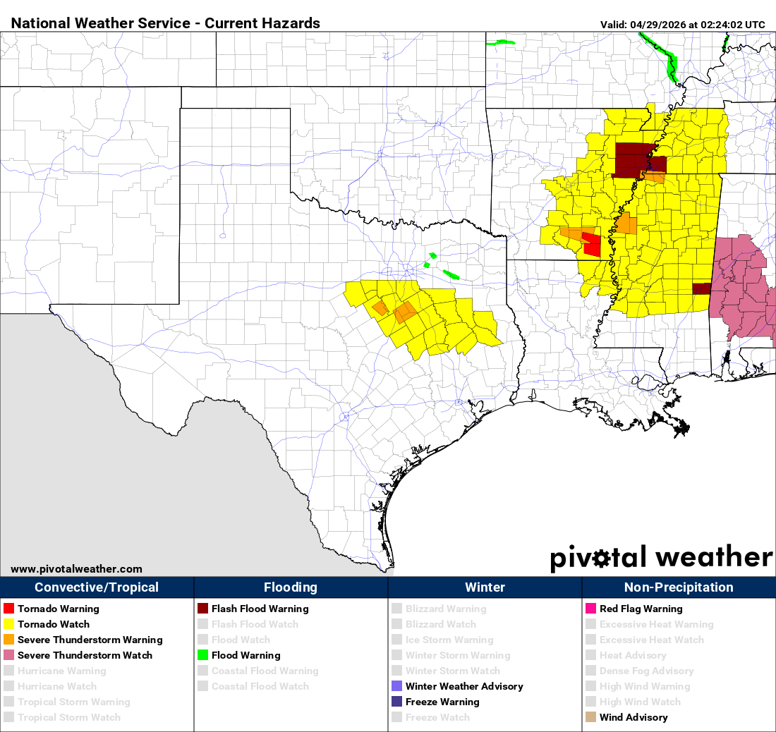
Tornado watches remain in effect into the early morning hours across parts of the South, with several severe storms continuing to move southeast across the region. Localized flash flooding will also be a concern as storms could train repeatedly over some spots. The threat for severe weather should gradually wane later tonight, and after nearly a week of very active severe weather the country will be transitioning to a new weather pattern with lesser (but still some) severe weather risks. More to come on that pattern change in tomorrow’s newsletter.

Leave a comment