Record heat and some severe weather expected in Florida next couple of days
May 01, 2026
Happy Friday and happy first day of May! As a follow-up to my post yesterday about the July 4 Texas Hill Country flash floods, I want to start off today by sharing this excellent story from Louis Amestoy, the editor of the Kerr County Lead news website. Louis has been doing excellent work investigating that myriad of aspects surrounding the Guadalupe River flash flood. His piece yesterday looks at the hydrometeorological aspects of the event based on a ArcGis StoryMap the National Weather Service put together about the event, and relates the evolution of the rainfall and flood to the actions (really in many ways, inactions) of county and local officials as the flash flood developed.
Louis also points out something that I missed in reviewing other coverage of the Monday Texas legislative hearing — that the actual meteorology and rainfall aspects of the flash flood were completely ignored in the hearing and apparently in the investigation conducted for the legislature:
This week, the Texas Legislature’s joint General Investigating Committee on the July 4, 2025, flood convened two days and nearly 20 hours of testimony examining what went wrong at Camp Mystic. The science — the storm, the atmosphere, the canyon, the structural limits of the warning system — was not discussed. When the committee’s own lead investigator, Casey Garrett, was asked directly whether her team had consulted a meteorologist, she answered simply: no. No committee member followed up on that answer.
I have to say that it is pretty unfathomable to me that you could do an investigation on this catastrophic event without even talking to a scientific expert on the topic. It seems as if the focus of the legislative hearing may have been on the Camp Mystic tragedy, which obviously generated tremendous interest — and indeed outrage — because of the number of children killed. However, this event impacted Kerr County well beyond Camp Mystic and nearly 100 others lost their lives along other parts of the Guadalupe River that morning, and the how and why those lives were lost needs to be examined just as closely as the Camp Mystic situation.
Again, this is why myself and many others have been urgently calling for a Natural Disaster Safety Board along the lines of the National Transportation Safety Board, to thoroughly and impartially investigate disasters such as this and develop recommendations for improvement. Preventing similar tragedies in the future — not just in central Texas but across the country — will require scientists, emergency managers, political leaders, and many others to be self-critical and willing to make some difficult choices to take tangible, sometimes difficult, steps to push forward needed changes.

As we head into this weekend, the weather pattern across the country is in the middle of a transition to a pattern dominated by an upper level trough of low pressure across the eastern half of the country. Part of that process involves an upper level weather disturbance moving east-southeast along the Gulf Coast region the next couple of days, which will bring widespread rain and thunderstorms to the area. While the rainfall is much needed, some training of strong thunderstorms could produce some localized flash flooding as well, and the Weather Prediction Center has highlighted the western and central Gulf Coast region in a slight (level 2 of 4) risk of flash flooding.
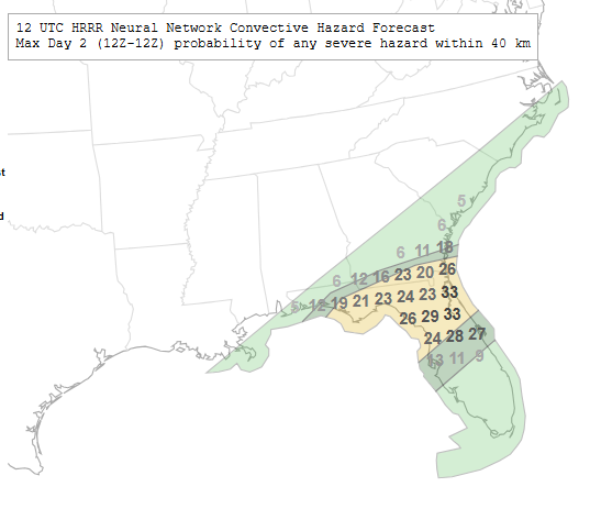
As this upper level disturbance moves farther east on Saturday, it will spawn a low pressure system over Georgia that will intensify as it moves northeast off the East Coast. This will bring a more focused risk of severe weather to parts of northern and central Florida and extreme southern Georgia. Damaging straight line winds, hail and a couple of tornadoes are possible with the most intense storms.
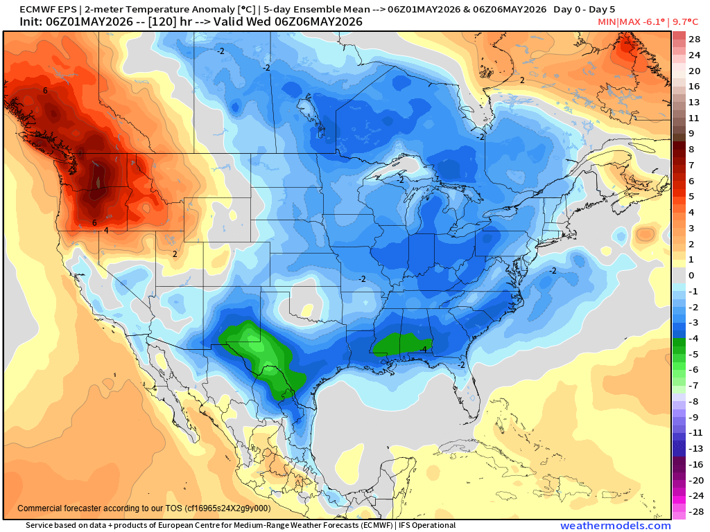
The evolving upper level trough over the East will mean generally below normal temperatures for much of the country the next several days. Some record cold temperatures are possible the next couple of days across the Mid-South and Southeast.
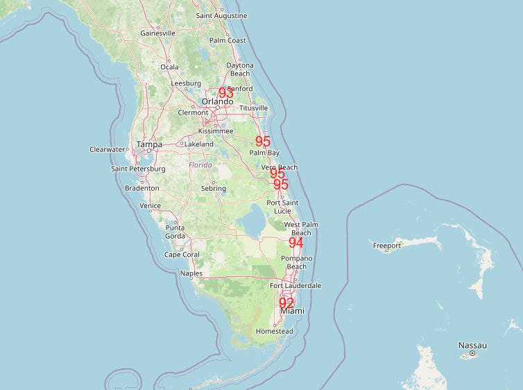
Before the cold front ushering in this cooler weather moves through Florida, a number of record high temperatures are expected Saturday afternoon. Elevated wildfire danger will also continue to be an issue until the front and some rainfall move in.
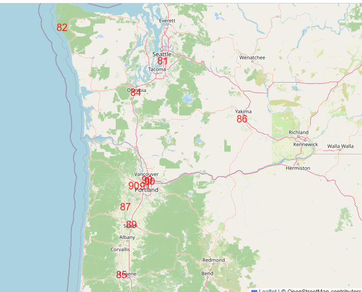
The Pacific Northwest will be the one area of the country with above normal temperatures the next several days, and in fact a number of record warm readings are expected on Sunday.

Leave a comment