Florida deals with record heat, fire danger and severe storms today
May 02, 2026
Starting off this morning with a recap of a bit of a surprisingly impactful severe weather episode that occurred in South Texas Friday afternoon. The severe weather was associated with this rather impressive looking band of severe storms that moved across the Victoria and Port Lavaca areas.
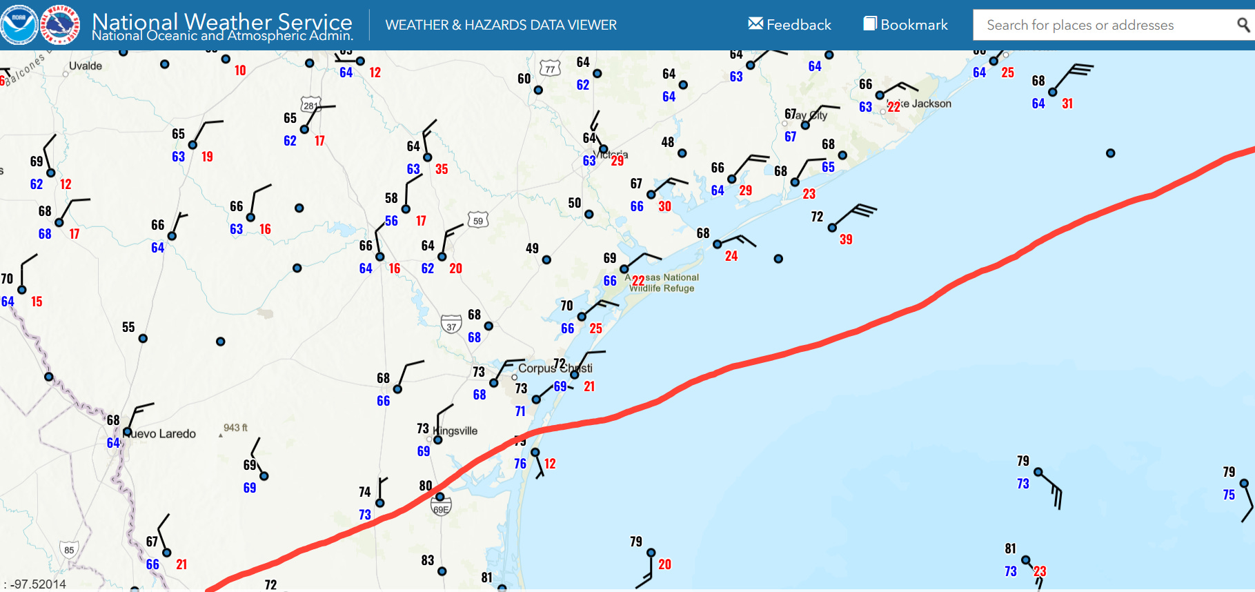
Some severe weather was anticipated in this region yesterday – the Storm Prediction Center had a marginal (level 1 of 5) risk in place. However, large hail was the primary focus for significant severe weather (SPC had a CIG1 risk of very large hail) given that this region was well north of a warm front (red line shows approximate position above) meaning that the unstable air feeding severe storms would be “elevated,” i.e., the warm, moist inflow would be aloft, not surface based. This sort of setup reduces the chances of damaging straight line winds and especially tornadoes — but does not necessarily mean no risk (SPC had low but non-zero probabilities of tornadoes and damaging straight line winds outlooked here).
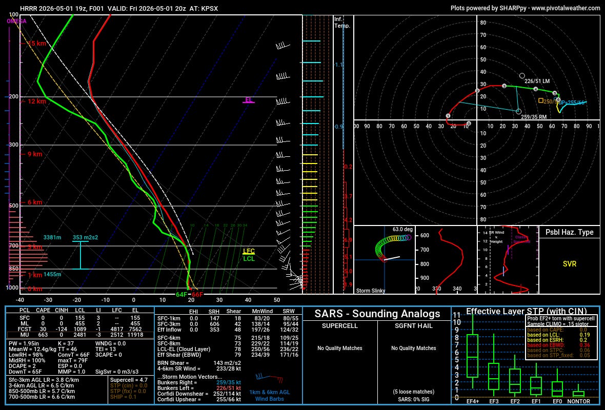
Often when elevated thunderstorm activity is occurring, there is what meteorologists call an “inversion” in place in the lower levels, where the temperature actually increases as one goes up into the lower levels of the atmosphere. This inversion serves as a kind of barrier, often preventing the thunderstorm downdrafts that cause damaging straight line winds from reaching the surface. However, this 2 pm CT model sounding for Palacios, TX taken from a 1 hour forecast of the High Resolution Rapid Model showed that the lower levels were more “isothermal,” i.e., rather than actually increasing the temperatures were rather steady up to about 10,000 feet where they started to decrease. You can also see that very strong winds of 60 to 80 mph are present in the layer from 10,000 to 20,000 feet AGL. These strong mid level winds provided wind shear to yield the organization of the severe storms we can see in the radar loop above.
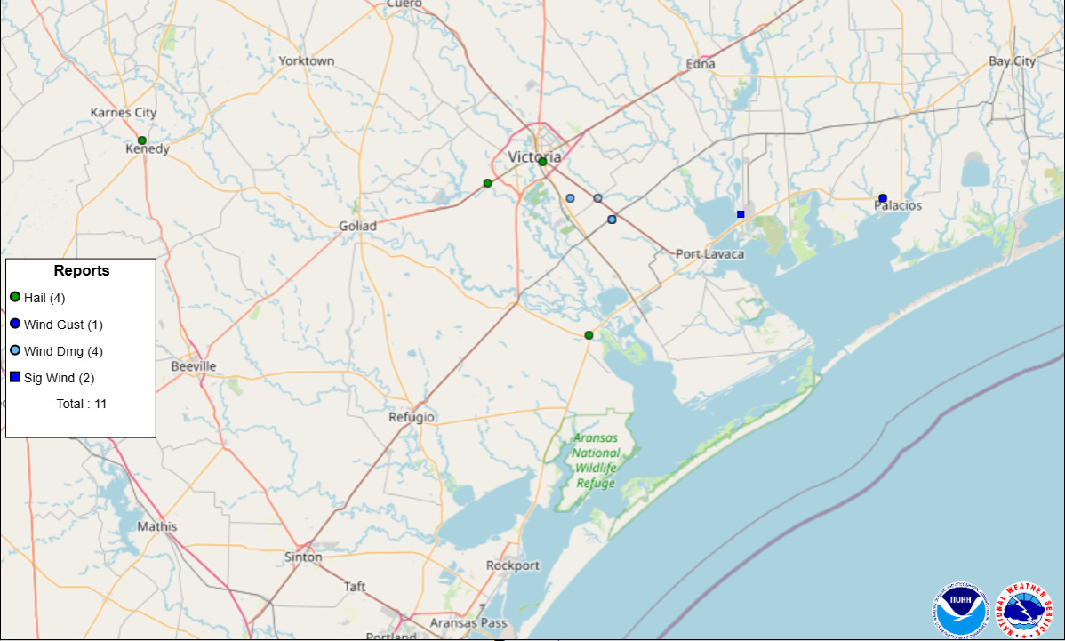
Along with several incidences of large hail, these storms ended up producing some intense winds, including a measured 119 mph gust at a WeatherFlow site near Port Comfort and 77 mph at the NWS observation site at Palacios. Significant wind damage was reported, with NWS Corpus Christi noting that damage in the area of the 119 mph gust appeared consistent with the reported wind speed. This is an interesting case showing again why severe weather forecasts are probabilistic in nature — many factors have to come together to produce significant severe weather, and sometimes even when the probabilities are low, the pieces do come together.
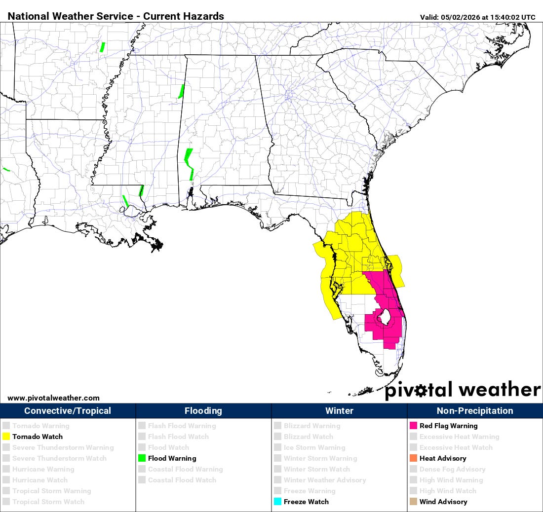
Florida will be the center for weather action today, as a line of strong to severe storms is expected to progress across northern and central Florida this afternoon. SPC recently issued a tornado watch for areas along and north of the Interstate 4 corridor. The most recent high resolution models suggest that the areas closer to the Gulf Coast may have the highest relative risk for severe weather within this area as more intense activity move in off the Gulf. Regardless, damaging winds and a few tornadoes are possible with the most intense storms in the watch area.
Farther south, windy and hot (record high temperatures expected this afternoon) conditions ahead of the cold front will result in elevated fire danger, and red flag warnings are in effect.

Severe weather looks as if it will get a bit more active again during the first half of next week as an upper level disturbance moves southeast on the western side of the upper level trough of low pressure taking shape over the eastern United States.

Leave a comment