This weekend has seen some record cold over the Southeast, while record warmth is expected over the Pacific Northwest today
May 03, 2026
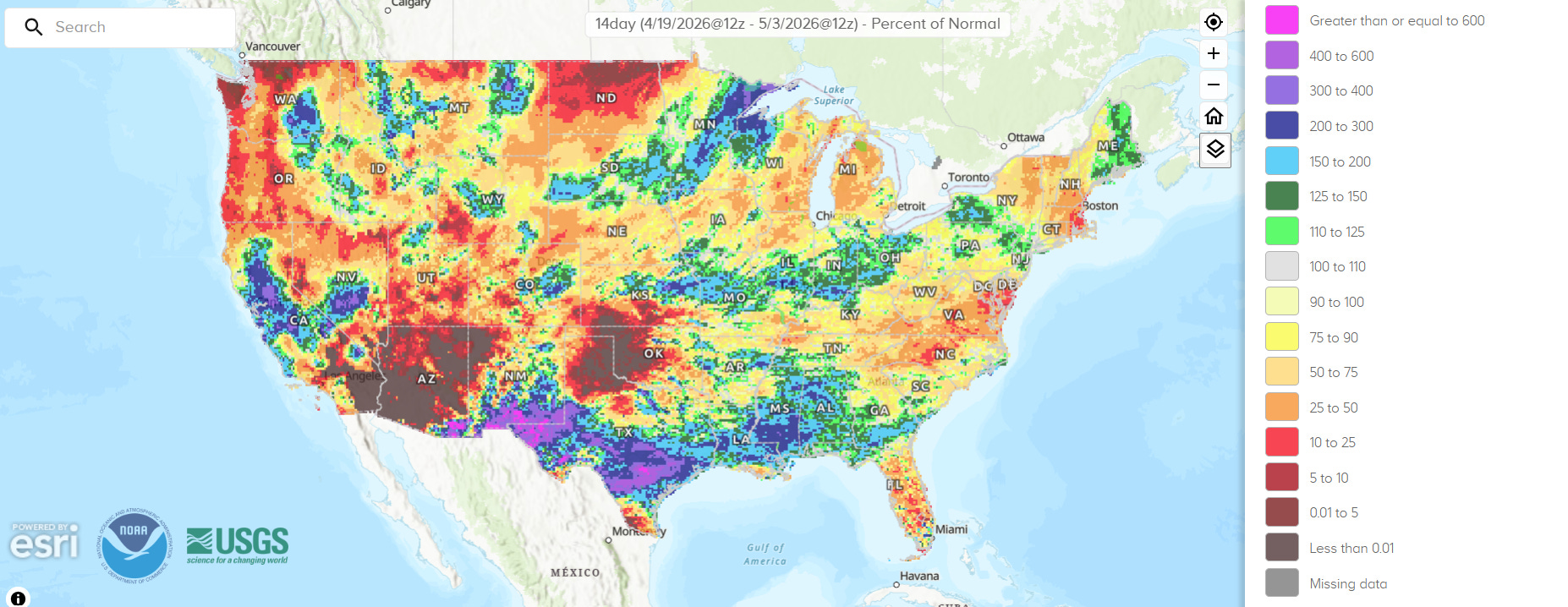
Whenever possible, I like to use Sunday to take stock of what the recent national climate trends have been. Starting with recent precipitation, the last two weeks have finally seen some beneficial precipitation from southern New Mexico across parts of Texas and into the Southeast, with the most anomalous compared to normal over the western parts of this area. While not a drought busting period of precipitation, it is certainly helpful and better than the persistent dryness that has been dominating this area.
With a few exceptions (central California/Nevada/Washington, parts of the Midwest), much of the rest of the country has, unfortunately, been drier than normal the last half of April.
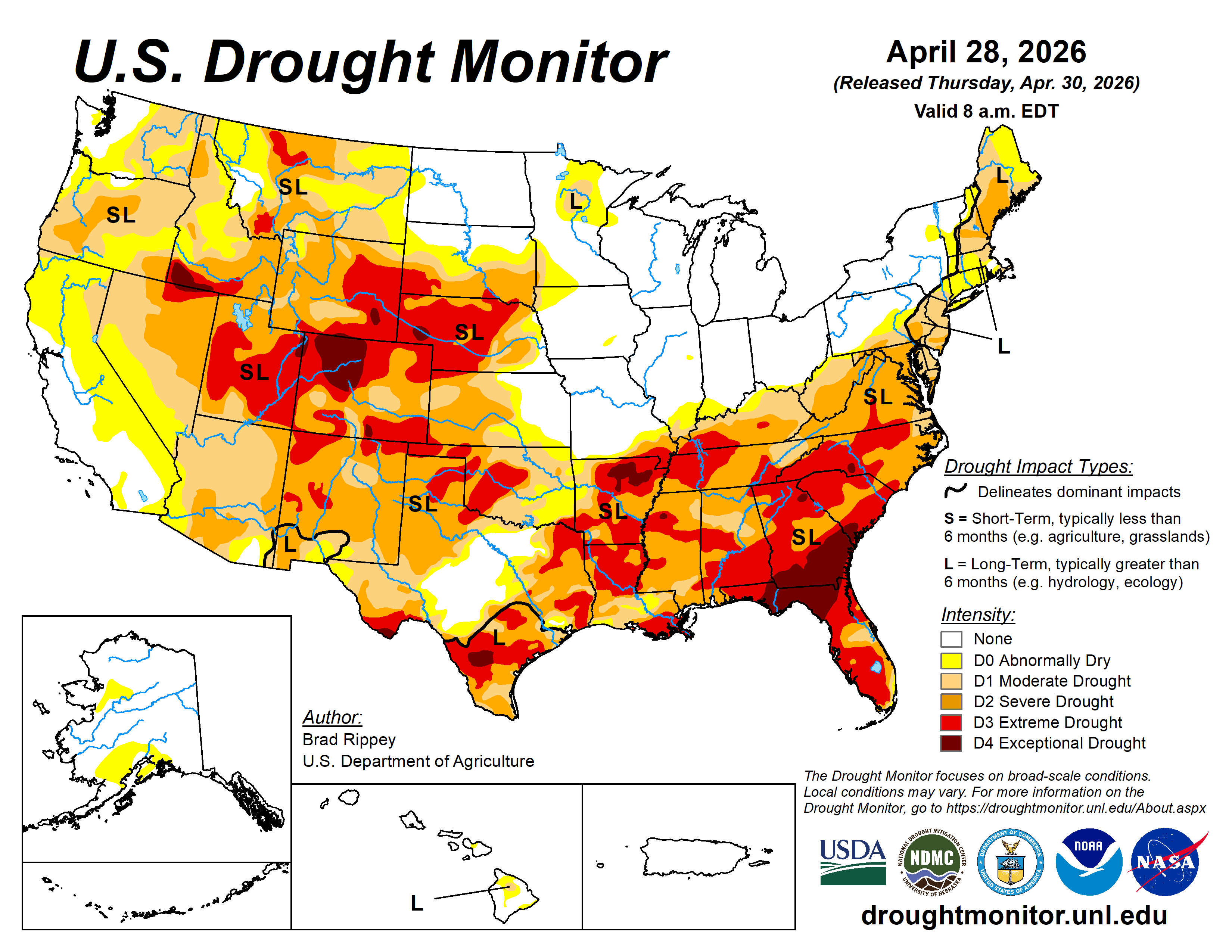
The most recent US Drought Monitor from last week continues to show most of the southern and western parts of the country in significant levels of drought — some improvement in drought will likely be seen in parts of the South when this week’s update is released due to this week’s rainfall. Climatologist Brian Brettschneider noted on BlueSky that the last 6 months was the driest November-April for the contiguous US since 1980-1, and the 7th driest on record back to 1895.
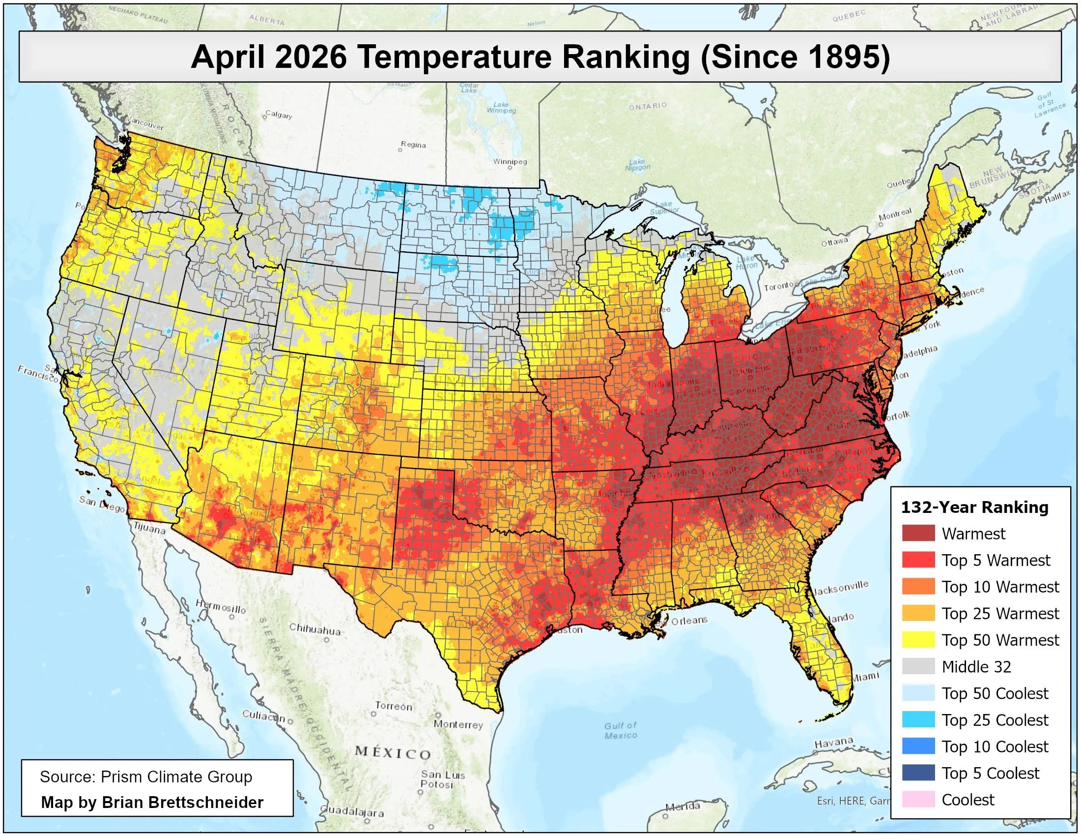
Brian also shared that April 2026 was the warmest April on record for a large part of the Ohio Valley and central Appalachians, and was the 8th warmest on record for the contiguous US.
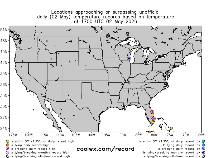
This weekend has seen unusually cold early May weather across parts of the Southeast as an upper level trough of low pressure has taken over the East, with a number of record low temperatures set. Ahead of the cold front ushering in this cool weather, the Florida Peninsula saw several record high temperatures on Saturday.
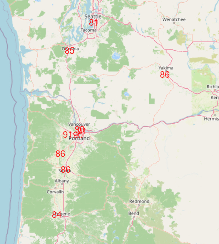
The Pacific Northwest also had a few record highs on Saturday, and there will be more on Sunday, including some early season lower 90s expected for the Portland metro area.
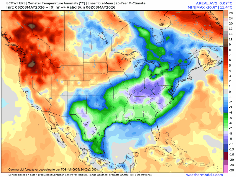
Unseasonably warm weather will continue in the Pacific Northwest this week, and gradually expand to encompass much of the West. Meanwhile, a brief warming trend will occur in parts of the East before the next surge of unseasonably cool weather moves in by the middle part of the week.

Risks of severe thunderstorms will accompany this next cold front as it moves southeast across the eastern half of the US, as shown in the NCAR AI severe weather probabilities for the next week.

Leave a comment