Severe weather remains a risk in parts of Southeast today…but overall a less active period looks in store
May 07, 2026
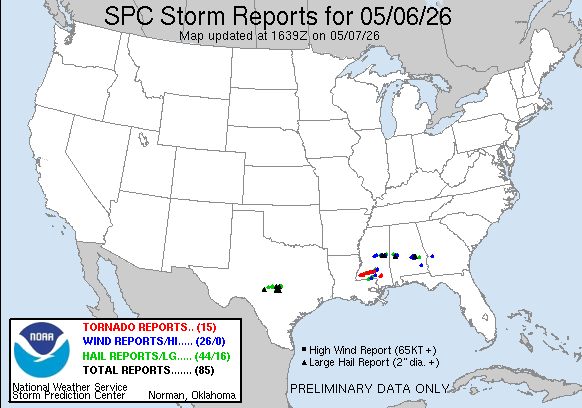
Late yesterday afternoon a number of supercell, i.e., rotating, severe thunderstorms moved across central and southern Mississippi and Alabama, producing very large hail and damaging wind gusts.
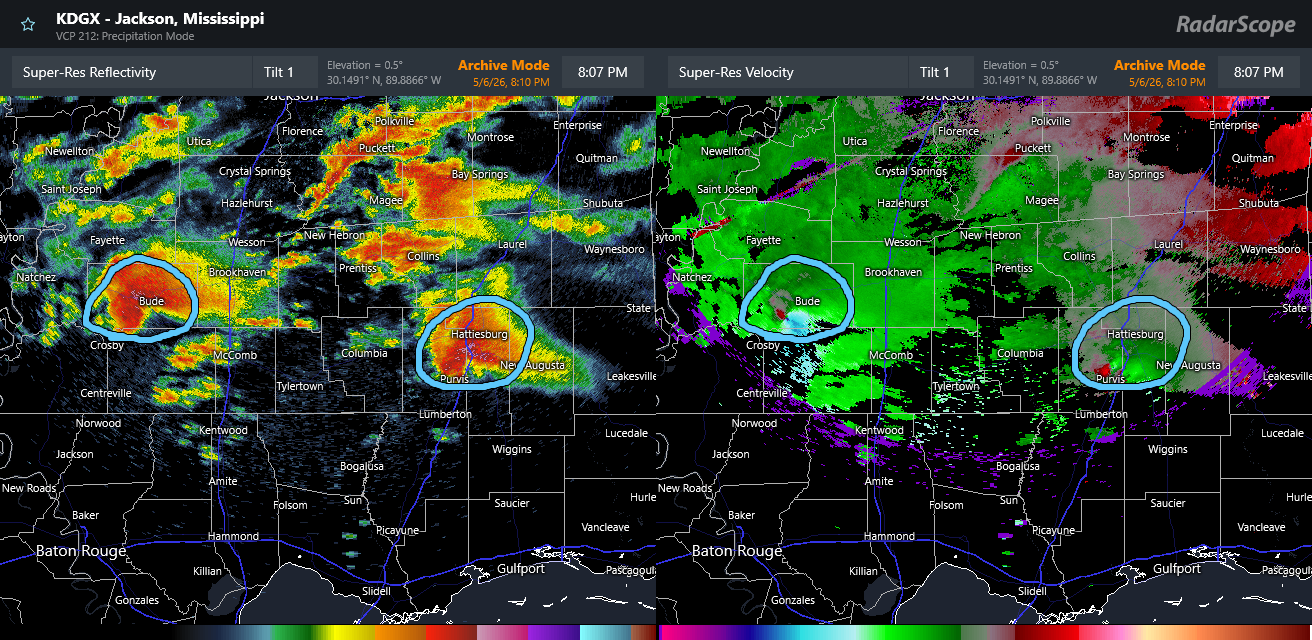
Early in the evening, two of these storms took advantage of increasingly favorable conditions to become intense tornadic supercells, one across southwest Mississippi and the other in southeast Mississippi.
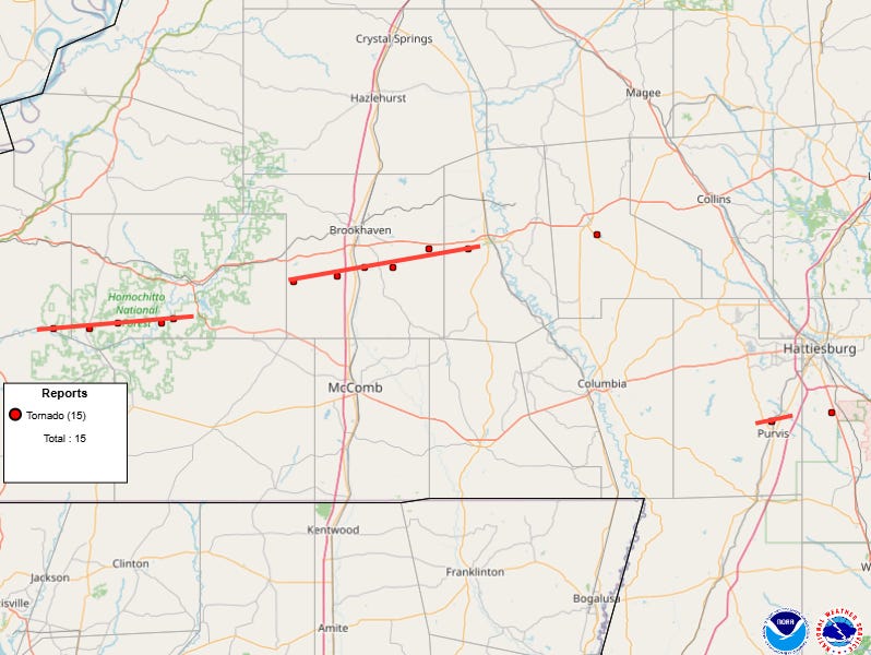
The storm over southwest Mississippi produced what appears based on reports and radar observed tornadic debris signatures to be two separate long-tracked intense (potentially EF3 or greater) tornadoes in mainly rural parts of Adams, Franklin, Lincoln and Lawrence Counties, while the southeast Mississippi supercell produced a shorter track but likely EF2+ tornado near the city of Purvis. I did a live video for paid subscribers last night doing a deeper dive into the radar data for these storms — if you are interested, you can view a recording here.

Damage assessments are ongoing in the affected regions, but as of now there have been thankfully (and amazingly) no fatalities reported in spite of hundreds of homes being damaged or destroyed – including a number of mobile and manufactured homes being demolished like in the picture above from Lincoln County (courtesy WJTV). Seventeen people were reported injured.
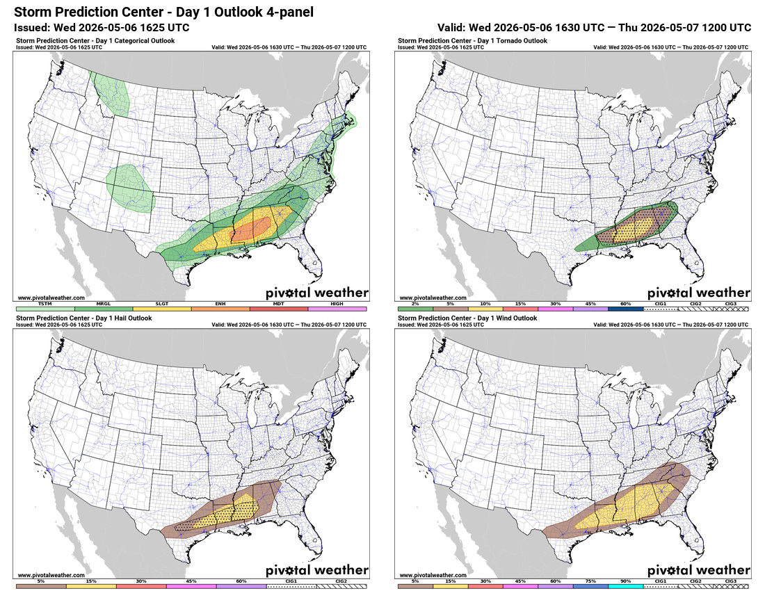
I think it is important to highlight that the outlooks from the Storm Prediction Center and warnings from the local NWS offices in the impacted areas all appear to have been very good — which certainly may have played a contributing factor to the low number of fatalities (zero so far) given the extensive damage.
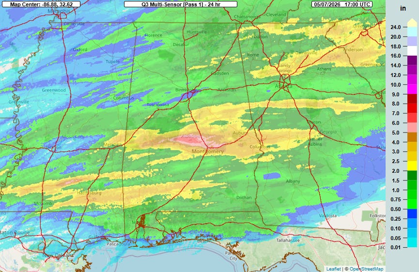
These storms also produced bands of heavy rainfall — particularly across central Alabama where a swath of more than 6” of rain per NSSL’s MRMS system that caused some flash flooding. The official NWS climate site in Montgomery reported 2.3” of rain which was a daily record.
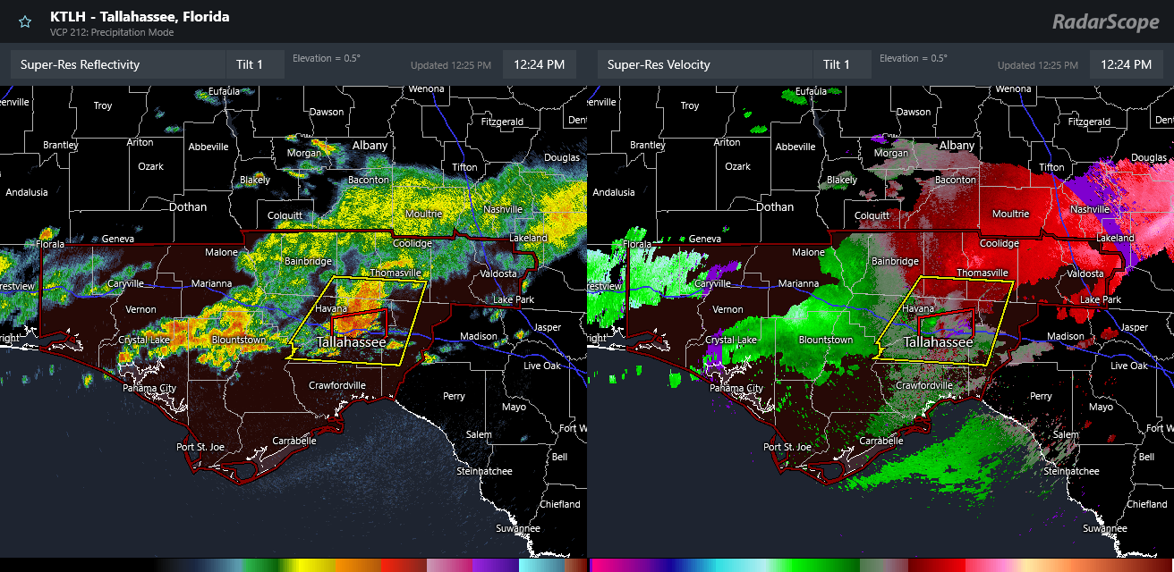
What remains of this severe weather producing system is now in the Florida Panhandle, where a tornado watch is in effect through mid-afternoon. As of 12:30 pm the most intense storm is in the Tallahassee metro area, where a tornado warning is in effect. The threat of severe weather and tornadoes will last for a few more hours and is then expected to gradually diminish as storms push farther east.

At a high level, the overall risks of severe weather look to be entering a quieter period over the next week or so as a large upper level trough of low pressure will dominate the weather east of the Rockies. There will still be some periodic risk of severe storms though in parts of the Plains and South as upper level rotate around th

Leave a comment