Severe weather risks look more summerlike this week, as another wave of record heat builds over the West
May 09, 2026
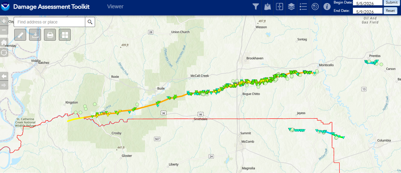
I want to start off today by recapping severe weather over the last few days. First, the NWS conducted additional damage surveys in south Mississippi on Friday, and determined that the initially reported two EF3 tornadoes from Wednesday’ night’s severe weather outbreak was actually a single, continuous long track tornado. The tornado had a path length of nearly 70 (69.8) miles, a maximum width of over a mile (1.17) and maximum winds near 140 mph. The tornado was in progress for nearly 2 hours. Mississippi is vulnerable to long tracked tornadoes, with at least 15 historical tornadoes with a track longer than 100 miles — even so, this tornado will likely end up in the top 25 of all-time longest track tornadoes in the state when it is finalized.
Amazingly, in spite of this long, wide path of significant tornado damage, no fatalities occurred although 13 people were injured. In the most recent episode of the Debris Ballers podcast I am a part of, I did a review of the radar data and (in my opinion) well-done, proactive warnings the NWS offices in Jackson and Slidell did for this storm. Check out the podcast here.
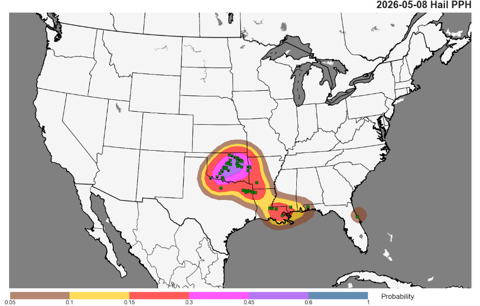
Yesterday ended up being a more active severe weather day than originally anticipated, particularly over Oklahoma where the coverage of severe weather was more like what would typically be expected from an enhanced risk day. As has been the theme of 2026 severe weather season, large to very large hail was again the primary impact. More than a dozen reports of 2” or greater hail were received by NWS, with several reports of baseball sized hail.
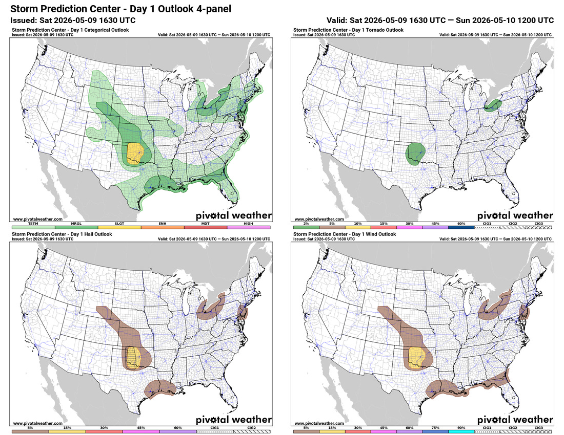
Today’s severe weather risk seems a bit more nebulous, with a few different areas of marginal (level 1 of 5) severe weather risk across the Plains, along the Gulf Coast, and in the Great Lakes. A somewhat more focused risk for a few supercell severe storms capable of large hail and a tornado may develop this afternoon and evening over the western half of Oklahoma and into far northwest Texas. There are also some signs of that an organizing complex of storms could move southeast out of Kansas into Oklahoma late tonight, with a threat of damaging winds.
A dissipating stationary front will provide a focus for shower and thunderstorm activity along the Gulf Coast this weekend, bringing some much needed rainfall along with the marginal risk of severe weather.
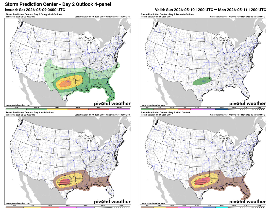
Sunday looks to bring an increase in severe weather activity across Texas as thunderstorms moving south out of Oklahoma are expected to intensify as they move into a more unstable airmass in northern Texas. As of now, conditions look favorable for an organized complex of storms capable of very large hail and damaging winds, and an enhanced (level 3 of 5) risk of severe weather is in place including the Dallas-Fort Worth Metroplex.

We are getting into the time of year where severe weather risks are less controlled by larger storm systems and upper level disturbances, and more by small scale atmospheric evolutions which are harder to forecast a day or two in advance. That certainly looks to be the pattern the next several days — so adjustments to severe weather forecasts should be expected.
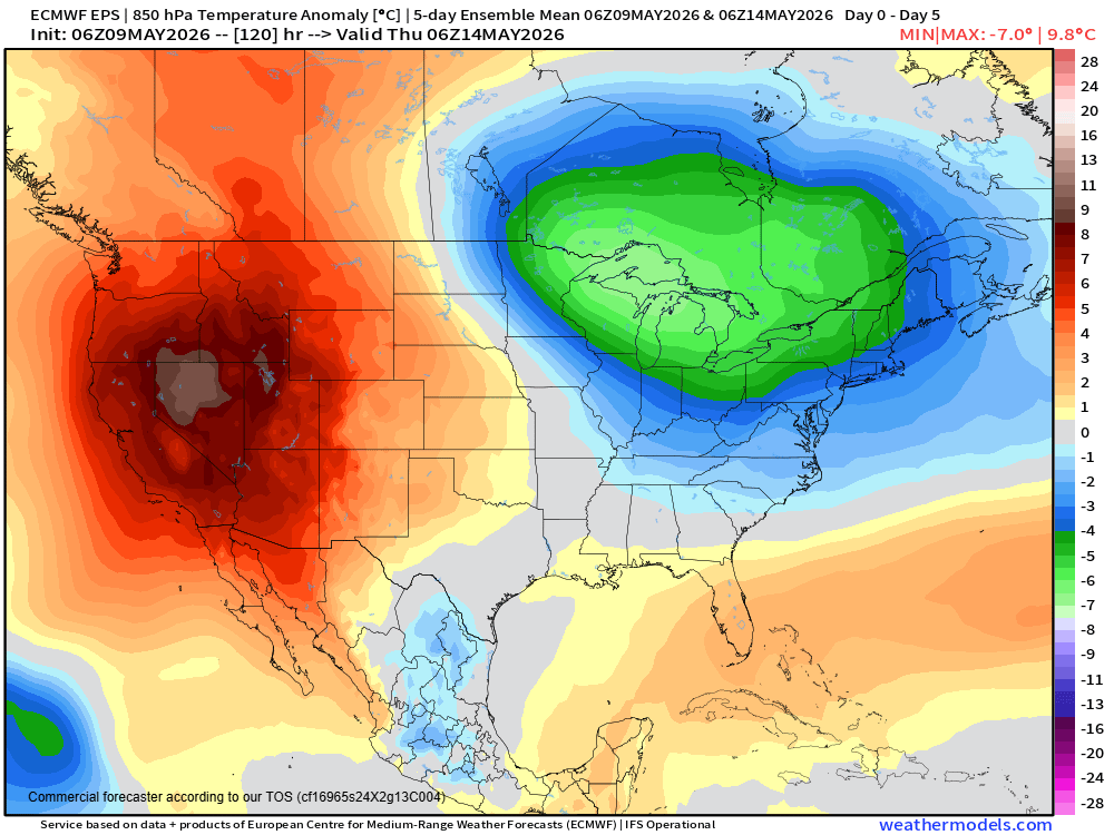
Another significant weather story the next several days will be a building area of upper level high pressure across the western United States, which will bring unseasonably warm conditions to much of the western half of the nation.
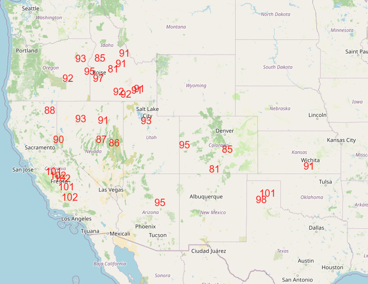
Numerous record warm temperatures are expected over the next several days, particularly on Monday and Tuesday (NWS forecast record maxes for Tuesday shown above).

Leave a comment