Record warmth in the West early this week shifts east by next weekend
May 10, 2026
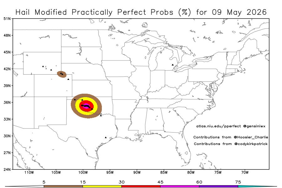
Happy Mother’s Day! Starting off today with a recap of Saturday, which ended up being another active day for hail across Oklahoma, this time primarily in the western part of the state. There were again about a dozen reports of very large (2+”) hail, including a report of baseball sized hail in Sayre.
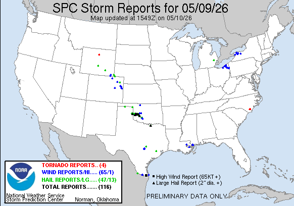
There were also scattered incidences of wind and hail along the Front Range in Colorado and Wyoming (just a couple of days after their snowstorm). Severe storms also caused some damaging winds in the Cleveland and Buffalo areas.

Late this morning a boundary left over from overnight thunderstorms across Oklahoma was crossing the Red River, with thunderstorms developing along it. As plenty of sunshine heats up the moist and unstable airmass ahead of this feature, the atmosphere will become very unstable, supporting intense thunderstorm development along this boundary as it drops south across northern and central Texas.
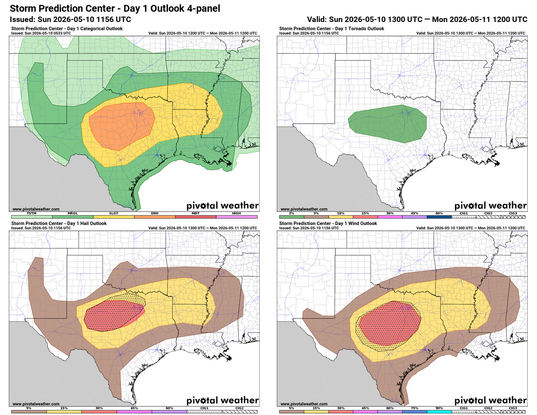
An enhanced (level 3 of 5) risk of severe weather is in place across this region this afternoon and evening, with severe storms capable of very large hail expected to be the initial primary threat. As the storms organize into a squall line, the risk for damaging winds will increase, with high resolution models suggesting the potential for numerous incidences of damaging winds with gusts greater than 75 mph possible as the storms move into central Texas this evening.
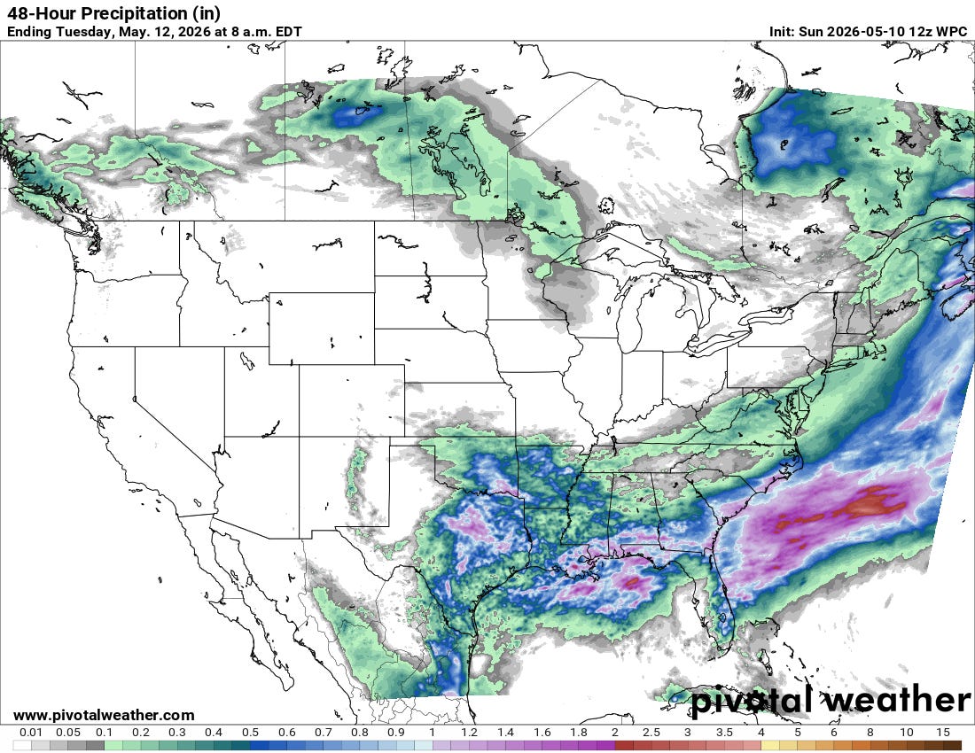
Although these storms will bring a risk of severe weather, they will also bring some beneficial rainfall to the region over the next day or two, with additional helpful rains expected to the east along the Gulf Coast and parts of the Southeast.
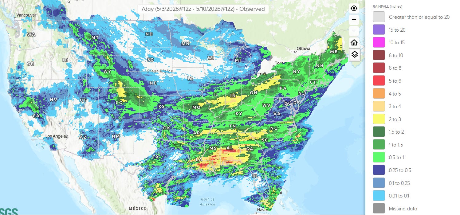
The Southeast had a good week as far as rainfall to help the ongoing serious drought conditions, with several inches of rain falling in many areas. The Front Range of Colorado and Wyoming also saw significant beneficial precipitation from their heavy snowfall event.
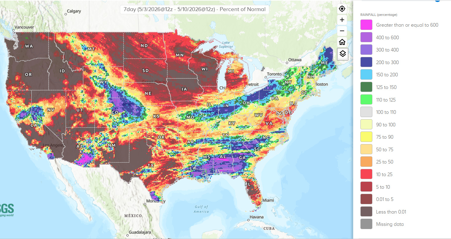
Looking at percent of normal precipitation for the last week, one can see that outside of these two areas much of the country remained unusually dry. A band of near to somewhat above normal precipitation fell from the Mid-Mississippi Valley into the eastern Great Lakes, and a few spots in the West such as southeast Arizona and the Lake Tahoe area did pick up some precipitation.
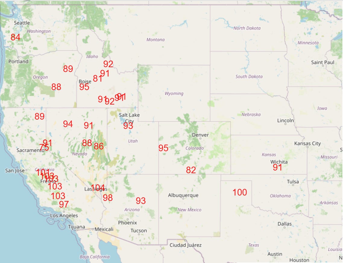
An unusually warm and mainly dry week is on tap for much of the western half of the country, with numerous record warm temperatures expected (Tuesday NWS forecast highs at or near records shown).
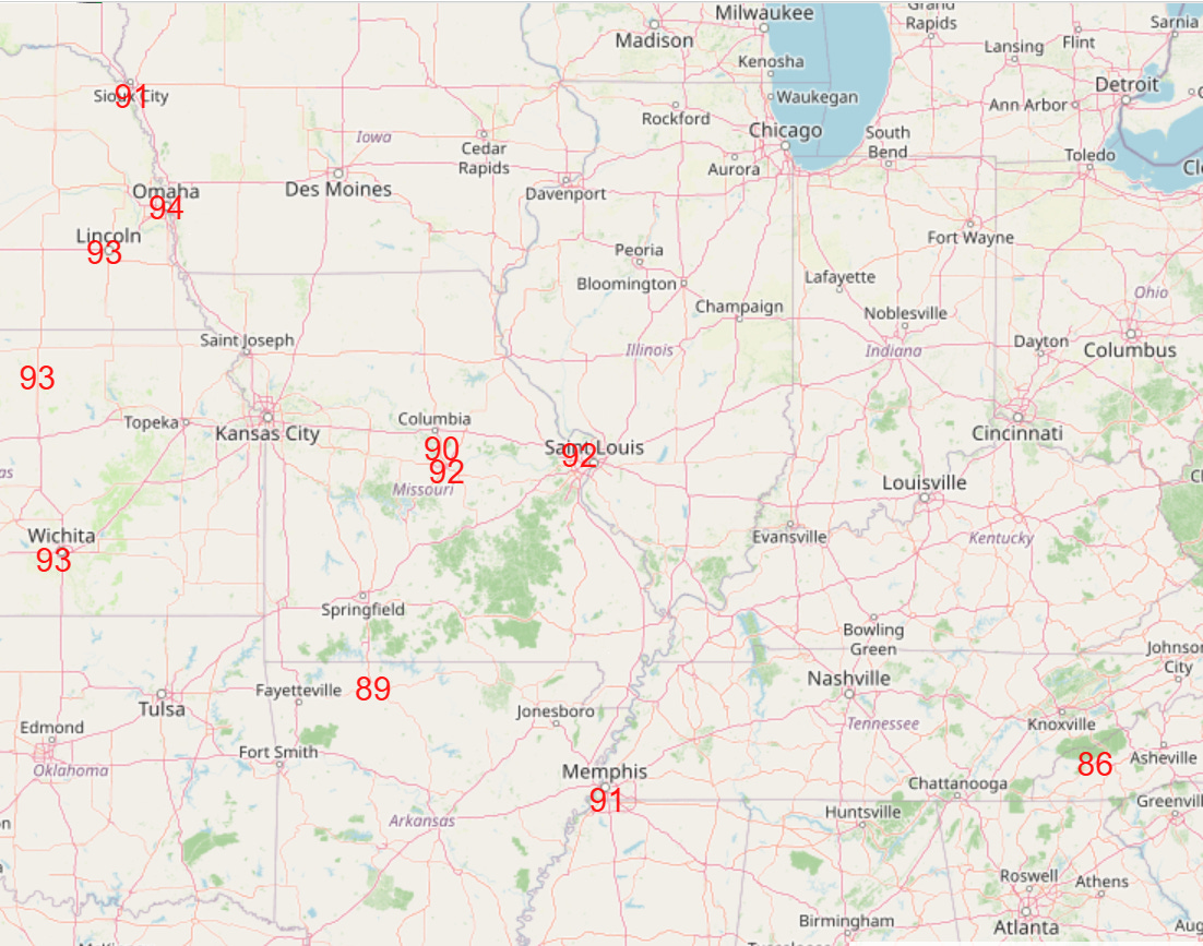
By late in the week, the record warmth is expected to shift into the Midwest (Saturday NWS forecast highs at or near records shown).

Leave a comment