Record warmth builds east as well
May 16, 2026
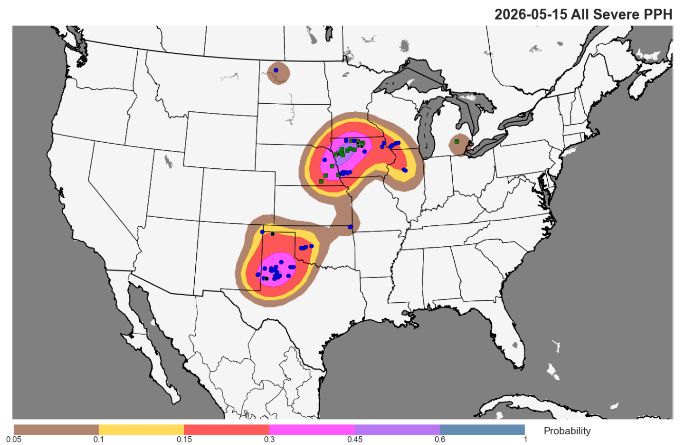
Friday was an active day to start off an active period of severe weather expected across the central part of the country. As generally expected, the Mid-Missouri alley was the most active as a number of supercells developed late in the day, producing numerous reports of large hail up to 2.5” in diameter, along with a more isolated supercell over southwest Iowa that resulted in several damaging wind reports.
In the Southern Plains, thunderstorms organized into a line of storms that produced numerous severe wind reports with measured gusts of up to 80 mph. The storms and their associated outflow winds along with continued hot and dry weather complicated firefighting efforts on several wildfires burning in the area, the largest of which is just south of Amarillo and has destroyed several homes and outbuildings and forced the closure of Palo Duro Canyon State Park.
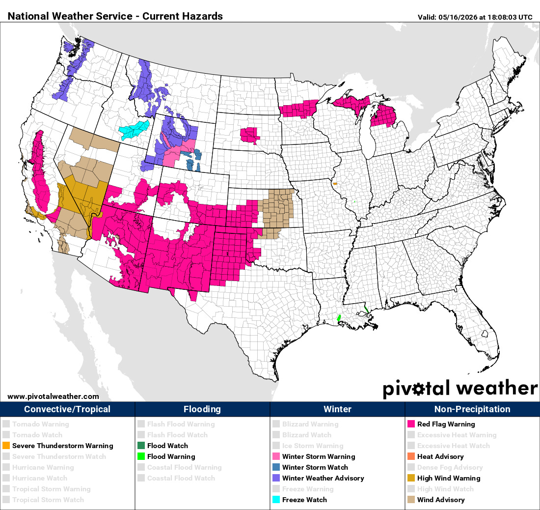
Critical wildfire danger will be a serious issue across much of the Southwest and Southern Plains this weekend with dry and windy conditions expected due to the upper level trough of low pressure that is building over the West. Red Flag Warnings are in effect for a large swath of the region, including as far west as parts of California.
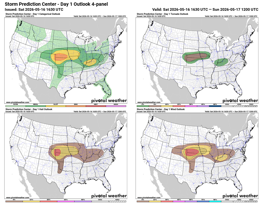
This upper level trough will also be responsible for the very active period of severe thunderstorms across the central US that Friday was the start of. For later today into tonight, the Storm Prediction Center is highlighting the region along the Kansas/Nebraska border for the greatest risk of severe weather with an enhanced (level 3 of 5) risk. Supercell severe storms should break out this afternoon with a risk of very large hail, and organize into a complex of severe storms with an increasing risk of damaging winds.
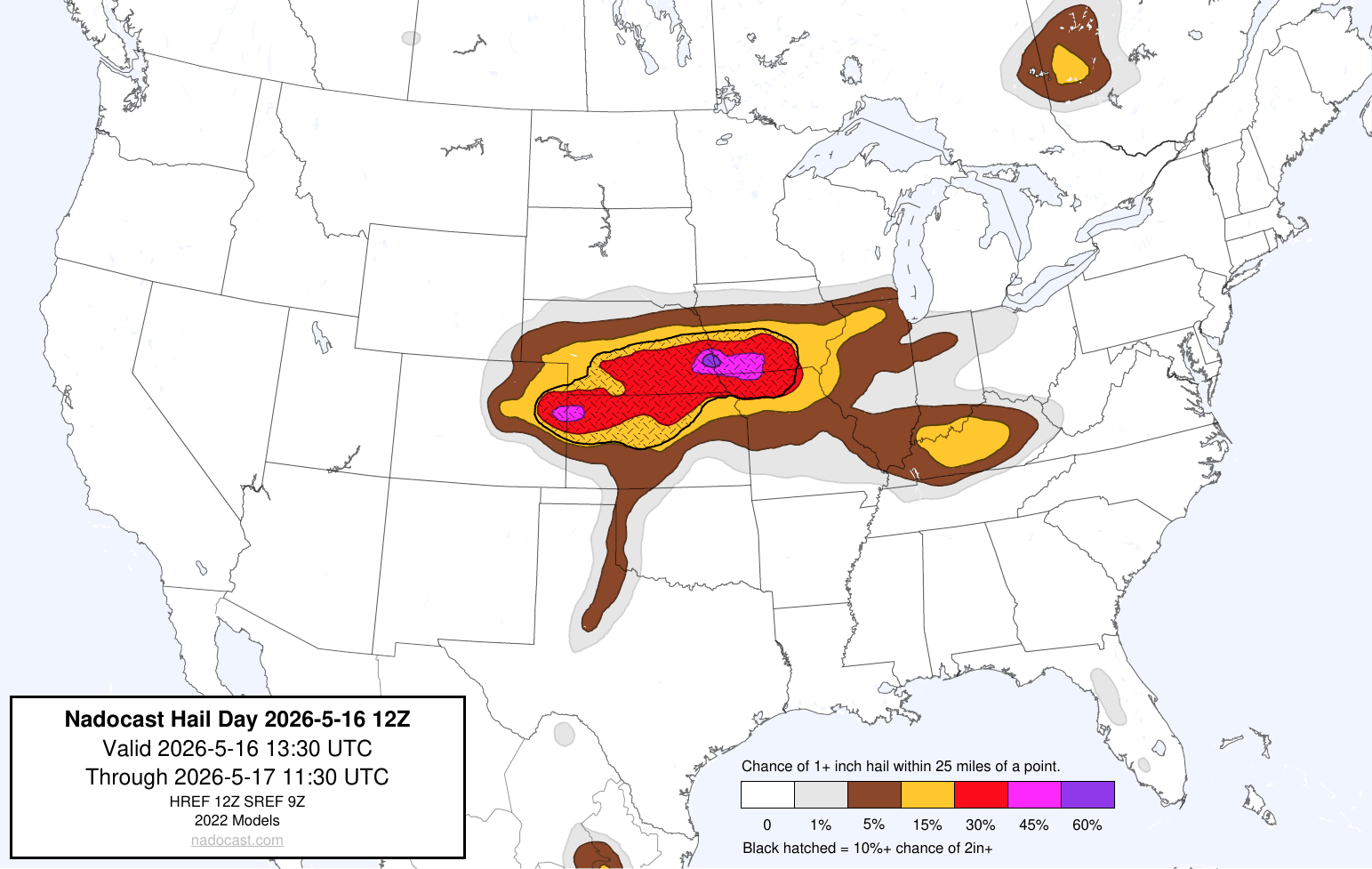
I will also be keeping an eye on areas farther to the east into southern Iowa, where the morning High Resolution Ensemble Forecast and the Nadocast AI system show the potential for supercells with a somewhat greater risk of very large hail and possibly a few tornadoes.
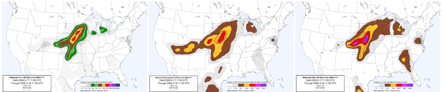
The Nadocast probabilities for day 2 focus on the Missouri Valley region, where an upper level disturbance interacting with an extremely unstable atmosphere looks should result in several intense supercell severe thunderstorms with the potential for very large hail, significant tornadoes and damaging winds. SPC has an enhanced (level 3 of 5) risk centered in this region. Farther to the southwest toward northwest Oklahoma, another disturbance moving out of the western upper level trough should help develop a few supercell severe storms with very large hail and possibly a tornado.
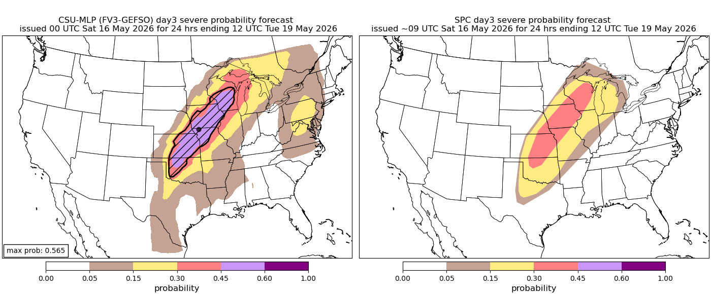
Monday appears to be the peak of this period of severe weather as he strongest upper level disturbance rotates northeast into Midwest. Strong forcing for thunderstorm development and increased winds at all levels of the atmosphere will overspread a large area of extremely unstable air, resulting in an outbreak of severe thunderstorms with intense tornadoes, very large hail and significant damaging straight line winds all possible with the strongest storms.
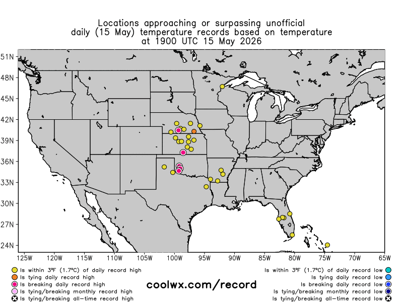
Record warmth will also continue to spread east this weekend after a number of record highs were set on Friday, including 105F at Childress, TX, 95F at Lincoln, NE, 93F at Wichita and St. Joseph, MO.
Programming note: As a reminder with severe weather expected the next several days that as my schedule permits I will be doing live Substack chats and occasional videos with updates and interesting things I see. These are benefits that paid Balanced Weather subscribers receive in thanks for their support. Any videos I do will be available as soon as I can get them processed as posts and on my YouTube Channel.

Leave a comment