Eastern Pacific has first three storms of 2026 – and last one (Cristina) has potential implications for the Gulf
Jun 09, 2026
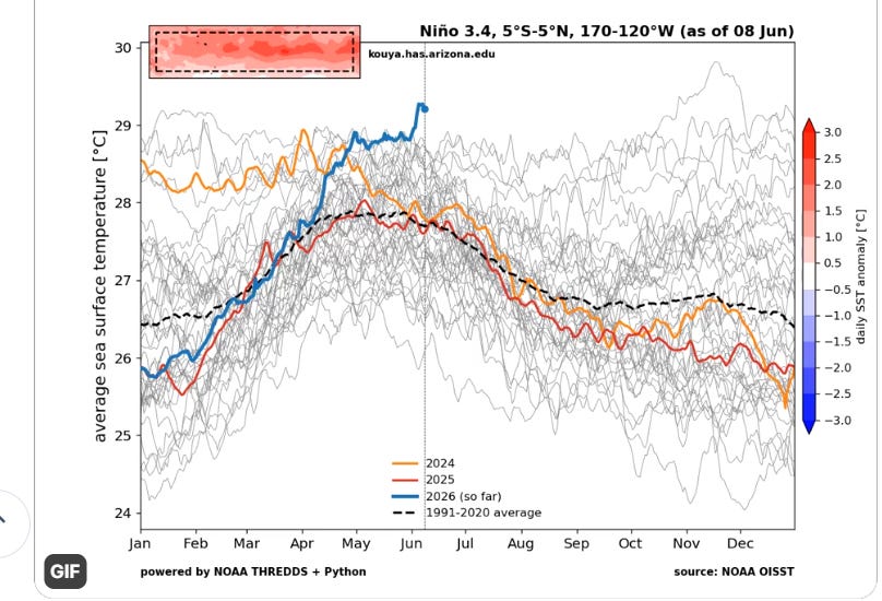
I want to start off this (late) weekly tropical update by talking about the driving force behind this year’s Northern Hemispheric tropical season, the anticipated El Nino. This climatic event has been getting a lot of media coverage in recent weeks as models have been forecasting a potential historic level El Nino by late this year — and the most recent trends in models and observational data have done nothing to turn the tide of that thinking. The graph above courtesy of University of Arizona professor and hurricane scientist Dr. Kim Wood from her BlueSky shows that the sea surface temperatures (SSTs) in the critical Nino 3.4 region of the equatorial Pacific Ocean are record warm for early June (data back to 1982).
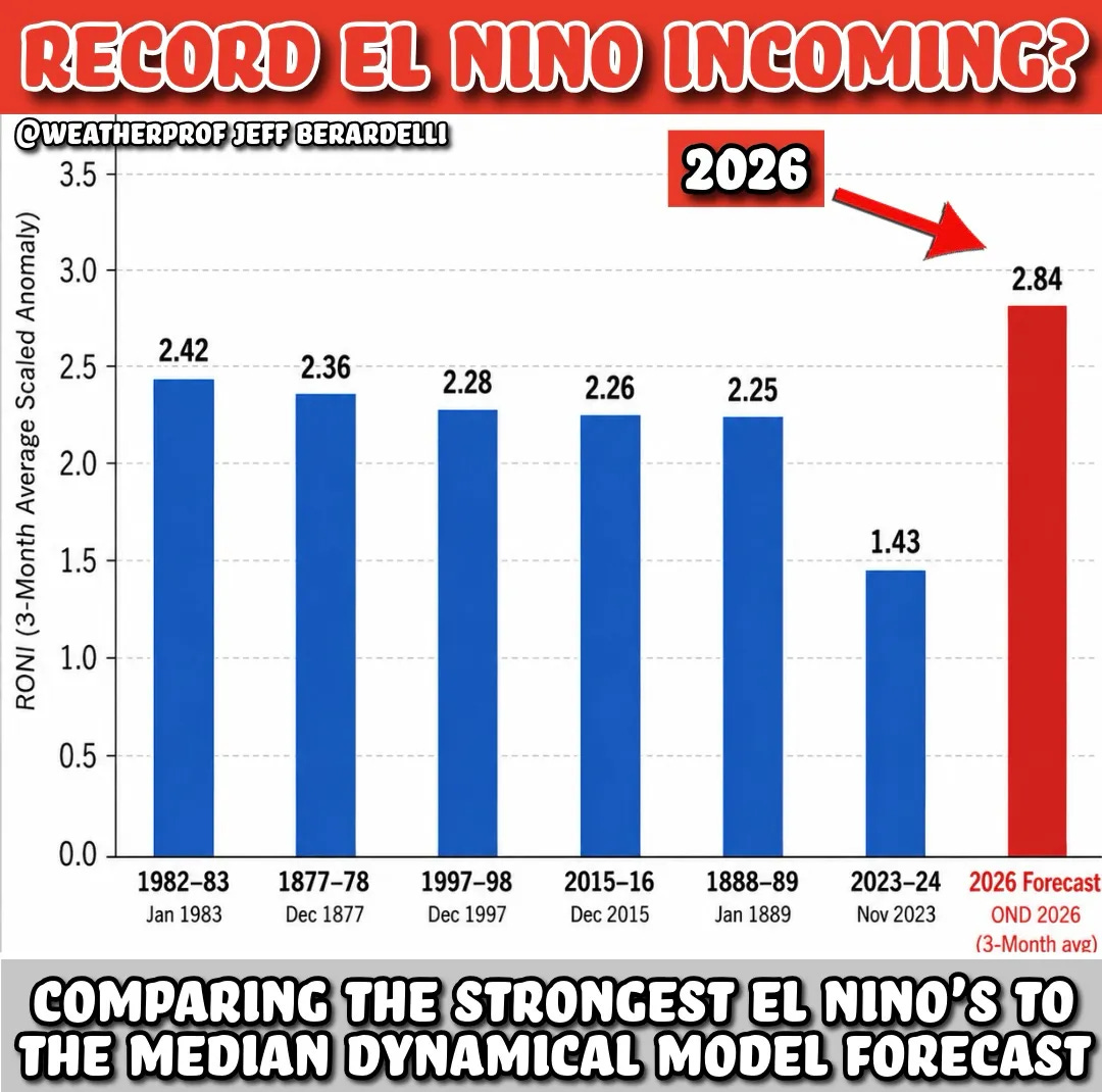
This supports the general idea advertised by the most recent climate models which suggest a potentially historic El Nino by late this year — with this graph from my colleague Jeff Berardelli showing the median forecast of the model forecasts for the Relative Oceanic Nino Index (RONI), a new index which is expected to better capture El Nino and La Nina events by comparing the equatorial Pacific SST values to the global SST values.
While we are still weeks away from an El Nino being officially declared due to the need for the warm Nino 3.4 anomaly to persist for several months, the atmosphere is already showing some signs of reacting to the warming Pacific waters, including increasing tropical activity in the Pacific. In the eastern Pacific, the last 10 days have seen the first three tropical storms of the year: Amanda, Boris and Cristina. Amanda formed well west of central America and has dissipated, while Boris formed just off the west coast of Mexico and quickly moved inland as a minimal tropical storm, producing heavy rainfall.
Cristina is still ongoing, centered just offshore of El Salvador as a minimal tropical storm and moving little. The storm is expected to continue to meander just offshore for the next 24 to 36 hours before turning north-northwest and moving into central America. Heavy rainfall and flooding/mudslides will be the primary risk from Cristina.
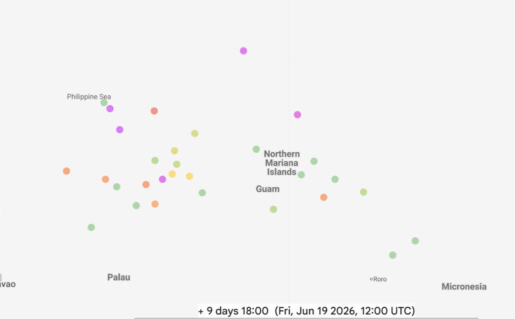
The western Pacific looks to get increasingly active in about a week or so, as both the Google DeepMind (shown above) and European ensembles show development — although the timing and specific location for a system to come together remains quite uncertain as shown by the model spread.
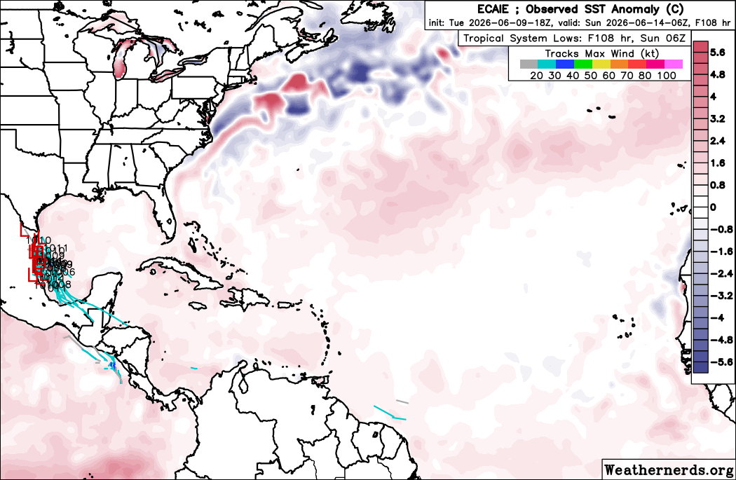
Meanwhile, the Atlantic tropics are quiet. The models have periodically hinted at potential development in the Gulf or Caribbean by sometime early next week as the favorable phase of the Madden-Julian Oscillation helping eastern Pacific activity moves farther east. Interestingly, today’s models have started to show the idea that a remnant of the rotational energy from Cristina could potentially reform in the far western Gulf of Mexico as the system drifts north over the next several days. The European AI ensemble shown above is particularly bullish about this idea — but the physical European ensemble and the most recent Google DeepMind AI also show a number of members with at least a weak system developing and drifting north near the western Gulf coast.
This type of scenario has certainly led to tropical development in the Gulf occasionally in the past, so it is worth keeping an eye on. As of now, Cristina is only forecast to slightly intensify before making landfall – watching how it trends in the next couple of days should help us in determining how likely such a scenario might be.
At a minimum, a slug of rich tropical moisture should surge north toward the western Gulf coast by this weekend, enhancing thunderstorm activity and the potential for some flash flooding.

Leave a comment