NHC highlights its first area to monitor in the Atlantic for 2026
Jun 10, 2026
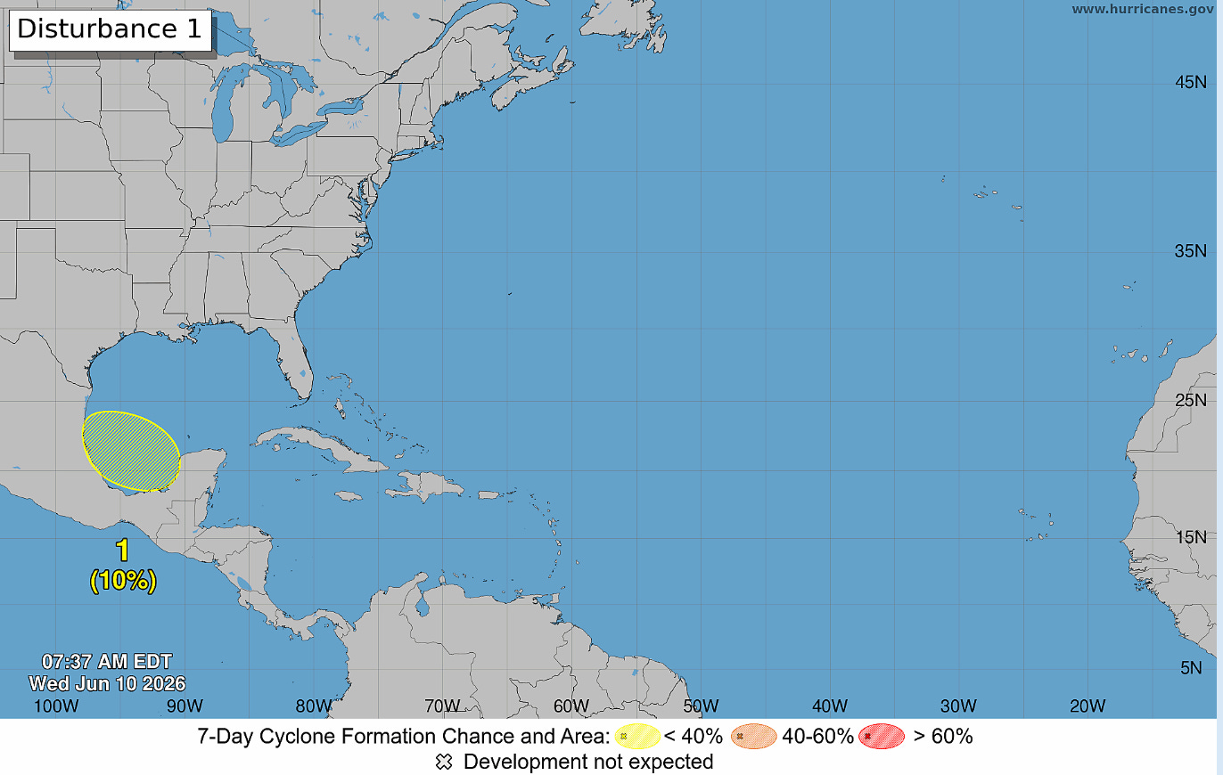
Starting off this morning with a quick update on the tropics. The National Hurricane Center has highlighted the area in the southwest Gulf that I talked about in last night’s tropical update post for a low (10%) probability of development in the next 7 days. The overall trend in TS Cristina in the eastern Pacific and its potential to spawn a new system in the Gulf has not really changed much since that post — I will obviously keep an eye on it.
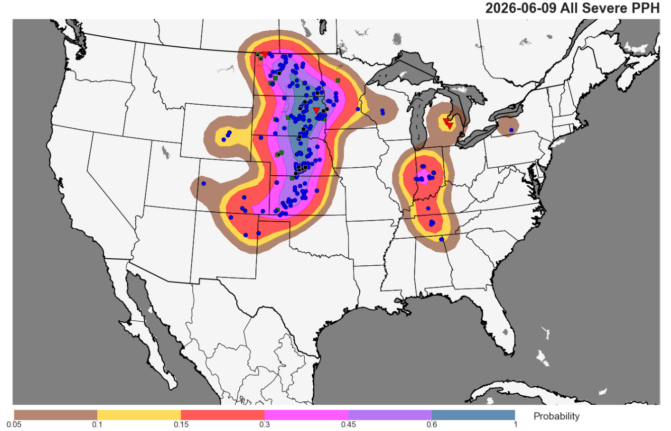
Yesterday was another busy day of severe weather across the central United States, with over 400 reports of severe weather, primarily focused in the central Plains. Hail up to 3” in diameter was reported, but as expected widespread significant straight line winds were the main severe weather impact, with nearly two dozen reports of significant (75+ mph) wind gusts, the strongest of which appears to have been an 85 mph gust near Kearney, NE associated with an intense bow echo storm that moved across southern Nebraska. Other significant severe wind gusts were reported in the Dakotas and western Minnesota. More than 30,000 customers are still without power in the central US after two days of high end severe weather, with Kansas and Minnesota the most impacted.
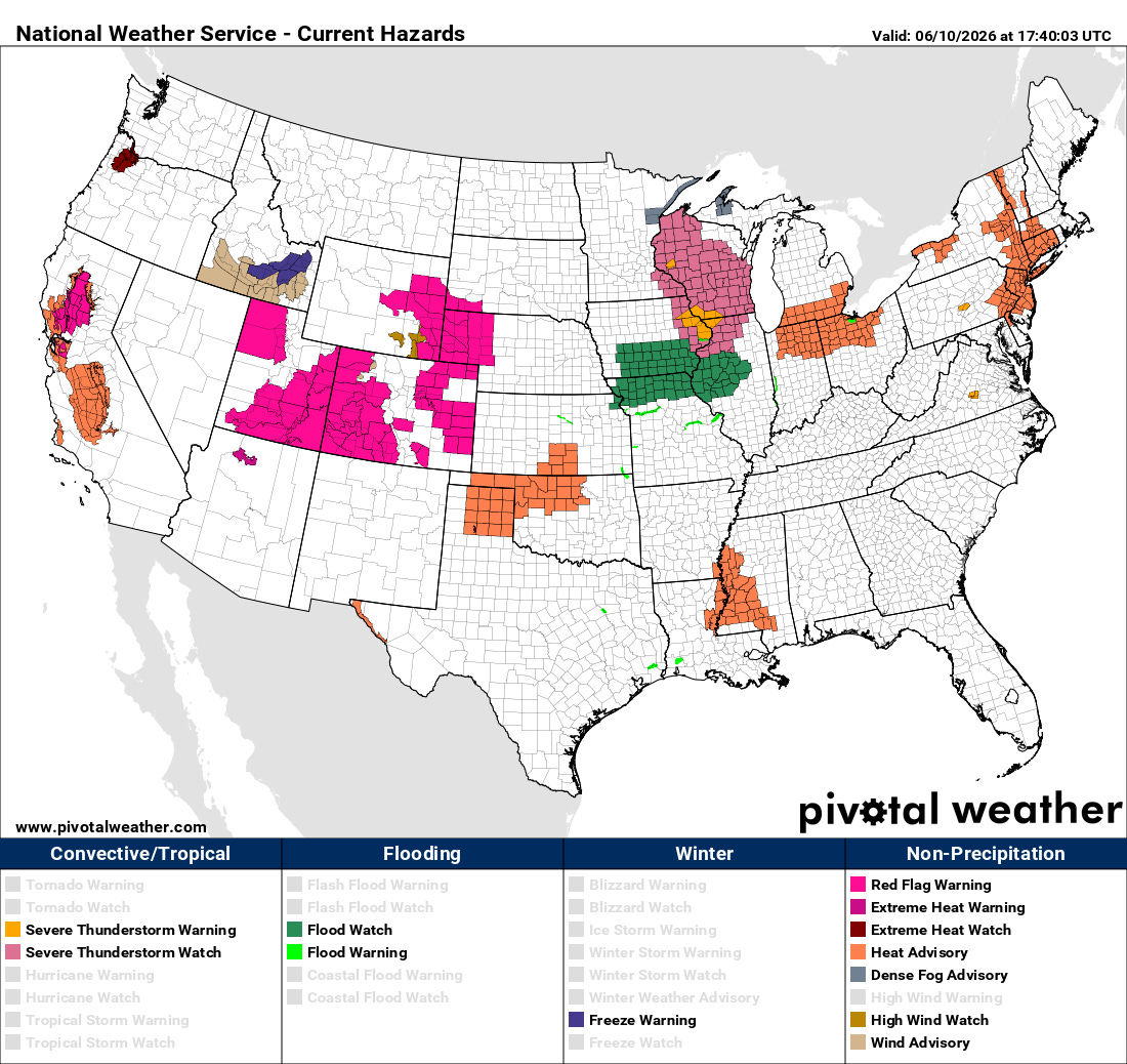
Today will be another active day for severe weather, with the focus shifting a bit farther east and southeast. A severe thunderstorm watch is already in effect for much of the Upper Mississippi Valley as a line of severe thunderstorms with damaging winds is pushing northeast across the Mississippi River north of the Quad Cities. This line of severe storms should continue to intensify and expand as it moves northeast into a warm and humid airmass ahead of it.
Farther southwest, additional severe thunderstorms are expected to develop across parts northern Missouri and adjacent areas — these storms could have a somewhat enhanced tornado risk this evening as low level wind shear increases. Flash flooding will also be a concern with these storms, and flash flood watches are in effect in these areas.
Farther west, Red Flag Warnings are in effect in many areas where fire danger will be a serious concern this afternoon. Heat and humidity is also fairly widespread over the country today, and heat advisories are scattered from coast to coast.
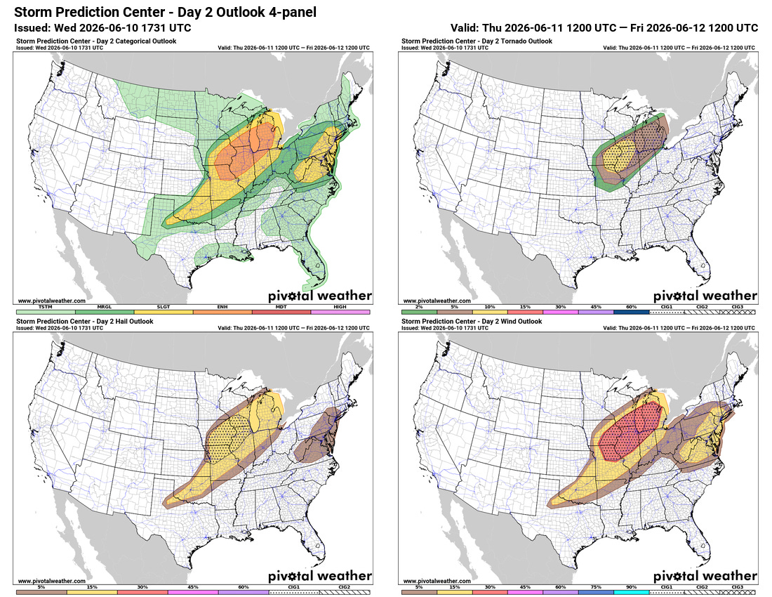
Thursday looks to be another day with serious severe weather risk over the Midwest as an even stronger upper level weather disturbance sweeps into the region. The potential evolution of severe storms looks a bit messy and uncertain as there will likely multiple rounds of storms that could impact the amount of instability and storm interaction. However, the overall setup looks very supportive of higher end severe weather including strong tornadoes and significant straight line winds, and it would not be surprising to me to see a moderate (level 4 of 5) risk for some part of the Midwest Thursday as trends become clearer. Severe weather will also be a concern along the Mid-Atlantic on Thursday afternoon and evening as today’s disturbance pushes toward the East Coast.
Programming Note: Given the increase in active weather, I have started utilizing the Substack Chat feature again to share occasional updates. I will be utilizing chat and occasional live videos over the next several days — as a reminder, these are benefits that paid subscribers receive for their support of Balanced Weather. Any videos I do will also be recorded and shared to all subscribers.

Leave a comment