Complex scenario today yields multiple risk areas with potential for significant wind damage and possibly strong tornadoes. Meanwhile, CPC declares El Nino conditions officially exist.
Jun 11, 2026
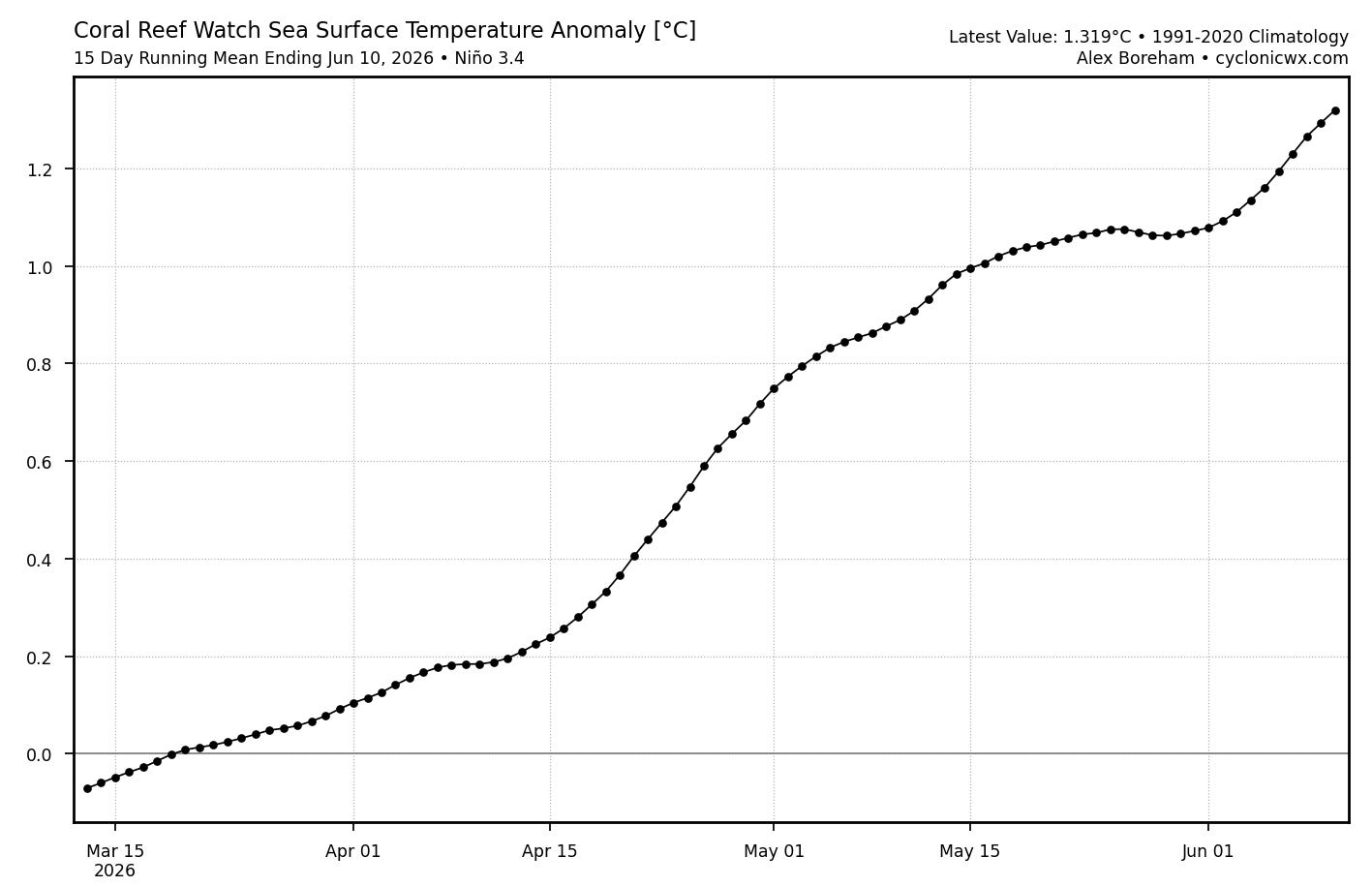
Before we get into the continuing active severe weather across the country, I wanted to share that the NWS Climate Prediction Center announced this morning that they “officially” are stating that El Nino conditions are now present. While this does not mean that El Nino has persisted long enough for this to be considered an official El Nino event, as I discussed in my tropical update post the atmosphere doesn’t care about our definitions and there are many atmospheric and oceanic data points showing that an El Nino is in progress, including that the sea surface temperatures (SST) in the equatorial Pacific are in record territory for this time of year and already in moderate El Nino territory (above).
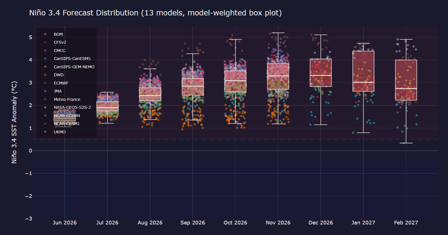
All signs are that El Nino conditions will not only persist for many months and qualify this as an official El Nino event, but that it will continue to strengthen and likely become one of the strongest El Ninos on record. The graph above from climate scientist Zeke Hausfather’s Climate Brink website shows that the model consensus has the SST anomalies in the equatorial Pacific at record levels near or above +3C. Meteorologist Bradlyn Oakes has an excellent overview on her Substack of potential global impacts from a major El Nino.
Turning to severe weather, the last 24 hours have been incredibly active across the Midwest, with multiple rounds of intense severe thunderstorms moving across the region.
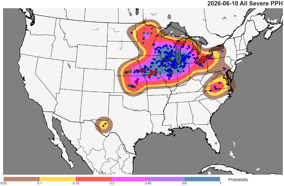
More than 600 reports of severe weather received by the NWS Storm Prediction Center on Wednesday, including a number of tornadoes from northern Missouri across southern Iowa, southeast Nebraska and parts of Kansas. Significant straight line winds impacted many area from the Mid-Missouri Valley to the Great Lakes, and at one point more than 500,000 customers were without power across the region. As of this morning, more than 300,000 remain without power, including 167K in Illinois and 56K in Michigan (power outage figures courtesy poweroutage.us).
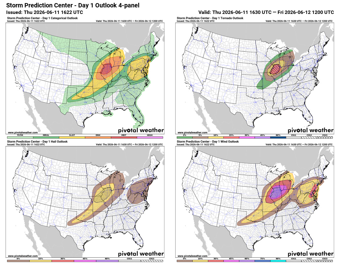
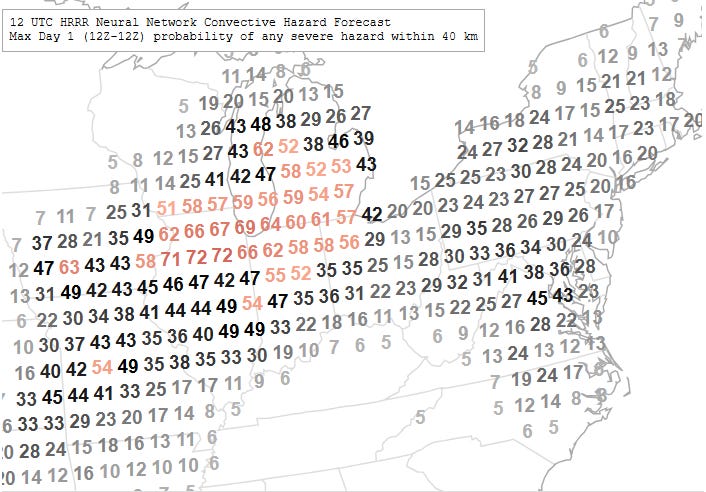
As I alluded to in yesterday’s newsletter, today looks to be another potentially high end severe weather day as an intense upper level disturbance will move into the Midwest this afternoon and evening — SPC now has a moderate (level 4 of 5) risk of severe storms over northern Illinois, with a large enhanced risk surrounding it.
However, the atmospheric scenario across the region is quite complex as shown by this loop of NOAA GOES high resolution visible satellite imagery and MRMS reflectivity mosaic courtesy of WeatherFront. The overnight thunderstorm complex that brought severe weather to parts of Iowa and eastern Nebraska is now pushing across northern Illinois and southern Wisconsin — an area that had already had significant airmass stabilization due to multiple rounds of severe storms the last 24 hours. This has resulted in the storms weakening during the midday hours.
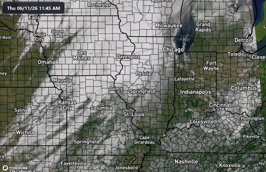
However, downstream of where the thunderstorm complex is now, plenty of daytime heating and increasing moisture coming up from the southwest ahead of a rather strong low pressure center over Iowa is expected to result in significant destabilization of the atmosphere, allowing this complex to eventually intensify and pose a significant risk of damaging winds across the Great Lakes region. Furthermore, as the atmosphere becomes increasingly unstable to the south of this ongoing complex, this unstable air will be pulled north by the the low pressure system, and could result in reintensification of storms with potential supercells including strong tornadoes across parts of northern and central Illinois and adjacent areas.
Severe storms are also expected today in portions of the Mid-Atlantic and Northeast as yesterday’s Midwest disturbance pushes east into the hot and humid airmass over the region. Damaging winds look to be the primary risk with these severe storms.

The Mid-Atlantic and Northeast will see another risk of severe thunderstorms on Friday as today’s Midwest disturbance moves east, with damaging winds again the primary threat. Severe weather risk will persist into the weekend as additional upper level disturbances move east across the Midwest and East.

I do not want to overlook the risk of flash flooding, as these storms are being fueled by significant levels of moisture and anywhere storms persist for a period flash flooding could result. As of now, that risk appears greatest for today and tonight in the Upper Mississippi Valley and Great Lakes regions.

Leave a comment