NHC initiates advisories on disturbance near Texas/Mexico border, expected to bring major flash flood risk to Gulf Coast region next few days
Jun 16, 2026
There is a tremendous amount of impact weather to talk about today — and I want to start with ongoing heavy rainfall and flash flooding in the South and the breaking news that the National Hurricane Center has initiated advisories in the tropical disturbance we have been talking about
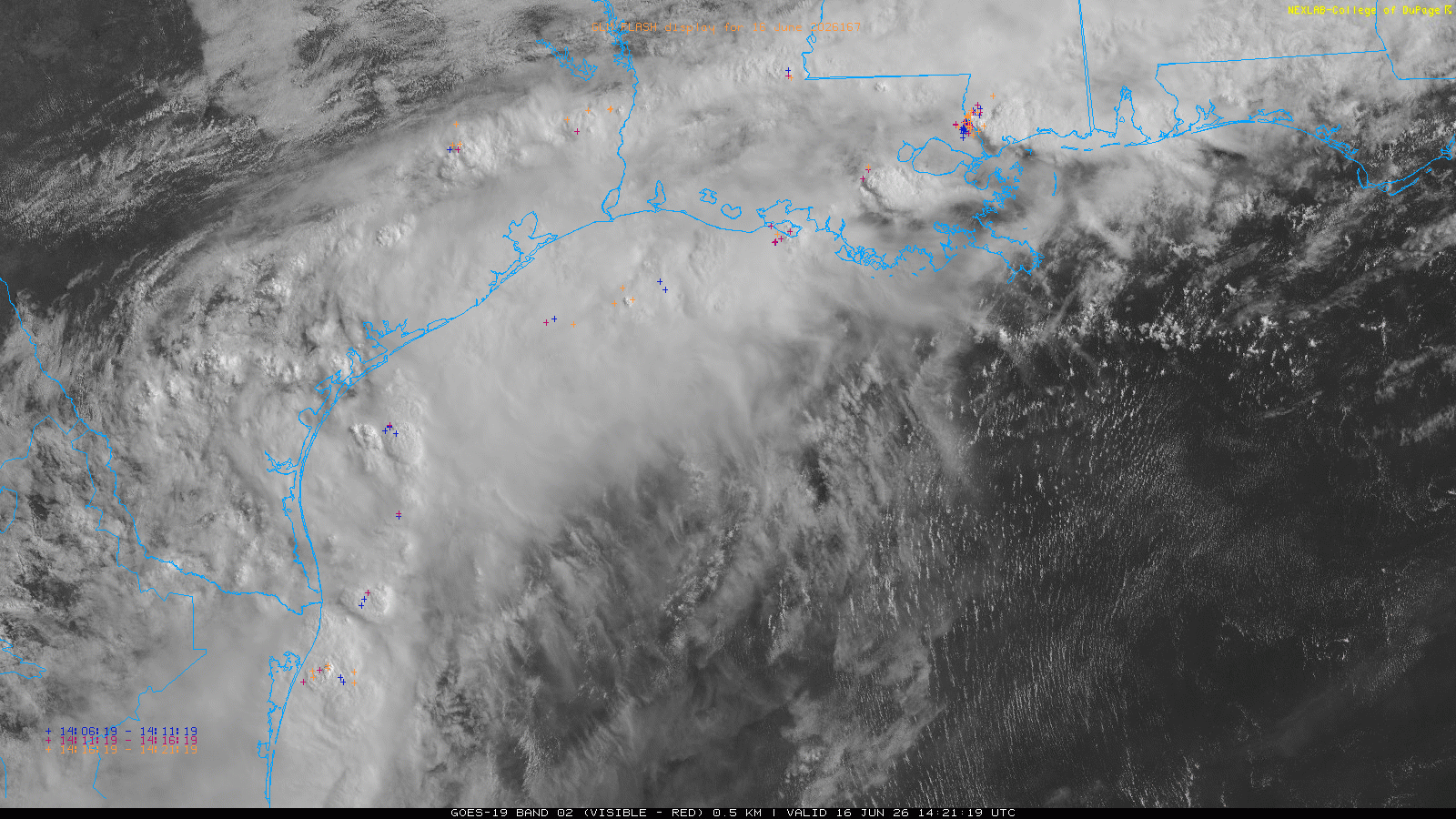
The morning visible satellite loop shows the spin of the disturbance pretty clearly near the Deep South Texas coast. Surface observations show that a developing weak low pressure system appears to be evolving just north-northeast of Harlingen, and satellite suggests the system is drifting east.
As I discussed in yesterday’s post, this developing low pressure system will be receiving a boost from favorable atmospheric dynamics to the southwest of a strong upper level jet stream over the Mid-Atlantic region. The drift of the low as well as thunderstorms developing over the Gulf should help the system consolidate more over water in the next 24-36 hours, and potentially become a tropical cyclone.

As NHC discussed in their morning advisory, the system will really be a hybrid of a tropical and non-tropical system — and because it will only be over water for a fairly short period of time it is unlikely to become anything more than a minimal tropical storm (and maybe not even that). The official forecast has the system briefly becoming a tropical storm (Arthur would be the name), and tropical storm watches are in effect for the central Gulf Coast from Sargent, TX to Morgan City, LA.
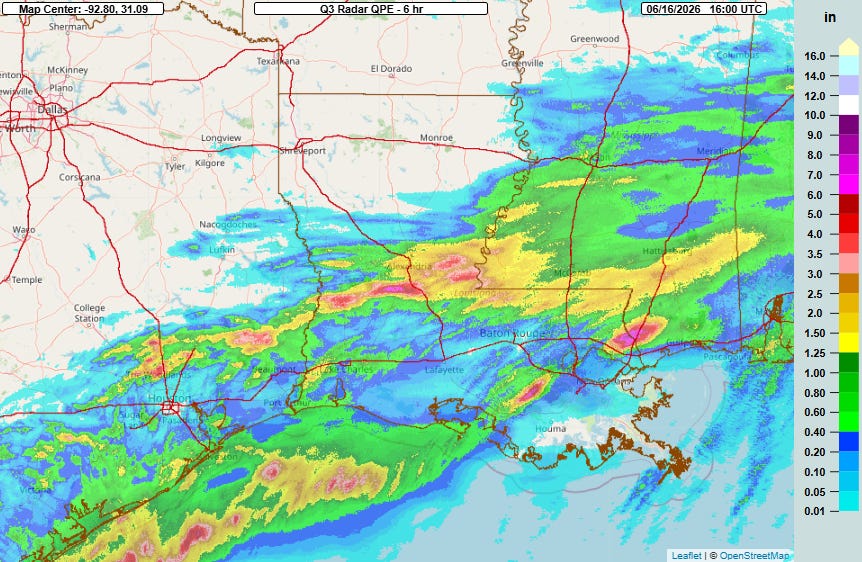
Undoubtedly the major risk with this event will be the potential for serious flooding. In the satellite loop above, you can see a persistent arcing band of thunderstorms from southeast Texas into southern Mississippi — and MRMS rainfall estimates show that up to 6” of rain has fallen in the last 6 hours in localized areas with this band.
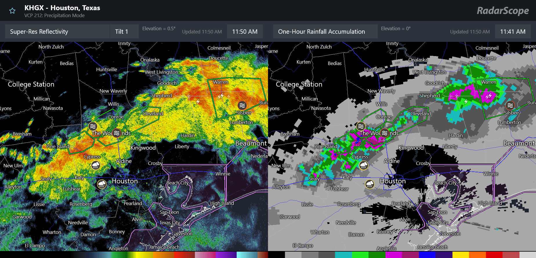
A number of flash flood warnings are in effect along this band. Some of the heaviest rain at midday is over the north and northwest suburbs of the Houston metro area, where rainfall of up to 3” per hour is occurring and significant flash flooding appears to be ongoing around The Woodlands.
![[Image of WPC Flash Flooding/Excessive Rainfall Outlook]](https://substackcdn.com/image/fetch/$s_!hwvs!,f_auto,q_auto:good,fl_progressive:steep/https%3A%2F%2Fsubstack-post-media.s3.amazonaws.com%2Fpublic%2Fimages%2F686641b8-976b-42d2-b3c7-eee0694e9d4a_1090x692.gif "[Image of WPC Flash Flooding/Excessive Rainfall Outlook]")
That band of thunderstorms is generally along the old stationary front that will remain in place as the low pressure system develops — and increasing southerly winds will transport extremely high levels of tropical moisture and focus thunderstorms with torrential rainfall along the front. The Weather Prediction Center excessive rainfall outlooks focus the highest risk of significant flash flooding along this axis through Thursday.
![[Image of U.S. rainfall potential]](https://substackcdn.com/image/fetch/$s_!TeI6!,f_auto,q_auto:good,fl_progressive:steep/https%3A%2F%2Fsubstack-post-media.s3.amazonaws.com%2Fpublic%2Fimages%2F2543f67f-886c-4a5d-aced-94090fc28c07_892x716.gif "[Image of U.S. rainfall potential]")
Rainfall amounts of up to a foot (or more) are possible in some spots — and where amounts like this occur serious, life-threatening flash flooding could occur along with significant river flooding.
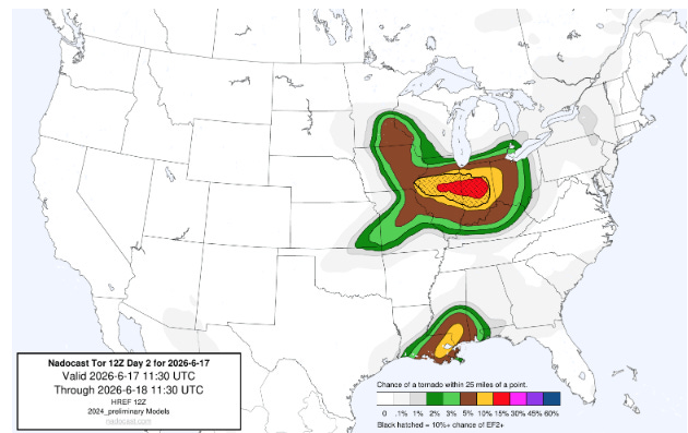
There will also likely be an increasing risk for some low topped, tropical supercell storms that could produce a few tornadoes along the central Gulf Coast as shown by the most recent Nadocast AI day 2 tornado probabilities.

In that Nadocast image, you can also see the signs of the other serious impact weather situation — what looks to be a major outbreak of severe thunderstorms and tornadoes across the Midwest. An unusually intense for June upper level weather disturbance will be swinging across the Upper Midwest Wednesday afternoon, spawning a similarly unusually strong for the time of year surface low pressure system that should move across the Lower Great Lakes into Wednesday evening.
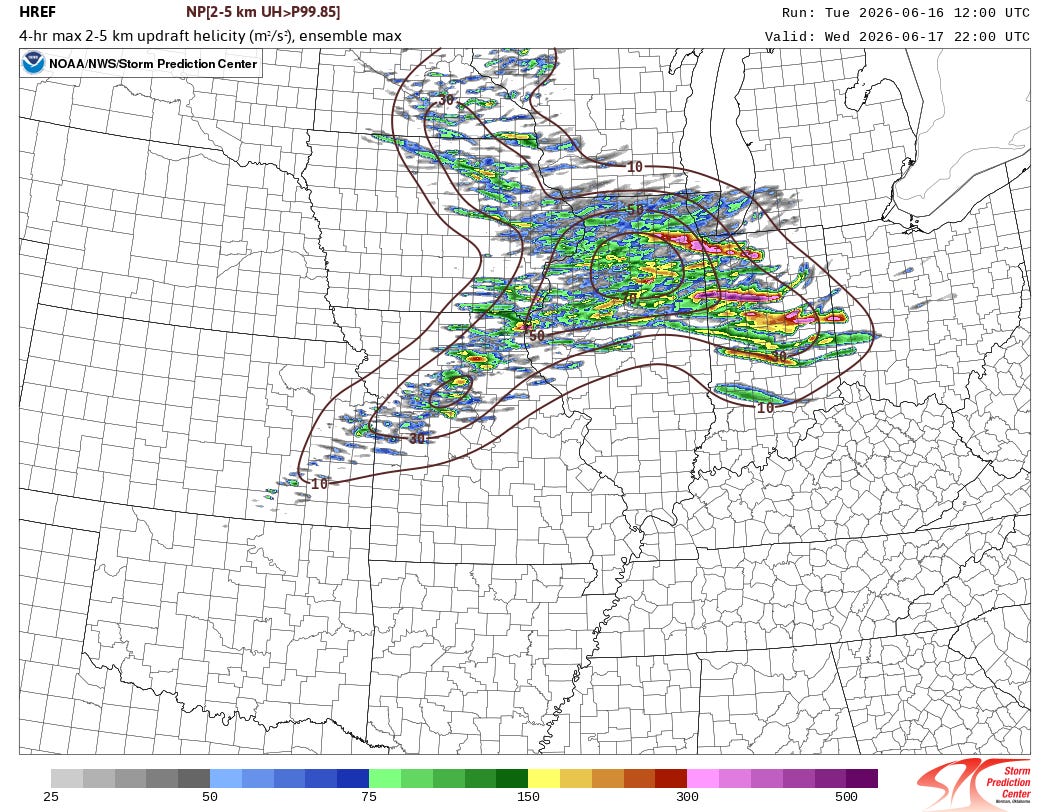
The High Resolution Ensemble Forecast (HREF) shows that as this dynamic atmospheric setup interacts with very moist, warm and unstable air, numerous supercell severe thunderstorms should erupt and move east in an environment very supportive of high end severe weather including intense tornadoes, very large hail and damaging winds — with the greatest tornado risk likely along the warm front I have drawn in on the map above. There is still some uncertainty as to where that warm front will setup given the expectation of thunderstorm activity across the region tonight into Wednesday morning. Eventually, a line of severe storms should also evolve along the cold front with significant damaging winds and potential tornadoes associated with it.
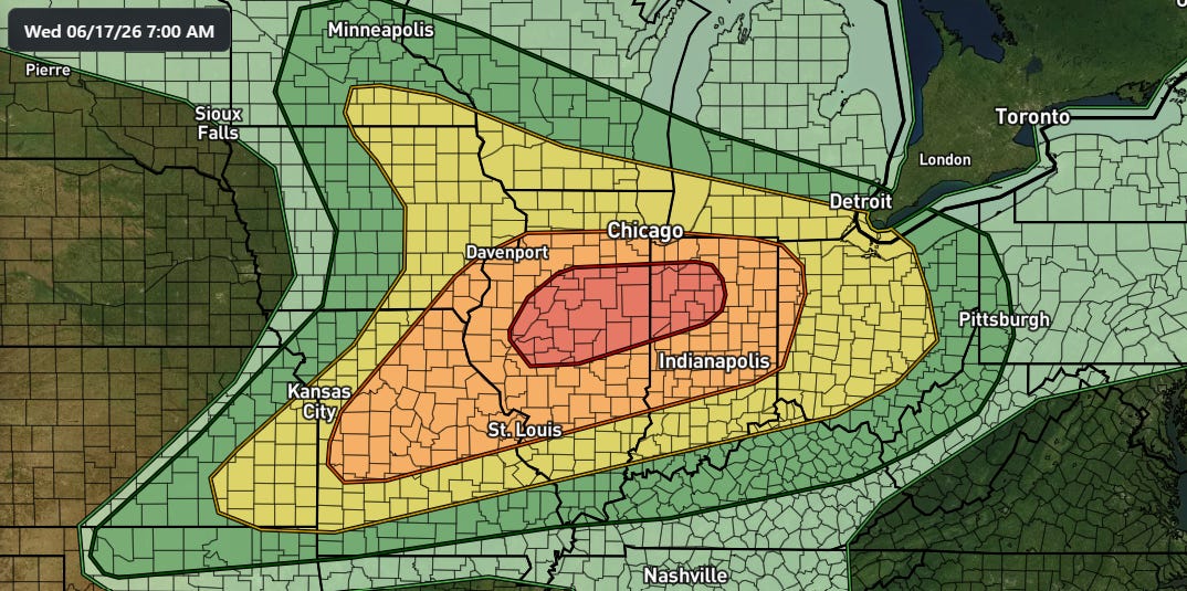
SPC already has a moderate (level 4 of 5, red area above) risk of severe weather in place. This is one of the more impressive looking severe weather setups I have seen in the Midwest in quite a long time, with a springtime storm system combining with summertime moisture and instability likely to yield volatile storms. While there is always the potential for a tornado forecast to “bust” due to unanticipated small scale atmospheric evolution, this setup should at a minimum produce intense severe storms with widespread significant damaging straight line winds and potential very large hail. People in the outlooked area should be taking this threat seriously and keeping up to date with the latest forecasts.
Graphics in today’s post not from NOAA websites are courtesy of the WeatherFront app.
Programming Note: Given the increase in active weather, I have started utilizing the Substack Chat feature again to share real-time updates. I will also be doing some live videos over the next couple of days to provide briefings and updates about the evolution of severe weather and flash flooding risks. As a reminder, these are benefits that paid subscribers receive for their support of Balanced Weather. Any videos I do will also be recorded and shared to all subscribers. I also provide updates on my BlueSky and Facebook feeds, and via occasional Substack Notes. To see an example of my Substack chat updates from the Thursday night severe weather in the Midwest, click here.

Leave a comment