Heavy rainfall and flash flooding risks increase across the South as NHC monitors system in the northwest Gulf
Jun 14, 2026
Before I get into today’s weather risk, I want to share that the latest episode of the Debris Ballers podcast I co-host was released this morning. Entitled “18 Minutes,” we take a dive into the tornado event in western Arkansas on June 6, in which tornadoes with Doppler radar debris signatures were ongoing for 18 minutes before the NWS issued a tornado warning. In the episode, we talk about what might have happened and contributing NWS organizational issues. I encourage you to check it out here.
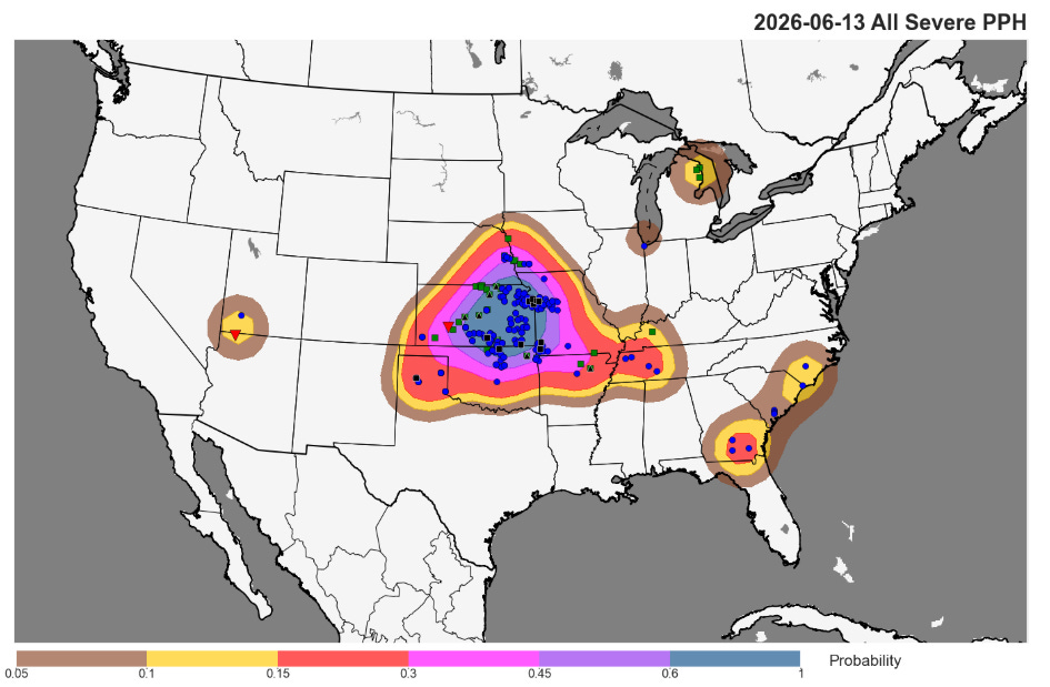
As expected, Saturday into Saturday night was another quite active day across the central United States, with 400 reports of severe weather received. A band of intense severe storms developed from central Kansas to northwest Missouri early in the evening and swept southeast into the overnight hours producing widespread damaging wind gusts. This included a dozen significant (75+ mph) severe gusts, with a 79 mph measured gust at Kansas City International Airport. A few embedded tornadoes likely also occurred, and tens of thousands of customers lost power. Nearly a dozen incidences of very large (>2”) hail were reported early in the evolution of the storm complex, with 4” diameter hail reported near Winfield, KS.

The severe weather today will be focused across the eastern United States. A strong upper level weather disturbance is moving into the Great Lakes region early this afternoon, and is expected to spawn a band of severe thunderstorms across Ohio and Lake Erie over the next several hours. Damaging winds should be the main threat with these storms — but as they move farther east conditions will become somewhat more favorable for a few tornadoes across western Pennsylvania and New York.
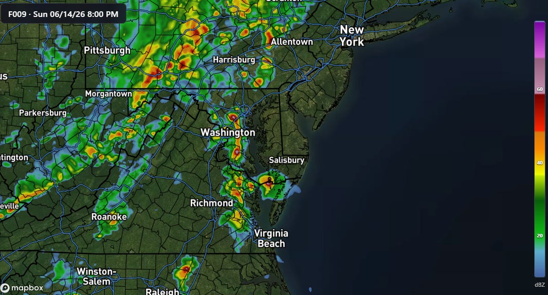
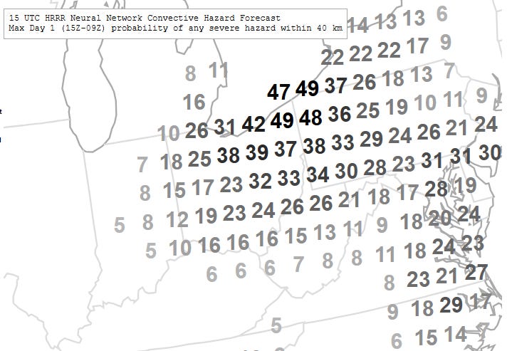
As this line of storms moves east into the late afternoon and evening, other scattered strong to severe storms should develop in the hot and unstable atmosphere across the Mid-Atlantic region. Damaging winds should also be the primary risk with these storms, although a few tornadoes and incidences of large hail are possible.

The risk of severe weather will become more muted for a couple of days as a large upper trough of low pressure temporarily pushes the heat and humidity that has been dominant over the eastern half of the country the last several days. However, as hot and humid air starts to come back north across the southern US at midweek, a new strong upper level disturbance dropping southeast across the Midwest and East will bring another round of potentially high-end severe weather Wednesday into Thursday as shown in the NCAR AI probabilistic forecast above.
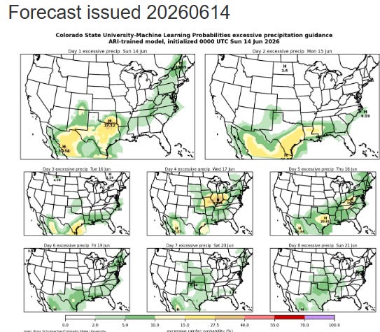
Flash flooding will also be a concern with all of this thunderstorm activity, and will become particularly focused the next few days in the Texas and Gulf Coast regions as the front associated with today’s severe weather stalls out in this region and moisture from the tropical disturbance we have been the talking about the last several days surges north into the region. Flash flooding risks will return to the Midwest Wednesday into Thursday as the next round of strong thunderstorm activity impacts the region.
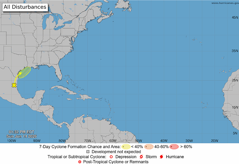
Speaking of that tropical disturbance, it is now centered just inland over eastern Mexico, but is forecast to turn back northeast into the northwest Gulf ahead of the front dropping south. Conditions could become somewhat more favorable as this happens, and some of the model ensemble solutions show some development as the disturbance moves back over water. This is still a relatively low probability risk, but NHC has increased the odds to 30% and as I mentioned in an earlier post this is the kind of system that can pop-up in June so we will keep a close eye on it.
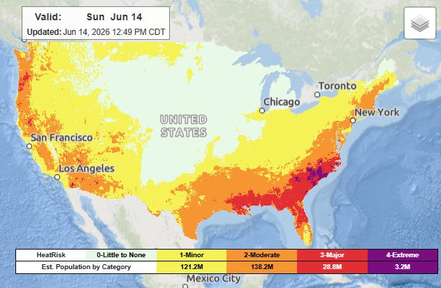
Last but certainly not least, I want to highlight the heat risk that will exist ahead of the cold front over the South and East today, particularly in parts of the Southeast and southern Mid-Atlantic where the combination of heat and humidity will result in areas of extreme heat risk. Heat will also be an issue in the west up into the Pacific Northwest where record high temperatures are possible this afternoon.
Programming Note: Given the increase in active weather, I have started utilizing the Substack Chat feature again to share real-time updates. I will be utilizing chat and possibly occasional live videos over the next several days — as a reminder, these are benefits that paid subscribers receive for their support of Balanced Weather. Any videos I do will also be recorded and shared to all subscribers. I also provide updates on my BlueSky and Facebook feeds, and via occasional Substack Notes. To see an example of my Substack chat updates from the Thursday night severe weather in the Midwest, click here.

Leave a comment