And detailing a spat between the White House and the Weather Channel
Jun 15, 2026
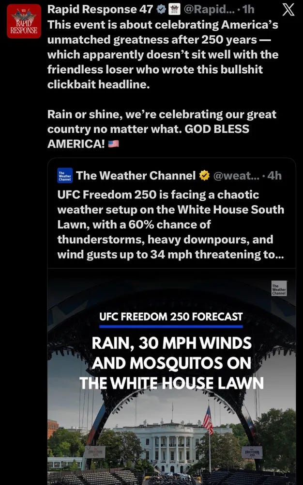
I feel like I have to start off my Monday morning newsletter by talking about this exchange of posts yesterday on X. The Weather Channel posted about the weather forecast for the UFC event at the White House last night — pointing out that thunderstorms were likely in Washington, DC Sunday evening, along with high heat index values (and bugs).
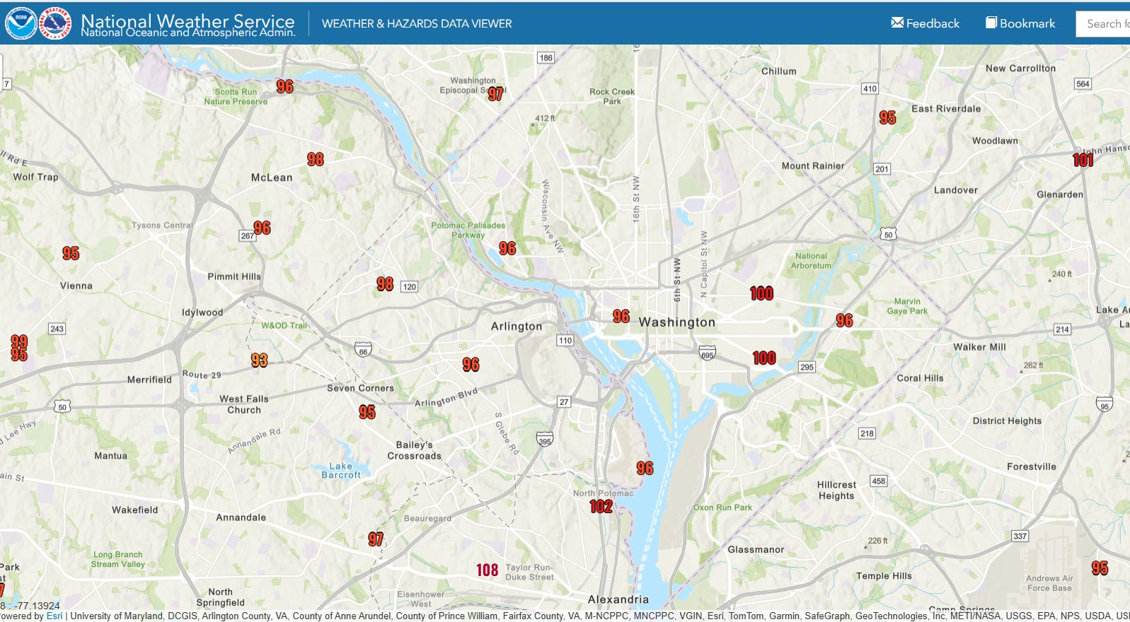
Heat index values were in fact around 100F Sunday evening across DC, and a severe thunderstorm watch was in effect for the area through the evening. Lightning struck within a couple of miles of the White House during the mid-evening hours, and a weather delay in the event was necessary during the early evening.
In spite of this obvious potential for hazardous weather, an official White House social media account chose to attack the Weather Channel for making a post about the weather situation (and personally attack the employee who wrote the post). Luckily for the event, most of the severe weather last night (of which there was plenty) missed DC proper as discussed in this event review from Capital Weather — but the fact that DC would be in the minimum of severe weather was by no means obvious hours ahead when the TWC post was made.
And even without the severe weather, heat and lightning are serious weather threats. It was just 2022 when three people tragically lost their lives when lightning struck Lafayette Park across the street from the White House. Having thousands of people gathered outdoors in a small area in the summer in DC has significant potential for dangerous — potentially deadly — impacts from weather; this fact was clearly recognized by federal officials as the Secret Service reported over the weekend that government and private meteorologists would be on-site to provide decision support.
The administration choosing to communicate disdain for concerns about potential hazardous weather — and the meteorologists warning about it — rather than making a productive weather safety post really speaks for itself. I will again restate what I would hope to be an obvious fact — hazardous weather is not a partisan issue. Throughout my career as a federal meteorologist, I worked very effectively with leaders at all levels of government from both sides of the political spectrum on dealing with a multitude of hazardous weather events and issues. It is only very recently that this has changed with situations like what we saw yesterday with this social media post from the White House. I truly hope that we will look back on this period as an aberration — and that soon we will return to working together to promote weather safety and the improvement of weather forecasts and warnings.
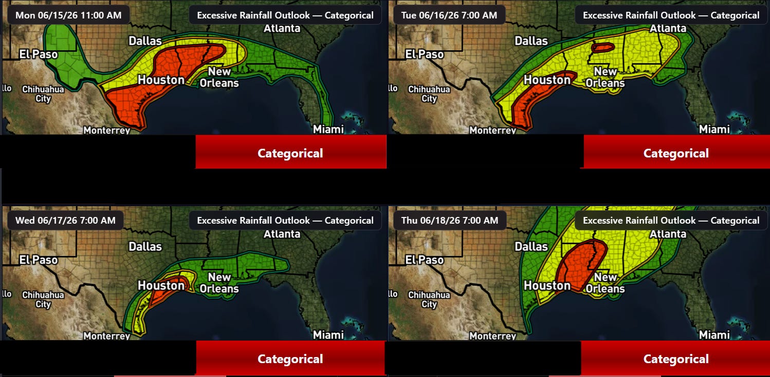
Speaking of hazardous weather risks, there will be plenty of them this week, starting with flash flooding. A multi-day heavy rainfall and flash flood risk will exist along the Gulf Coast this week as extreme levels of moisture from a tropical disturbance moving north-northeast from the western Gulf region combines with a stalled out front and favorable jet stream dynamics to produce waves of thunderstorms with torrential rainfall rates. Moderate (level 3 of 4) risks of excessive rainfall are in place for each of the next four days as shown above.
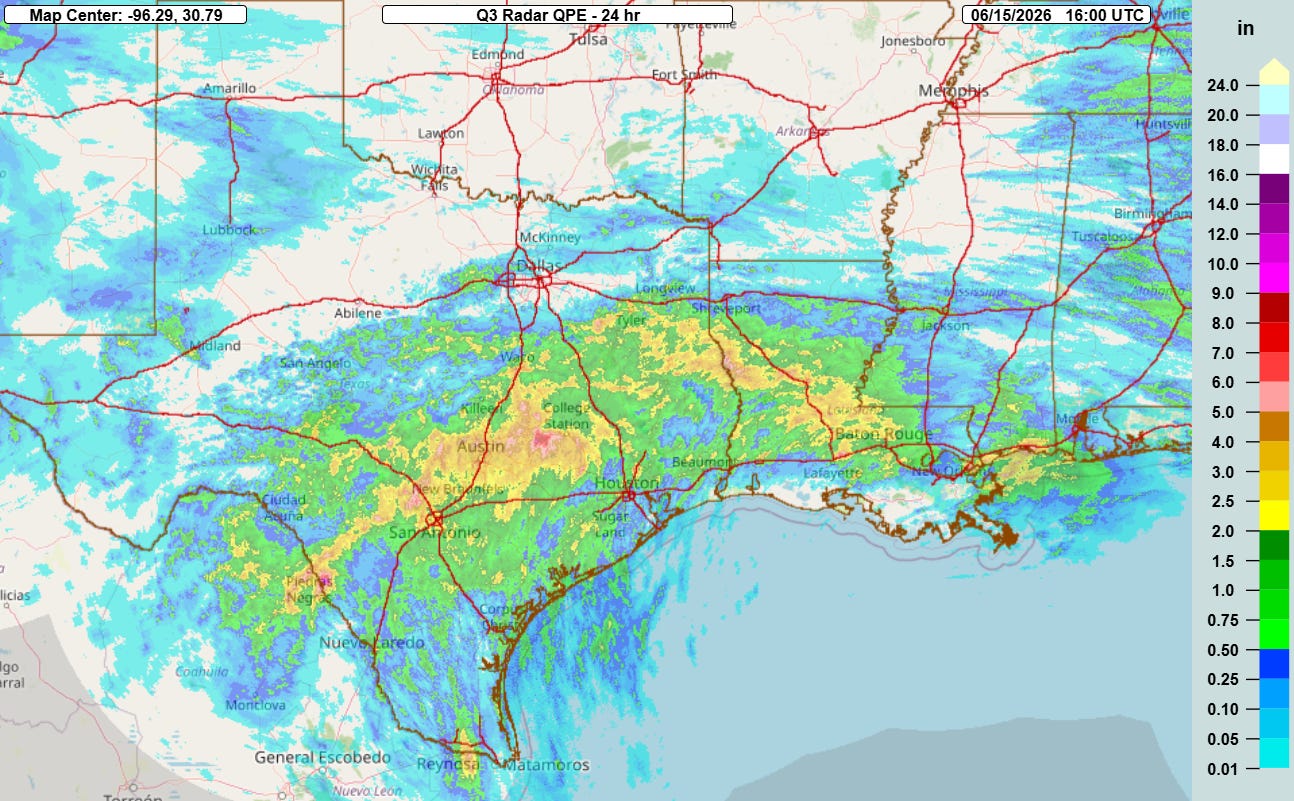
Heavy rainfall and flash flooding have already been an issue the last 24 hours across Texas and Louisiana, with some serious flash flooding already having occurred along the I-35 corridor from Waco to San Antonio.
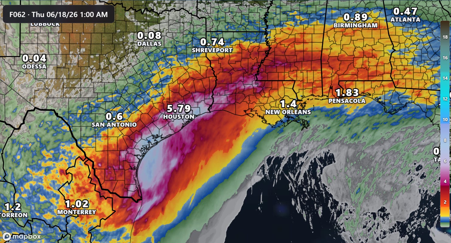
For the next couple of days, the primary focus of heavy rainfall should be from the Texas and Louisiana Gulf coasts up through Mississippi. As is typical in these sorts of setups, the heaviest rainfall will be more localized in areas where thunderstorms are more persistent — and these areas will be prone to significant, potentially life threatening flash flooding.
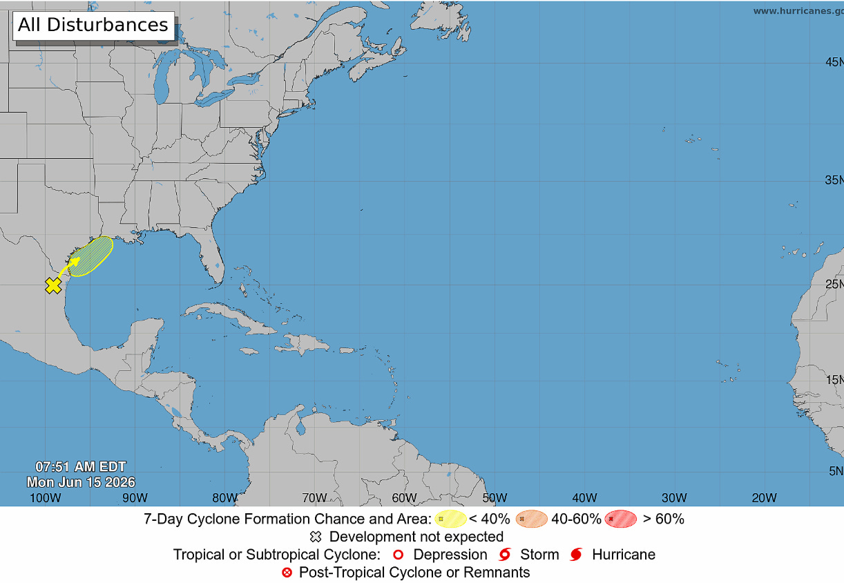
How the flash flood threat evolves Wednesday into Thursday will depend upon how much of an organized low pressure system develops out of the tropical disturbance centered near the mouth of the Rio Grande currently. The National Hurricane Center continues to put 30% odds on the potential for a tropical cyclone to develop.
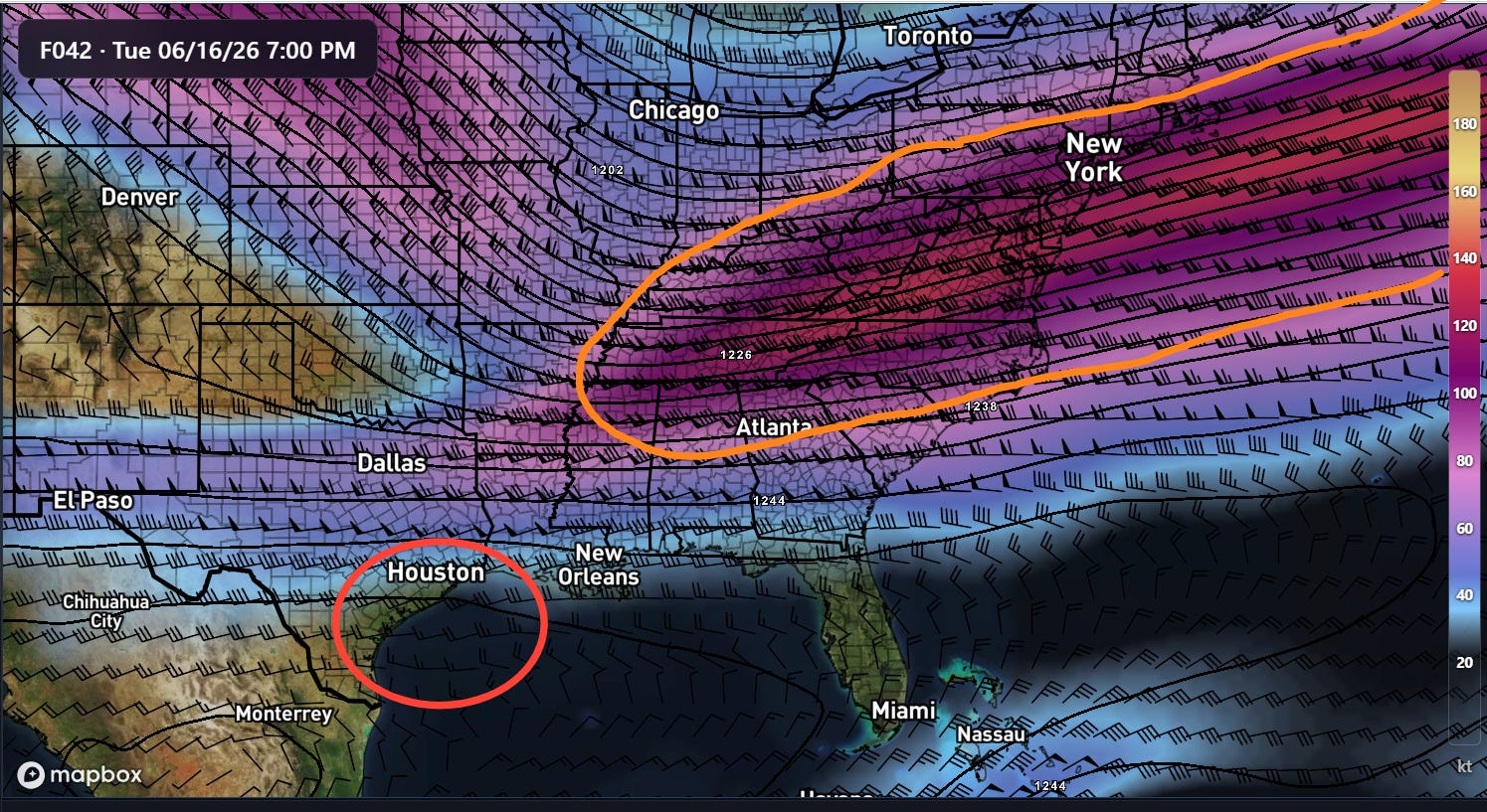
At least a weak area of surface low pressure will likely develop in the western Gulf coast region due to non-tropical atmospheric processes. The red highlighted area above to the southwest of a strong upper level jet stream over the Mid-Atlantic and Tennessee Valley regions (orange area) is favored for surface low pressure development. If this system ends up over the warm Gulf water for a period of time, it would make a stronger, more tropical system possible. Even then, though, the main threat will be heavy rainfall and flooding — a stronger system would just likely make the risk more focused and intense.
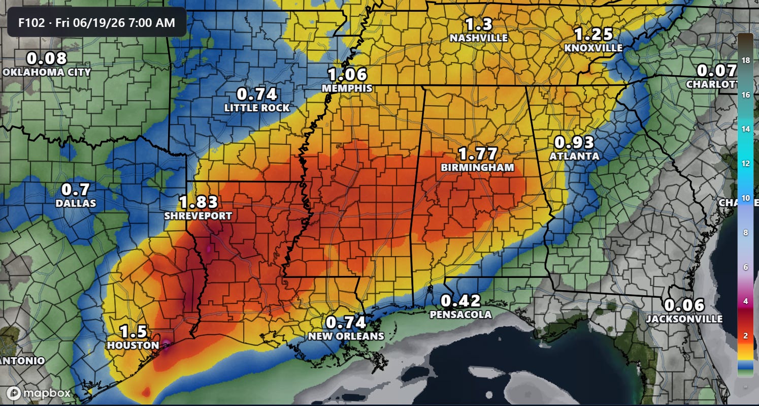
Whatever system does develop should move northeast across the central Gulf Coast region on Thursday, enhancing the heavy rain and flash flood risk there.
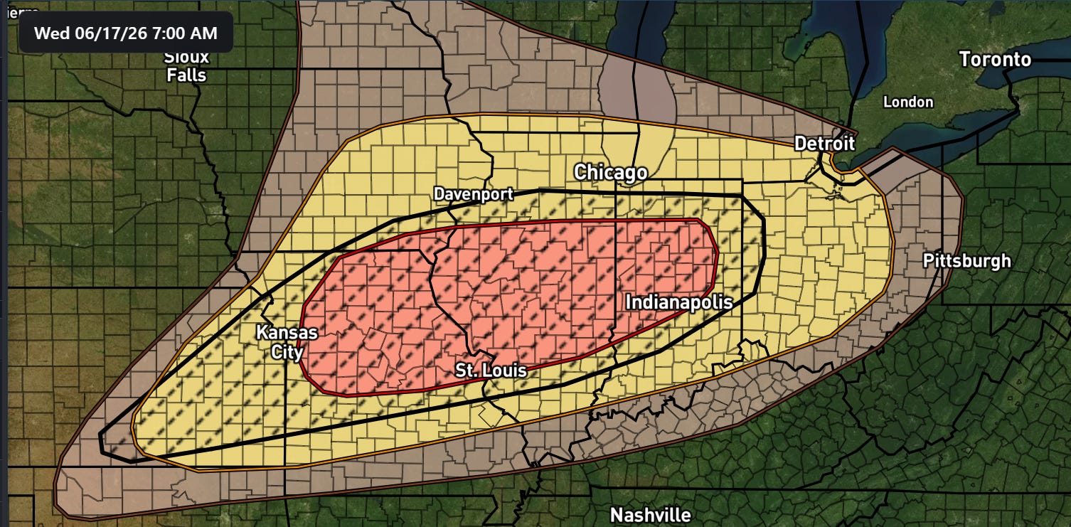
In addition to the flash flood risk, a rather high end severe weather situation looks to evolve Wednesday into Thursday as well, as a strong storm system develops over the Midwest and taps into the warm, humid and unstable air over the South. The Storm Prediction Center already has a large enhanced (level 3 of 5) risk of severe weather across Midwest for Wednesday into Wednesday night, including a conditional intensity level 1 showing the potential for higher end severe storms including strong tornadoes and significant damaging winds. Flash flooding will also be a real concern with these storms.
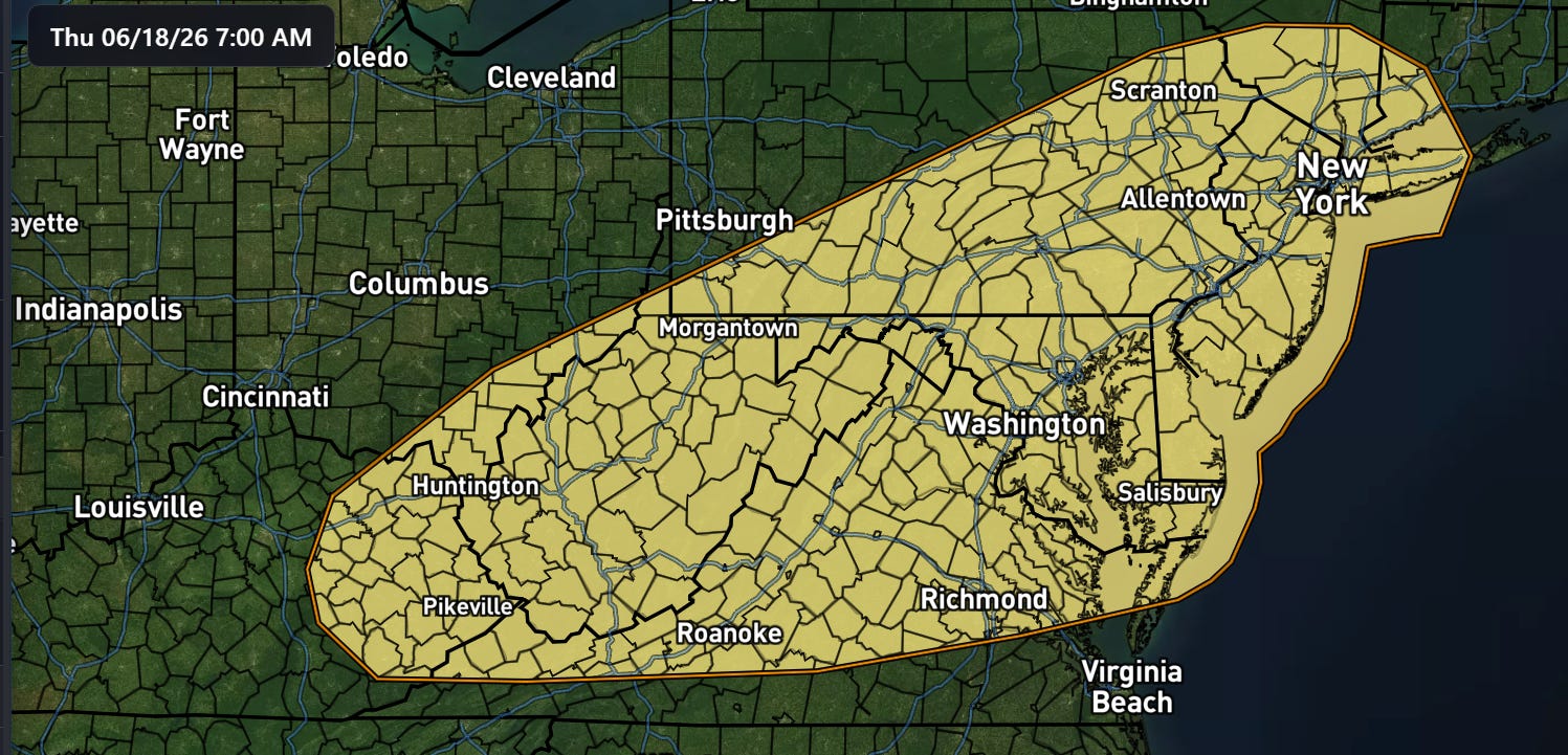
As the storm system shifts east on Thursday, the severe weather risk will also shift into the Mid-Atlantic region.
Graphics in today’s post not from NOAA websites are courtesy of the WeatherFront app.

Leave a comment