Models continue to support significant severe weather outbreak for parts of Midwest Wednesday, while tropical disturbance is moving offshore of south Texas
Jun 16, 2026
First off, before I provide a quick late evening severe weather and flash flood update, I want to apologize to those who tuned in for my live video this afternoon or watched the recording. I did not realize that I had an audio issue with my computer, and unfortunately Substack e-mailed the video to all of you before I had a chance to watch it (I will change that setting to keep that from happening again). I tried another video this evening and was still having the same issue — hopefully I will get it rectified tomorrow.
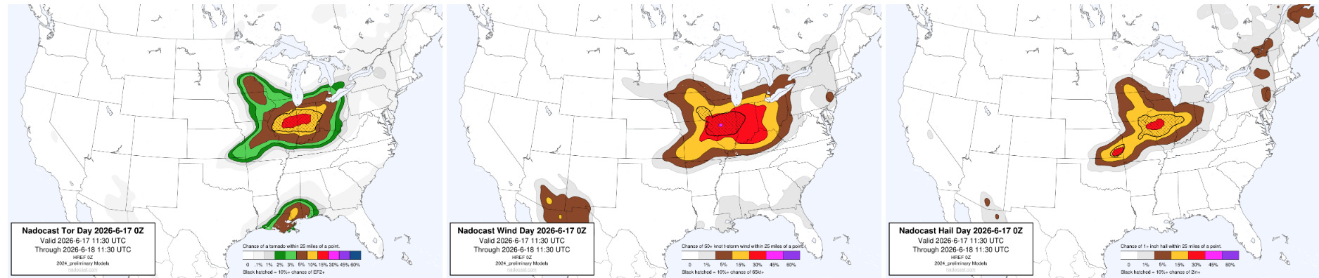
The new evening high resolution model runs are in, and at a high level there is very little change with the overall setup in the Midwest for Wednesday afternoon and evening. Accordingly, the new Nadocast AI probabilistic guidance has not changed much either, still showing moderate risk level probabilities of significant tornadoes and wind damage across parts of central Illinois and Indiana, along with the potential for very large hail.
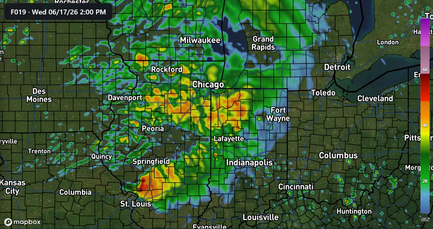
There are some subtle differences in this evening’s runs that I want to note. In general, tonight’s models are a bit slower and farther south with the thunderstorm complex that is expected to develop later tonight across Iowa and move southeast through the Mid-Mississippi Valley tomorrow morning. The NSSL-WRF shown above is most pronounced with this trend, having strong thunderstorm activity in the northern St. Louis metro at 2 pm and actually intensifying it into a potent severe storm complex as it moves through southwest Illinois. The other models are not quite as bullish as this — but if this trend verifies in the real atmosphere, it could push the highest threat of significant severe weather a bit farther to the southwest, a trend that can be seen in the evening High Resolution Ensemble Forecast.
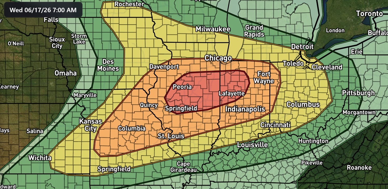
The bottom line to me this evening is that anyone in the enhanced (orange) and moderate (red) SPC risks — particularly from the Mississippi River east — need to be watching the weather closely on Wednesday and be aware of the potential for significant severe storms including intense tornadoes. We will be monitoring the radar and observational trends closely in the morning to try to pin down the magnitude and location of the greatest severe weather risk.

Not much has changed with the overall setup with the tropical disturbance and related flood risk across the Gulf Coast region. The poorly organized disturbance is moving off the South Texas coast this evening, and is forecast to move northeast while becoming no more than a minimal tropical storm.
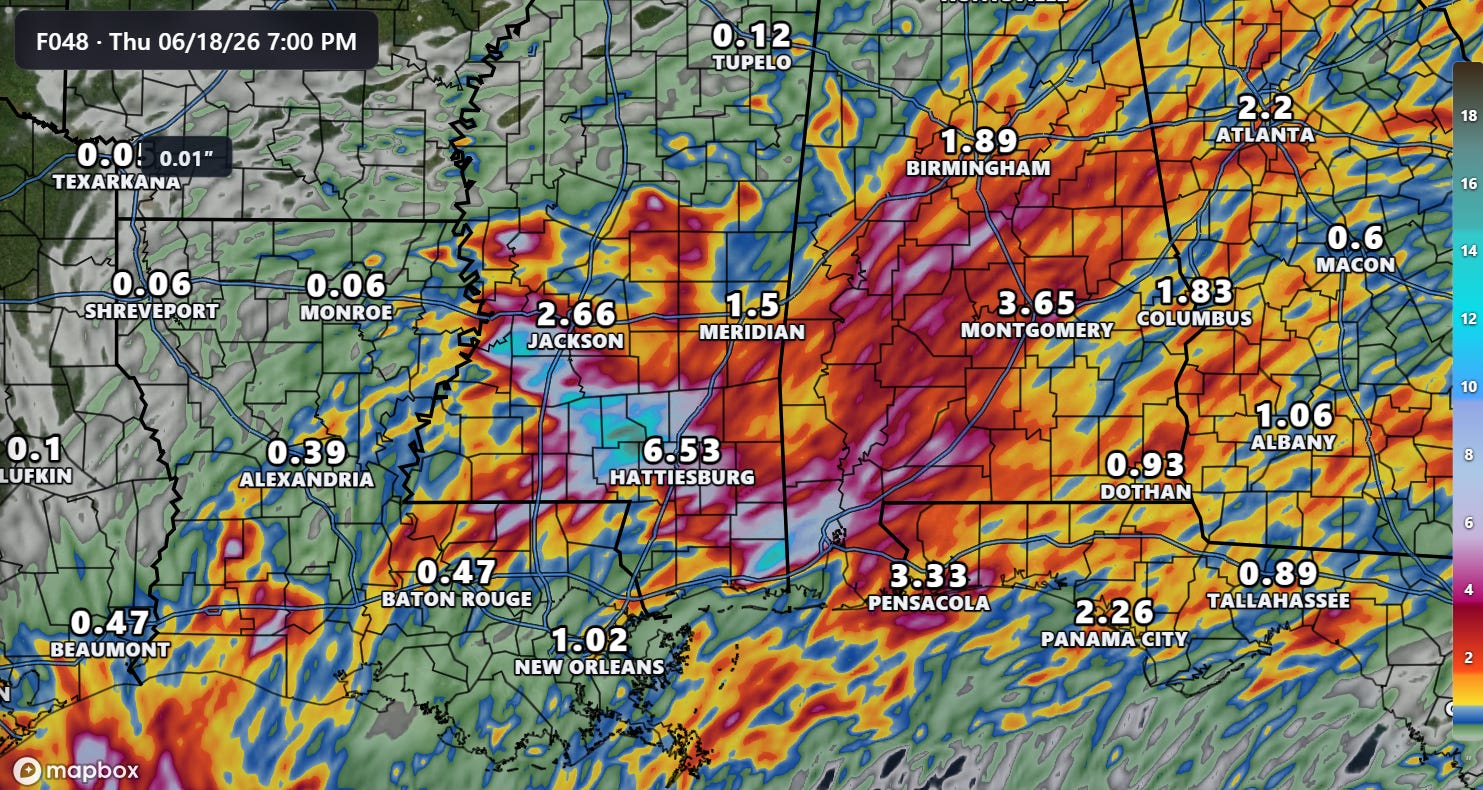
We are in a bit of a lull this evening as most of the heavy rain producing showers and storms have shifted offshore — but that should change through the day Wednesday and especially Wednesday night into Thursday as the low pressure system increases the transport of tropical moisture into the central Gulf Coast region. This evening’s HRRR model shows some very impressive rainfall totals across parts of Alabama and especially Mississippi by the end of the day Thursday as shown above. While one should not expect those exact amounts to verify, I am showing this forecast to give an illustration of the type of amounts (locally 12”+) that are likely somewhere in the central Gulf Coast region and to show the pattern of varying amounts due to training storms.
Where those heaviest amounts occur, significant potentially life-threatening flash and river flooding are possible. Several rivers are already forecast to go into minor to moderate flood from southeast Texas across coastal Mississippi and Alabama.
More to come tomorrow on all of this potentially high impact weather.
Graphics in today’s post not from NOAA websites are courtesy of the WeatherFront app.
Programming Note: Given the increase in active weather, I have started utilizing the Substack Chat feature again to share real-time updates. I will also be doing some live videos (technology permitting!) over the next couple of days to provide briefings and updates about the evolution of severe weather and flash flooding risks. As a reminder, these are benefits that paid subscribers receive for their support of Balanced Weather. Any videos I do will also be recorded and shared to all subscribers. I also provide updates on my BlueSky and Facebook feeds, and via occasional Substack Notes. To see an example of my Substack chat updates from the Thursday night severe weather in the Midwest, click here.

Leave a comment