Record heat possible early this week in Pacific Northwest
Jun 21, 2026
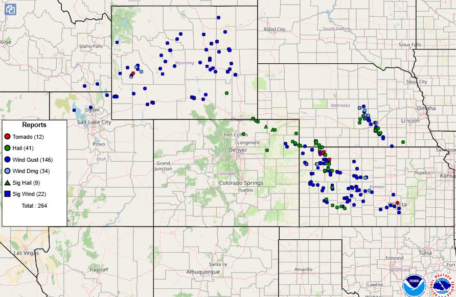
Happy Father’s Day! After a very active Saturday from Wyoming southeast across Kansas, with several intense clusters of severe storms producing swaths of significant straight line winds with measured gusts of up to 100 mph along with several tornadoes and incidences of very large hail, today is shaping up to be another busy day for severe weather across the central United States.
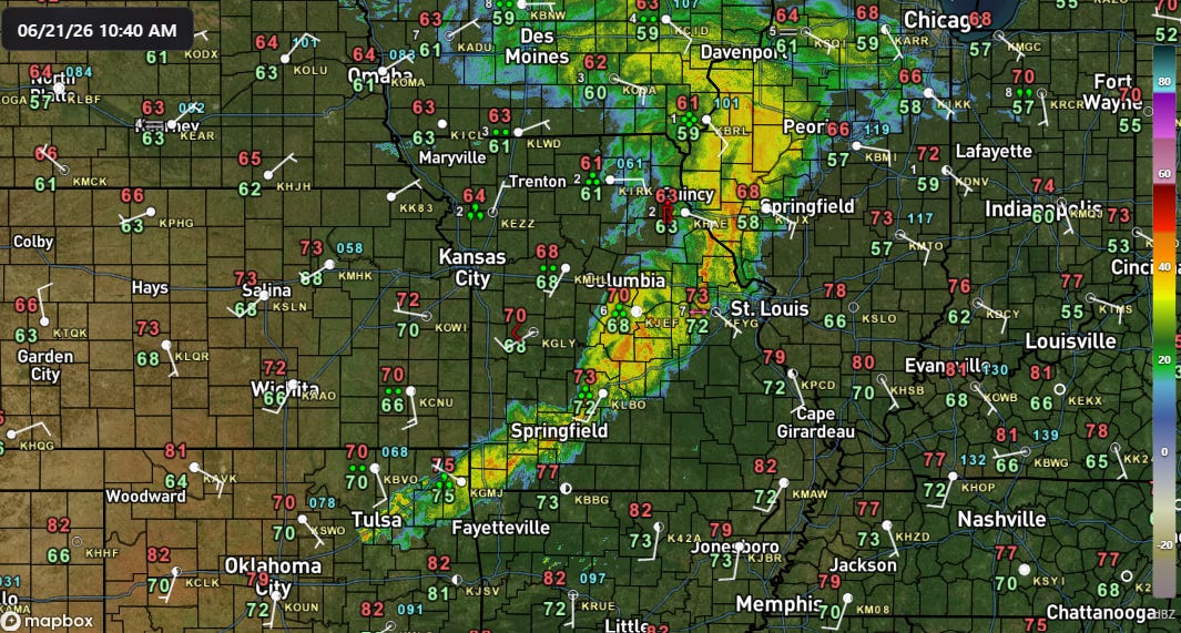
As is typical in late June, a rather complex severe weather scenario is unfolding this morning as a band of weakening thunderstorms has been moving across the Midwest. This area of thunderstorms is associated with an upper level weather disturbance and area of surface low pressure moving across the region. Ahead of all of this, the atmosphere is gradually becoming more unstable as a warm front along Interstate 64 slowly lifts north, with dewpoints in the 70s and temperatures rising into the 80s south of it.
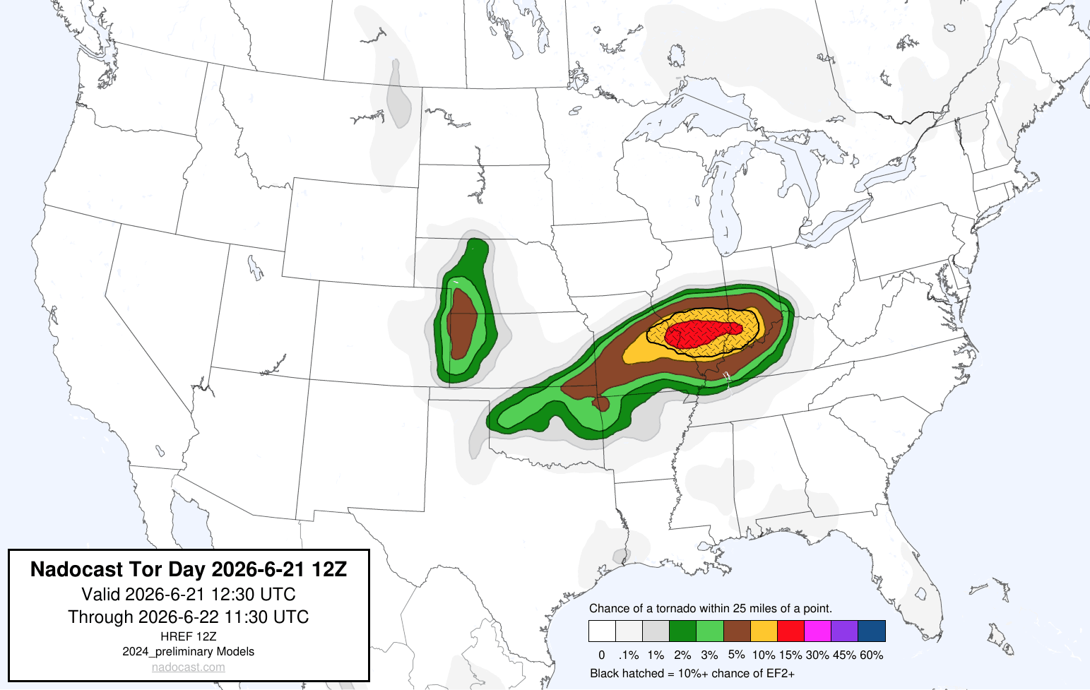
The combination of atmospheric forcing and increasing instability should support the ongoing complex of storms reorganizing and intensifying, along with the potential for new thunderstorm development ahead of it. This should result in an increasing risk for severe weather as the storms spread east and southeast across the Mid-Mississippi and lower Ohio Valley regions. Along with damaging straight line winds and large hail, tornadoes are possible, and there are signs in the morning high resolution models and AI probabilities of an enhanced risk of potentially strong tornadoes in the vicinity of the warm front from the St. Louis metro area east into southern Illinois and Indiana.
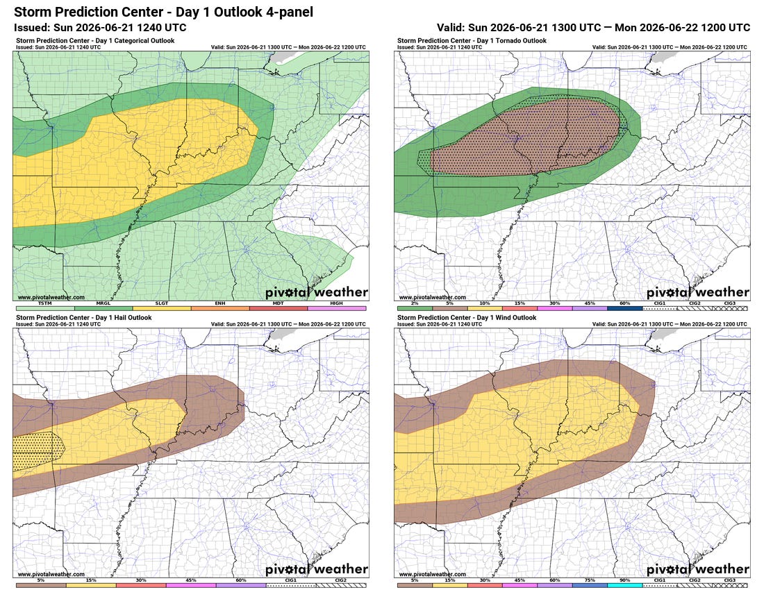
As of now, the Storm Prediction Center outlook has a 5% probability of tornadoes in this region with a “CIG1” area indicating the potential for strong tornadoes — but we will be watching for the potential for a more focused tornado potential within this area later today.
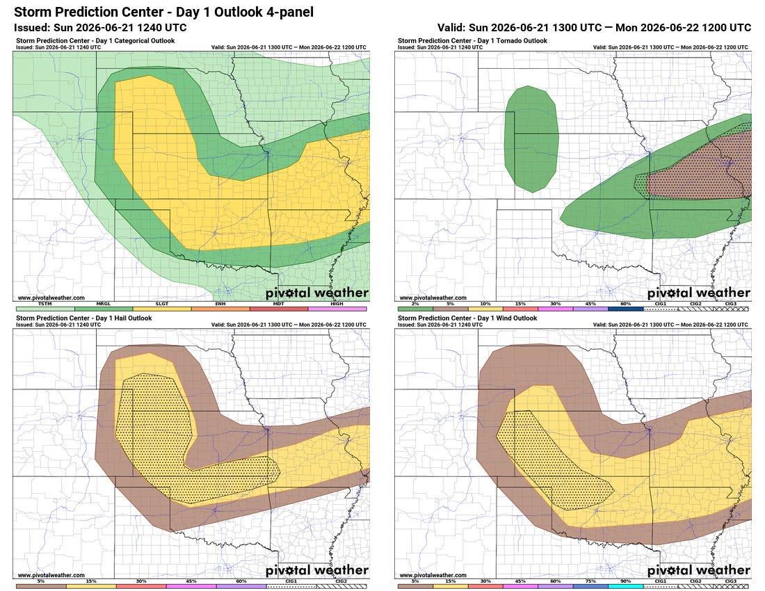
Another area of severe weather focus today will be from the central High Plains southeast into Oklahoma and the Ozarks. The atmosphere here is expected to become quite unstable this afternoon — and weak disturbances moving through fairly strong (for late June) westerly winds aloft are expected to support clusters of intense southeast moving severe storms with potential for swaths of significant damaging straight line winds and very large hail.
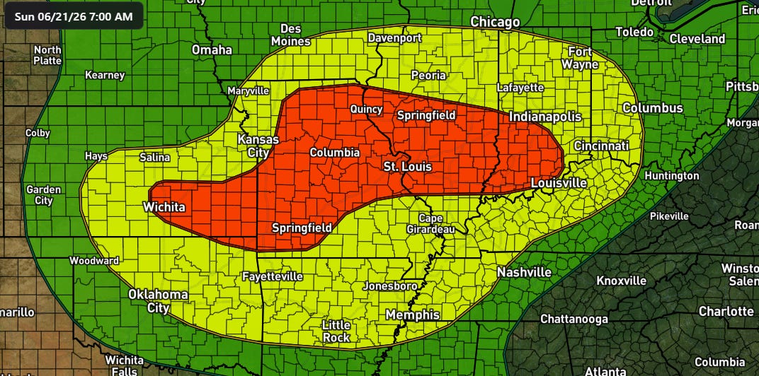
Flash flooding will also be a concern through tonight, with a moderate (level 3 of 4) risk in place for a large area from southern Kansas into southern Indiana.
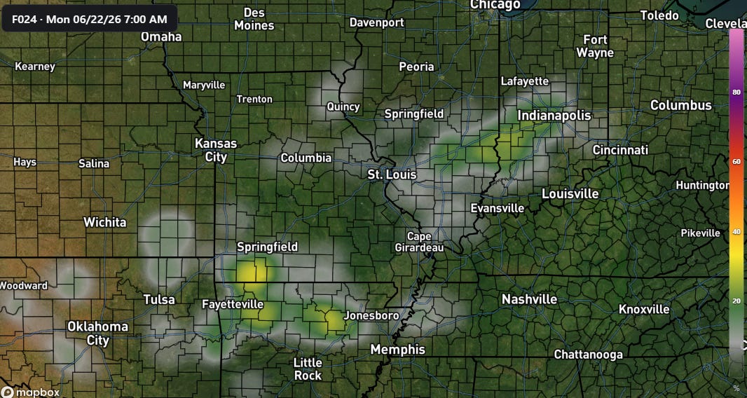
Data from the morning Rapid Refresh ensemble (REFS) suggests the potential for more significant flash flooding to be from St. Louis east across Indiana where thunderstorms could train along warm front this afternoon and evening, and then in the Ozarks later tonight when a southeast moving complex of storms could slow down in this region.
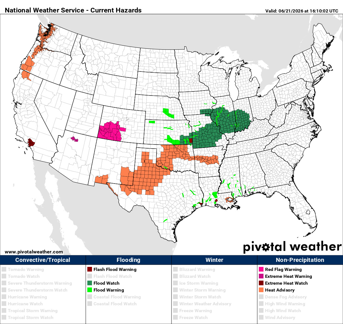
Hot and humid weather will continue across parts of Texas today and spread for a day across Oklahoma before the cold front slips back south — heat advisories are in effect for these area. Excessive heat watches and warnings are also in effect for parts of the West where heat will build early this week, with record high temperatures possible in the Pacific Northwest including Portland and Seattle.

Leave a comment