Heatwave continues to build over Europe
Jun 22, 2026
Welcome to a new work week — lots going on in the weather world to dive into.

Sunday was another very active day of severe weather across the central United States, with numerous supercell storms impacting the lower Ohio Valley — while supercells that initially developed over northeast Colorado and adjacent areas organized into an intense squall line that produced widespread damaging winds as it swept southeast across Oklahoma and western Kansas.
What unfolded in the lower Ohio Valley was really a relatively focused tornado outbreak, with 3 dozen reports of tornadoes centered in southern Illinois and southwest Indiana. A number of radar confirmed tornadoes were evident, and several of these tornadoes were likely significant.
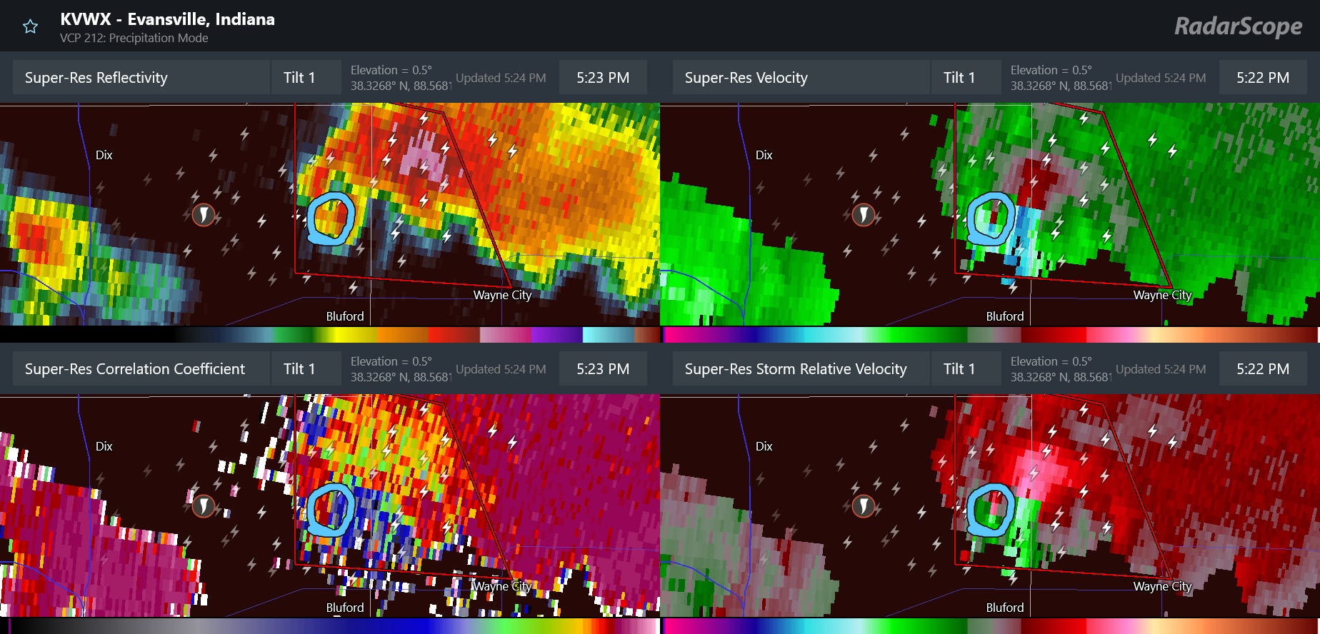
One of these significant tornadoes occurred a bit northeast of Mount Vernon in Jefferson County, IL (above, circled)). This storm exhibited intense rotation and a distinct debris signature both in dual-polarization correlation coefficient data (lower left) and in reflectivity data (upper left, i.e., a debris ball). Unfortunately, two people were killed and five others hospitalized by this tornado.
Meanwhile, supercells that initially produced several tornadoes and incidences of very large hail east of Denver evolved into an intense bowing line of severe thunderstorms that plowed southeast across western Kansas Sunday evening and then across much of Oklahoma overnight before gradually weakening.
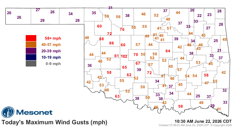
Nearly a dozen measured significant (75+ mph) wind gusts were reported with this complex of storms, including 102 mph at the Oklahoma Mesonet site in Hinton. Per NWS Norman this morning, the event has been preliminarily classified as a derecho – a long-lived, organized storm complex that produces widespread, significant damaging winds. More than 100K customers lost power across Oklahoma and Arkansas at the peak of the storms (including your author), and per PowerOutage.us more than 60K remain without power this morning (not including your author who thankfully got it back at 8 am).


It has to be acknowledged that the magnitude, coverage and impact of the severe weather on Sunday was higher than what one would usually expect from a slight (level 2 of 5) risk day. SPC did upgrade the area along the path of the derecho in Kansas and Oklahoma to an enhanced (level 3 of 5) risk, but not until the late Sunday evening update. The outlooks also had “CIG1” areas indicating conditional risks of significant tornadoes over the lower Ohio Valley and significant straight line wind along the general path of the derecho.
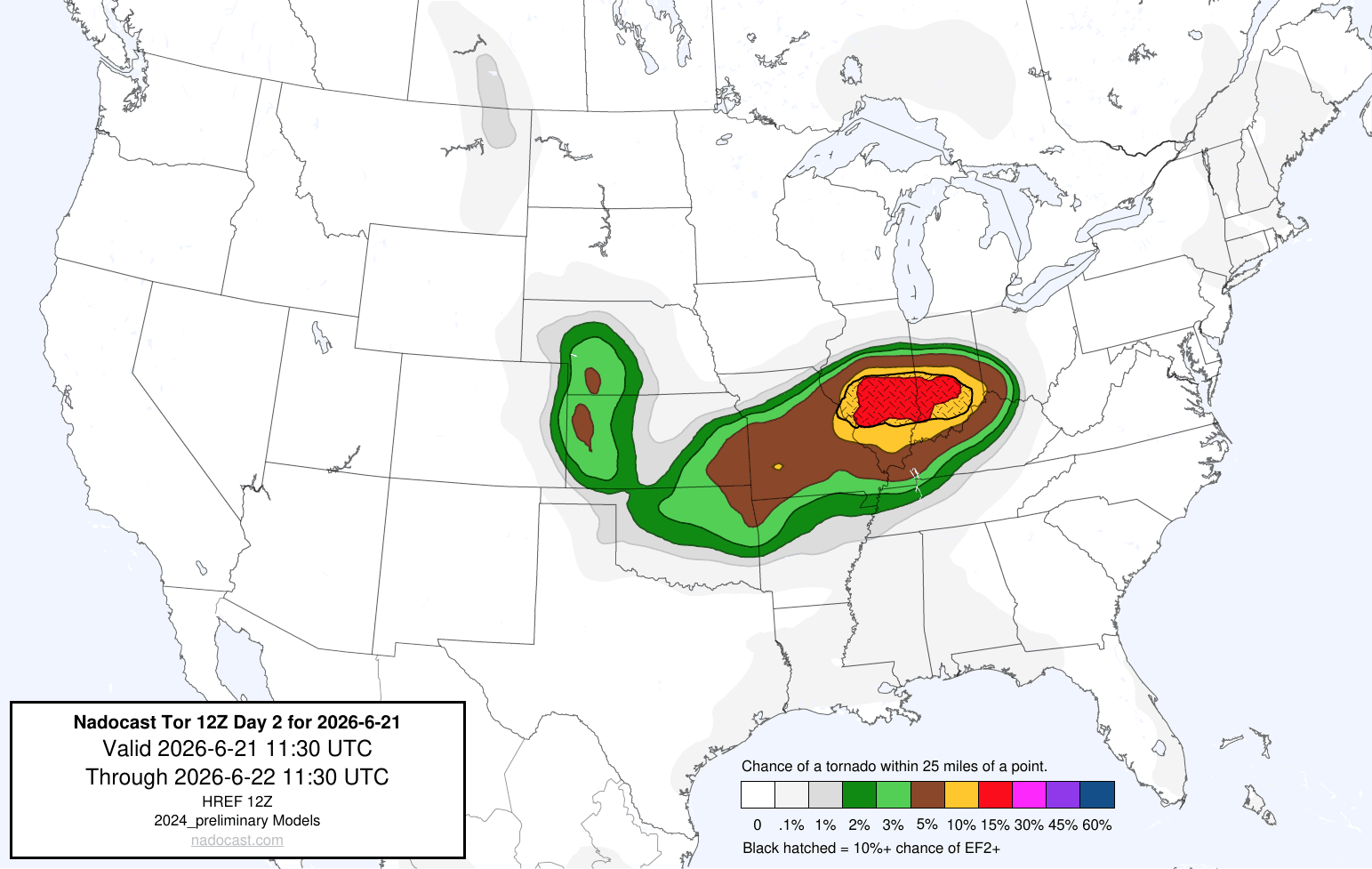
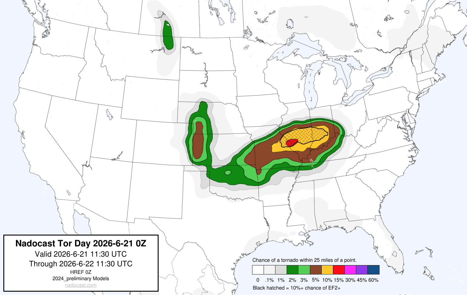
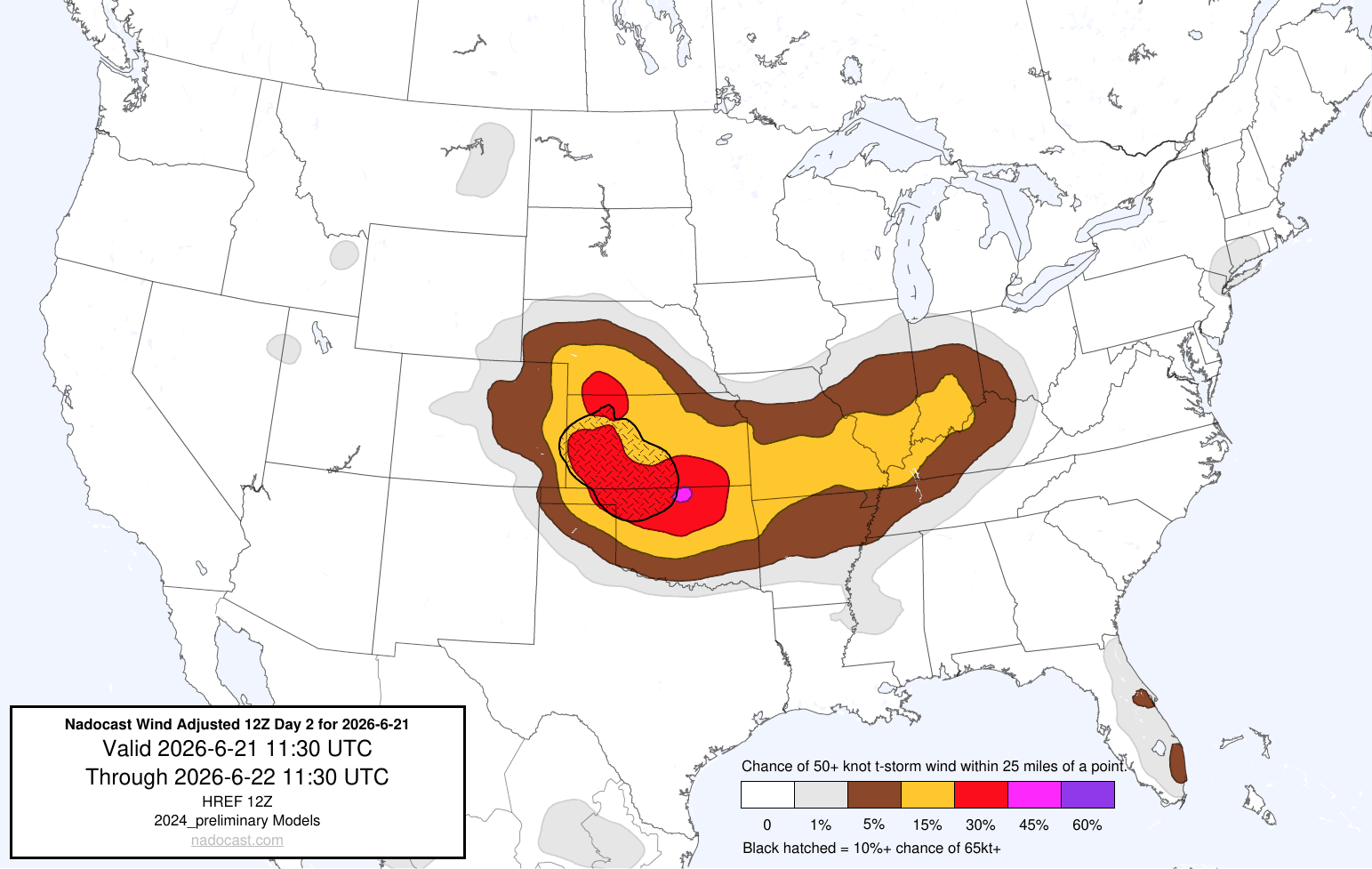
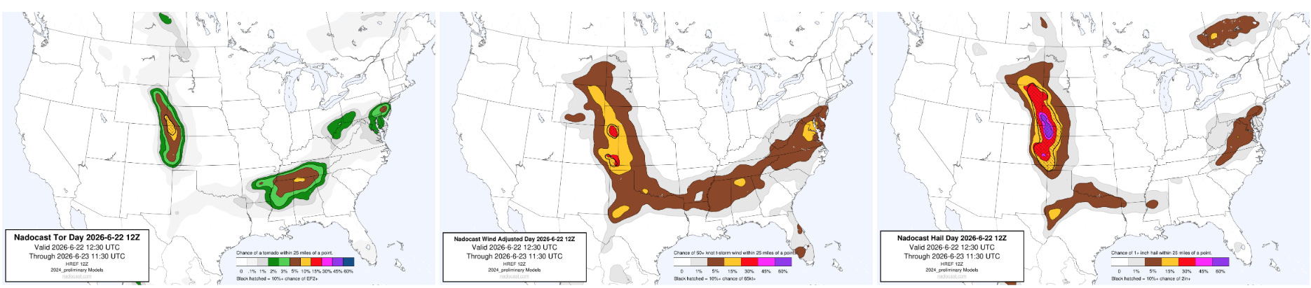
I discussed in the last couple of day’s newsletters that there were signs in the high resolution model data and the AI guidance that areas east of St. Louis could have a more pronounced risk of higher end severe weather including tornadoes. Above is the initial day 2 Nadocast tornado probabilistic guidance from midday Saturday valid for Sunday, and below is in the initial day 1 Nadocast guidance for Sunday that was generated late Saturday evening. You can see a pretty consistent signal for higher tornado probabilities from the St. Louis area east across southern Indiana, including a “hatched” area indicating at least a 10% probability of significant (EF2+ tornadoes).
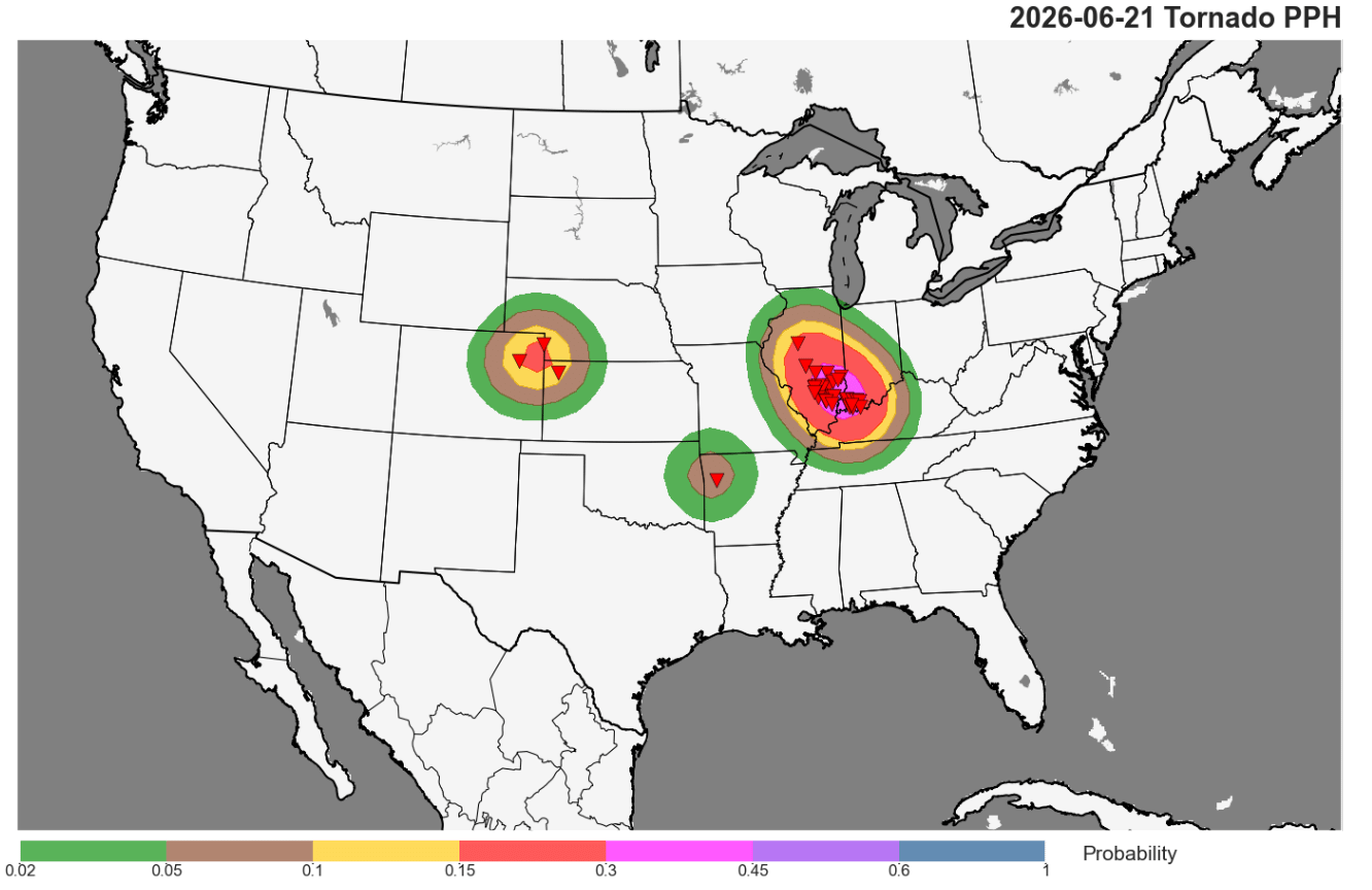
The 10-15% forecast area in the Nadocast guidance verified relatively close to the actual 15-30% area in the observed hindcast probabilities.
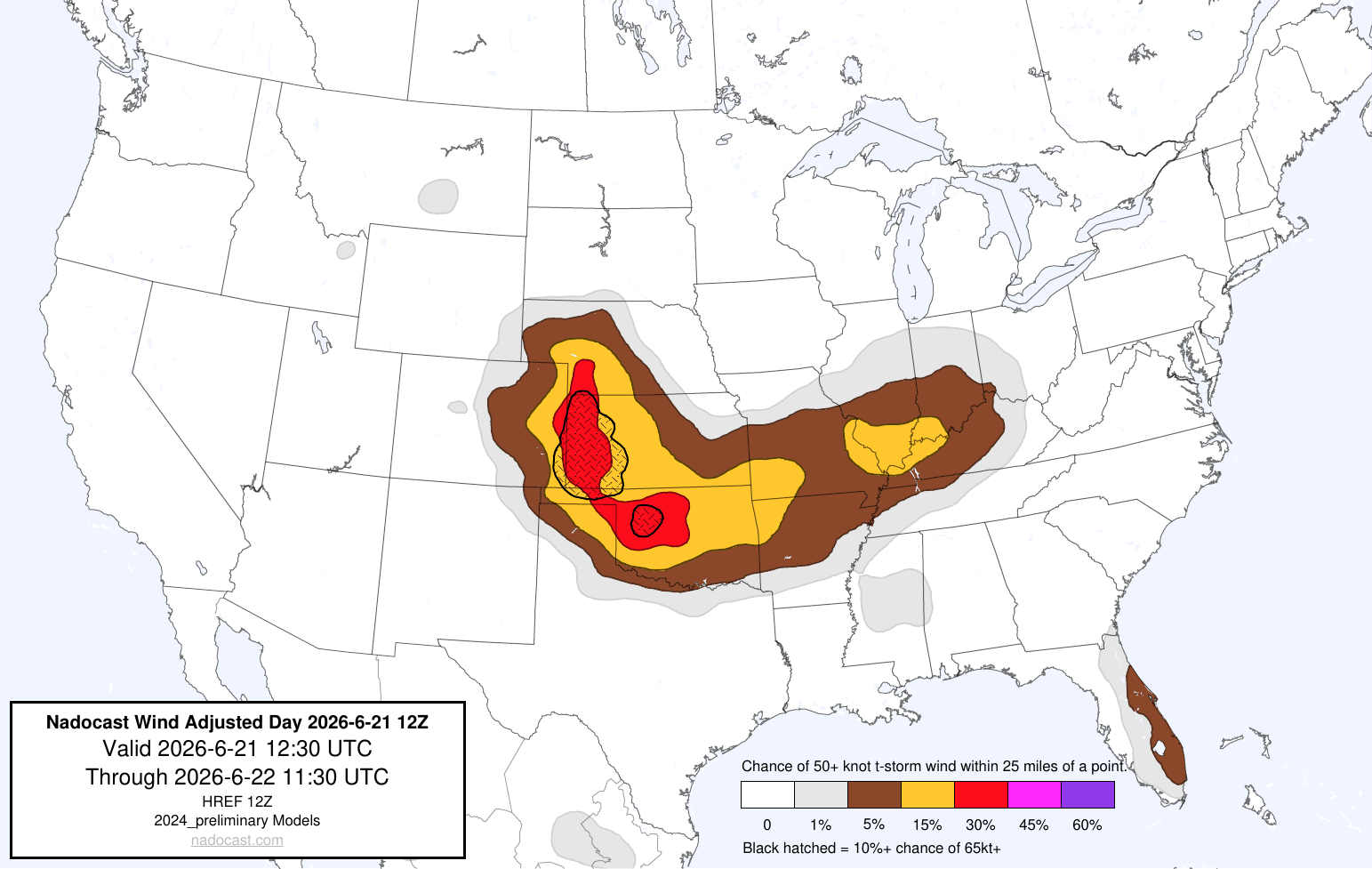
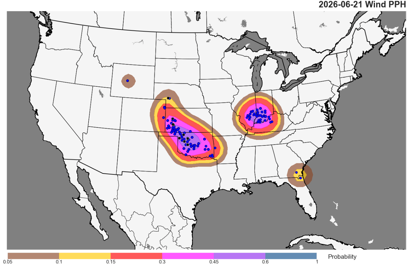
Looking at the Nadocast guidance for wind (which in full disclosure I did not mention in my newsletters), again there is a pretty clear signal for heightened probabilities along the path of the bow echo, including hatching for 10% probabilities of significant straight line wind.
Obviously, the Nadocast guidance is nowhere near perfect and has failures — but of course, the same can be said for human forecasts. From looking at AI severe weather guidance (Nadocast, NCAR, Colorado State University and others) nearly every day for the last couple of years, it is clear to me that much of it is skillful in a way similar to the Google DeepMind tropical cyclone forecasting success — and many colleagues I talk to about severe weather forecasting feel similarly. However, I am concerned that we as a weather enterprise are not yet leveraging this guidance as fully as we can or should be in our actual forecasts. Of course, the AI forecasts should only improve as better science and processing techniques continue to be developed — and hopefully as more people become aware of them their use in forecasts will become increasingly integrated into the weather enterprise.
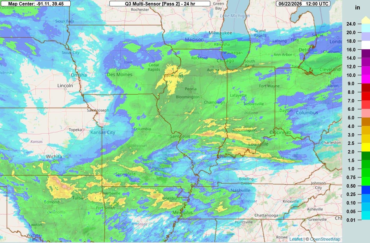
These severe storms also produced very heavy rainfall that resulted in a number of reports of flash flooding — the high resolution ensemble forecasts I discussed in yesterday’s newsletter appear to have done a pretty good job of capturing the areas of maximum rainfall potential.
Today will see the start of what looks to be a trend this week in the severe weather risk to focus in the Rockies and High Plains regions, with the highest probabilities for severe weather focused across eastern Wyoming and Colorado and adjacent areas. Scattered supercell severe storms could produce some tornadoes and incidences of very large hail later today. Scattered severe storms are also possible along the cold from the Mid-South into the Mid-Atlantic region, with damaging winds and possibly a few tornadoes the main threats. The area around the Tennessee Valley will be a particular focus later today for a potentially somewhat enhanced tornado risk due to enhanced wind shear from the remnant atmospheric spin from last night’s derecho.
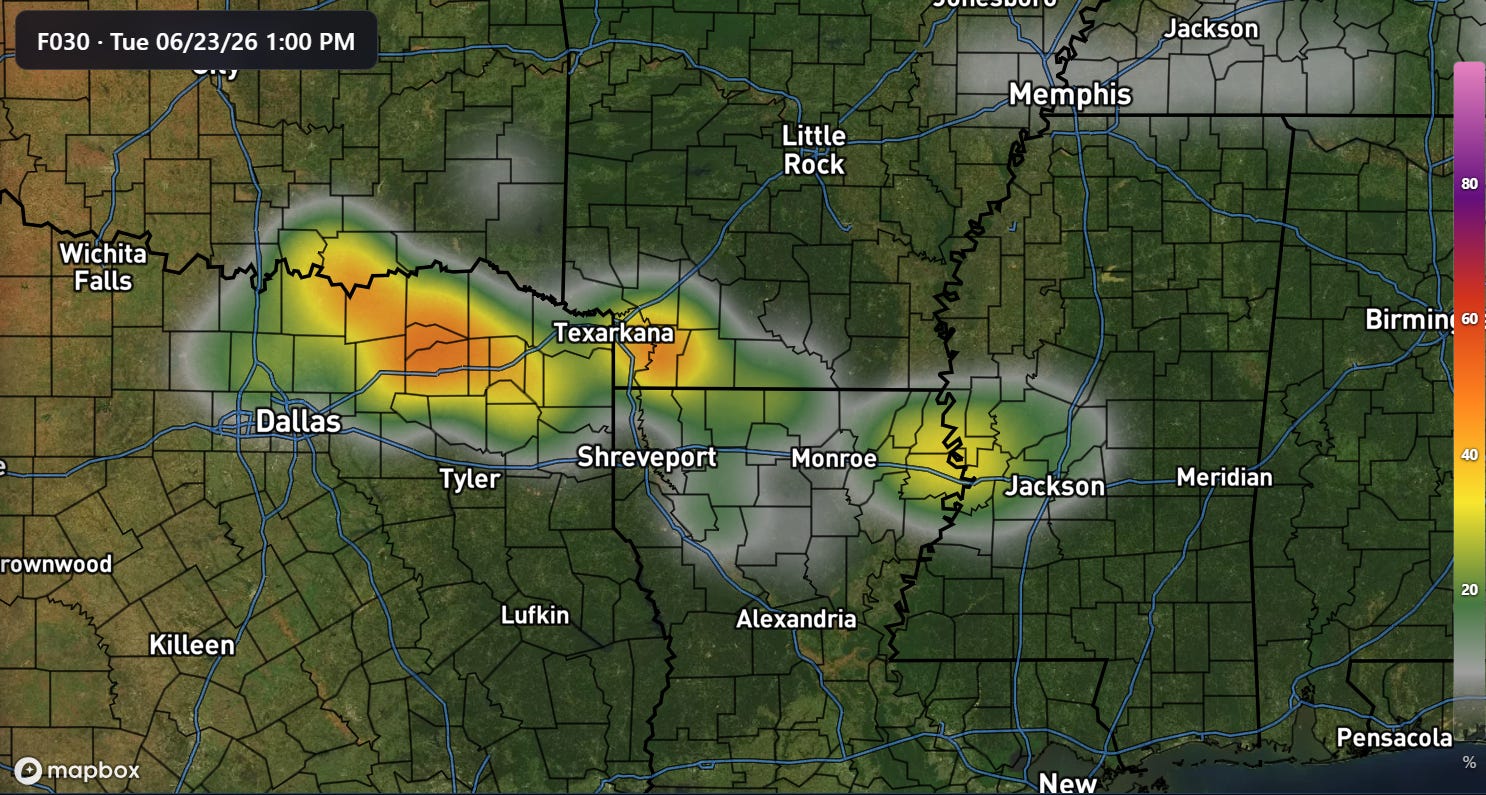
The Tennessee Valley will also have some risk of flash flooding, as will the Arklatex into Arklamiss areas where bands of thunderstorms developing along the flank of the remnants of last night’s derecho could bring some localized heavy rainfall totals of 5” or more. This could lead to a few incidences of significant flash flooding.
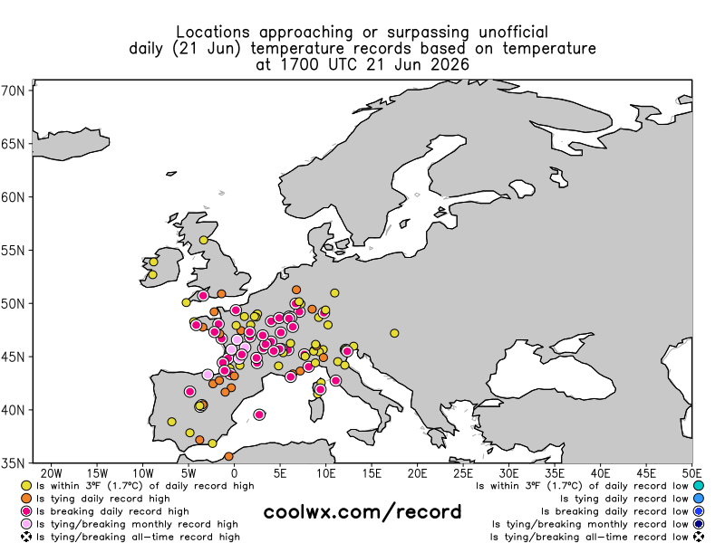
Even with all this weather stateside, I have to spend some time talking about the incredible heatwave ongoing in Europe. The loop above from CoolWx.com shows that numerous locations across western and central Europe set monthly — and in several cases, all-time — record high temperatures today.
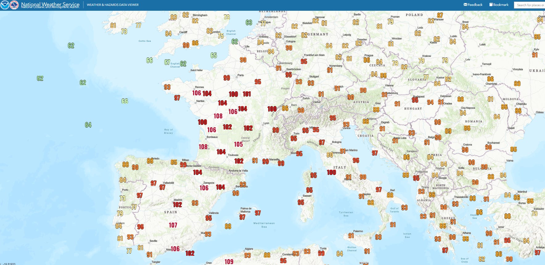
High temperatures included 102F at Madrid, 108F at Poitiers, FR and 95 at Frankfurt. Humidity has been unusually high as well, along with overnight low temperatures. Climatologist M. Herrera reported that Almeria on the southern coast of Spain recorded minimum temperatures above 30C (84F) on consecutive mornings for the first time ever.
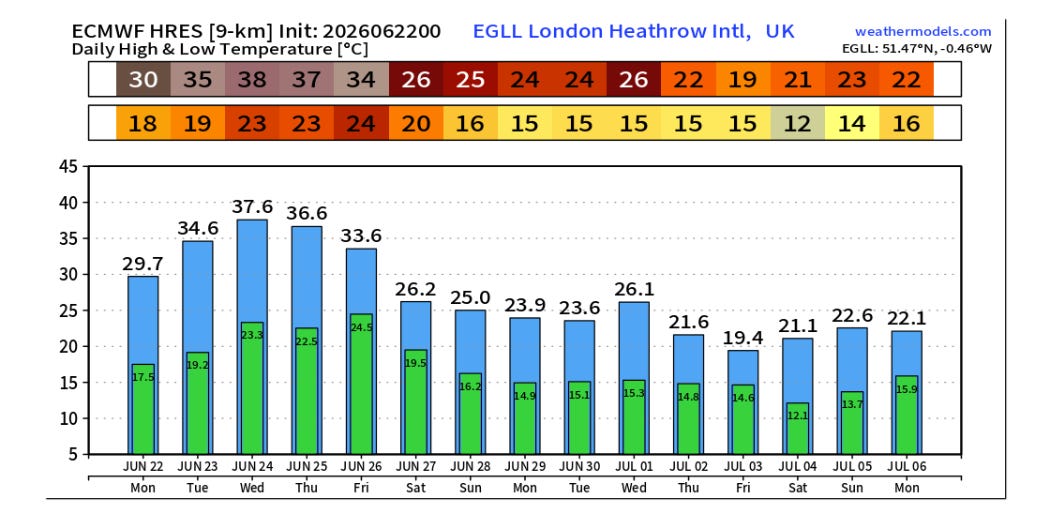
This incredible heat wave will continue for much of the week, and expand into areas farther to the north. A red-level (highest) extreme heat warning has been issued by the UK Met Office for large parts of England and Wales for Wednesday and Thursday where temperatures may approach or exceed 100F.

Leave a comment