Multiple tropical systems look to evolve in western Pacific, while eastern Pacific and Atlantic remain pretty quiet
Jun 22, 2026
Hi everyone — I am doing a short bonus post today since I did not get an actual tropical update out last week and I want to talk a bit about what is happening with El Nino and tropics. First, I would like to highlight a great post this morning by my friend Matt Lanza on his Substack talking about the historic central Gulf Coast flooding last week. I talked last week about how TS Arthur was a relatively minor player in much of that flooding, and Matt gives his own perspective on that being the case. He also recaps some of the crazy rainfall stats from the region, and talks about Michael Lowry’s speculation that Arthur becoming a tropical storm might have complicated and muddied forecast communication for the floods. Both Matt’s and Michael’s pieces are well worth your time.
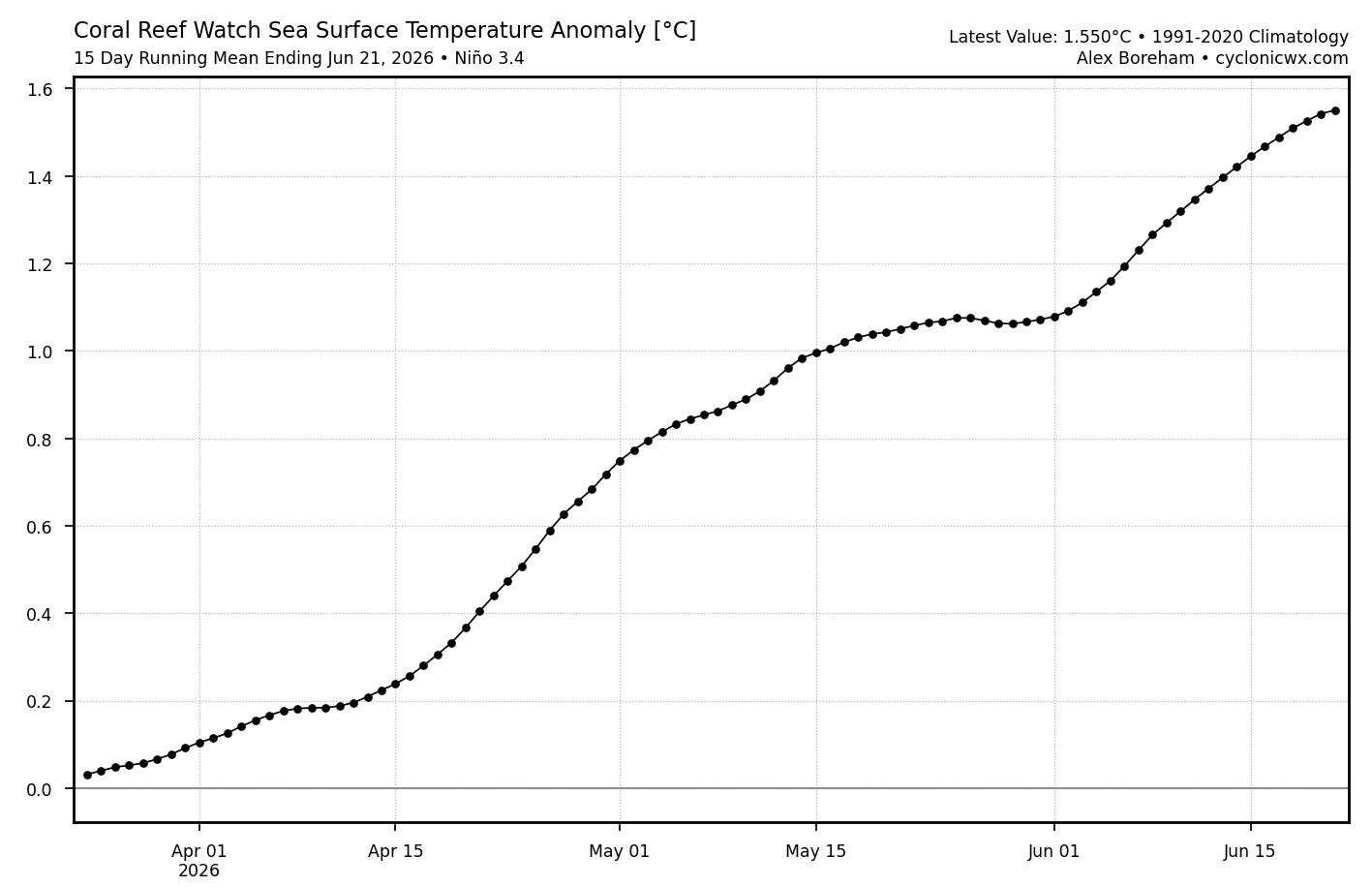
Sea surface temperature data from the equatorial Pacific shows that El Nino has continued to strengthen unabated, with the 15 day running mean from Alex Boreham’s excellent cyclonicwx.com webpage showing that the anomaly in the crucial Nino3.4 region now just above 1.5C, which is the threshold of a strong El Nino. Again, those levels of values have to persist for several months to qualify as a strong El Nino “event” — but there do not appear to be any real signals suggesting that this will not peak as a very strong El Nino later this year.
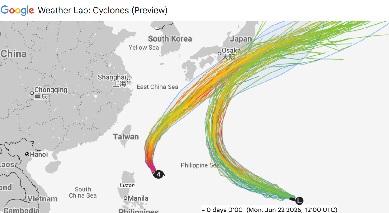
While El Nino tends to suppress hurricane activity in the Atlantic, it does the opposite in the Pacific and right now we have two active tropical cyclones in the western Pacific. Mekkhala is a category 4 equivalent typhoon centered east of the northern tip of Luzon Island, while a new tropical depression is centered just east of the Northern Mariana Islands. Both systems are expected to recurve and pass just southeast of Japan. The depression east of the Marianas is expected to strengthen to a tropical storm, but per NWS Guam the disorganized nature of the system should result in limited impacts even in the northern parts of the islands.
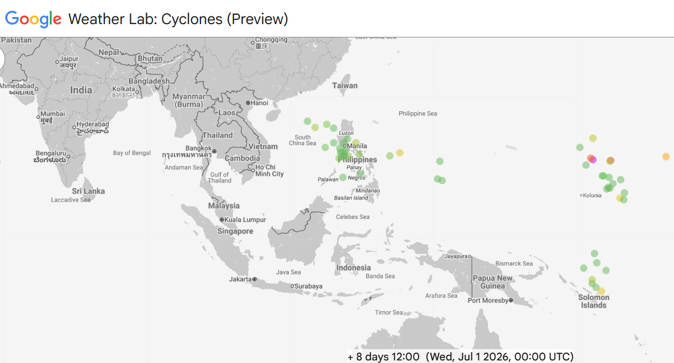
The western Pacific looks to stay active, with the Google DeepMind ensemble having a number of members develop potential new systems near the Philippines and farther east near Micronesia in about a week. Interestingly, a number of members also develop a system across the equator from the potential easternmost system, showing a tropical cyclone near the Solomon Islands. If these twin cyclones do evolve, it would be reflective of a potential westerly wind burst along the equator, another indication of a further strengthening El Nino.
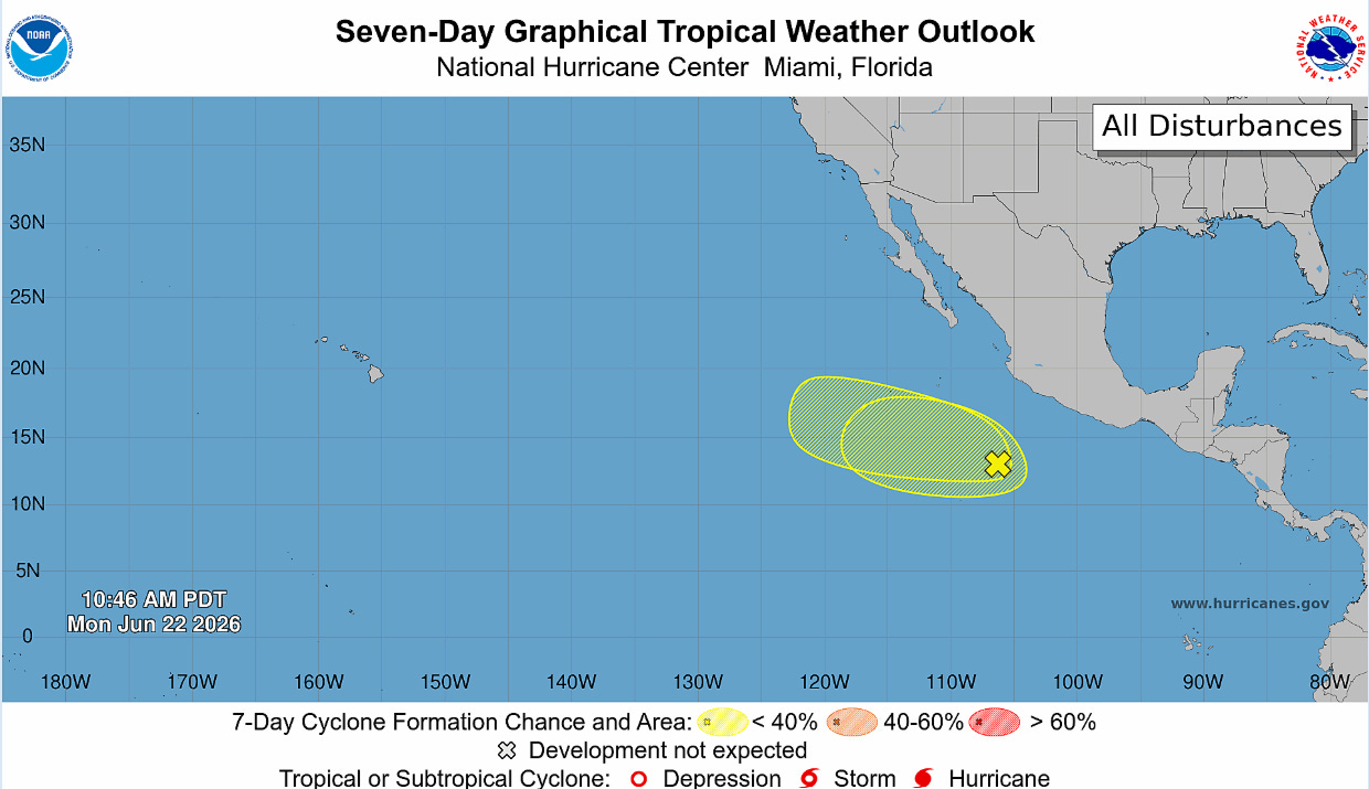
The eastern Pacific has been relatively quiet the last couple of weeks, and while a couple of areas of interest are currently being identified by the National Hurricane Center, there are not really any signs of any development beyond perhaps a tropical storm well offshore of Mexico any time in the next 7-10 days.
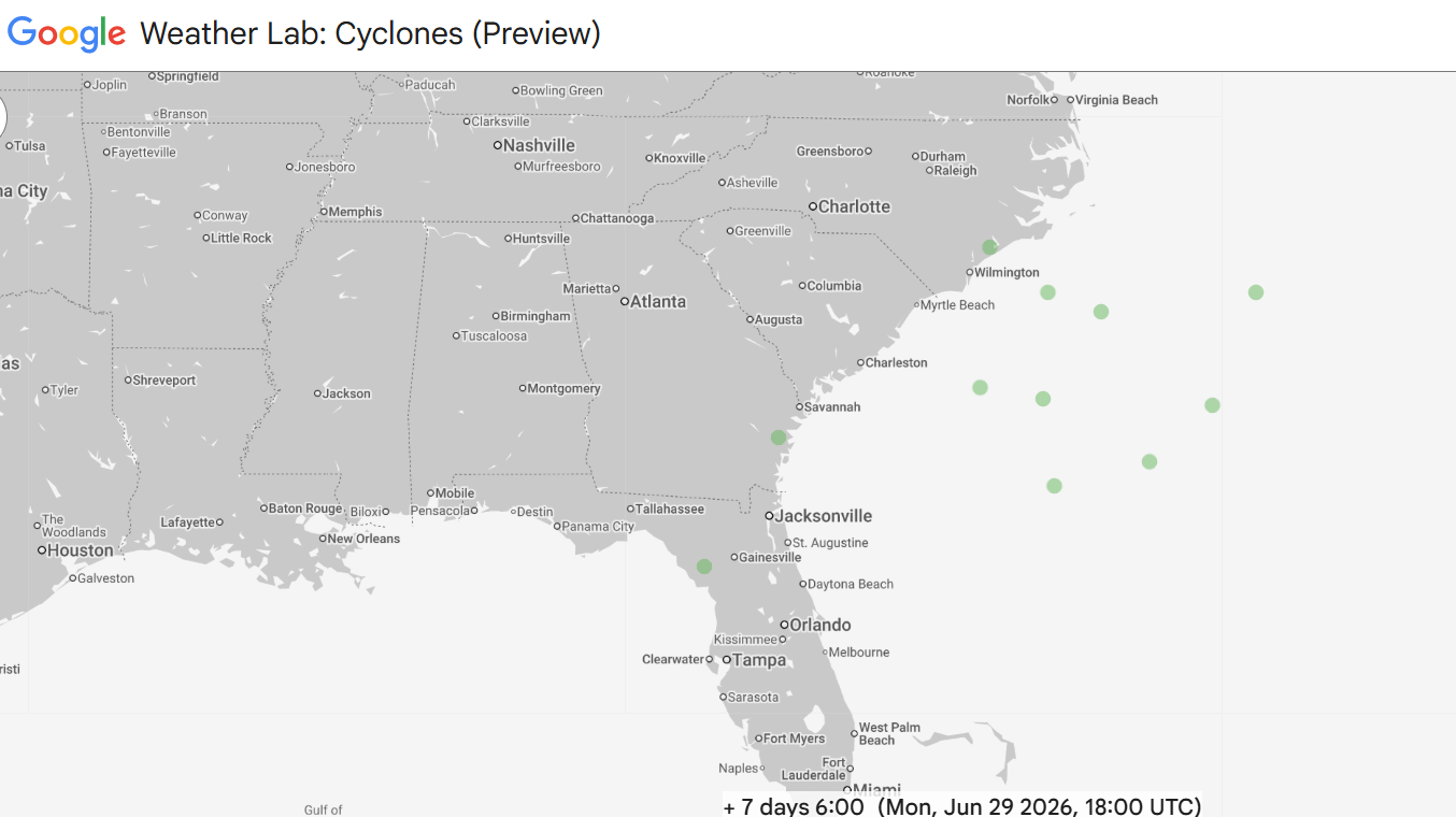
The Atlantic also looks quiet for at least the next week. A small percentage of European and Google DeepMind ensemble members look to try to develop a very weak system somewhere in the vicinity of the southwest Atlantic about 7 to 10 days from now. From what I can glean, it seems like this might be the result of a piece of the southern end of a departing upper level trough of low pressure breaking off and sitting over the warm water long enough to form some sort of system. At this point, this a very low probability evolution — but of course we will keep an eye on it.

Leave a comment