Arthur was truly only a small part of last week’s historic flooding. In weather, things stay active in central US with severe weather and flash flood risks.
Jun 23, 2026
Lots of weather today, but before I get into it, I wanted to talk about a news story that popped up in my inbox this morning that piqued my attention.
As a longtime resident of Mississippi, I am still very interested in what is happening there and I subscribe to Mississippi Today – a nonprofit newsroom which does an incredible job of covering the state. The above is an excerpt from their daily news summary e-mail I get — and as you can see, it pins the blame for all of the severe weather and record flooding last week from Tropical Storm Arthur.
To be clear, this framing is not unique to Mississippi Today — I have seen it in many media articles over the last week. I think this one particularly bothered me because it attributes all of the impacts very directly on Arthur — including even implying the flash flood risk in the state today is still somehow tied to Arthur. The fact is that Arthur was barely a tropical storm — and to be honest, a case could probably be made that it was not a tropical storm or at least more of a subtropical or hybrid system. Weather is a dynamic process that has a lot of complex feedbacks. Arthur itself would not have existed without the overall weather pattern that drove a serious flood risk that was discussed for days ahead of time — while its formation probably augmented the rainfall and flooding in some ways, serious flooding would have occurred regardless.
While I do not expect non-meteorologists to understand all these nuances, I do think it is important that the weather community work with journalists and broadcast meteorologists to help improve the communication because in my opinion some of these details truly matter. I worry that in our sound byte obsessed media environment that people somehow think we cannot have major weather impacts in the South during the summer months without there being a named storm.
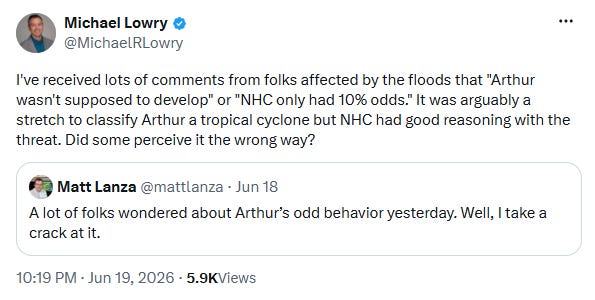
I believe this is what my colleague Michael Lowry is getting at with his post on X (which I accidentally referred to as a “piece” in my tropical update yesterday). NHC was hammering the flood risk in their advisories before Arthur even developed — and that flood risk was going to happen regardless of its development. If people now have the idea that the historic floods only happened because the system got a name, that is very problematic. One of the most memorable flood events of my career on the Gulf Coast was the historic 2016 catastrophe centered on Baton Rouge — and there was no named storm. We in the weather enterprise have to continue to work to help people understand the importance of focusing on threats — not just named storms or their tracks on spaghetti plots.
A messy weather pattern is in place across the central United States today as lots of humidity, an old front and northwest wind flow aloft with disturbance rippling through it is leading to several complexes of strong storms moving southeast across the region.
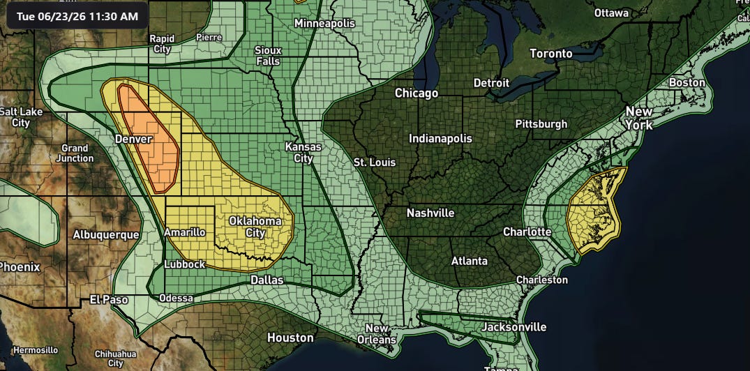
The atmosphere is favorable for severe thunderstorms with damaging winds and large hail over this broad region today — but it will be complicated by the very number of storm complexes and how much clouds hamper (or do not hamper) afternoon heating and destabilization of the atmosphere. The greatest risk for severe storms is focused along the Front Range, where upslope flow should lead to scattered supercell storms capable of very large hail, damaging winds and a few tornadoes. The complex of storms moving south across western Oklahoma also seem likely to remain robust for the next few hours with damaging winds and large hail potential, and a severe thunderstorm watch is in effect with these storms.
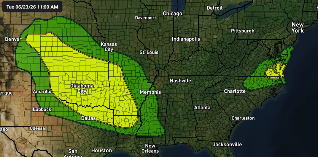
High levels of atmospheric moisture along with the old front potentially focusing training of thunderstorms will also result in a risk of flash flooding.
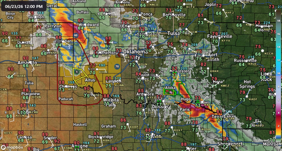
Some rather impressive rainfall totals have occurred in the last several hours across the Arklatex and in the vicinity of the convection moving south out of northwest Oklahoma. A flash flood emergency was recently issued just south of Atoka, OK, where radar estimates over 6” of rain has fallen in the last 3 hours.
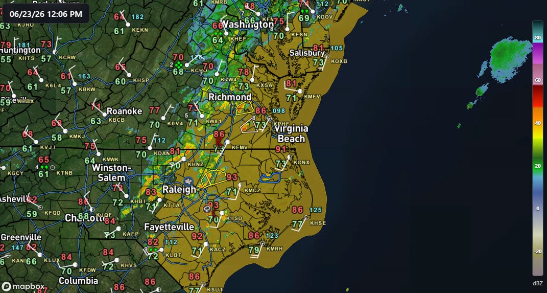
Scattered severe thunderstorms are also expected along the Mid-Atlantic coastal areas this afternoon as storms form in and move through the hot and muggy atmosphere across the region. A severe thunderstorm watch (orange above) is in effect, with damaging downburst winds the main anticipated threat. Localized flash flooding is also possible. A few severe storms and tornadoes are also possible over northern and western Minnesota and the eastern Dakotas this afternoon and evening near an upper level low pressure center.
The other big weather story is heat, i.e., the all-time record heat wave going on in Europe, and increasing risks of heat here in the U.S. I will have more on that in a video or additional post later today.
Maps today are from the WeatherFront app.

Leave a comment