Dangerous heatwave still on track for central and eastern US this week
Jun 29, 2026
I talked in my weather briefing video last night about how these “Ring of Fire” scenarios we are anticipating this week can lead to somewhat surprising intense complexes of severe thunderstorms — and this morning the atmosphere provided a perfect example. A complex of severe storms evolved across southern South Dakota to the southwest of Pierre, and plowed northeast across the state and into western Minnesota this morning (video above of MRMS radar mosaic with SPC storm reports overlaid, courtesy WeatherFront app).

The radar data from this convective complex was incredibly impressive, with the NEXRAD in Aberdeen showing a rear-inflow jet of winds exceeding 125 mph. This complex produced measured winds gusts greater than 110 mph at five different locations across South Dakota, with a peak of 131 mph at a mesonet site in Hyde County.

To demonstrate the surprise aspect of this, the late afternoon Sunday outlook from the Storm Prediction Center for last night only had a 15% probability of severe wind in this area, and the bulk of the reports actually happened just outside of the 15% area.

The outlook also did not highlight any “conditional intensity group” for damaging wind, which implies that any wind reports would mainly be below “significant” (75+ mph) levels.
As I mentioned in my video last night, the severe weather forecasts in these summer heatwave patterns are particularly challenging, as relatively weak atmospheric disturbances can trigger intense thunderstorm complexes in the hot, humid and unstable atmosphere at the edge of the “heat dome.”
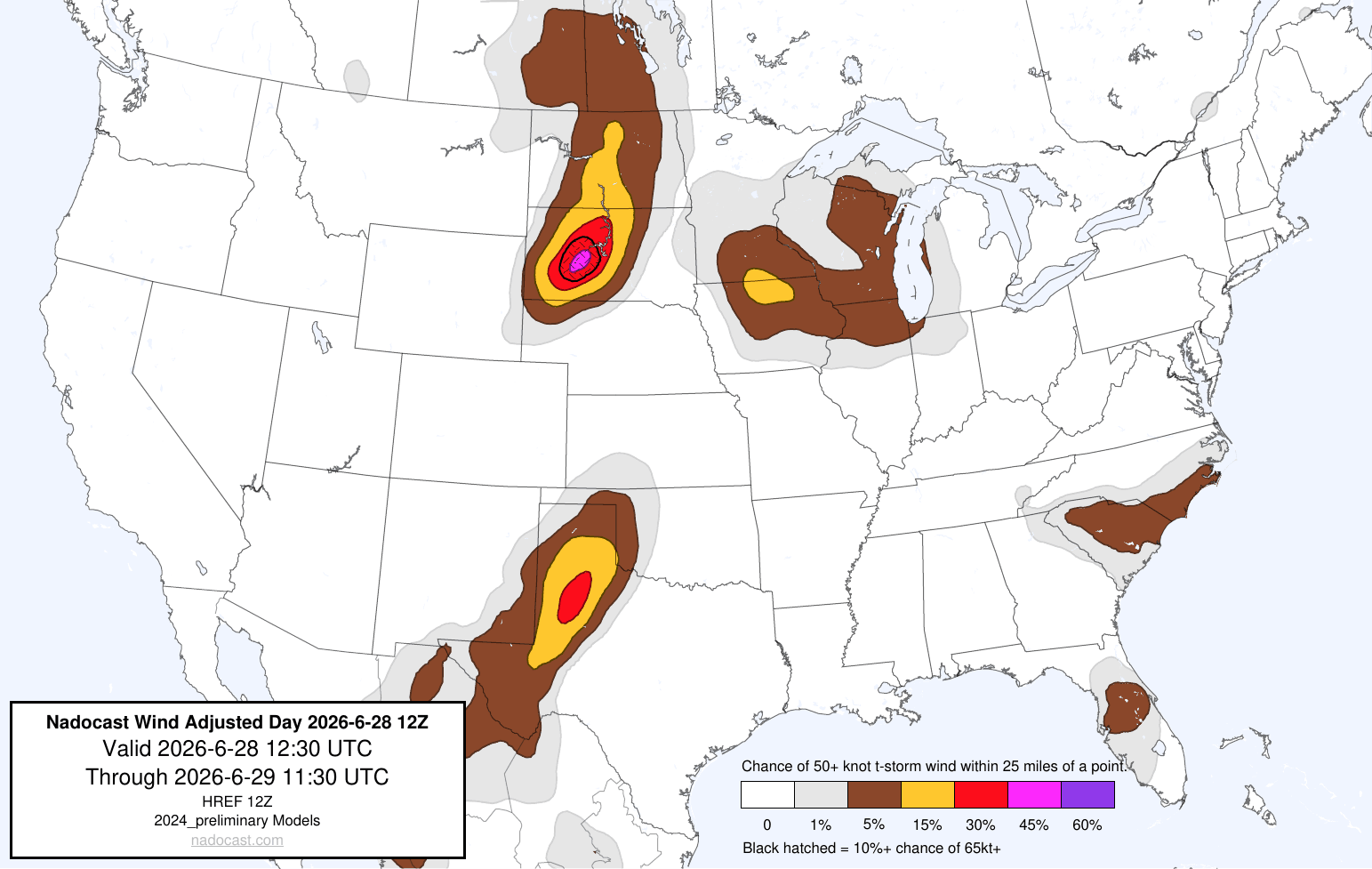
Interestingly, the Nadcoast AI reweighted wind probabilities from Sunday afternoon did highlight an area for higher wind probabilities and a 10% or greater risk of significant winds across South Dakota (Nadocast still uses the old SPC approach to significant severe weather). It was a bit too far west with the axis of maximum risk similar to the SPC outlook, but at least had a signal for a higher end event. I will be very interested to see how some of the AI approaches handle the severe weather risks for this upcoming pattern of heat and humidity.

Speaking of one of those AI approaches, the NCAR AI probabilities based on the European ensemble shows a rather active pattern across the Northern Plains and the Northeast this week on the northwest and north sides of the building dome of upper level high pressure across the Mid-Atlantic and Ohio Valley. That risk should start to expand a bit more into the Mid-Atlantic by this weekend as the upper level high starts to break down.
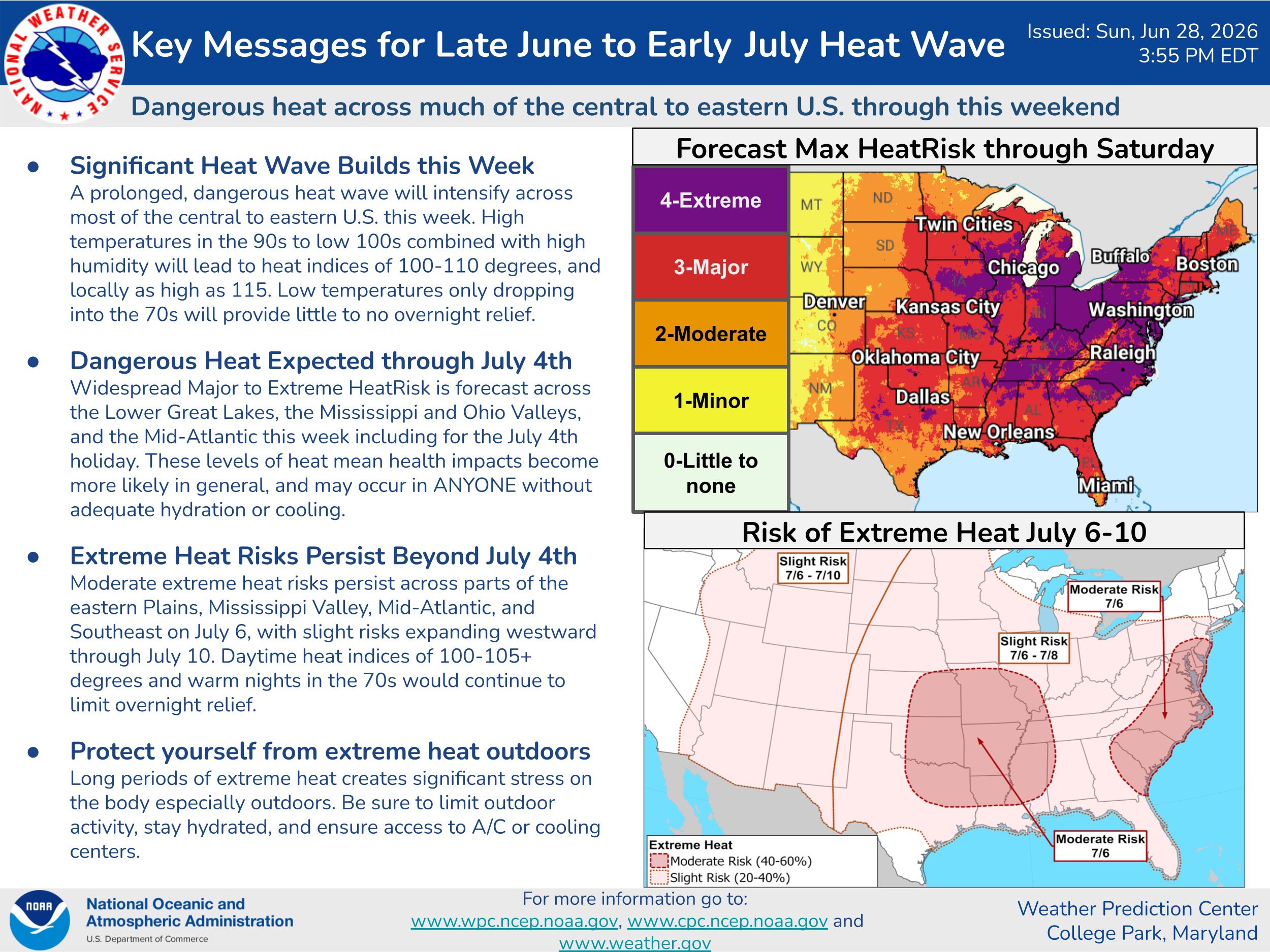
The overall anticipated scenario and impacts for the heatwave across the central and eastern US this week still look mainly on track.

Friday still looks to provide the absolute peak of the heat on the East Coast, with probabilities from the NWS National Blend of Models for air temperatures of 105F or higher still quite high from Virginia north to the Boston area. These temperatures would approach all-time record highs at some locations.

There does seem to be a trend in the models over the last 24 hours to back off a bit in how quickly the upper level high breaks down, and probabilities for 100+F temperatures for the 4th of July have come up slightly as far north as New England. However, the challenges with forecasting thunderstorm complexes also pose potential impacts to temperature forecasts, so there could certainly be changes to these forecasts several days out.

Turning to the wildfire situation, unfortunately the last few days of extreme fire weather ended up resulting in the anticipated dramatic increase in fire activity across the Four Corners region, with numerous large wildfires now burning. While fire weather conditions are not expected to be as extreme today as the last few days, gusty winds and low relative humidity values are still anticipated, and Red Flag Warnings are in effect for many areas as shown in the Watch Duty map above.
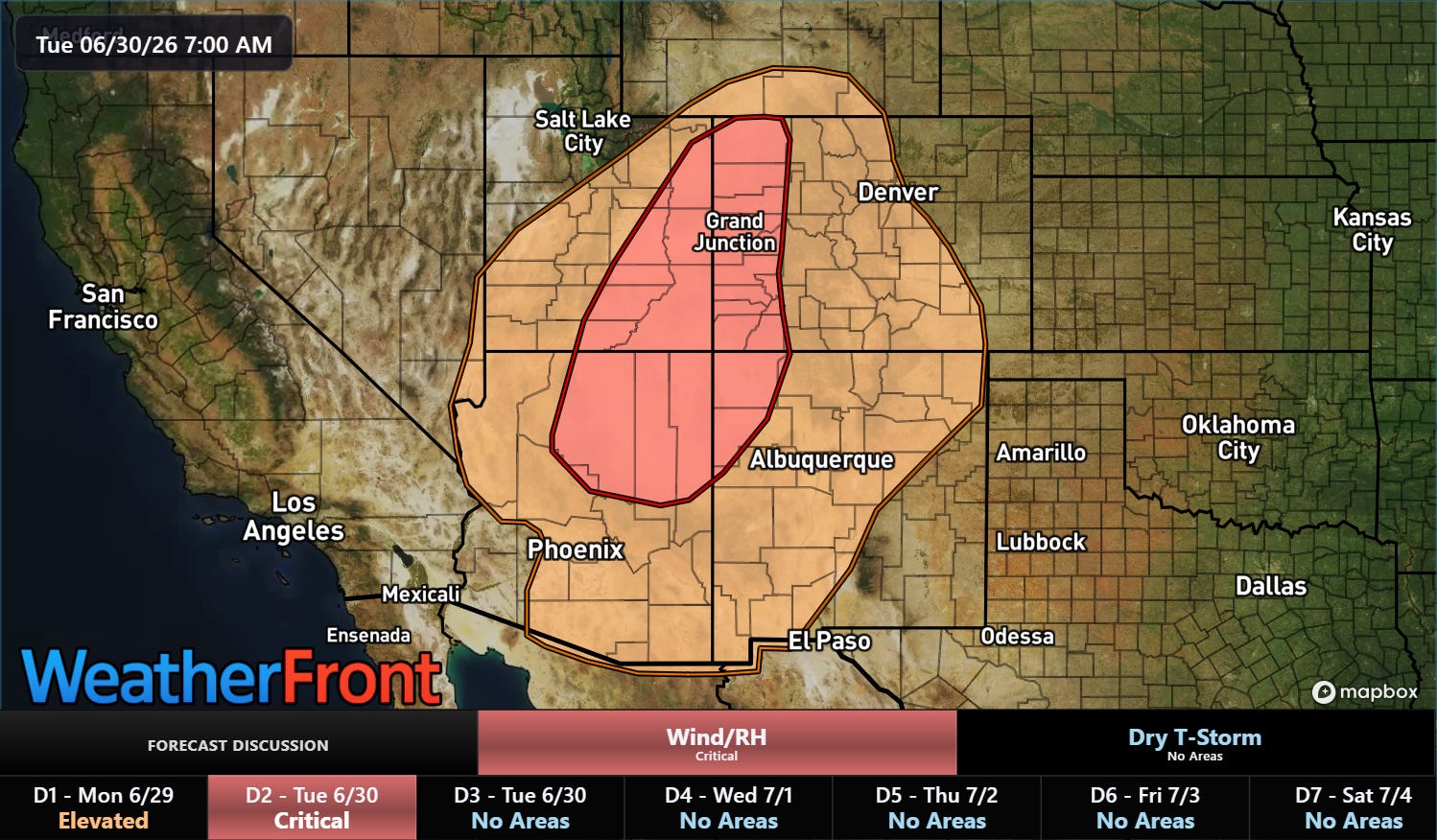
SPC is now anticipating an uptick in fire weather conditions for Tuesday as an upper level weather disturbance rotates through the base of the upper level trough of low pressure across the West. Critical fire danger conditions are generally forecast to be centered on the Four Corners region yet again. Active fire weather conditions with low relative humidity, gusty winds and little to no rainfall are expected to continue for the foreseeable future.

Leave a comment