Weekly tropical update: Atlantic and east Pacific still pretty quiet, western Pacific on watch for major typhoon
Jun 30, 2026
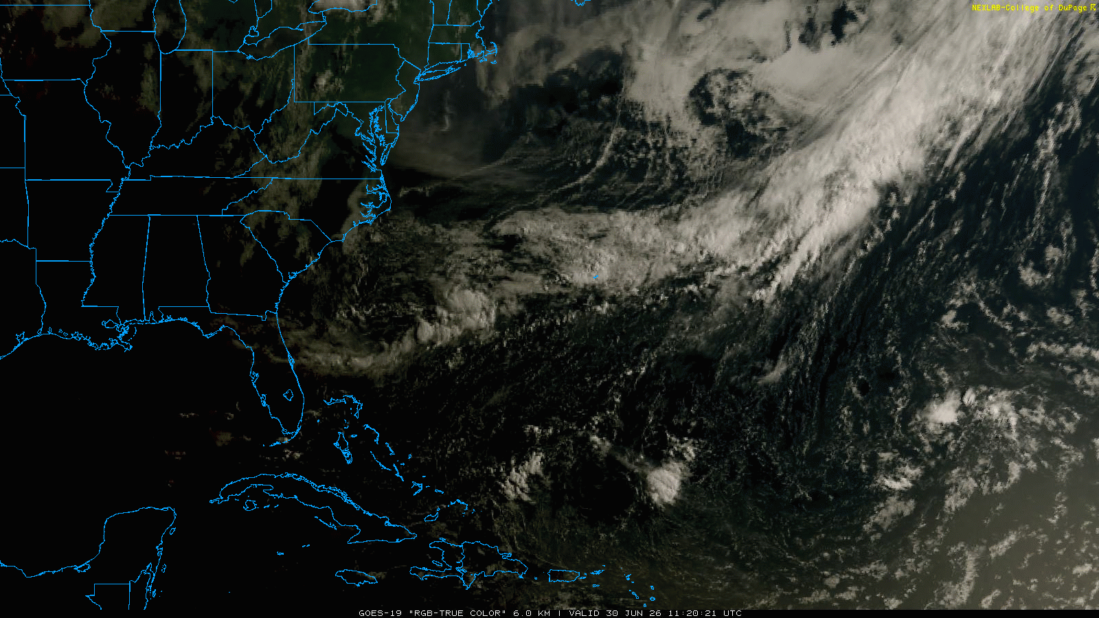
Starting off today with a quick weekly tropical update. The morning visible satellite imagery over the Atlantic shows a weak area of low pressure and associated thunderstorm activity over the southwest Atlantic just about due east of the Georgia/Florida border and due south of Cape Cod. The National Hurricane Center continues to have this system highlighted for low (10%) probability of development, but at this point none of the reliable models develop it and the already marginal conditions seem less favorable. Odds are high we do not have to concern ourselves with this disturbance.
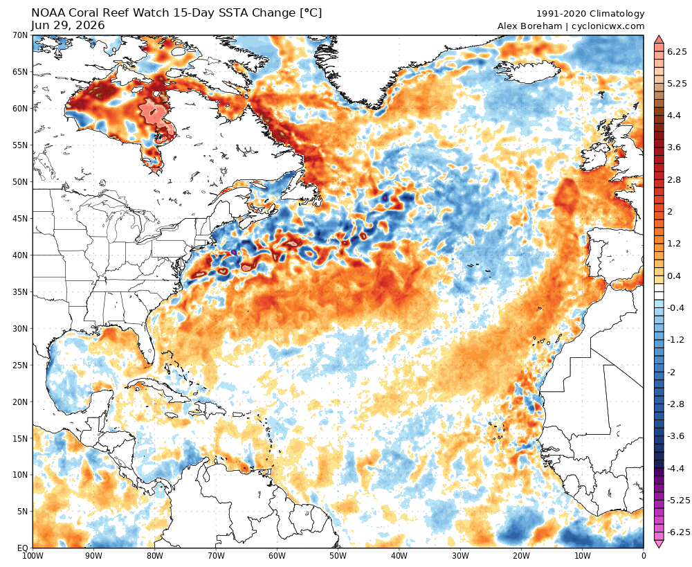
Elsewhere across the Atlantic, things are very quiet and with El Nino continuing to slowly build, there is little change in the current expectations for the season. Interestingly, sea surface temperature anomalies have continued to warm over the last 2 weeks across the eastern Gulf and much of the subtropical Atlantic.
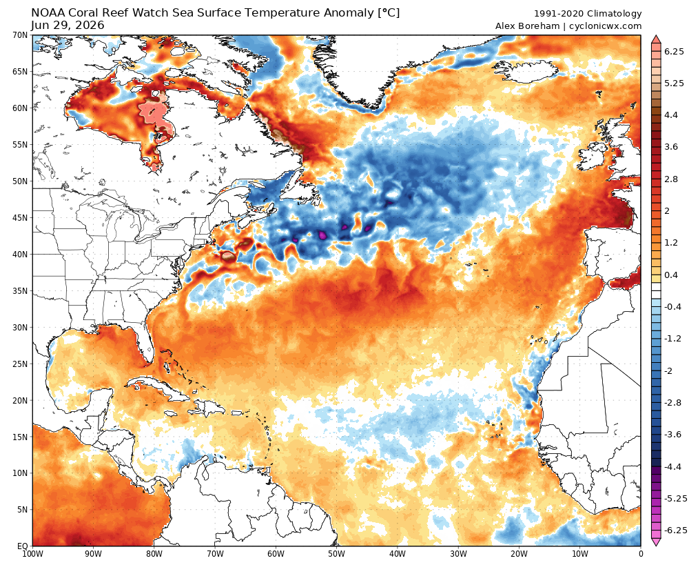
This does show that water temperatures will be quite supportive of tropical development — or maintaining tropical cyclones — across much of the Atlantic Basin for any systems that can get going. However, temperatures in the deep tropical Atlantic remain somewhat below normal, which is another sign along with the growing El Nino of a more quiet season.
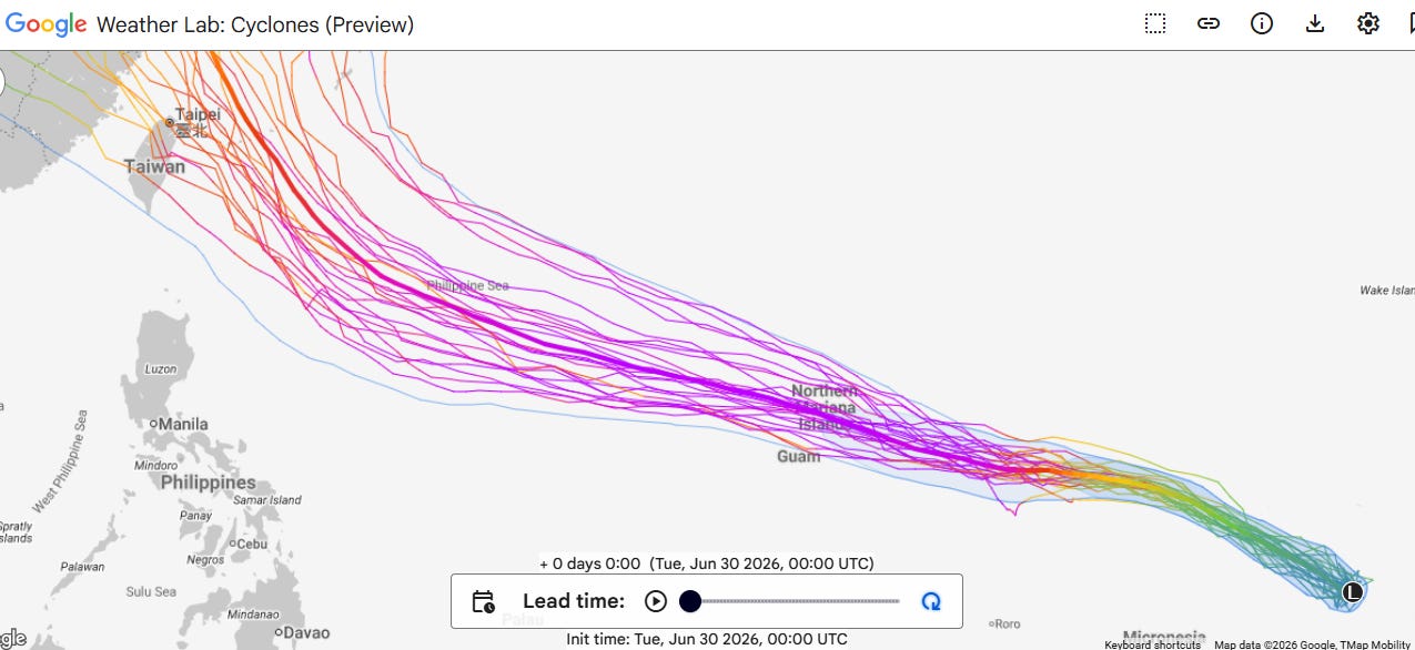
The main tropical system of interest in the next week will be a disturbance currently northwest of the Marshall Islands, which is expected to become a very intense and long lasting typhoon as it moves west-northwest across the northwest Pacific the next 7-10 days. All of the models are in rather good agreement on this scenario (Google DeepMind AI shown above). Right now most of the models take the system through the Mariana Islands north of Guam as a potent system, so it will be of concern there over the next several days.
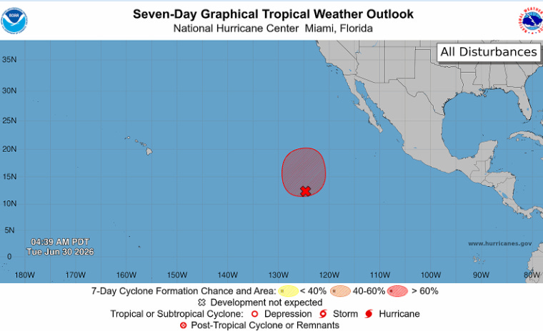
The Eastern Pacific has remained rather quiescent so far this season, and is running at only about 25% of its normal activity level to date. NHC does have high probabilities of development on a system well offshore of Mexico — but it is not expected to develop into anything more than a fairly short-lived tropical storm. The rest of the eastern and central Pacific looks to remain quiet for at least the next week.
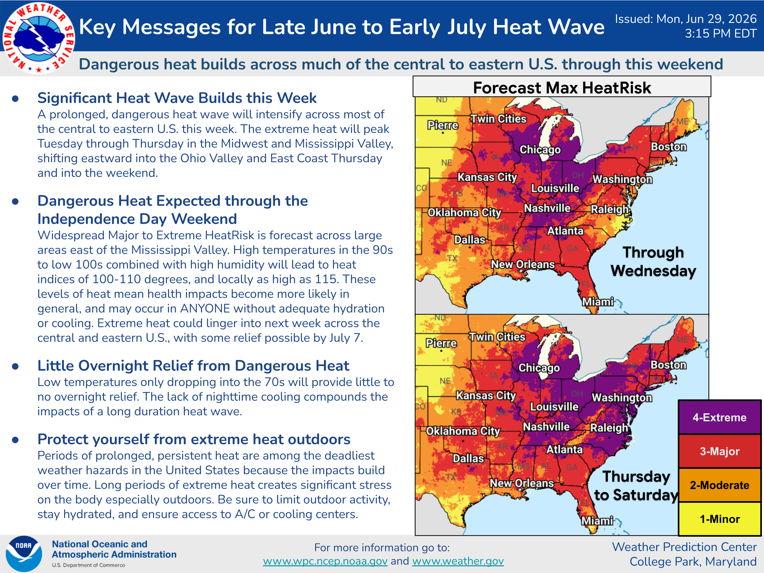
Coming back to the US, heat and fire danger will continue to be the big national stories this week — but severe weather and flash flooding will still be an issue as well. Starting though with the heat, everything still appears on track for a major, prolonged heatwave for much of the eastern half of the country over the next several days.
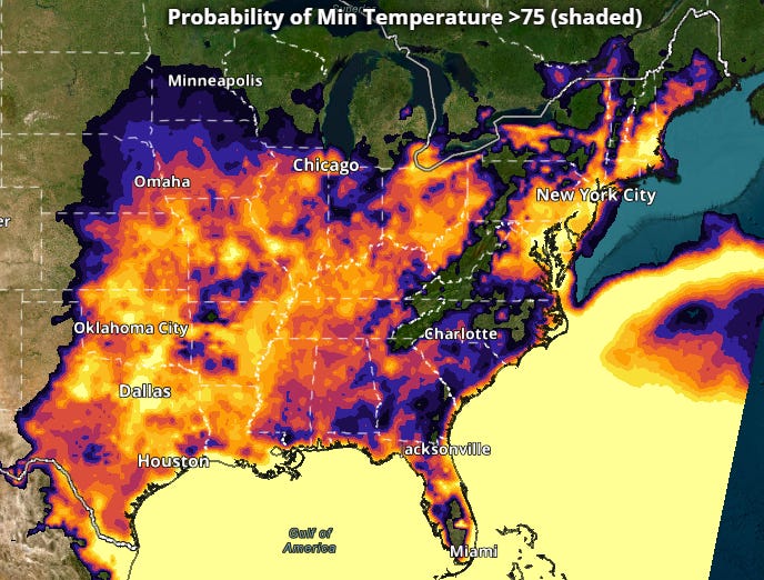
Again, particular concerns with this heatwave are the anticipated humidity and overnight minimum temperatures which will make relief much more difficult to come by. Many areas will see multiple days of low temperatures in the upper 70s or warmer.
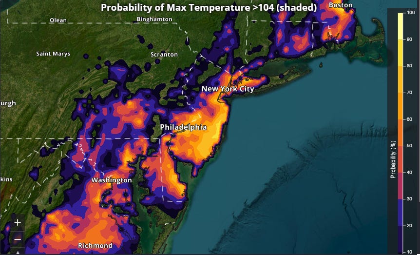
The most anomalous maximum temperatures look as if they will be centered along the East Coast, where the latest NWS National Blend of Models continues to shows significant probabilities for temperatures of 105F or higher on Friday. This would approach all-time record highs in the major cities from DC to Boston.

The most recent European ensemble forecast has a maximum temperature of 107F on Friday at Reagan National in DC, which would exceed the all-time DC record of 106F.
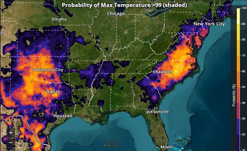
While the upper level area of high pressure responsible for this heatwave is still expected to start weakening by this weekend, the models continue to trend slower and less aggressive with said weakening. As a result, much of the Mid-Atlantic is now expected to have temperatures near or above 100F through the weekend. 100F or hotter temperatures are also expected across the Southern Plains.

One of the primary potential complications for temperature forecasts this week will be the development of any thunderstorm complexes and their impact on temperatures due to clouds and precipitation. As I have been discussing, forecasting these complexes in a heat dome environment such as this is even more challenging than normal — and given the heat and humidity fueling them, storm complexes in this environment can be particularly intense with strong winds and flash flooding. The latest NCAR AI probabilities shows the highest risk the next few days running from the Plains through the Great Lakes and Northeast along the periphery of the upper level high pressure area — with the risk gradually shifting farther south into the Mid-Atlantic this weekend as the high pressure area starts to break down.
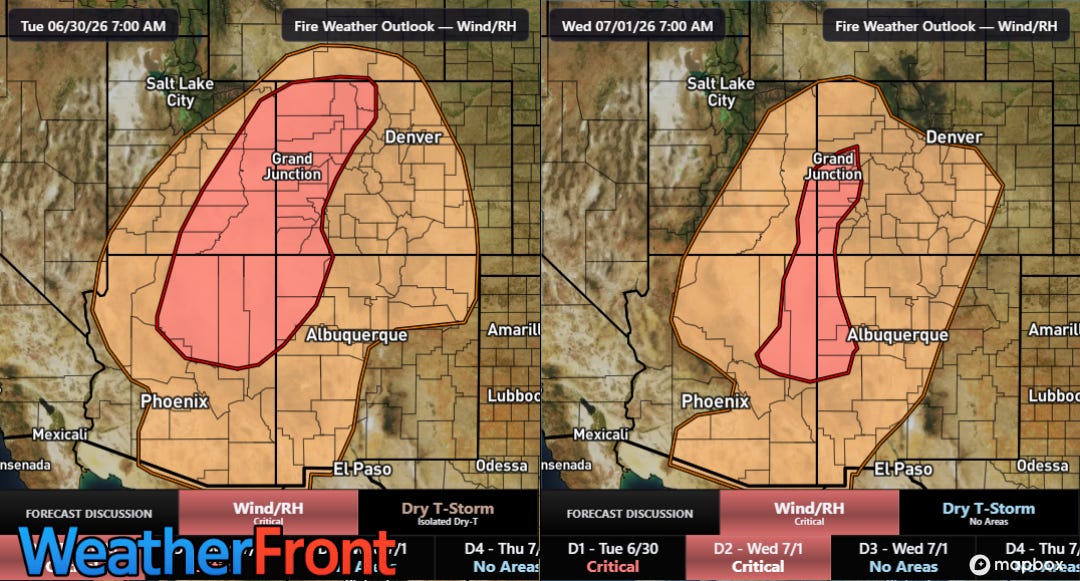
After somewhat less volatile fire weather conditions Monday, conditions are expected to deteriorate again today into Wednesday with SPC forecasting critical conditions across the Four Corners region. On Monday, a new fire erupted to the west of Pueblo, CO, and its rapid spread has forced the evacuation of several thousand people from towns near the fire. Numerous large wildfires continue to burn across the region, and on Monday the governor of Colorado joined Utah in declaring a state of emergency. The national wildfire preparedness level moved to a PL4 on Monday, the second highest possible. Fire weather conditions are expected to remain poor across the Southwest into at least this weekend.

Leave a comment