“Ring of fire” risks of severe storms and flash flooding will exists from the central US into the Northeast
Jul 01, 2026
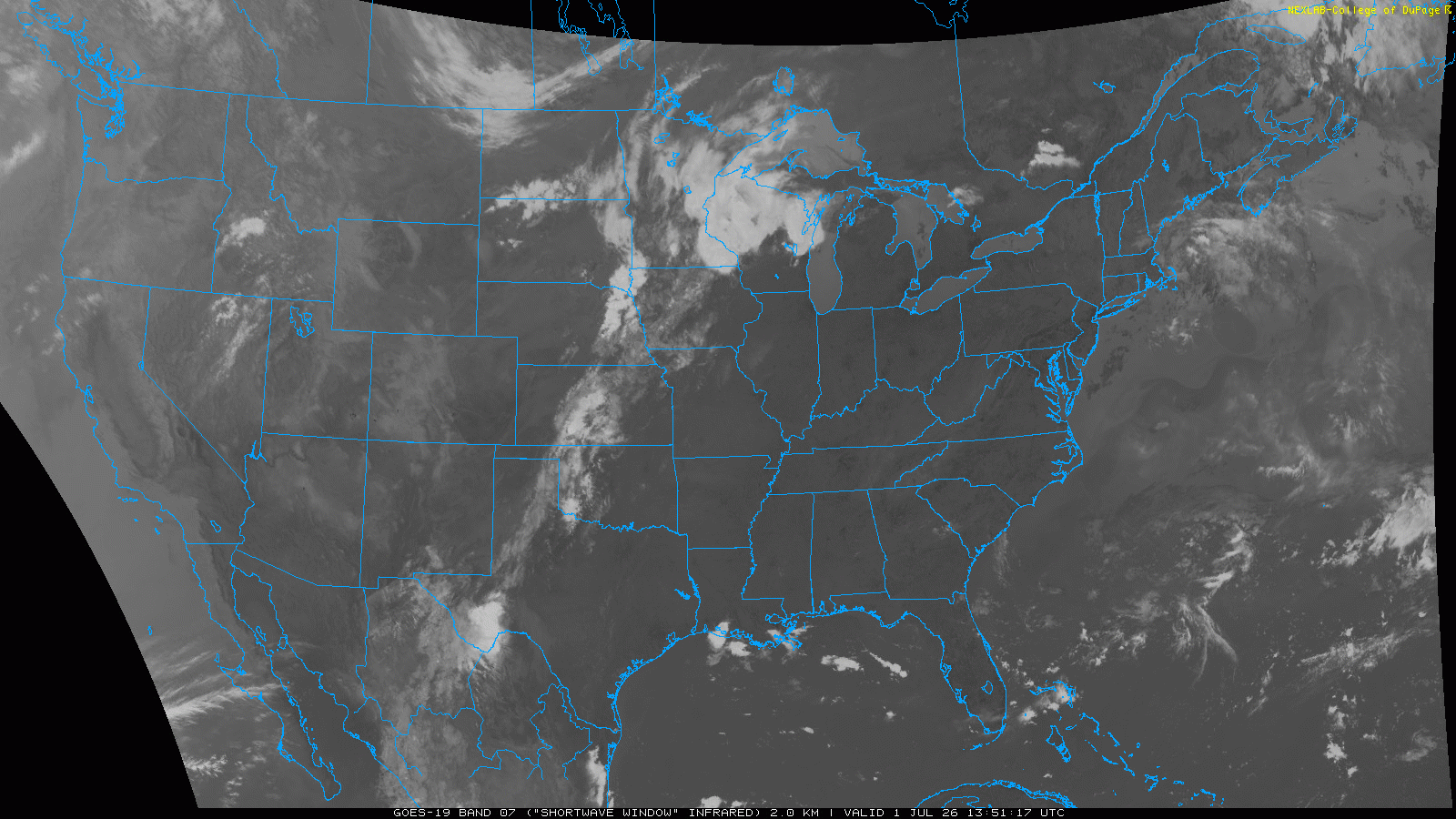
This morning’s infrared satellite loop shows very clearly how the dominant weather pattern for the remainder of this week of excessive heat, fire danger and active thunderstorms has become established across the country.
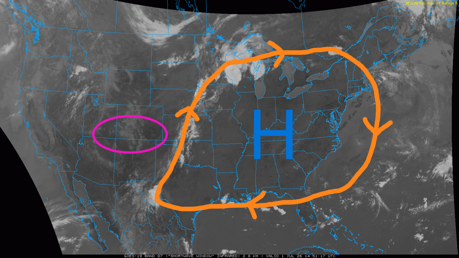
The large, strong area of upper level high pressure has become established across the East, with the sinking air under it resulting in mostly clear skies and building heat. Surrounding it, clusters of thunderstorms (the “ring of fire”) are rotating around the edge of the high pressure dome — feeding off the heat and humidity, these storms are strong to severe and producing torrential rain. Farther west, the black speckles of burning wildfires can be seen across the Four Corners region.
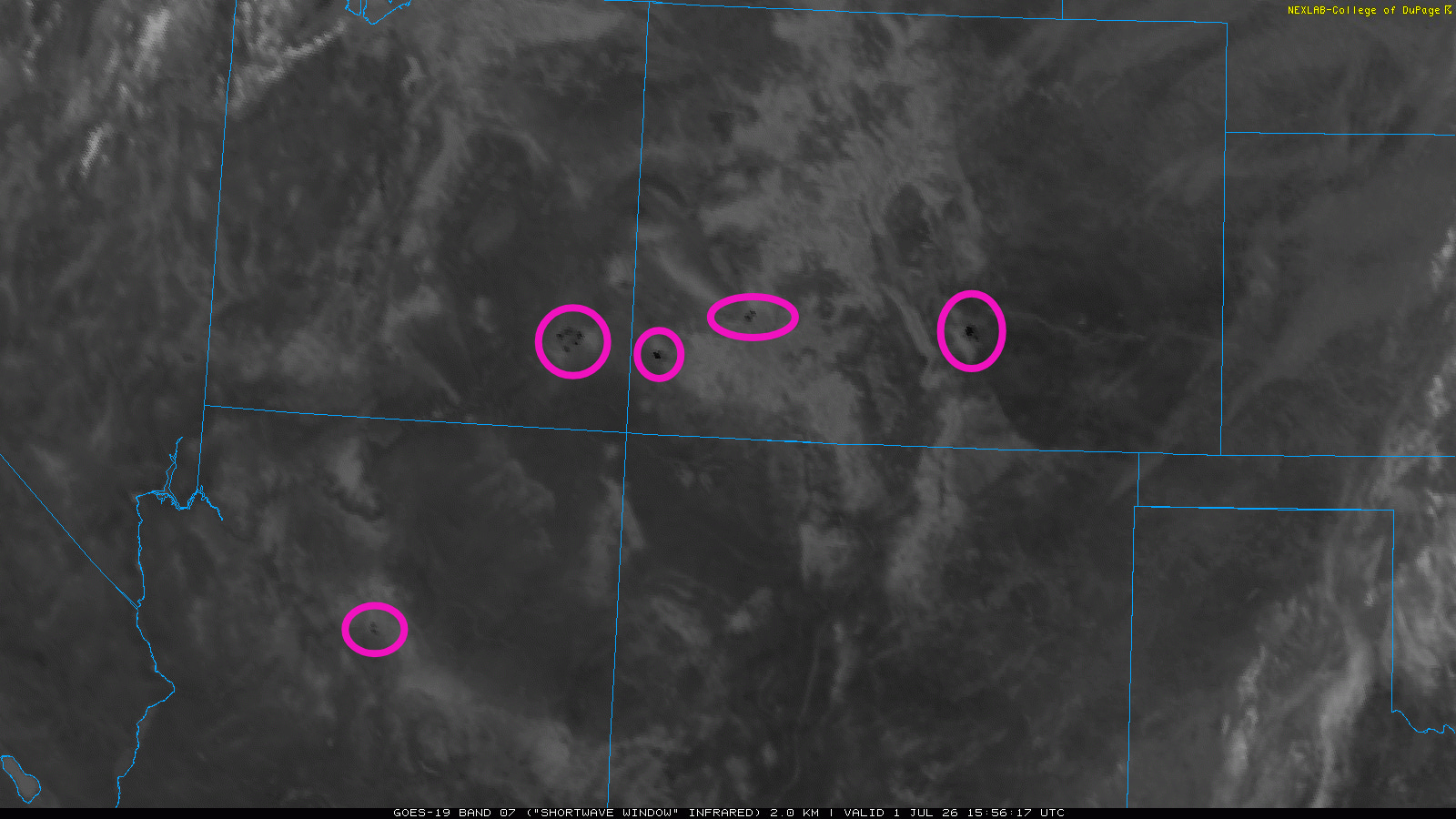
These fires are not as discernible in the early morning when they are less active, but are still visible when we zoom in a bit.
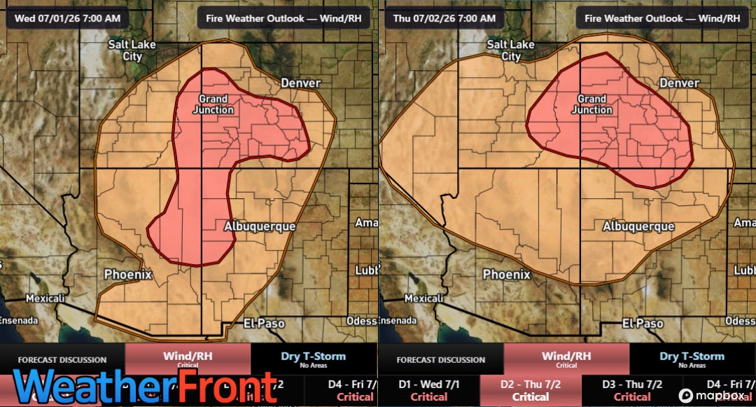
The fires should become more active again this afternoon as critical fire weather conditions with gusty winds and low relative humidity are expected. By Thursday into Friday, the most critical fire weather conditions are expected to be across eastern Utah and western Colorado. SPC notes in their fire weather discussion for Thursday that wind gusts of up to 35 mph are expected with minimum RH values of 3-15% will occur as “very to record dry fuels continue to cure.”
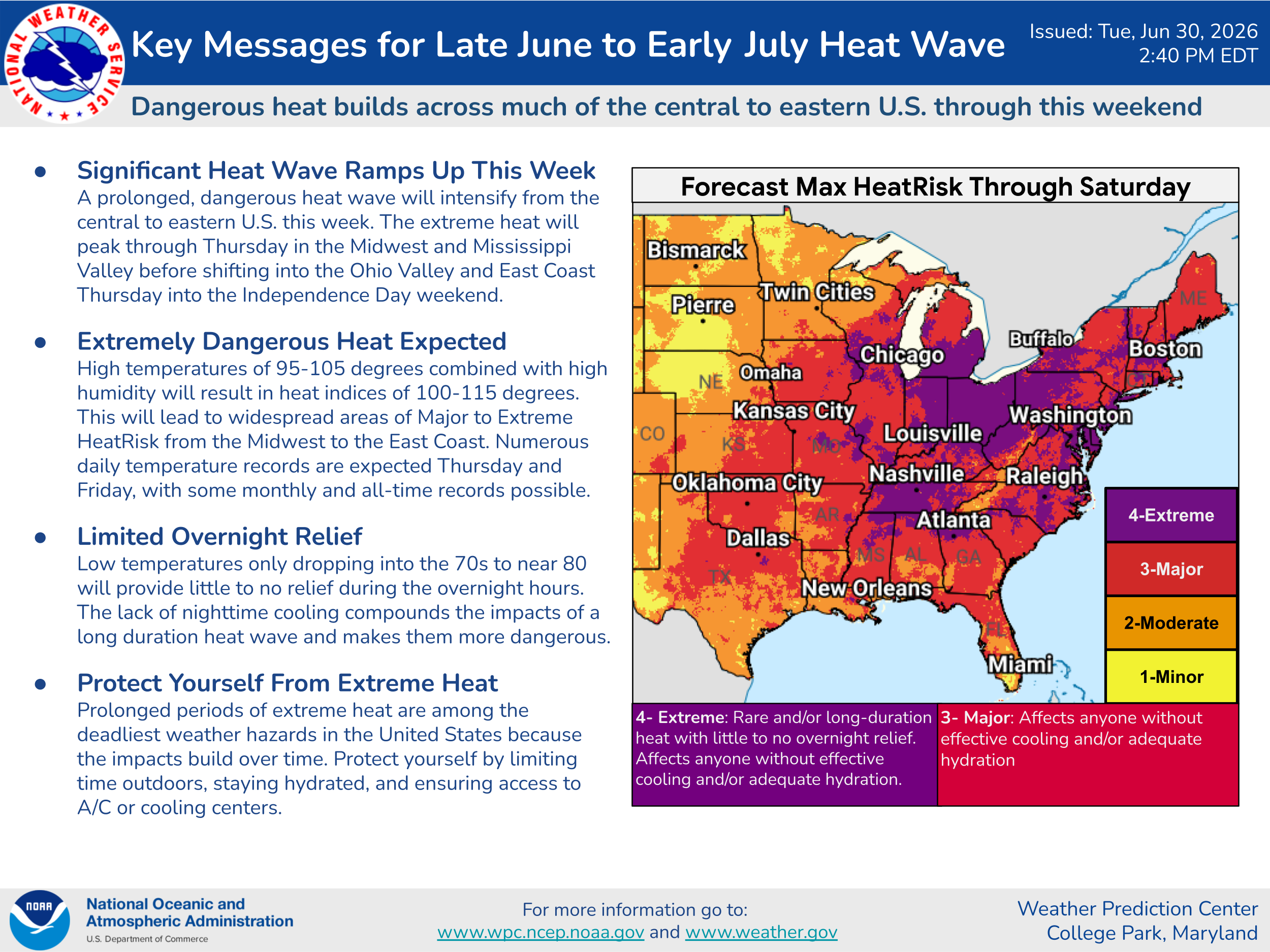
Under the high pressure dome, heat will continue to build across the Ohio Valley and East Coast regions into the 4th of July — this key message graphic from the Weather Prediction Center summarizes things well.
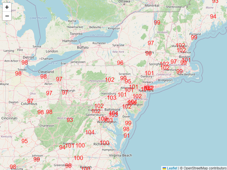
Numerous daily record warm temperatures — both maximums and minimums — are expected Thursday through Saturday (Thursday NWS forecast high temperatures near or above daily records shown above).

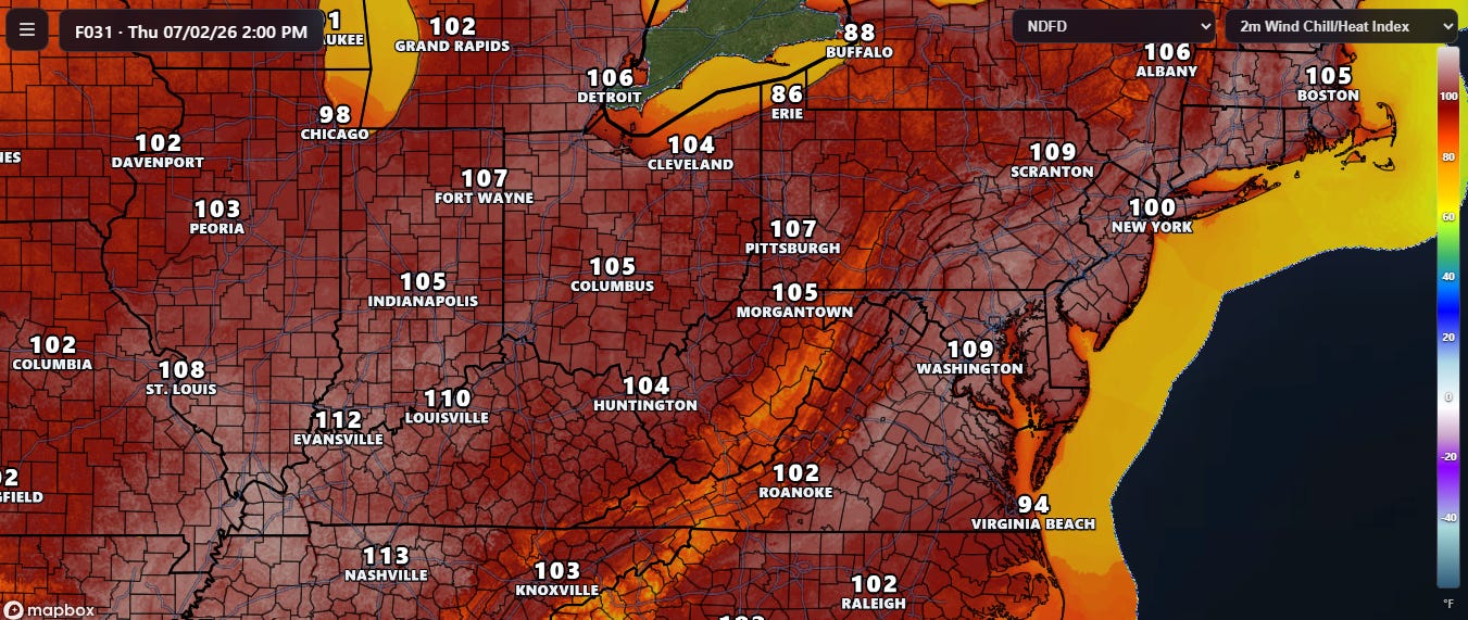
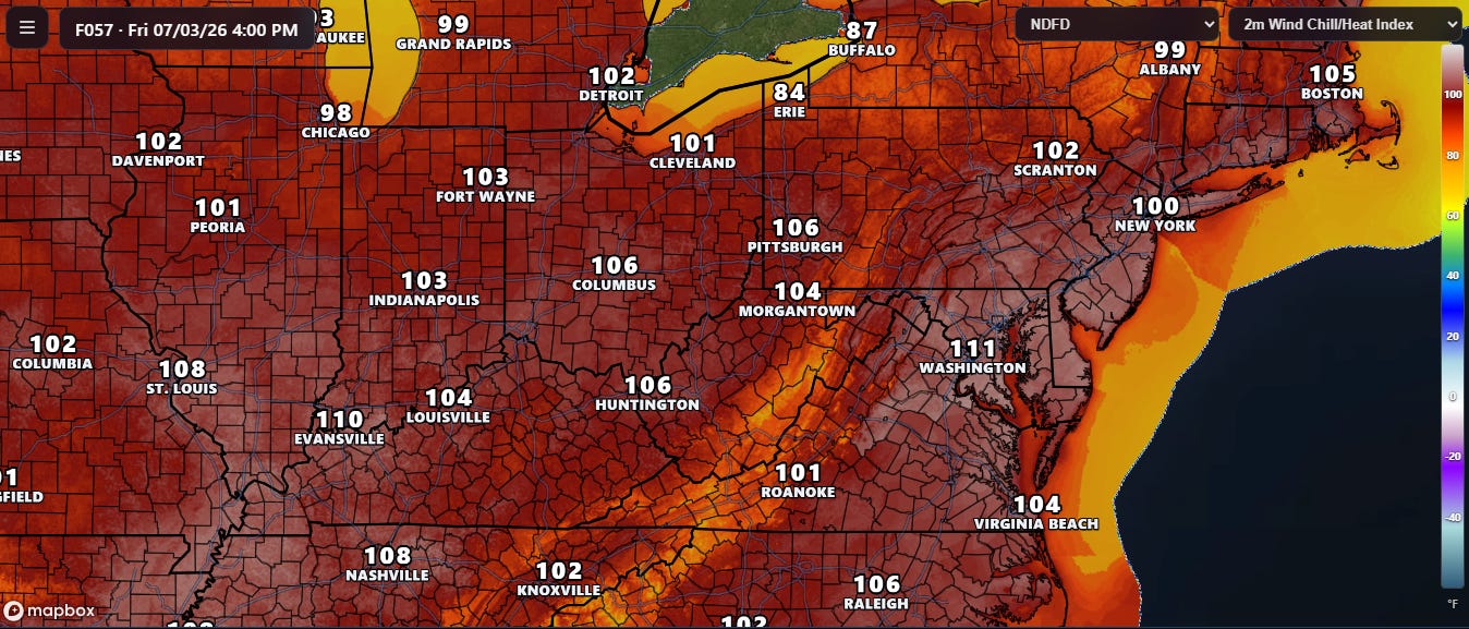
There remains uncertainty in just how hot the ambient temperatures will get in the East. High resolution models such as the HRRR now have forecasts out through Thursday, and are showing temperatures challenging all-time records in DC and Philadelphia — and the peak of the heat is not expected until Friday. I did a video last evening explaining that while the models can certainly run too hot in weather situations like this (and, indeed, there are signs in the observations today that the models are running a bit hot), that bias may be tempered in this situation by the drought and dry ground conditions across the Mid-Atlantic. This could especially be the case by the time we get into Friday and Saturday when the compounding effects of several days of heat and dryness (assuming no thunderstorms) will be maximized.
Regardless of the exact air temperatures, the combination of heat and humidity will result in widespread heat index values above 105F, and with overnight lows in the 70s, heat related health risks will be significant.
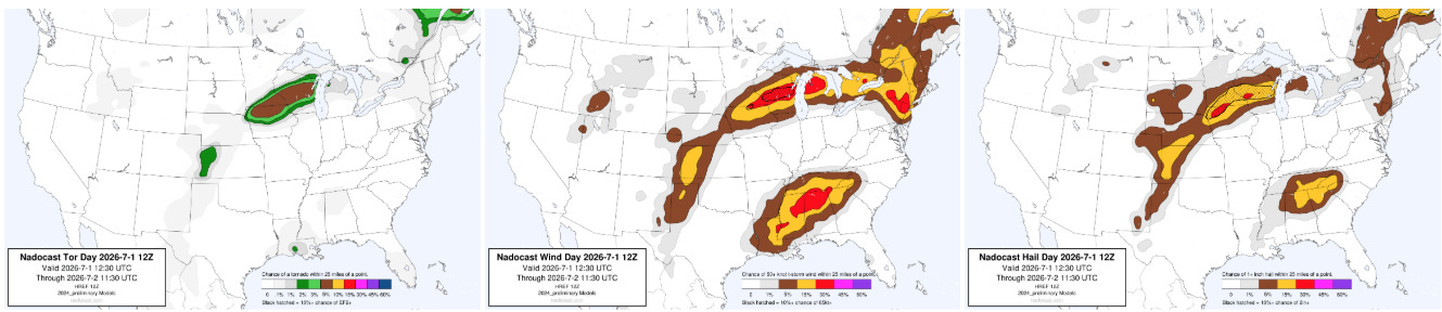
Around the edge of the high pressure dome, the “ring of fire” will continue to see a risk of severe thunderstorms through tonight, with damaging winds a particular risk. Areas of the upper Midwest from northern Iowa across central Wisconsin will have more favorable conditions for supercell severe storms that could also produce very large hail and a few tornadoes.

The risk of severe storms will continue across these same general areas the next couple of days. As the area of upper level high pressure across the East starts to weaken, the risk for severe weather will start to shift more southeast and become focused in the Mid-Atlantic region this weekend into the first part of next week.
With all of the severe weather risk this next several days, it is important to be aware that the high levels of heat and humidity will be fueling potentially intense storms — if and where severe storms become organized, a risk of significant damaging winds will exist. High levels of moisture will also mean a threat of flash flooding if thunderstorms move slowly or train over vulnerable areas such as urban regions.
Programming Reminder: Given the ongoing active weather, I am utilizing the Substack Chat feature to share periodic real-time updates. I also do occasional live videos to provide briefings and updates about the evolution of severe weather and flash flooding risks. As a reminder, these are benefits that paid subscribers receive for their support of Balanced Weather. Any videos I do will also be recorded and shared to all subscribers. I also provide updates on my BlueSky and Facebook feeds, and via occasional Substack Notes.

Leave a comment