Severe thunderstorm risks continue for central and eastern US, as Typhoon Bavi threatens the Marianas
Jul 03, 2026
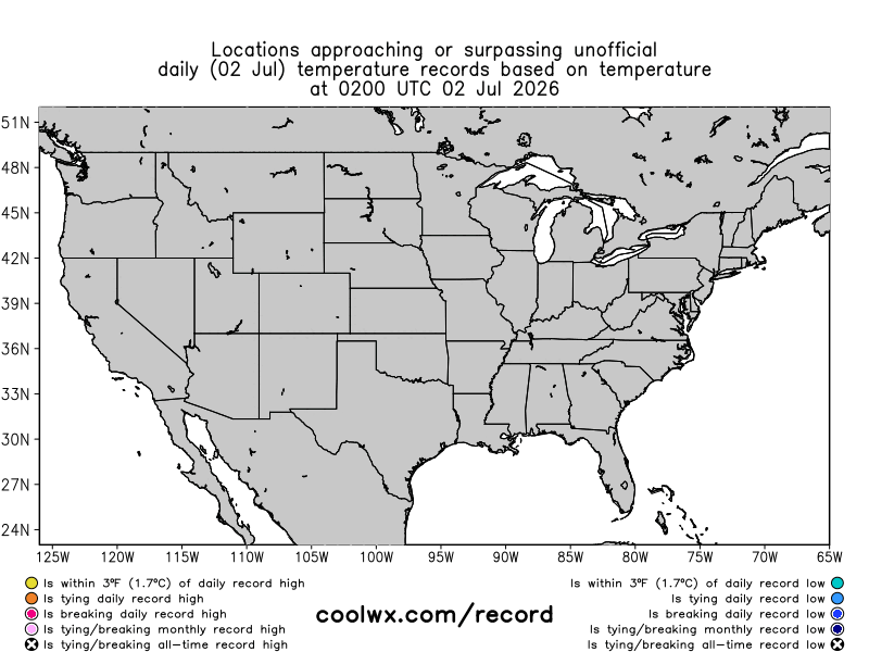
Thursday was one of the hotter days for the Northeast in recent memory. While the only all-time record highs (black x in the map above) were at shorter term climate stations, a number of longer term climate sites did have one of their hottest days on record.
Topping that list is probably Newark, with a high of 105F — that maximum has been reached 8 other times in Newark’s long climate history (back to 1843), and would be the all-time record high other than the 108F that was reached on July 22 2011. Wilmington, DE established a new daily record by 5F with a high of 103F, which tied for the third hottest maximum temperature on record. NYC Central Park reached 100F for the first time since 2012. Boston Logan’s high of 101F set a new daily record — 3 degrees short of the all-time record of 104F, it tied for the 9th hottest day on record at a site that has data back to 1872.

I have been emphasizing the importance of the warm overnight low temperatures and lack of cooling in the public health threat from the heatwave — and this morning’s low temperatures were truly extreme. The morning low of 87F at Newark would establish a new all-time record high minimum, and the lows of 84F at Washington National and NYC Central Park would tie the all-time record high minimum at those sites. Many other sites around the Northeast and Mid-Atlantic are also looking at record warm minimums ranging from daily to all-time. Cooling thunderstorms this evening could potentially keep some of these records from being established by dropping the temperature to a cooler reading before midnight — but obviously the public health impacts from the heat of the last 48 hours have already occurred.

Temperatures across the East today are generally running near to a couple of degrees warmer than 24 hours. Today should be the peak of the heat for most locations, especially in the Mid-Atlantic region from Virginia north to southern New England.
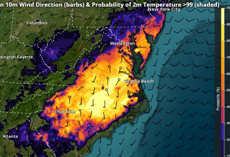
As we have been saying though, the cooling will be gradual for areas east of the Great Lakes, and many locations from the Carolinas north through New Jersey will see highs 100F or above on the 4th of July.
Animation Caption: Radar animation with severe weather reports and NWS alerts overlaid from Thursday evening
After a busy day yesterday for severe weather with nearly 300 reports — primarily focused from South Dakota to southern Lake Michigan including several tornadoes, a wind gust of 105 mph at the NWS observing site in Huron SD, and hail up to 3.5” in diameter — the heat and humidity will fuel another active day today.
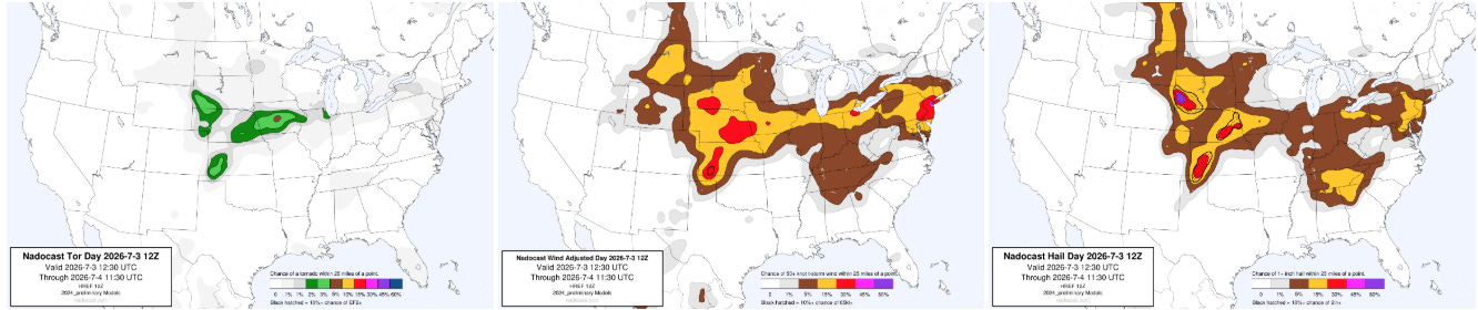
The Central Plains and Midwest will continue to see risks of supercell severe storms with very large hail, damaging winds and a few tornadoes, while the Mid-Atlantic will see increasing coverage of scattered severe storms later today into this evening, with damaging wind gusts being the primary threat.

Out West, many of the large wildfires in the Four Corners region became quite active again Thursday afternoon, particularly in Colorado and New Mexico.

This afternoon and evening will see additional elevated to critical fire weather conditions across the region with gusty winds and low relative humidity values. Wildfires have already destroyed hundreds of structures in the region and caused numerous evacuations, and while winds will decrease some this weekend, heat will be building across the region into next week. Meanwhile, major wildfires are also burning in France after their intense heatwave — and unfortunately signs are pointing to another major heatwave overspreading western Europe in the next 7-10 days.

Finally, the Western Pacific I mentioned in this week’s tropical update has continued to develop and intensify in the last few days, and Typhoon Bavi has now become the equivalent of a category 4 on the Saffir-Simpson Hurricane Wind Scale. It is expected to continue to intensify through the weekend and move through the Northern Mariana Islands. My colleague Michael Lowry has an excellent post this morning on his Substack about Bavi.

Leave a comment