
And the impacts on global climate and weather are significant
Jul 27, 2026
With it being a Monday, I want to focus today on a tropical update given that I have not had a chance to do one in a while. Before diving into the specifics of what is happening in the tropics, though, I want to talk a bit about the bigger global picture.
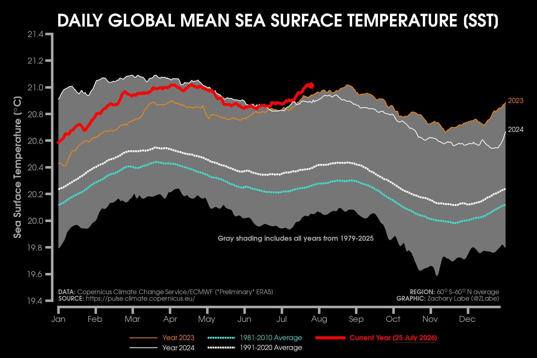
Climate Central climate scientist Zack Labe posted over the weekend from his incredible climate data tracking website this graphic showing that global sea surface temperatures (SSTs) are currently running at all-time record warm levels — even warmer than the unprecedented levels seen in 2023 and 2024.
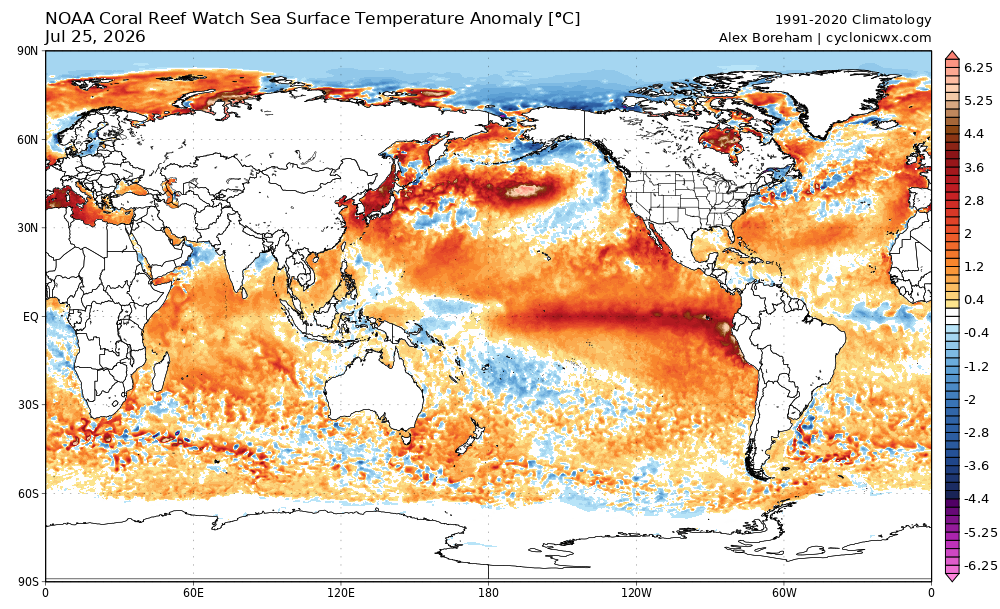
This record warmth is foundationally supported by the rapidly growing El Nino — with SSTs in the tropical Pacific also at record warm levels for this time of year. But as you can see by this global SST anomaly map, with a few exceptions anomalous warmth is pretty much everywhere. A particularly warm “blob” continues over the northern Pacific where SSTs are as much as 5-6C above normal.
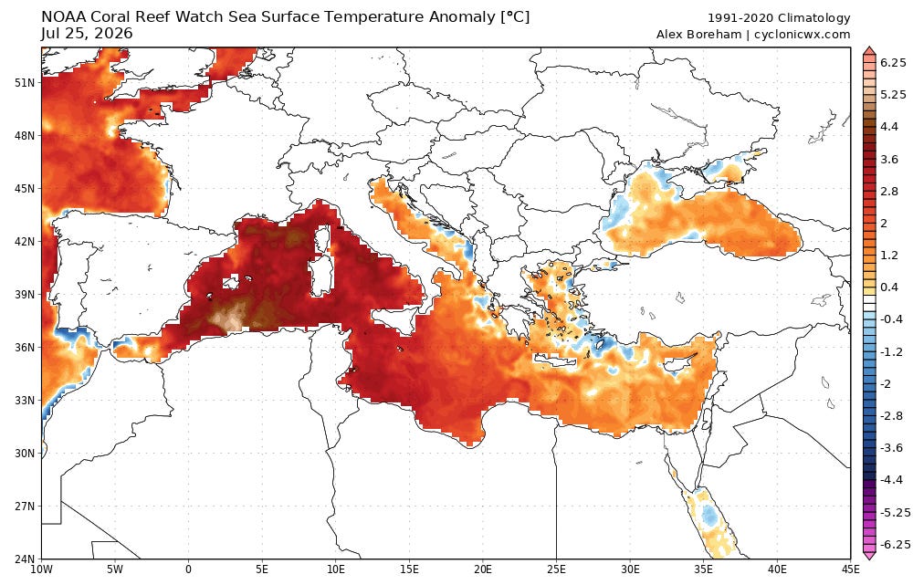
Much of the Mediterranean Sea (and Atlantic waters offshore western Europe) is also experiencing particularly abnormal warmth, with temperatures of 4-5C above normal over much of the western half of the basin. These warm SSTs and ongoing record heat across Europe are likely in a dynamic self-reinforcing process which is also playing a key role in the drought and massive wildfires plaguing the region.
The all-time record warm minimum temperatures at places like Phoenix this past weekend, unusually high dewpoint values and moisture levels being observed across much of the central and western US, and these anomalous SST values are all interrelated. As I told one of my colleagues over the weekend, I truly think it is important for people to understand that at its core this is not rocket science. A warmer planet means warmer oceans which means more moisture in the atmosphere which means higher rainfall rates (when thunderstorms occur) and warmer overnight low temperatures. These connections are some of the most studied aspects of climate change and are clearly supported by basic science.
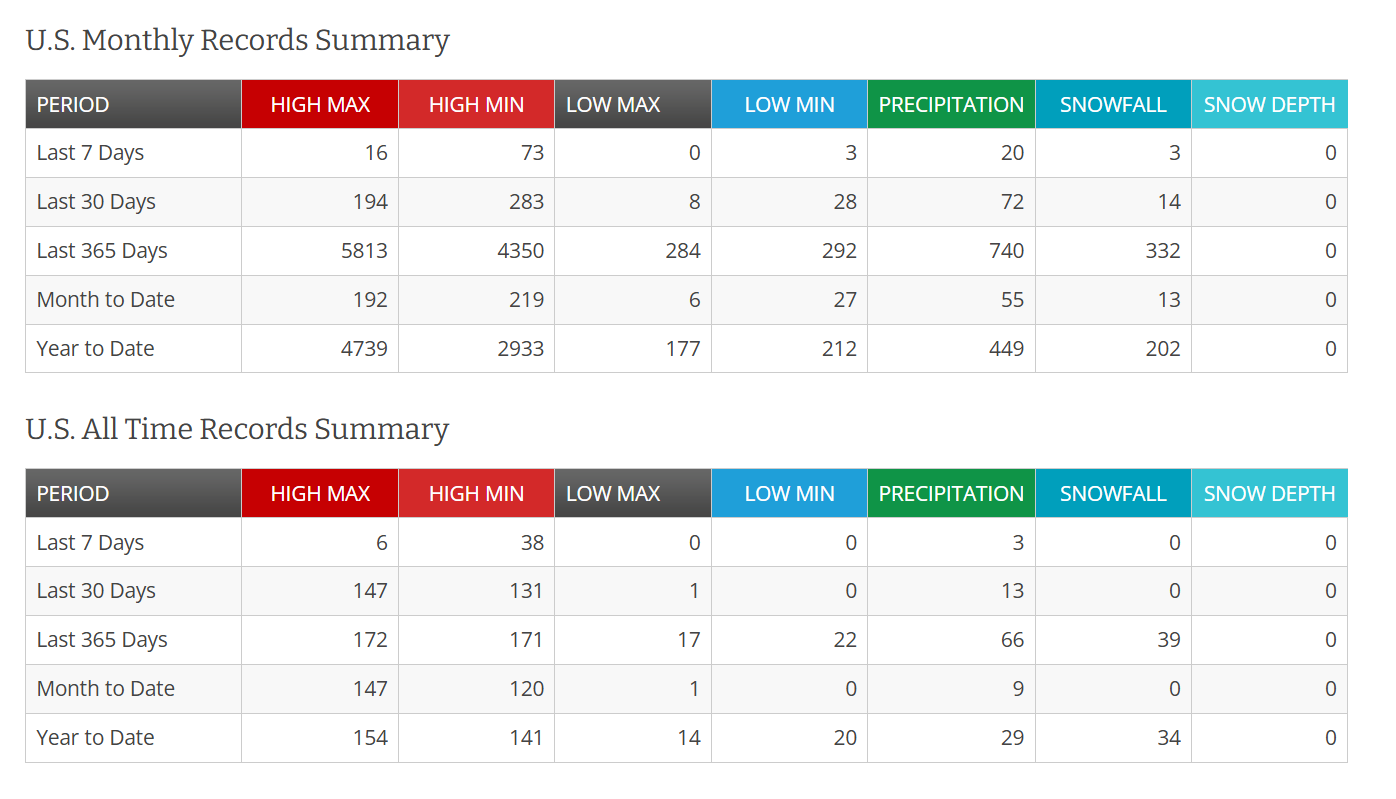
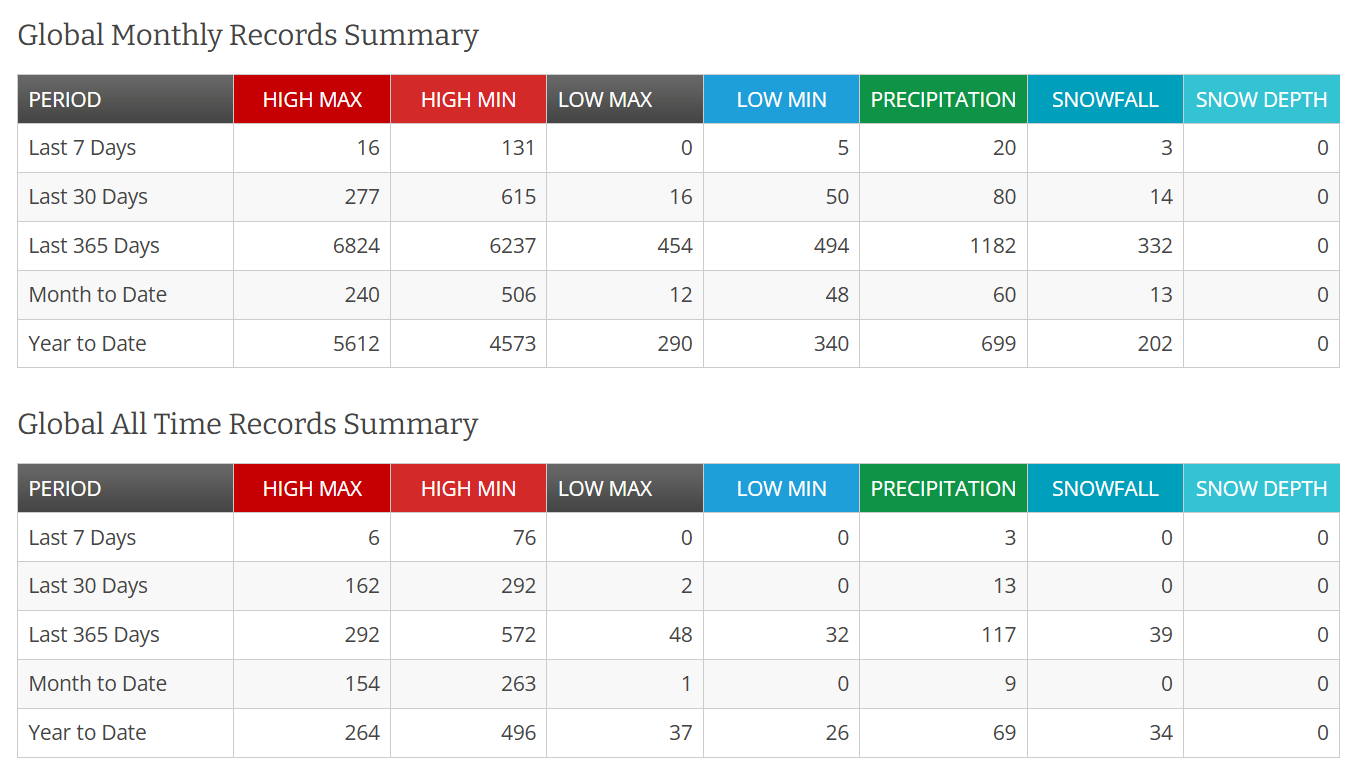
They are also supported by observed data. Climate record monitoring from the NOAA National Centers for Environmental Information show that US and global monthly and all-time record warm minimum temperatures are literally occurring at about an order of magnitude more frequently than record cold minimum temperatures.
The next several months will bring a lot of focus and attention to global climate and the impacts of what increasingly looks as if it will be a record El Nino. While El Nino is a natural phenomenon, what is happening more broadly in our climate is heavily influenced by human activity — and we cannot overlook the increasing impact that human influence is having on weather and climate impacts.
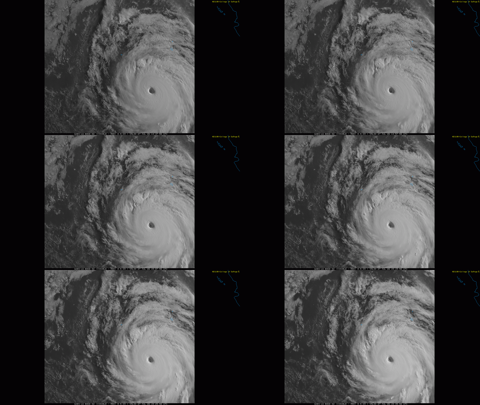
So let’s talk about some of those specific aspects in the global tropics. The eastern and central Pacific has not been quite as active so far this season as one might expect given the growing El Nino, but in the last couple of days Hurricane Genevieve has been aiming to change that. It rapidly intensified into a category 5 hurricane — the first in the eastern Pacific since 2024. Luckily, Genevieve is well away from any land, and is expected to eventually weaken over colder waters to its northwest later this week.
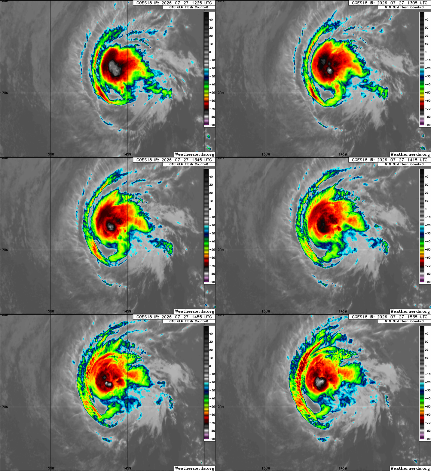
Fausto has been tracking west-northwest across the eastern and now central Pacific as a hurricane the last several days, and it remains a category 1 hurricane this morning.
![[Key Messages]](https://substackcdn.com/image/fetch/$s_!dULi!,f_auto,q_auto:good,fl_progressive:steep/https%3A%2F%2Fsubstack-post-media.s3.amazonaws.com%2Fpublic%2Fimages%2Ff9638b9a-d49e-46c6-9f14-4d7466054d7b_897x736.png "[Key Messages]")
Fausto will continue to move west-northwest this week, with weakening anticipated due to increasing shear and colder SSTs. With the center expected to pass well to the north of the Hawaiian Islands, the main impacts there are expected to be from large surf and rip currents.
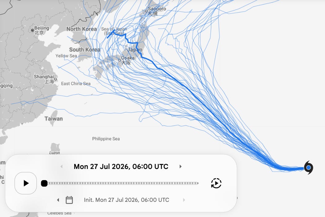
A bit farther west, Tropical Storm Dolphin (cute name) recently formed just west of the International Date Line and is expected to have a long track across the western Pacific, eventually as an intense supertyphoon. It is expected to pass north of the Mariana Islands and not be a threat to land for a number of days. Eventually it could become some threat to the area around Japan (as a weaker system), but as can be seen in the Google DeepMind ensemble forecast there is a lot of spread in tracks by the time we get to the 10 day period when this could become an issue.
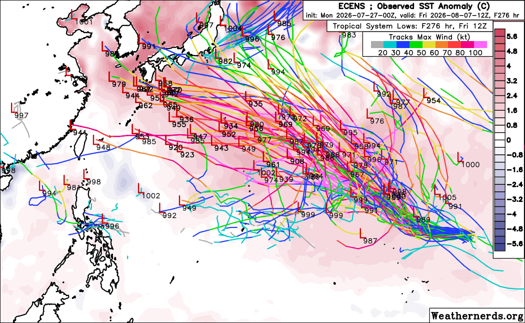
The “traditional” European physics based ensemble model system also shows a large spread in tracks, from southwest of the main Japanese islands to a recurve into the northern Pacific.
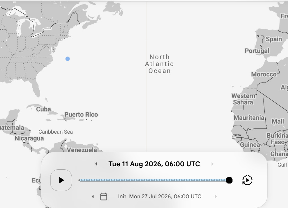
The Atlantic looks absolutely dead with the models (Google DeepMind shown above) not even really having even a sniff of any systems for the next two weeks.
Finishing off this morning by noting that we have some rapidly developing and intensifying severe thunderstorms over the western Great Lakes region as we approach midday. Several tornado and severe thunderstorm warnings are in effect, with the storms approaching Appleton, WI warned for destructive wind gusts of 80 mph.
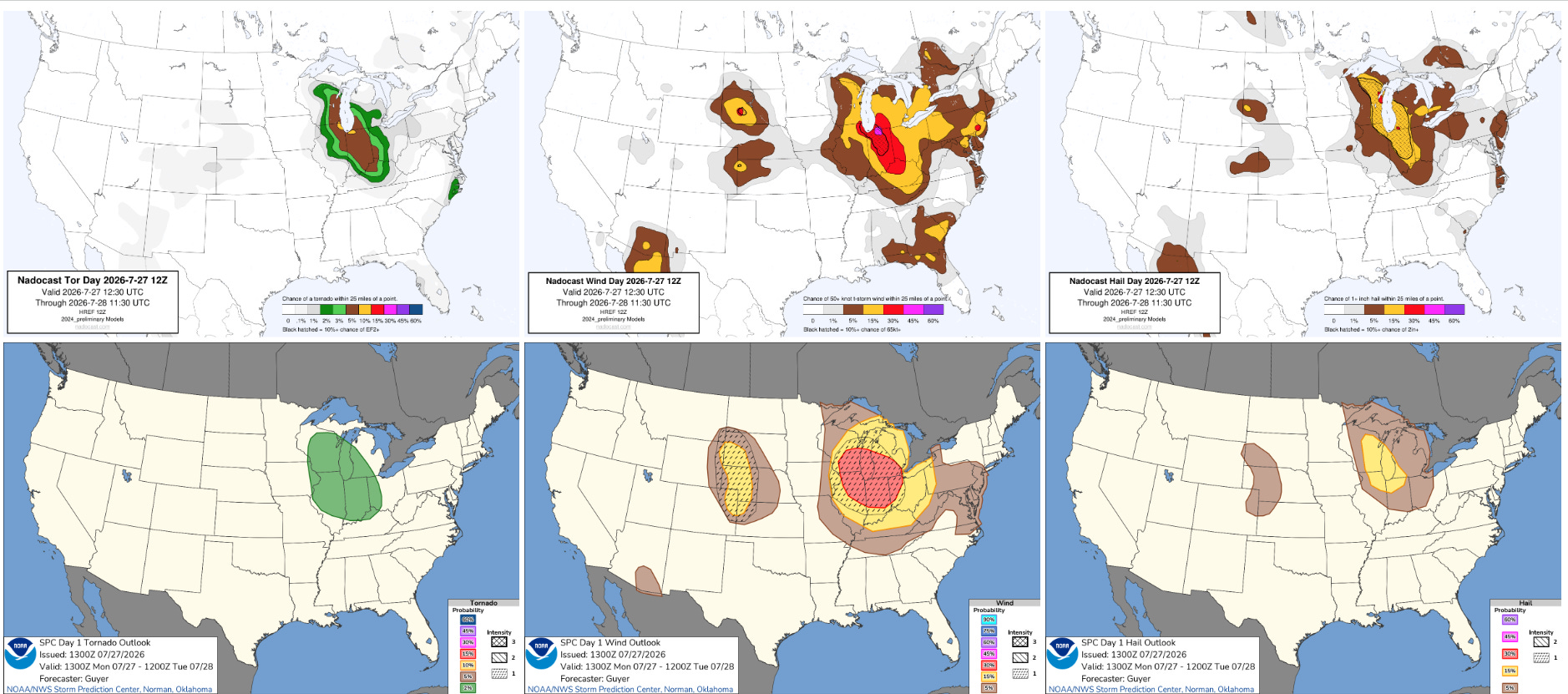
These storms are anticipated to build downstream into a favorable environment for severe weather across the lower Great Lakes and Ohio Valley today, with an enhanced risk (level 3 of 5) of severe weather in place for much of this region (red area in the bottom middle SPC wind graphic above). The most recent Nadocast AI forecast has shown a bit of an increased tornado risk with the storms anticipated this afternoon and evening, along with the potential for significant damaging straight line winds and very large hail.
I will have more later today on the ongoing weather with a video or two — as a reminder paid subscribers can participate in my videos live, they are posted for all subscribers as soon as I can process them. I will also likely be doing some paid subscriber Substack Chats today given the anticipated severe weather.
Programming note: I am posting semi-regularly again — but family commitments and travel after the passing of my mom will mean those posts will not be as frequent or consistently timed as they typically have been.
 Balanced Weather
Leave a comment