
Severe weather also a concern with tornado and severe thunderstorm watches for Mid-Atlantic and Appalachians
Jul 28, 2026
As I talked about in last night’s video update, a developing upper level low over the Northeast is bringing a rather significant risk of severe weather and flash flooding to the East Coast region for the next 24 to 36 hours. In the radar loop above, you can pretty clearly see how storms are rotating around the consolidating upper level system centered around Lake Ontario. Strong winds aloft to the south of this system combined with plenty of moisture and instability are resulting in conditions favorable for severe storms across the Appalachians and Mid-Atlantic, with severe thunderstorm (yellow) and tornado watches (red) in place.
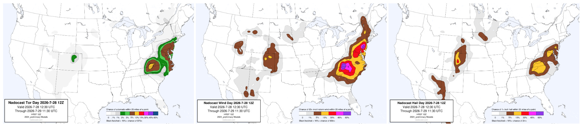
Along with the tornadic risk in the Mid-Atlantic region where the tornado watch is in effect, the most recent Nadocast AI guidance shows another maximum in tornado probabilities in the southern Appalachians, where there are currently a couple of tornado warned rotating supercells moving southeast. Damaging winds will be the other big risk with severe storms across the region this afternoon and evening.
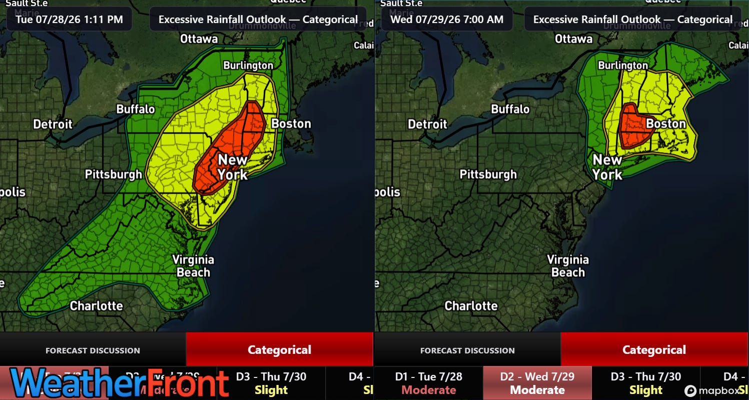
A growing concern for the Northeast this evening and into Wednesday morning will be the potential for significant flash flooding as thunderstorms with intense rainfall rates train on the southeast side of the developing upper level low. Moderate (level 3 of 4) risks of flash flooding are in effect with a large surrounding slight (level 2 of 4) risk.
This animation of precipitable water — the amount of moisture through the atmosphere available to support precipitation — from the latest high resolution (HRRR) model shows how anomalously high levels of moisture will pivot around the upper level low and provide a persistent feed of moisture into the Northeast for the next 36 hours.
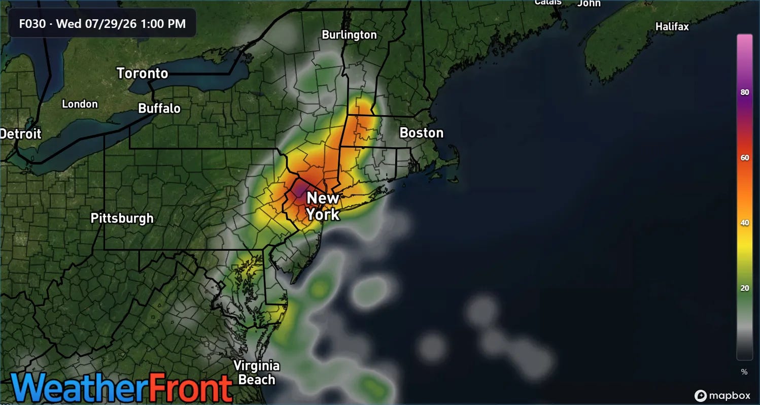
The high resolution ensemble model (REFS) shows quite high probabilities for rainfall amounts in excess of 5” from eastern Pennsylvania into southern Vermont through midday Wednesday. This is the period where the most intense rainfall rates are expected, although storms with locally heavy rainfall are expected to be a risk into early Thursday.
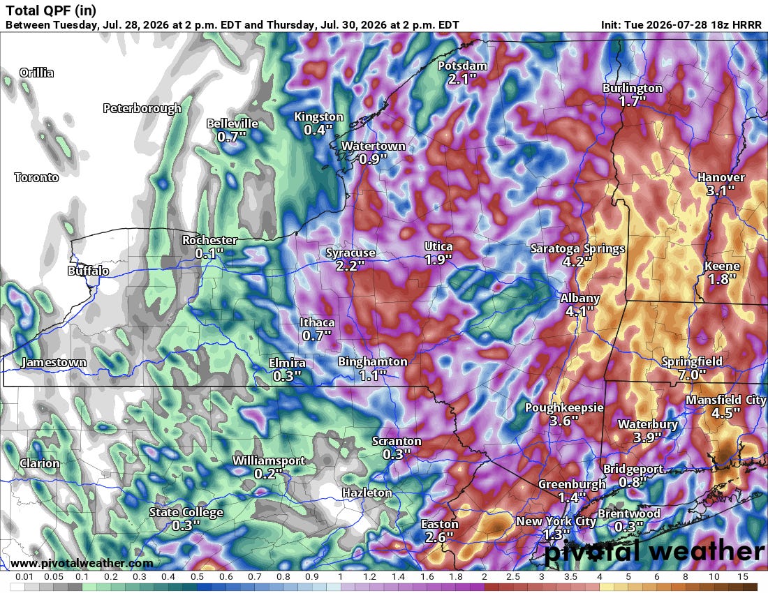
The recent midday run of the HRRR model shows rather widespread 4-8” rainfall across the moderate risk areas with localized amounts of 10-12”. Given that much of this rainfall will be from thunderstorms and will fall in a relatively short (several hours) period of time, serious flash flooding could result, especially in urbanized areas.
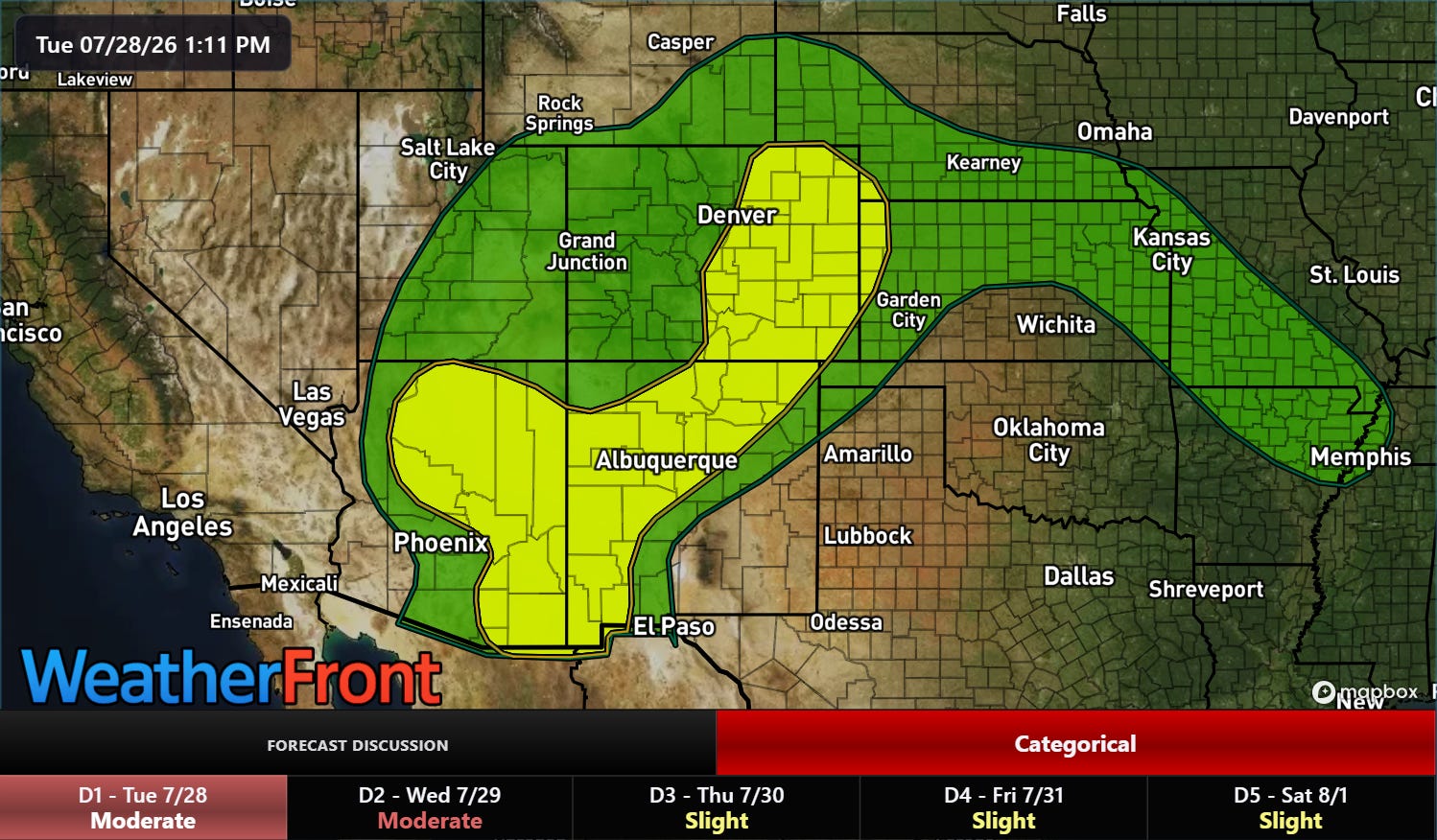
The Southwest monsoon is also bringing a flash flood risk to portions of the West this afternoon and evening. The monsoon pattern will be weakening over the next few days as a large upper level high pressure area builds across the region again, expanding record heat once more.
Programming note: I am posting semi-regularly again — but family commitments and travel after the passing of my mom will mean those posts will not be as frequent or consistently timed as they typically have been.
 Balanced Weather
Leave a comment