
Record heat will expand across the West into this weekend
Jul 29, 2026
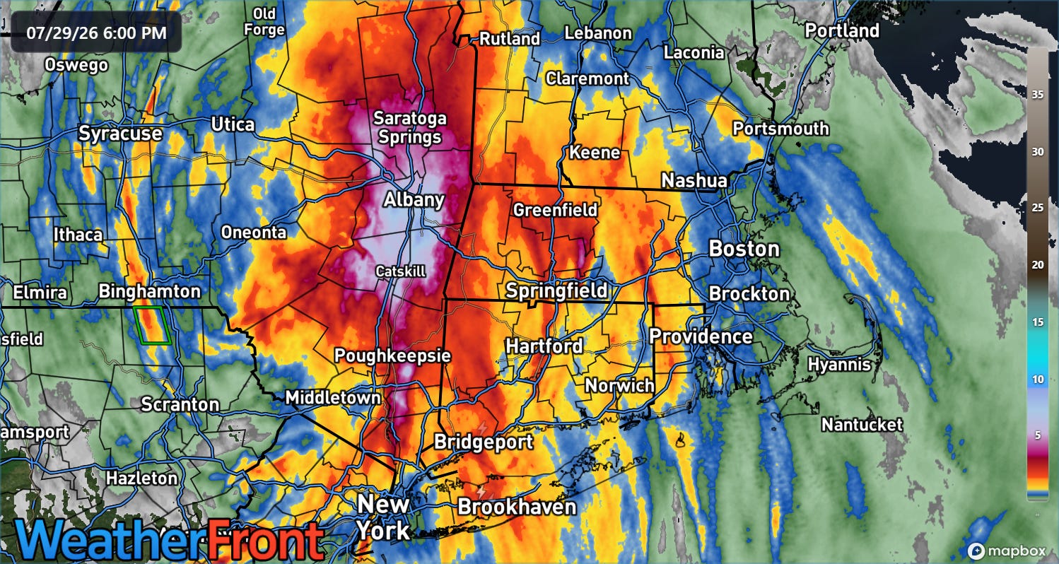
The heavy rainfall event I discussed in last night’s newsletter for the Northeast evolved more or less as anticipated, although the absolute heaviest rain fell perhaps a bit northwest of forecasts, with the Hudson Valley up through the Capital District of upstate New York being the hardest hit.
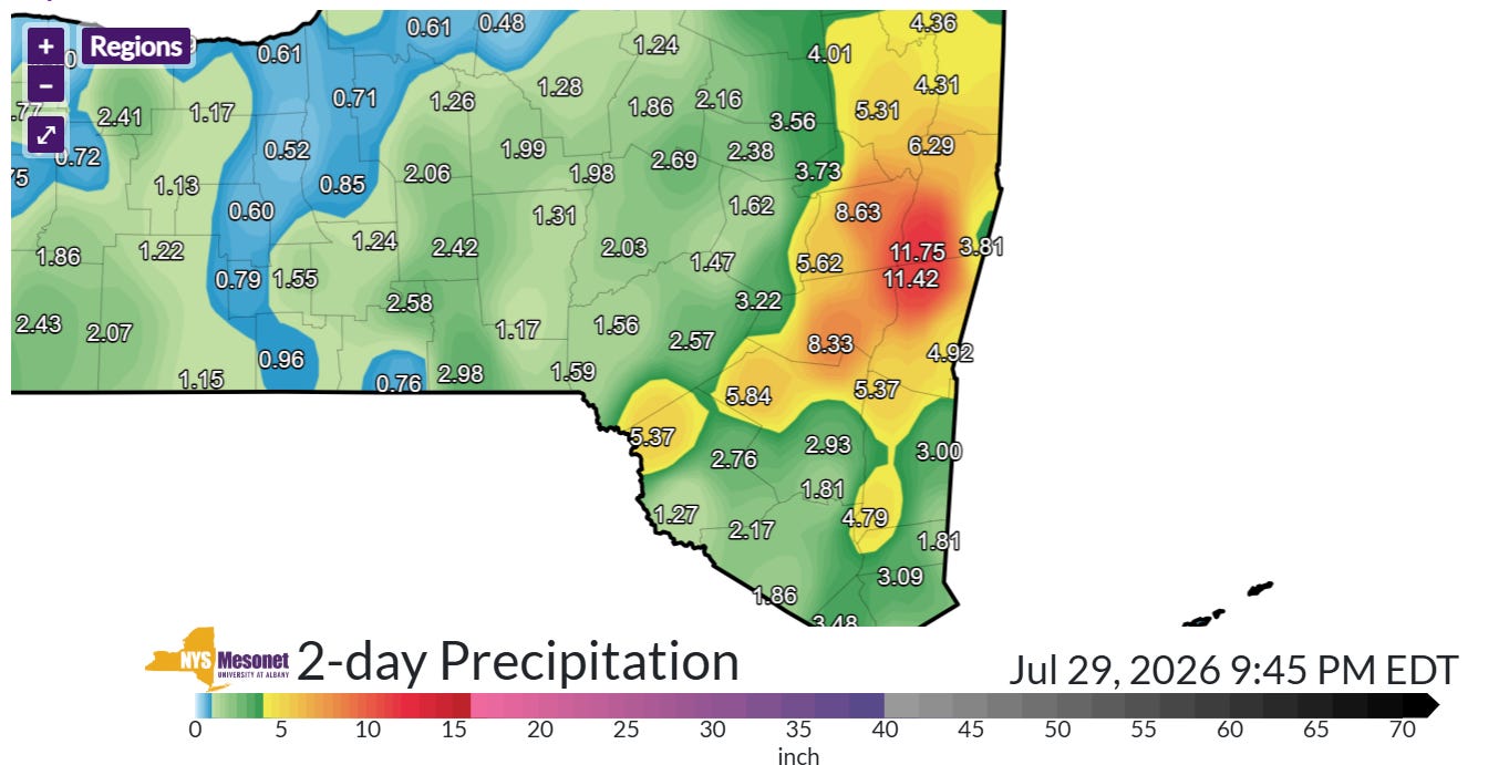
Rainfall of nearly a foot in less than 36 hours was measured at New York State Mesonet sites just southeast of Albany. The mesonet sites at Kinderhook and Schodack both recorded just over 11” of rainfall in 24 hours ending around 3 pm ET this afternoon. These totals shattered the NYS mesonet 24 hour record of 9.4” in August 2024.
The official NWS climate site at Albany had received 5.18” of rain as of 4 pm ET, which not only set a monthly daily rainfall record, it was the second wettest day on record behind 5.60” of rain on September 16, 1990. Incredibly, precipitation records for Albany go back to 1826 — so this is truly an impressive rainfall event. Showers were still moving through the region and will likely push today’s rainfall total at Albany at least a bit higher before the end of the day.

River levels were quite low heading into this rainfall event, with the Hudson Valley region on the northwest side of an area of moderate drought conditions. Still, intense rainfall rates and high totals in a relatively short period of time caused serious flash flooding across the region, including flooded homes and people having to be rescued by boat.
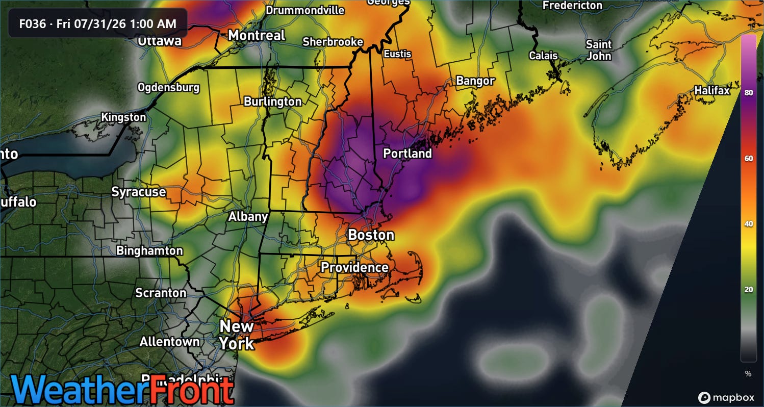
While the most widespread and organized period of heavy rainfall has now ended, showers and storms with heavy downpours will continue to rotate around the upper level low pressure system responsible for this flooding event — and could produce some additional localized flooding issues in the next 24 hours or so.
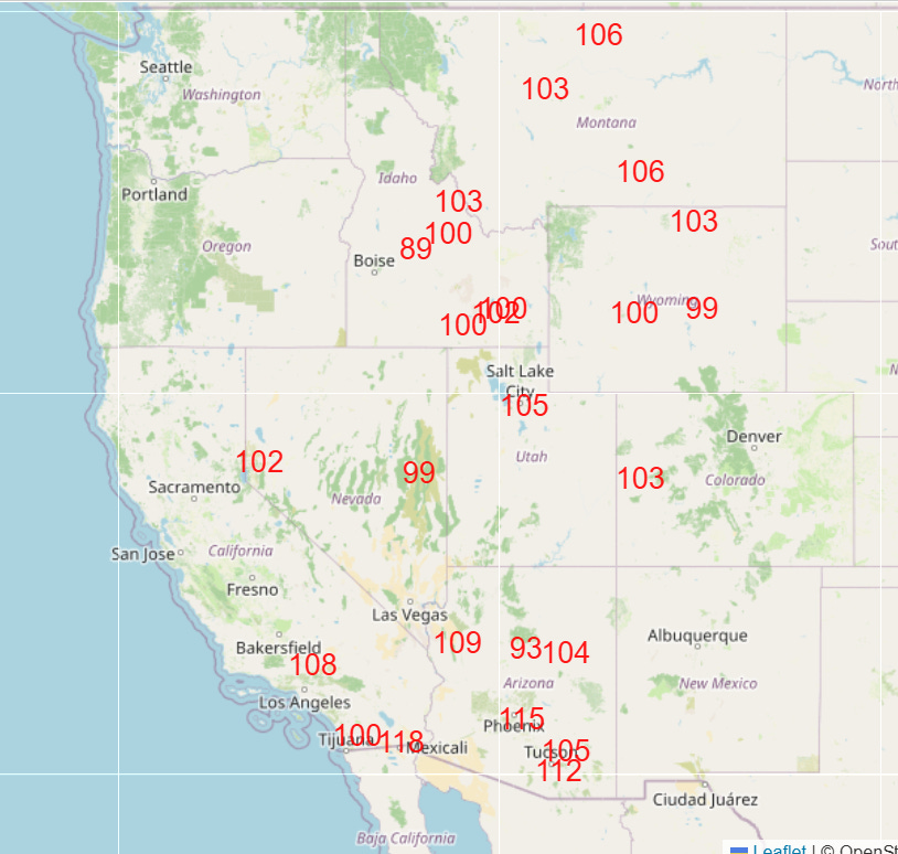
After several record high temperatures today in the Southwest and Upper Midwest, record heat will be expanding across the western United States the next few days as another unusually intense upper level high pressure systems builds across the Southwest. By Saturday, numerous daily record high temperatures are expected across the region (shown above), with some monthly and even a few all-time records possible.
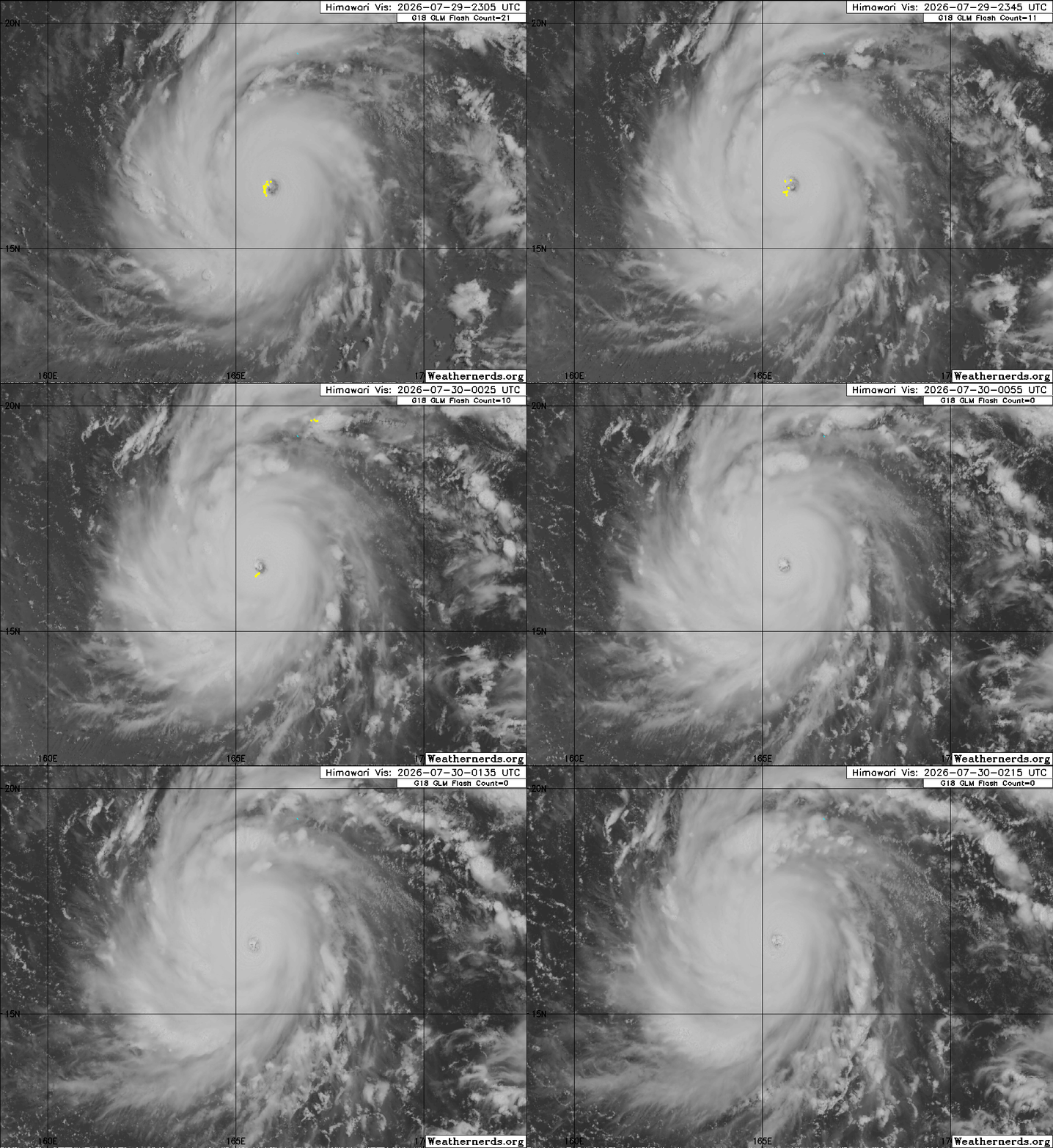
In the tropics, impressive Dolphin has become a super typhoon with maximum sustained winds of 160 mph.
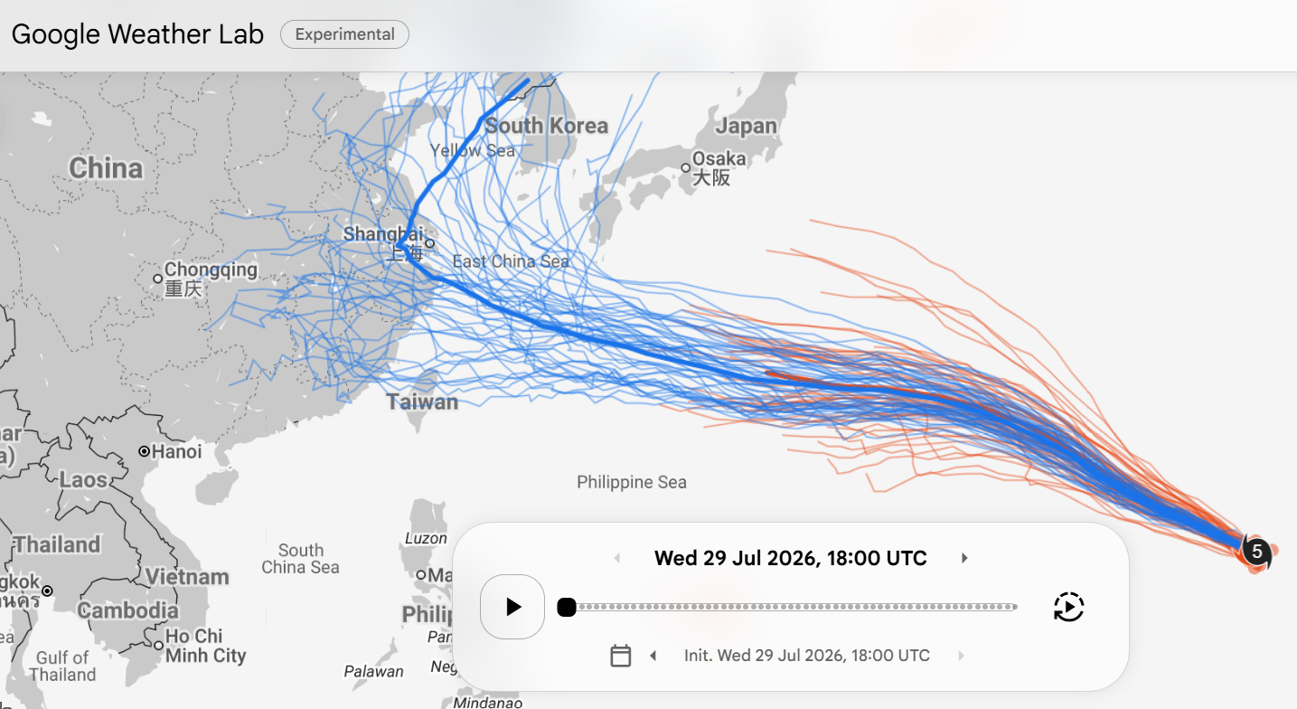
Over the last few days, longer range forecasts for Dolphin have shifted quite a bit south and now show a threat to the far southern Japanese islands (e.g., Okinawa) in several days’ time. Dolphin is expected to weaken gradually, and typically these super typhoons become less intense but much larger in size and they move more into the northwest Pacific region.
Programming note: I am posting semi-regularly again — but family commitments and travel after the passing of my mom will mean those posts will not be as frequent or consistently timed as they typically have been.
 Balanced Weather
Leave a comment