
Oklahoma City sets record on Saturday for hottest temperature so late in the year
Sep 13, 2026
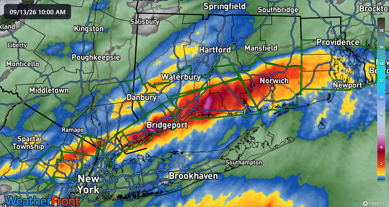
This Sunday has gotten off to a wet — and flooded — start in parts of the Northeast, as training thunderstorms produced a band of 3 to as much as 7 inches of rain in just a few hours across southern Connecticut and northeast New Jersey.
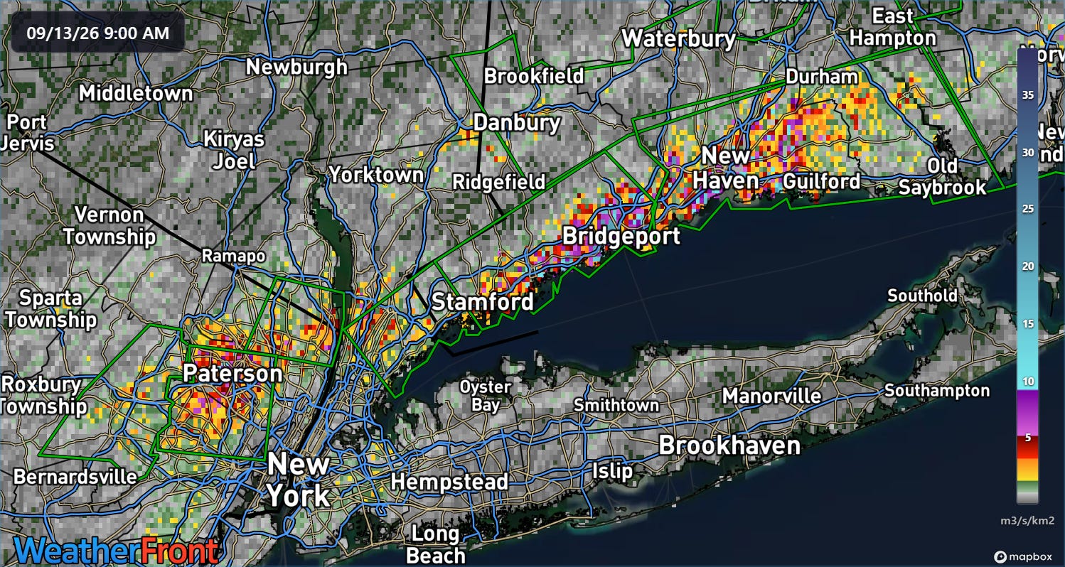
The Multi-radar Multi-Sensor FLASH unit streamflow product showed very high values indicative of significant flash flooding across this region including Paterson, Bridgeport and New Haven. Indeed, local media reports numerous incidents of serious flash flooding in the region including stranded motorists and water rescues.
As of midday, the heaviest rain has shifted into Rhode Island and southeast Massachusetts.
MRMS FLASH was showing increasing inundation values across the Providence metro area, indicative of likely worsening flash flooding in this region. Within a few hours, the rainfall should taper off from west to east, allowing for conditions to improve.
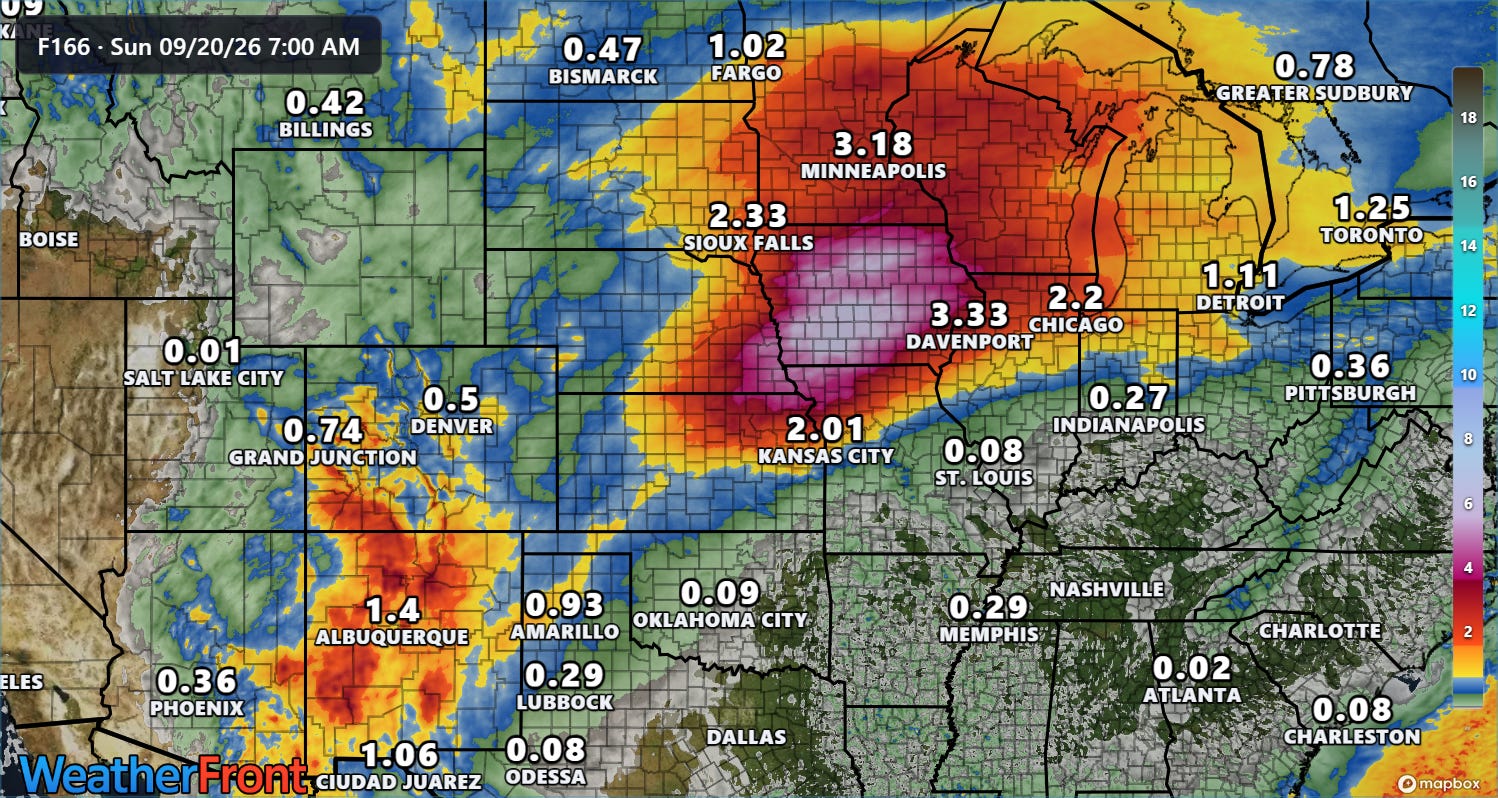
The focus for heavy rainfall and potential flash flooding this week will then shift from New Mexico northeast into the Upper Midwest, where monsoonal moisture will be transported around the periphery of a building upper level dome of high pressure across the south central and southeast United States.
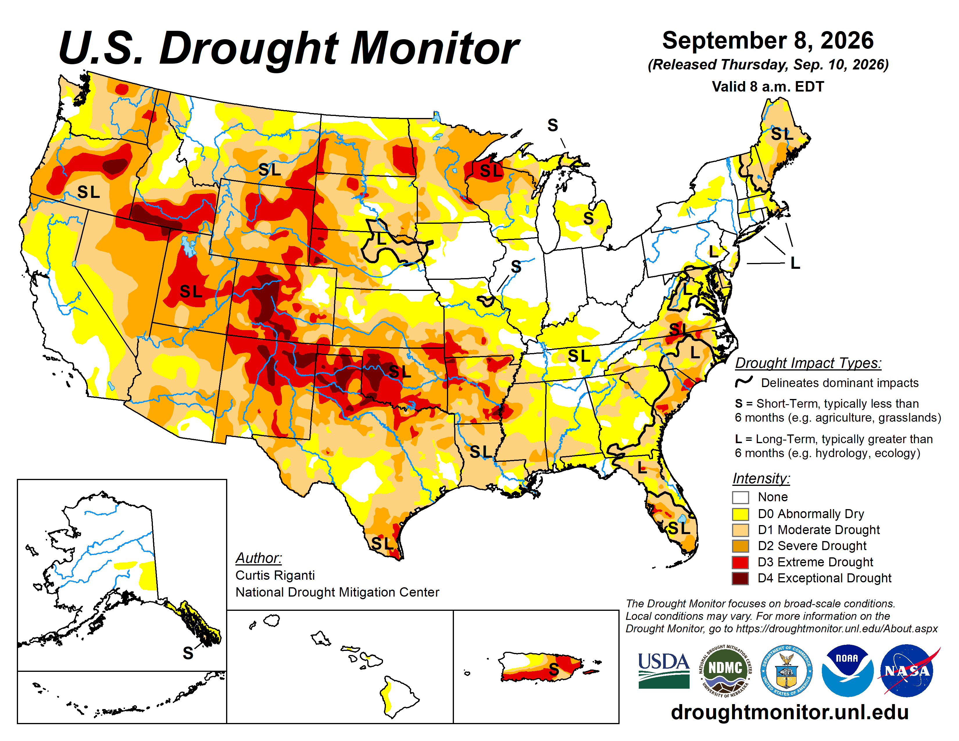
Areas from New Mexico north-northeast into Minnesota are suffering from serious drought, so rainfall will be welcome — but particularly intense rainfall rates from thunderstorms could still cause flash flooding. The region from Iowa across northern Illinois was exceptionally wet in August from multiple waves of severe thunderstorms, so this area will be more prone to flooding impacts as rainfall increases this week.
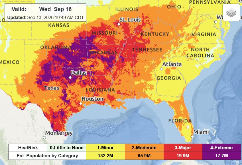
Under the high pressure dome, heat will unsurprisingly be the main issue this week, with widespread major to extreme heat risk building and expanding, peaking around midweek.
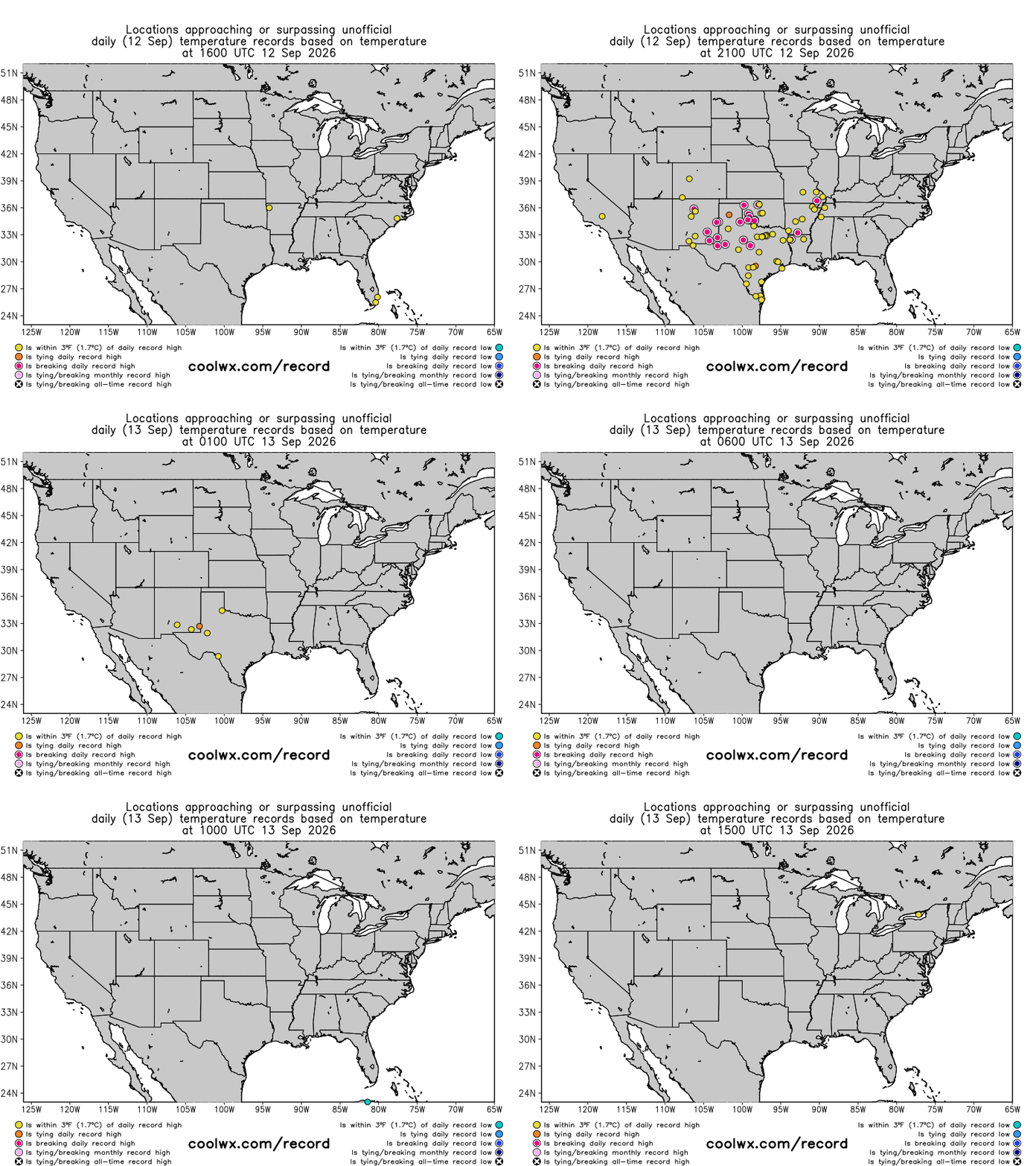
Record warmth will continue into the upcoming week after Saturday saw numerous record high temperatures again across the south central US. Oklahoma City hit 106F, breaking its daily record by 4 degrees and setting a record for the hottest temperature so late in the season. It was the latest 106F has been reached at OKC by a week (prior latest 106F was September 6, 1947).
Abilene broke a record high set in 1893 when they reached 105F. Abilene set a record earlier this month for longest streak of consecutive days at 100F or above with 33 days reached on September 3. The site failed to reach 100F by a degree on September 4, and has been 100F or higher every day since. The 99F on September 4 is the only day with a high less than 100F since August 1.
There have been plenty of record warm minimum temperatures as well. Las Vegas set a daily record warm minimum yesterday of 85F, after setting a new September monthly record warm minimum of 89F the prior day.
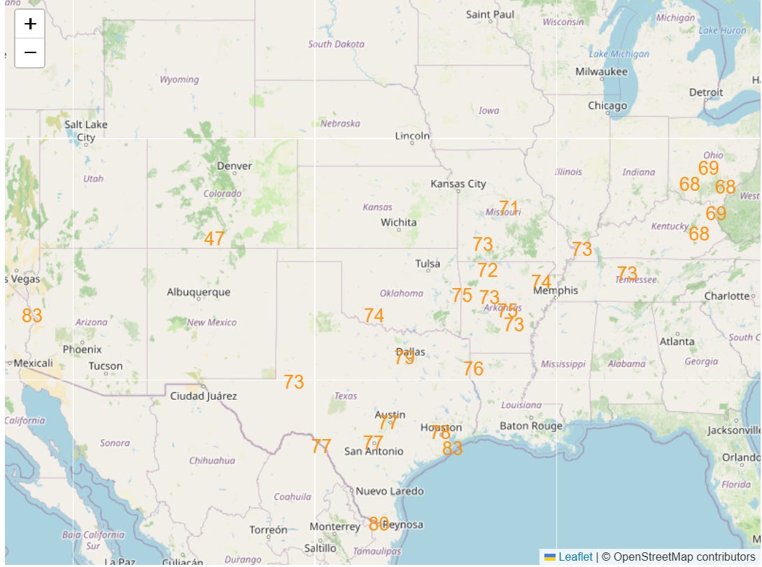
Numerous and widespread record warm minimum temperatures will also continue this week (forecast for Thursday shown as an example).
Again, it is obviously not just the US experiencing this warmth. Climatologist M. Herrera reported that Honduras and El Salvador set national records for hottest September temperatures on Friday, as well as continued record heat across the Middle East and Asia.
 Balanced Weather
Leave a comment