
Models have mixed signals on a potential system in the central Atlantic this week
Sep 14, 2026
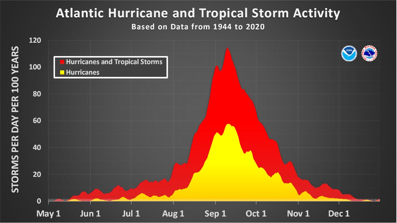
Happy Monday and happy new work week. I try to do a tropical update on Mondays and with us being at the peak of Atlantic hurricane season — September 10 is the day of peak likelihood of hurricane formation — it seems appropriate to take a look at where we stand so far.
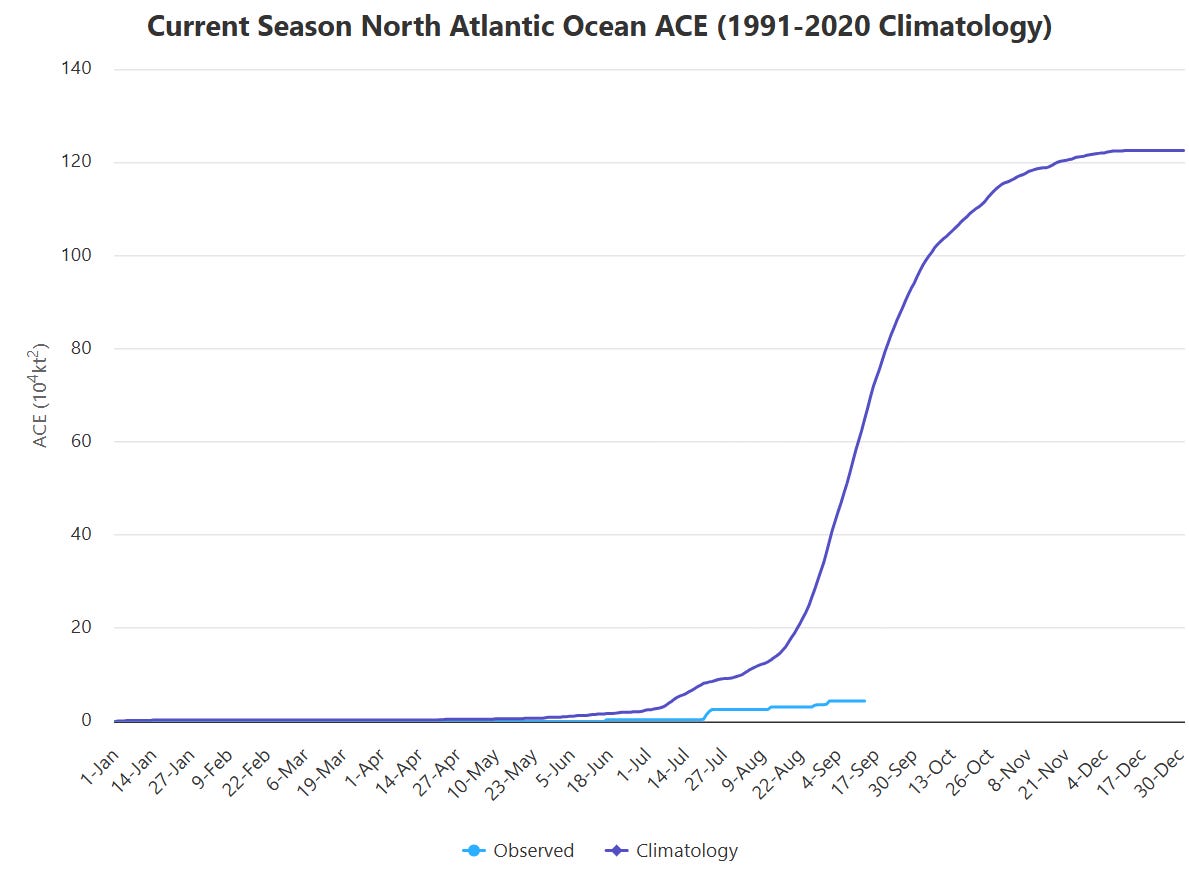
Where we stand is a historically quiet hurricane season to date. As tropical meteorologist Michael Lowry outlined on his Substack, this year has the lowest Accumulated Energy Index (ACE) — a parameter that integrates cyclone intensity and longevity to provide an estimate of total seasonal tropical activity — in the satellite era (1966 and later). No year in the most reliable (post-1950) Atlantic hurricane records has went past September 11 without a hurricane — until 2026.
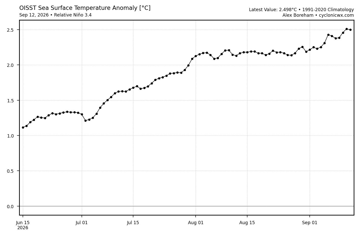
Undoubtedly a big reason for this is the intense El Niño that continues to evolve in the tropical Pacific. Real-time daily tracking (courtesy Cyclonicwx.com) of the Relative Oceanic Niño Index (RONI) — the parameter that most agencies now use for official monitoring of the El Niño-Southern Oscillation (ENSO) phenomenon — has now reached approximately +2.5C, near record levels for the time of year and well above the +1.5C threshold for a strong El Niño event.
El Niño events are correlated with below normal Atlantic hurricane seasons. One of the primary mechanisms for this is above normal upper level wind shear in the Caribbean due to warm El Niño waters in the eastern Pacific fueling more thunderstorm activity in that region than normal.
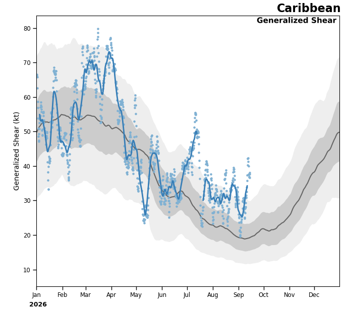
NOAA tracking of wind shear in the Caribbean indeed shows unusually strong upper level wind shear in this region which has resulted in a dearth of activity in this region.
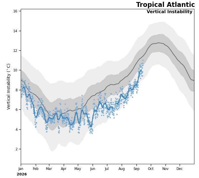
The Main Development Region (MDR) east of the Caribbean has also been unusually inactive. However, NOAA’s wind shear tracker shows that shear has actually been relatively normal in the MDR this season. A more likely culprit for the lack of activity appears to be below normal atmospheric instability, as large areas of stable, dusty Saharan air have moved repeatedly over the basin.
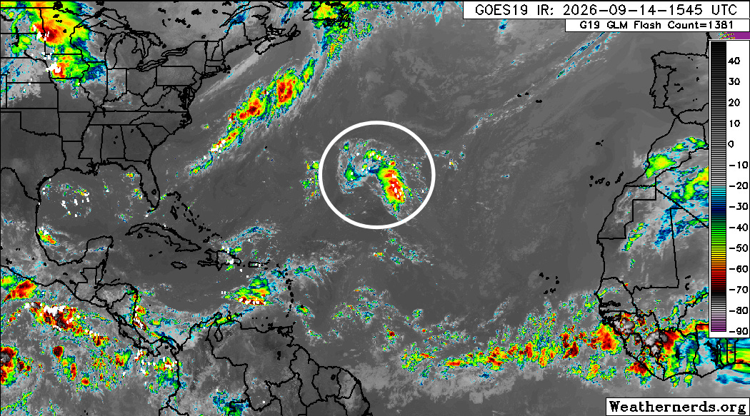
Often in El Niño years we have to look outside of the deep tropics to find more favorable conditions for development, and that is the case week. The National Hurricane Center is monitoring an area of disturbed weather right in the center of the Atlantic Ocean for potential development, giving it 30% odds to develop into a tropical cyclone in the next week as it moves slowly west-northwest.
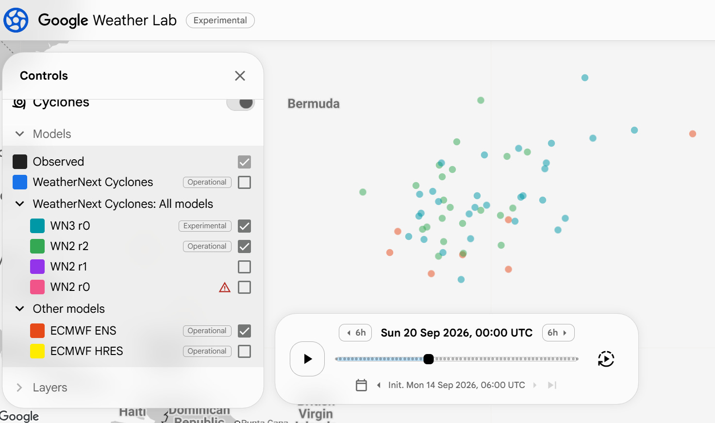
This is yet another case where there is a dramatic difference between the newer AI based model guidance and the traditional physics based models. The Google DeepMind (GDM) AI (green and blue dots in image above) is quite aggressive with developing this central Atlantic disturbance, with a number of members showing a hurricane. Meanwhile the physical European model ensemble (red dots) is much more muted with only a handful of the 50 members of that showing a coherent system — although the European AI model is more bullish similar to the GDM.
GDM is still clearly the best model guidance once a system develops: retired NHC ops branch chief James Franklin did a preliminary analysis on 2026 Atlantic and eastern/central Pacific systems that showed GDM improving on official NHC track forecasts by 30% while also being competitive on intensity forecasts. However, my sense is that forecasting genesis of systems still remains a bit more mixed, so it will be interesting to see how things play out with this new disturbance in the coming week.
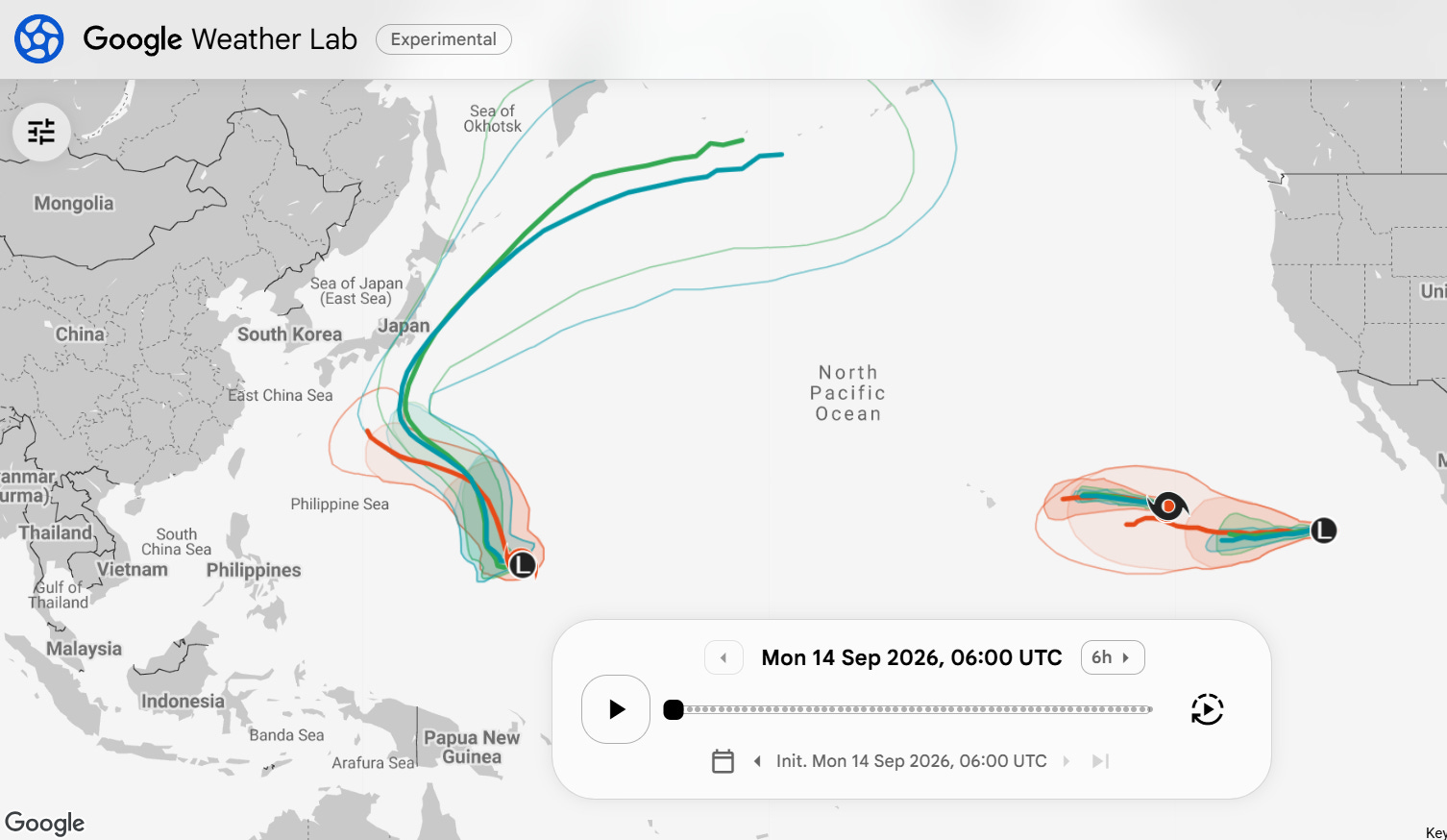
Elsewhere in the tropics, Norbert and Tropical Depression Fifteen-E continue in the eastern Pacific, but are expected to spin down over open waters and not be an issue. A new typhoon should develop in the western Pacific and move northwest toward Japan this week. While the GDM guidance suggests that it will recurve before reaching Japan, this is still several days away and it is certainly worth monitoring for potential risk there. Recurving western Pacific typhoons often cause significant pattern changes in the downstream jet stream across North America that the models can struggle with capturing — so this is also something we will be keeping an eye on over the next couple of weeks.
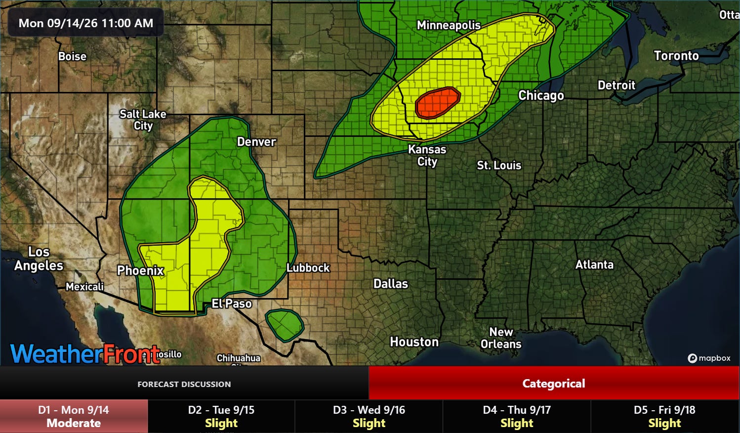
Outside of the ongoing building heat in the south-central and southeastern part of the country, flash flooding will be the main impact weather this afternoon and night as thunderstorms with heavy rainfall continue to form and move northeast around the periphery of the upper level dome of high pressure responsible for the heat. Risks of excessive rainfall (slight — yellow, level 2 of 4 and moderate — red, level 3 of 4) are in place for the Four Corners region and parts of the Upper Midwest.
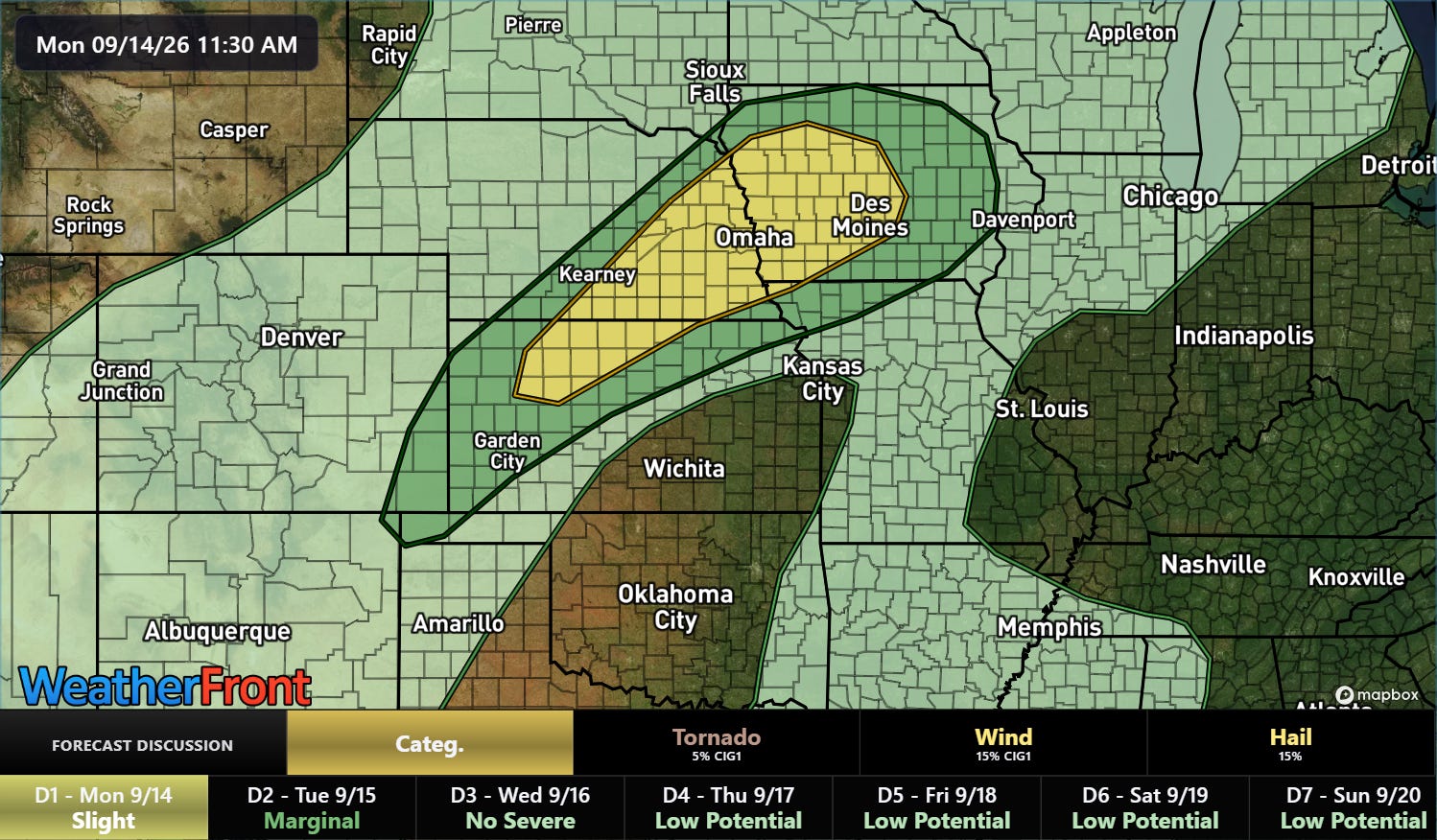
A slight (level 2 of 5) risk of severe storms is also forecast from northern Kansas into Iowa. Scattered strong to severe storms capable of large hail, damaging winds and a few tornadoes are expected.
 Balanced Weather
Leave a comment