
Flash flooding to be a risk next several days, today centered on KC area
Sep 15, 2026
With a number of serious heat waves across the US and globe in the last couple of years, the term “heat dome” has gotten a lot of traction in the media. A Google search for the term brings at least 10 articles in the last couple of days from different news organizations.
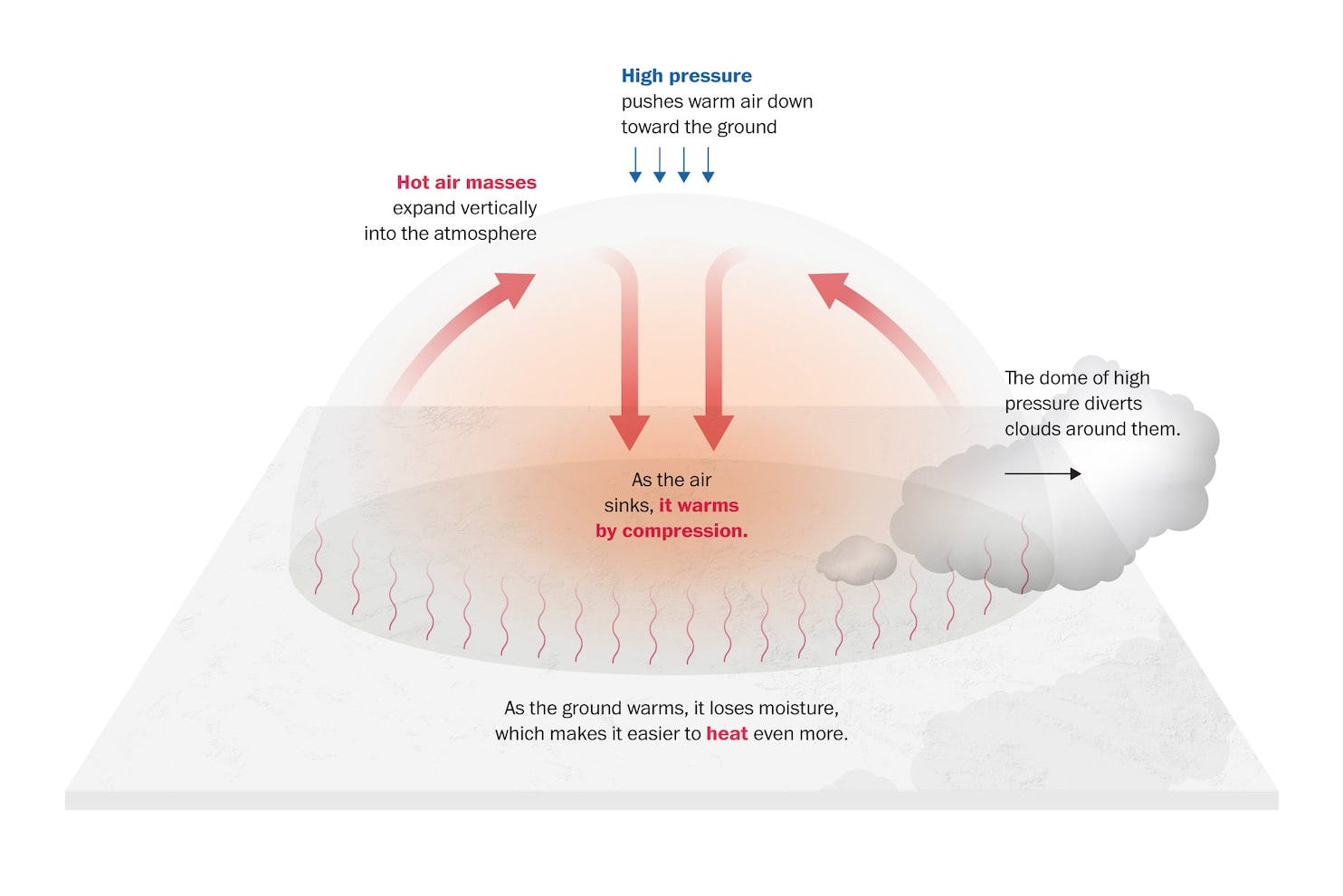
To be clear, while the term has been getting more publicity recently, “heat dome” is not any kind of new scientific discovery. It is simply a large high pressure area in the middle and upper levels of the atmosphere. As this graphic above from the Washington Post shows, these high pressure centers cause air to sink and warm, which also causes drying and even more heating. This can become a self-reinforcing process during the warm season, resulting in stable areas of high pressure that can linger for days or even weeks, resulting in long term heat waves and drought.
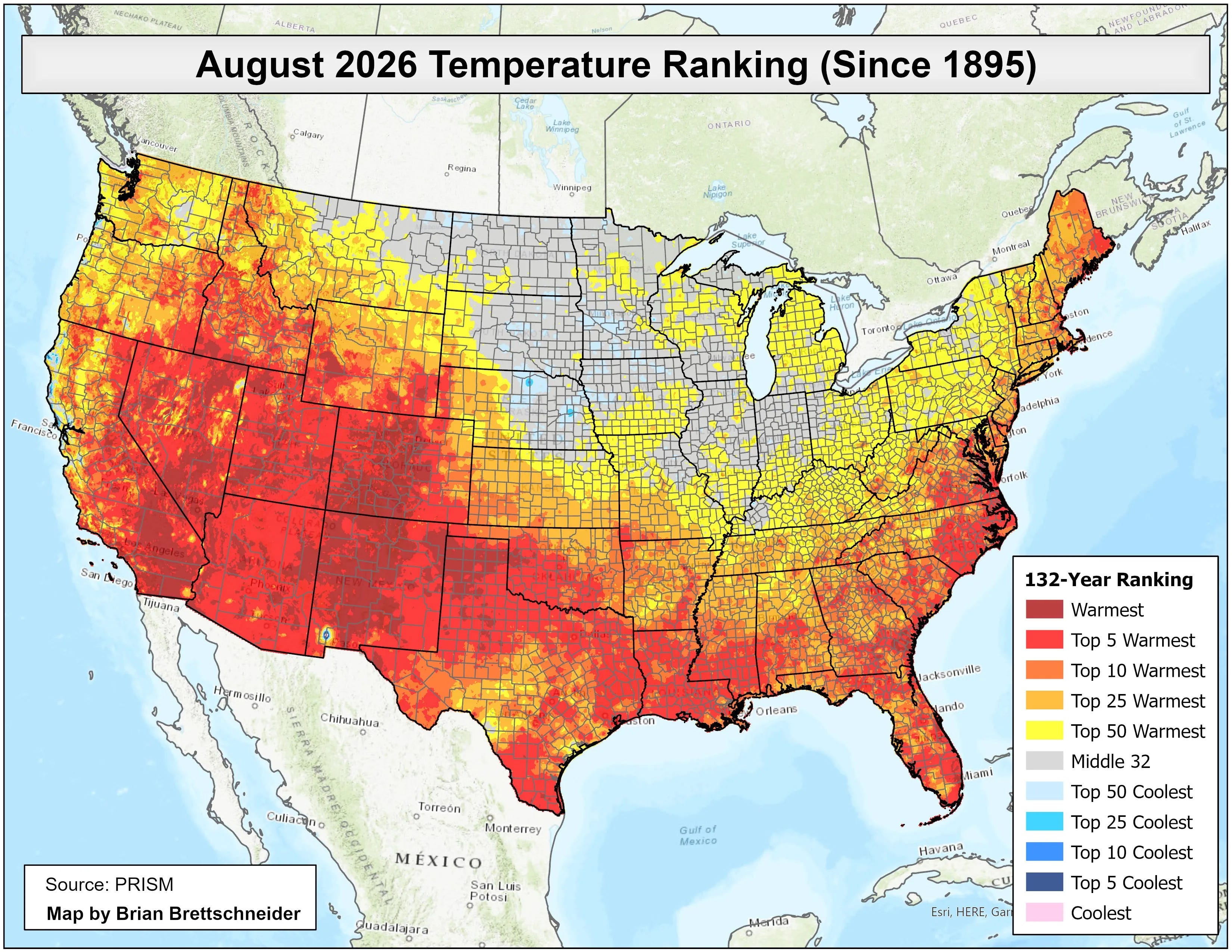
Over the last couple of months, there has been a large, persistent area of high pressure in middle and upper levels of the atmosphere centered across the south-central US and Four Corners region, resulting in unusual warmth across this region. This analysis from climatologist Brian Brettschneider shows that for much of this region August 2026 was a top 5 warmest on record, and for many spots was the record warmest.
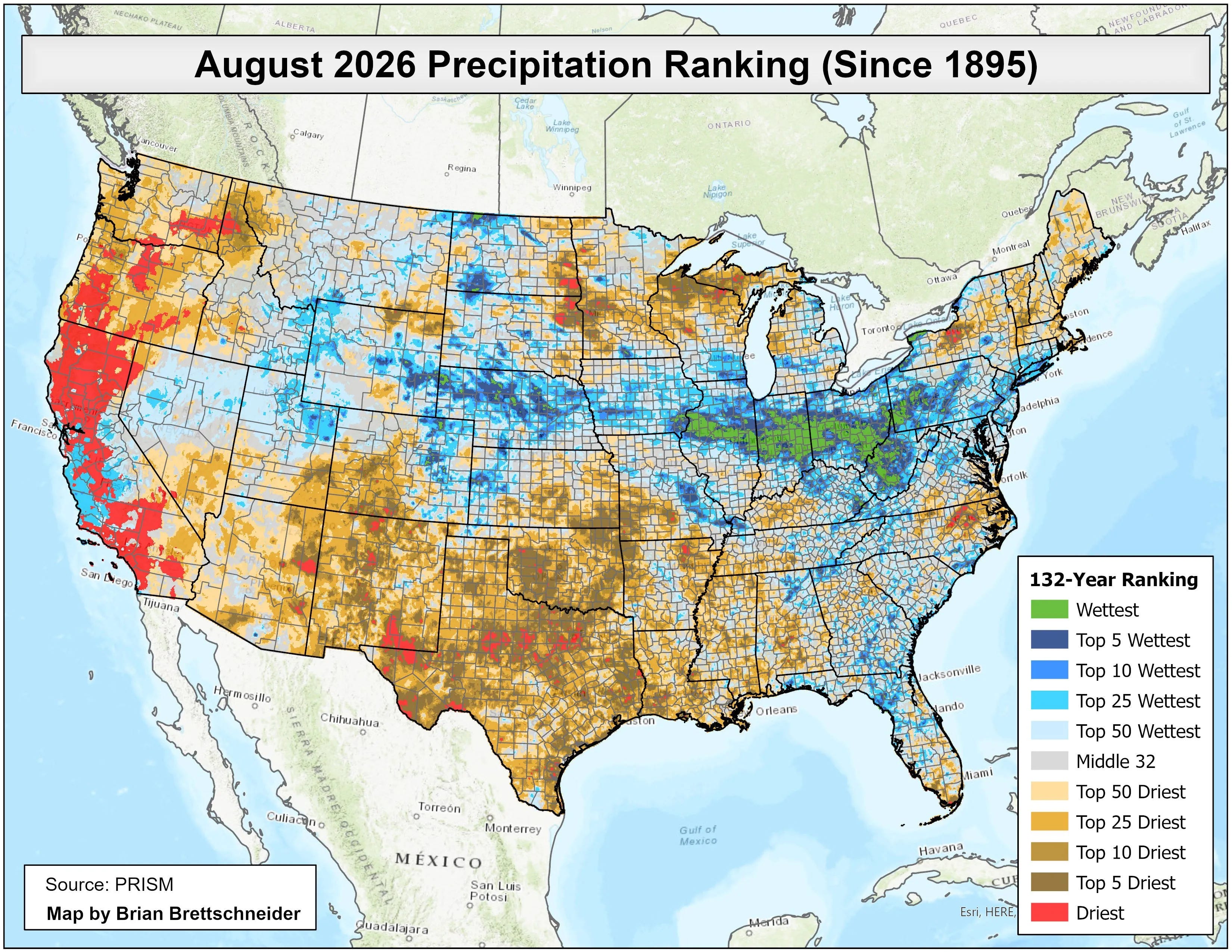
Not surprisingly, it was also unusually dry — many locations had a top 5 driest August with some locations from eastern Arizona into the Southern Plains experiencing their driest August on record.
Unfortunately, this dome of high pressure has not shown any signs of going anywhere. As weather systems evolve around its periphery, it “morphs” in size, strength and location. This week, it is intensifying across the Mid-South, and by Thursday morning is expected to peak in intensity at 500 millibars, the level about 18,000 ft AGL where meteorologists focus for mid and upper level weather analysis.
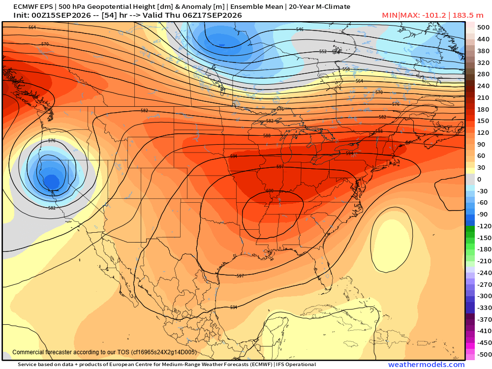
At upper levels of the atmosphere, instead of analyzing pressure we analyze “geopotential height” to find high and low pressure centers. The European ensemble model forecast (above) shows the geopotential height at 500 millibars (mb) exceeding 6000m across much of the Mid-South Thursday morning. I have talked in previous newsletters about how geopotential heights of 6000m at 500 mb is kind of a “magic value” for meteorologists that is impressive to see — it is particularly amazing to me to see such a large 6000m area in the last half of September.
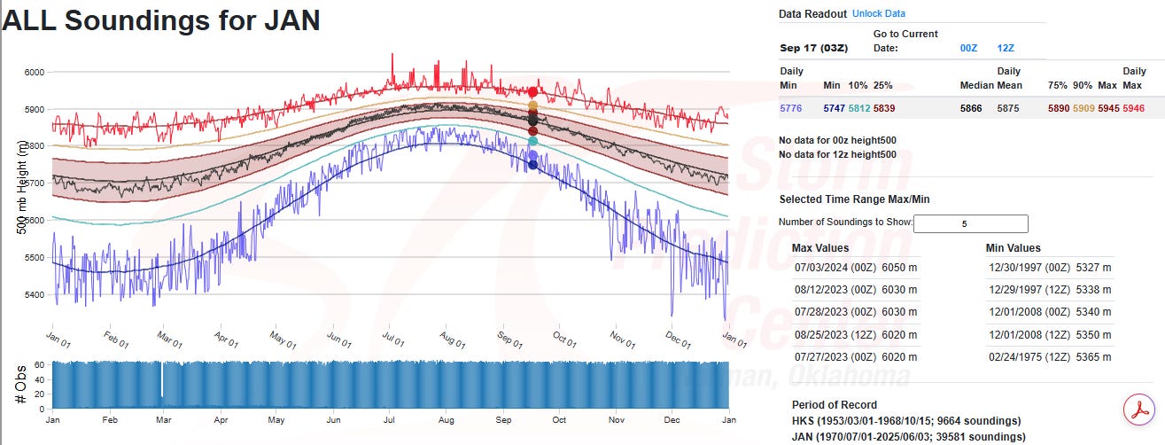
To give some idea of how extreme this is, this plot from the Storm Prediction Center’s upper air climatology shows that Jackson, MS has only reached 6000m a handful of times in its history (back to 1953), and never after August 25. Obviously, what I am showing above is a forecast and the European model does have a bias to somewhat overforecast the intensity of upper level high pressure centers — but at this timeframe the forecast will likely be close. Regardless, 500 mb heights even approaching 6000m in this part of the world in September is incredibly impressive and unusual.
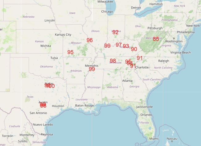
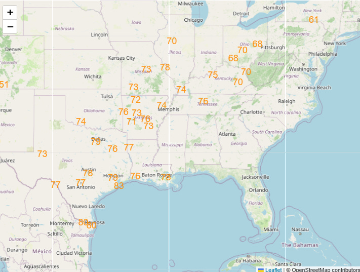
Unsurprisingly, record warmth is expected to be widespread across this region through the week, with Thursday likely to be the peak day.
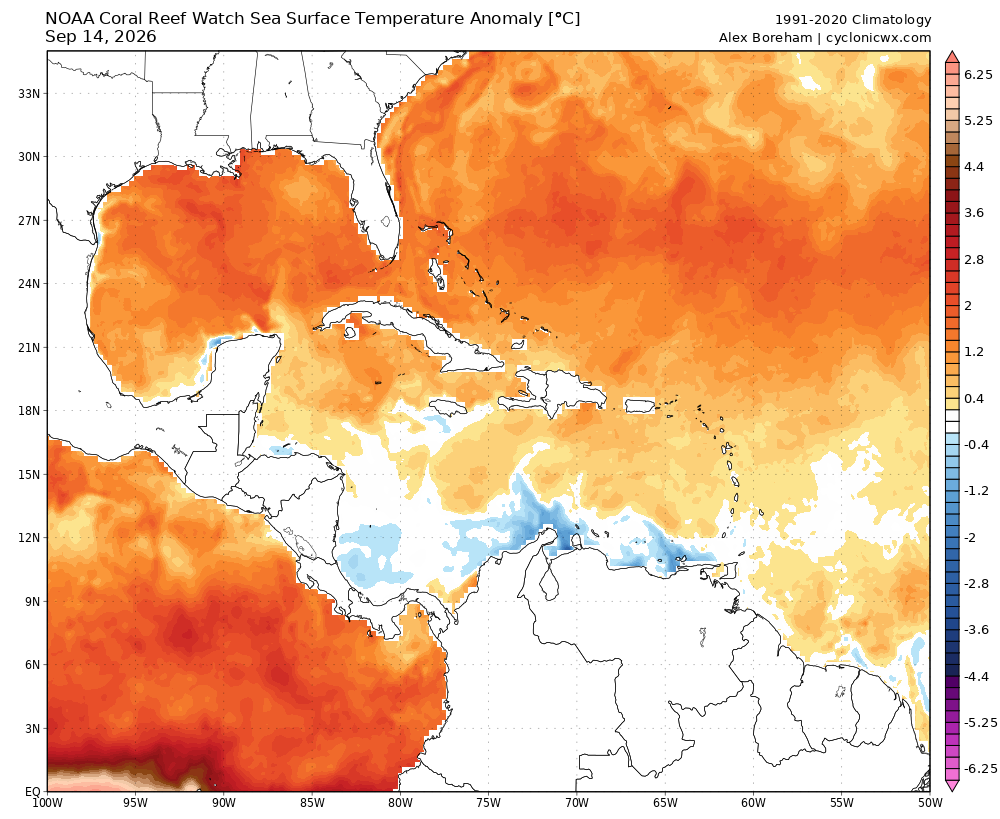
As is now typical under these “heat domes,” the low temperatures and humidity will be particularly anomalous. Along with the long term global trend of increased atmospheric moisture, in the weather situation this week southerly winds off of an unusually warm Gulf of Mexico — SST anomalies approaching 3C off the coast of Louisiana — will contribute greater low level moisture than normal.
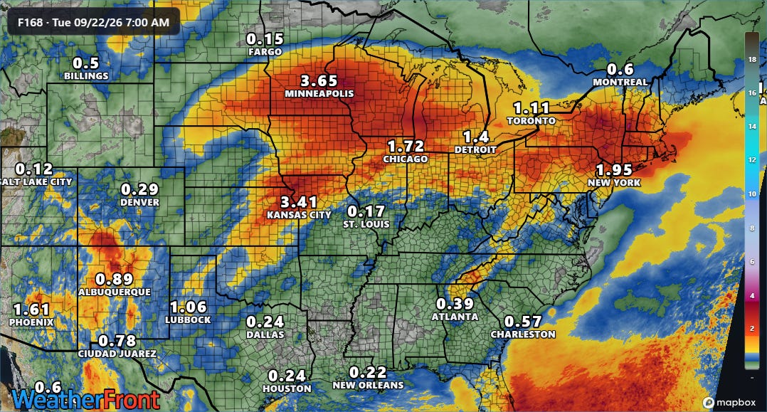
This low level moisture will also contribute to thunderstorms with particularly intense downpours along the periphery of the high pressure area over the next several days.
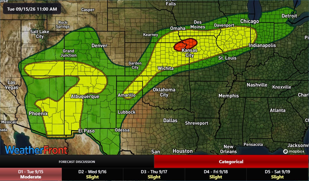
This will mean a risk of flash flooding, with the axis of greatest risk evolving each day as the high pressure center evolves and a quasi-stationary front meanders around the region. Today’s risk will extend from the Four Corners region into the Midwest, with the maximum (moderate/red, level 3 of 4) risk centered over the Kansas City metro area.
 Balanced Weather
Leave a comment