
South central United States experiences warmest first half of September on record, and more heat on tap
Sep 17, 2026
Hi everyone, apologies for not getting a newsletter out yesterday. We were traveling but I expected to have time to write at least a short post — unfortunately, that didn’t happen for a variety of reasons. Anyway, let’s get into what is has been going on the last couple of days.
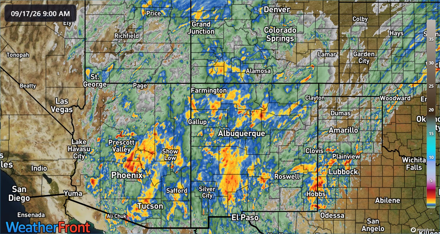
We have been talking about monsoonal moisture surging into the Four Corners region, and that moisture supported waves of thunderstorms with heavy rainfall across Arizona and New Mexico the last 48 hours. Multi-sensor 2-day rainfall estimates from the MRMS system show amounts of 3+ inches over eastern parts of the Phoenix metro area and near Tucson, as well as in parts of New Mexico.
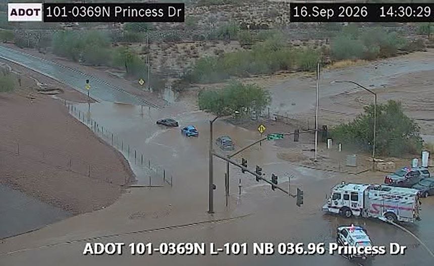
This rainfall in the normally dry desert regions caused serious flash flooding, particularly in Arizona on Wednesday afternoon and evening.
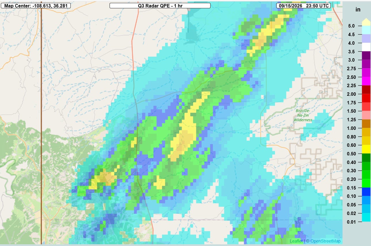
Sadly, earlier in the heavy rainfall event, three people were killed when they were swept away by flash flooding on the Navajo National near Newcomb in northwest New Mexico. The bodies of the three individuals were found shortly after midnight Wednesday morning, and the rainfall that produced the flooding appears to have occurred Tuesday evening. MRMS multi-sensor estimates showed only about .5 to 1” of rainfall in the region.
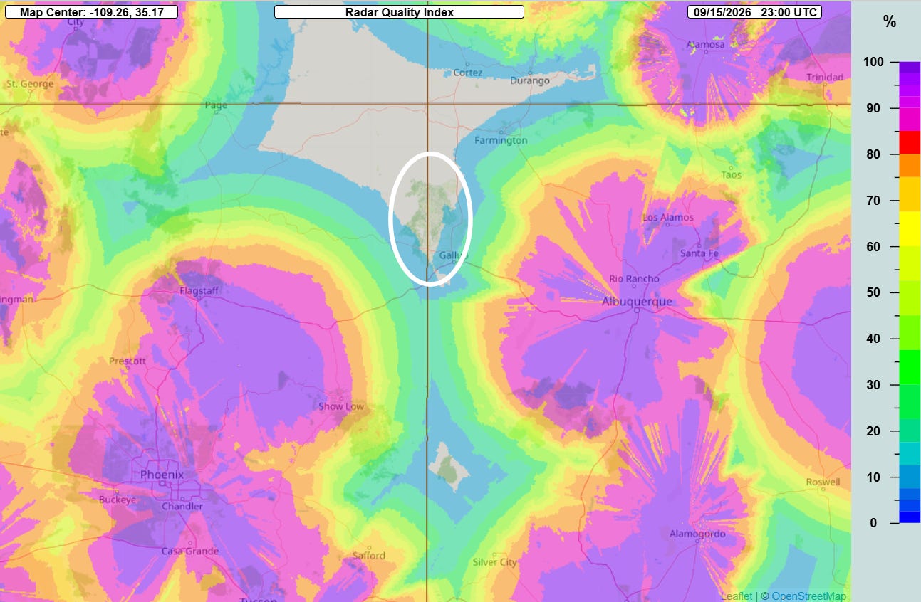
Even that relatively small amount of rainfall certainly could have produced flooding of arroyos and dry riverbeds in the area, but it is also possible that heavier rainfall than radar estimates occurred given that this region is in an area of particularly poor radar, sitting at a significant distance from the Phoenix, Flagstaff and Albuquerque radars as shown above.
While meteorologists have developed multi-sensor techniques to try to help improve rainfall estimates in areas such as this, the reality is that radar data is crucial for accurate real-time rainfall estimates to support flash flood forecasts and warnings. Poor radar coverage is one major challenge to issuing effective flash flood warnings in the West — very rural areas with often poor communication and numerous small normally dry river and stream basins that have varying sensitivity to rainfall are other major problems. These flash flood fatalities in New Mexico have all of these challenges, and in fact there does not appear to have been a warning in effect at the time of the flooding.
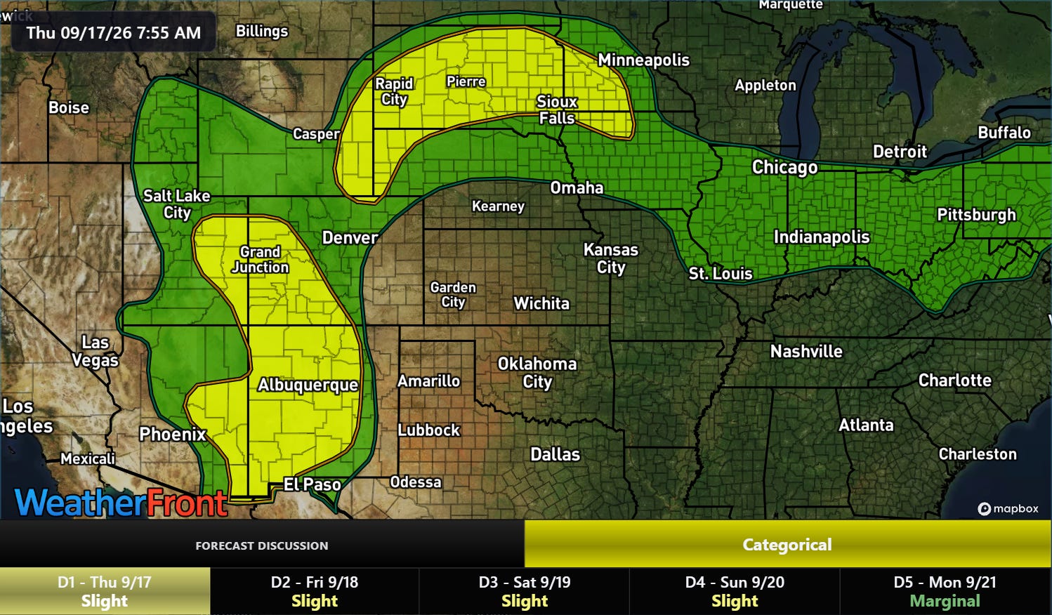
The area from New Mexico and eastern Arizona north into western Colorado and eastern Utah will see additional flash flooding risks this afternoon and evening as monsoonal moisture remains high on the western side of the intense upper level high pressure area dominating the Southeast.
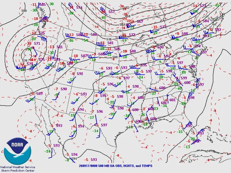
Speaking of that upper level high pressure center, last night’s upper air balloon data showed that this was likely the strongest 500 millibar high pressure center this late in the year, with multiple NWS upper air sites reporting 500 millibar geopotential height values of 6000m or a bit higher. It truly is insane to me to see the number of locations reporting this high of 500 mb heights on September 17.
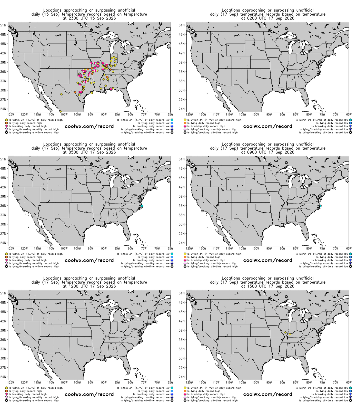
Unsurprisingly, numerous record high temperatures were set near and to the west of this center of high pressure.
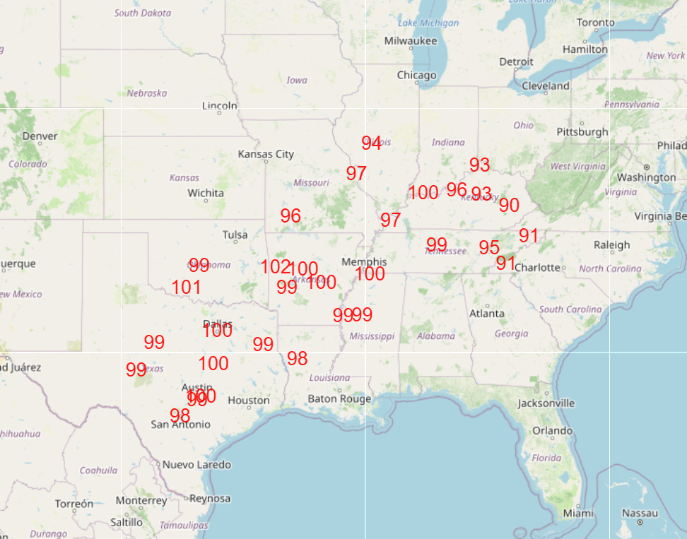
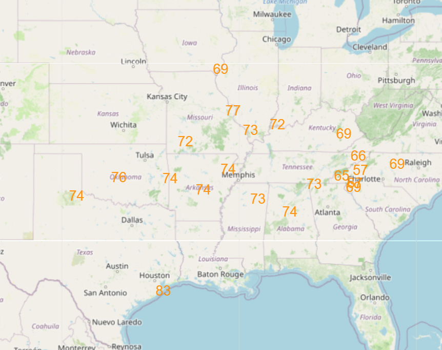
While the upper level high has reached its peak intensity, it will only be slowly weakening, and numerous additional record warm temperatures — both highs and lows — are expected across the region the next few days.
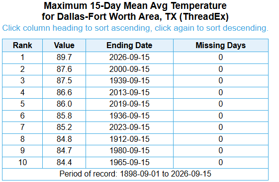
This comes after numerous locations in the south central United States experienced their warmest first half of September on record. DFW is shown as an example above — shattering the record by more than 2F and beating out the infamous September of 2000 as well as Dust Bowl years 1939 and 1936.
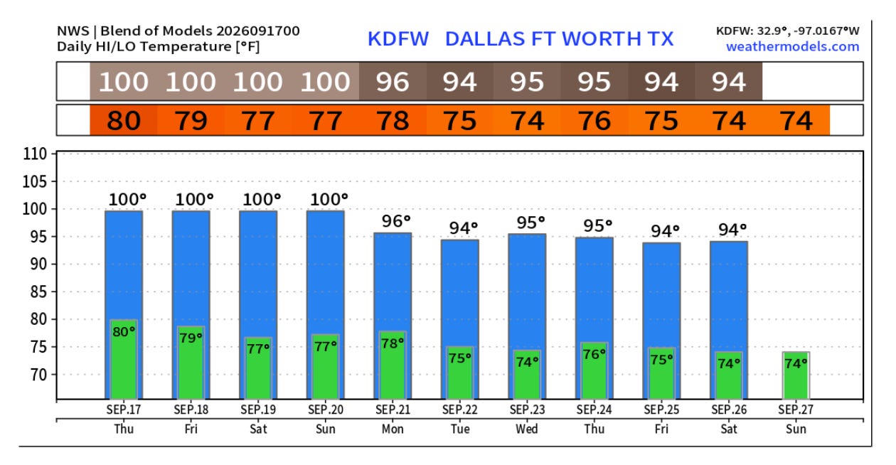
While some slight cooling is anticipated next week, overall well above normal temperatures are expected to continue in this region for the foreseeable future.
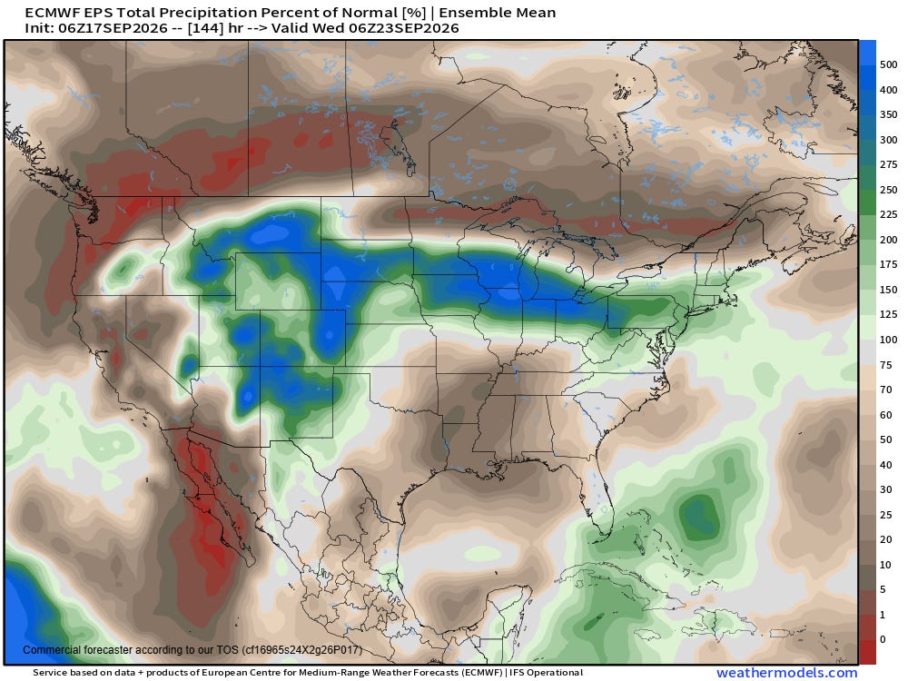
Unfortunately, the upper level high pressure will also keep well below normal precipitation across the region as well — while high levels of moisture on the periphery of the high will continue to support above normal precipitation and potential flooding from the Four Corners region into parts of the Midwest.
 Balanced Weather
Leave a comment