
A lot of heat for the central and southern US for another college football Saturday
Sep 18, 2026
Happy Friday! Starting off today by sharing an article from Andrea Thompson at Scientific American in which she took a look at the implications on the National Weather Service of the recent executive order to change the name of Lake Ontario to Lake America. It gives insight into how placenames are interwoven throughout the operations and IT systems of the NWS, and the potential issues with having to prioritize this unanticipated mandate to complete it on the 30-day deadline outlined in the executive order. (Ed. note: I am a supporter of the international process for geographic standardization and also have many subscribers outside of the US, so I plan to continue to use Lake Ontario just as I have continued to use Gulf of Mexico.)
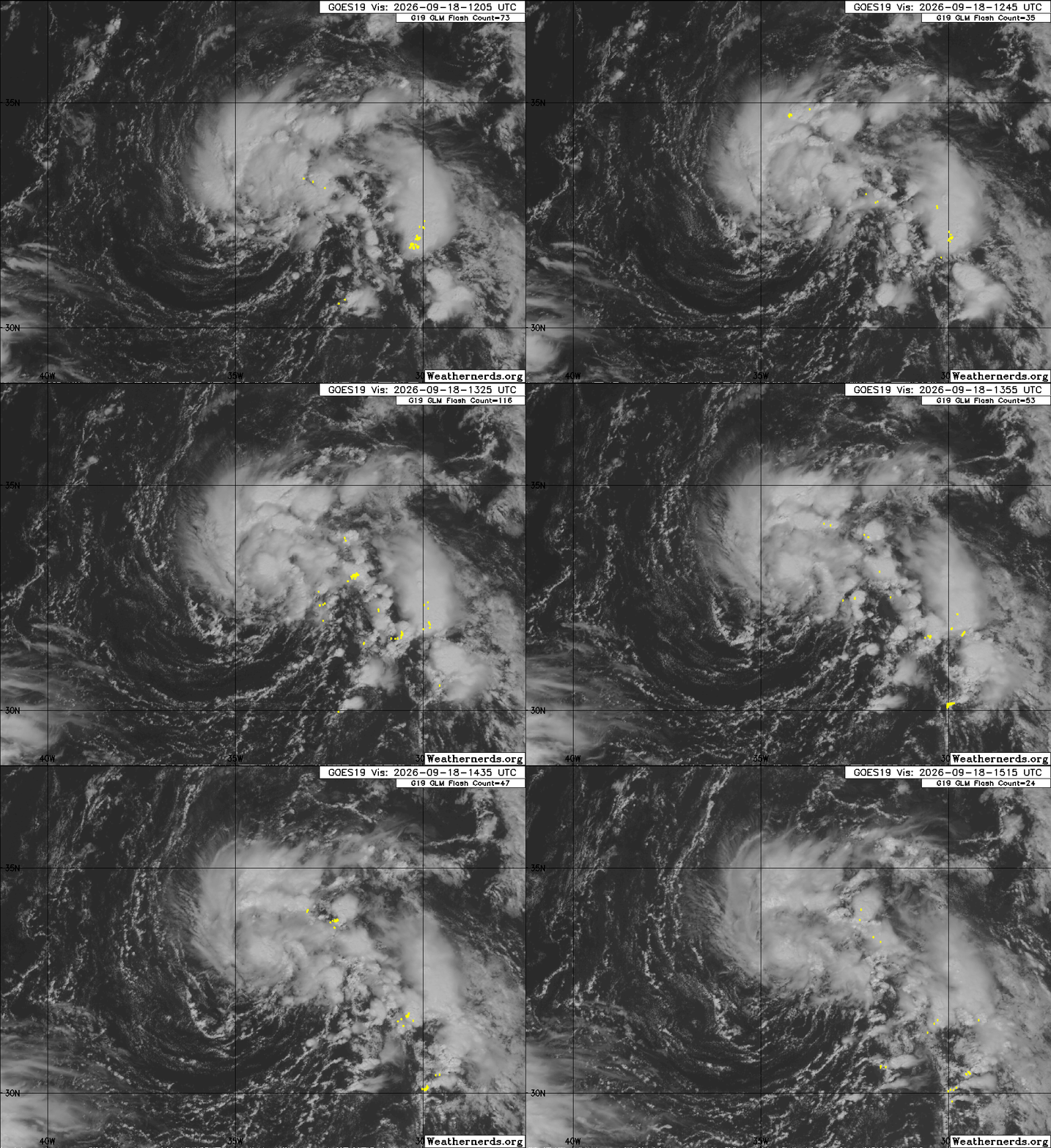
The unusual 2026 Atlantic hurricane season continues its weirdness today, as the National Hurricane Center has designated a new “invest” area — 99L —in the far northeast Atlantic a few hundred miles southwest of the Azores. This area appears to be to just north of an area of stronger wind shear, which is allowing it to become better organized with a relatively well defined circulation and some bands of thunderstorms rotating around it.
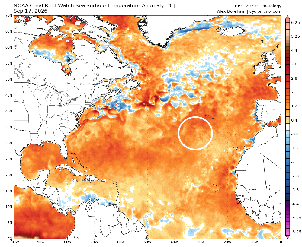
Sea surface temperatures are running 1-2C above normal in this area, and at 27-28C are warm enough to support tropical cyclone development assuming overall conditions remain favorable.
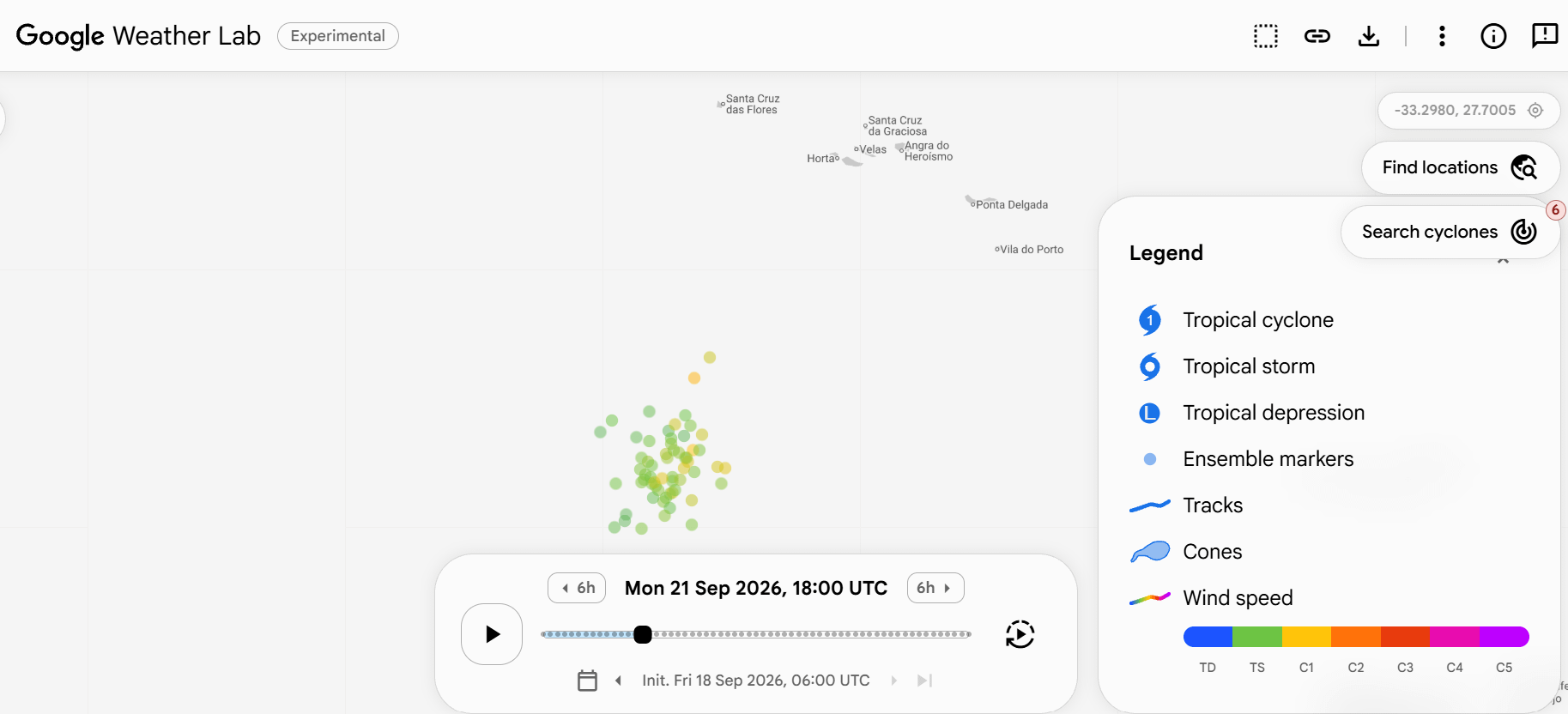
The Google DeepMind AI system has latched onto 99L and most of its ensemble members show it becoming a tropical storm or even a category 1 hurricane over the next 72 hours as it meanders around southwest of the Azores. Given the satellite trends of increasing organization, NHC is now giving 99L a 60% probability of developing into a tropical cyclone, and in a recent special outlook stated that it could become a tropical depression as early as this afternoon.
On a side note, this is not the system that I was talking about in earlier newsletters farther to the west which the AI models were showing development of. This system has pretty much faded away and NHC is no longer discussing it in their outlook. This appears to have been a definite case of the physics based models having the right idea with not developing this system. While the AI models are showing major skill improvements with forecasts of established tropical systems, genesis remains tricky and the physics based models still (to me) have significant value.
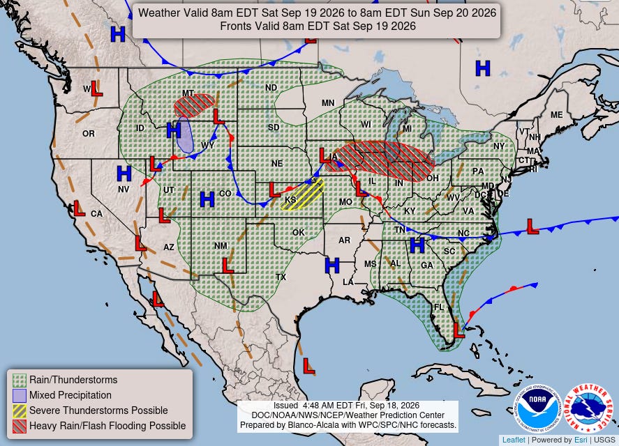
As we head into this weekend, an upper level disturbance moving east across the central part of the country will bring a risk for severe storms and flash flooding to parts of this region on Saturday.
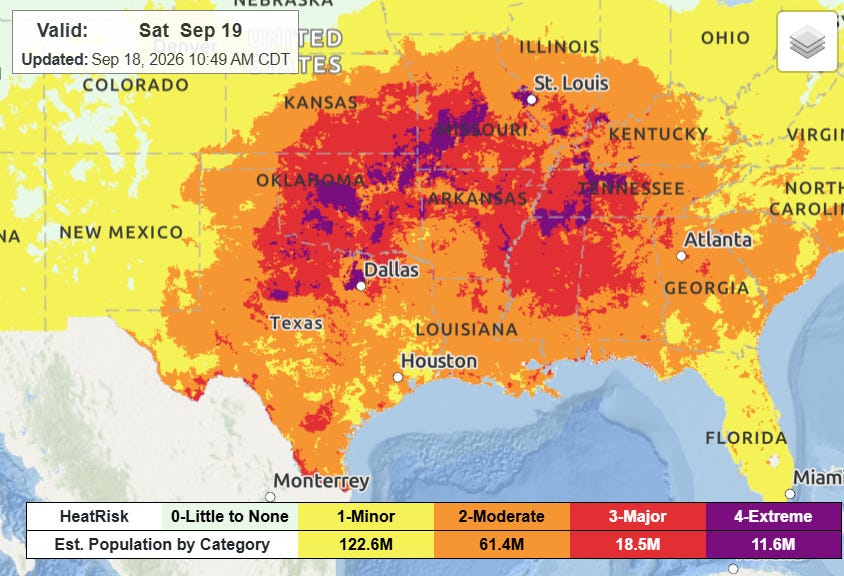
Heat will also continue to be a major issue across the central and southern parts of the country, with widespread major to even extreme heat risk for many areas on Saturday as record warmth continues. If you are planning on attending a college football game or other outdoor activities in these areas, be sure you are taking the heat into account and have plans to stay hydrated and take cooling breaks.
 Balanced Weather
Leave a comment