
Hurricane and storm surge watches issued for portions of the Gulf Coast; recurving eastern Pacific Hurricane Rachel could cause impacts in western US
2 minutes ago
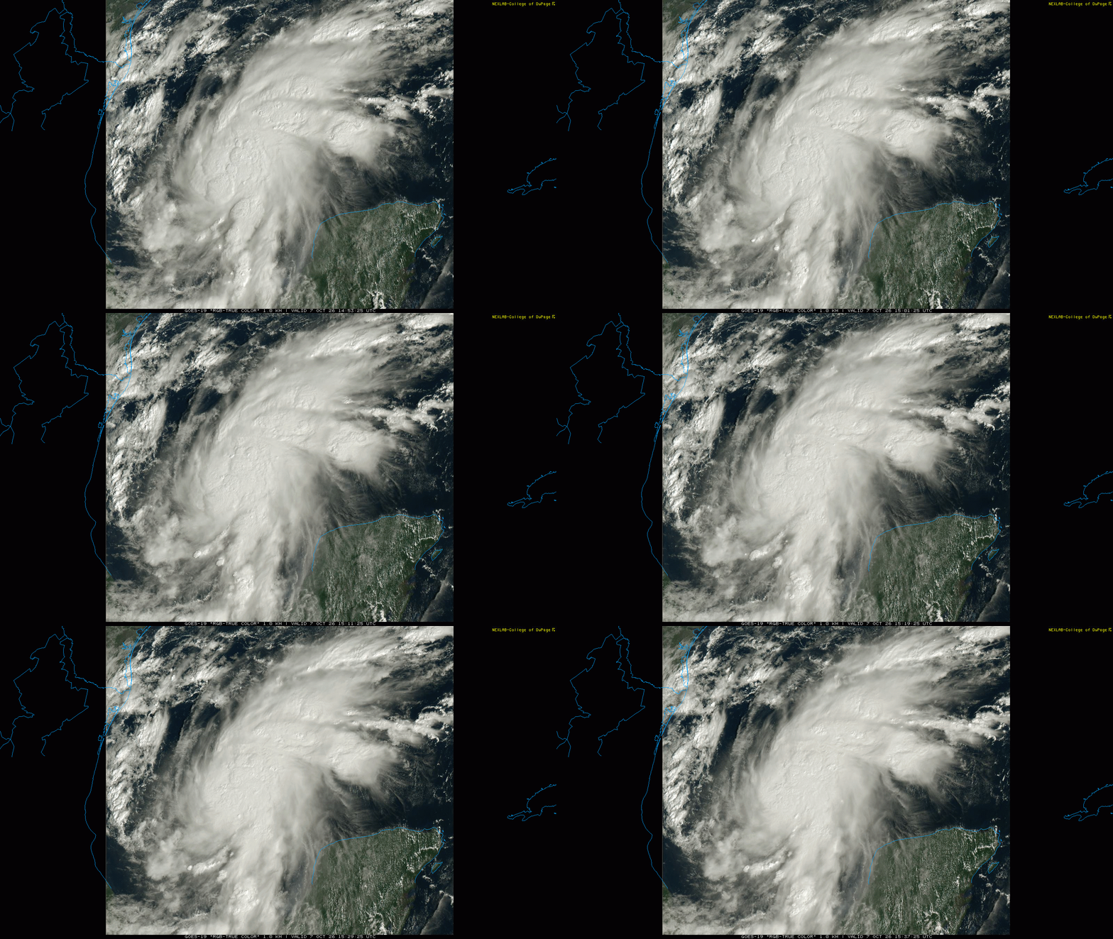
The tropical disturbance in the western Gulf that we have been discussing the last few days became a tropical depression yesterday afternoon, and strengthened into Tropical Storm Isaias (pronounced ees-ah-EE-ahs, it’s a tough one) overnight. Satellite imagery this morning shows that the Isaias is getting its act together pretty quickly, with increasing bands of thunderstorms around a better defined center.
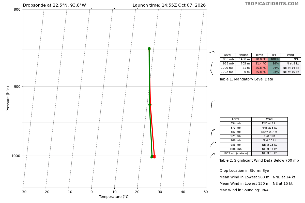
A US Air Force reconnaissance aircraft in the storm recently released a dropsonde into the center which “splashed” with a pressure of 1002 millibars (mb) and 15 knots of winds at the surface, which tells us that the pressure at the center of Isaias is around 1000 mb. (We estimate that the center pressure is about 1 mb lower for every 10 knots of wind a center dropsonde measures.) The aircraft is also finding winds at flight level as high as 50 mph — which equates to a tropical storm with maximum surface winds of 45 mph.
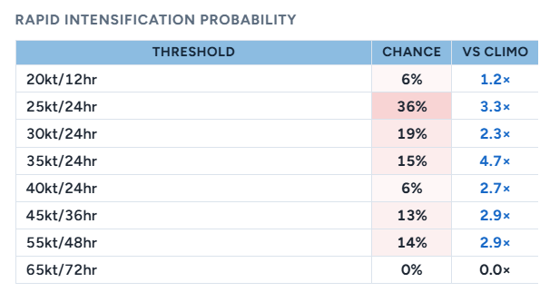
Based on the increasing signs of organization in satellite and recon data and the anticipated environment, Isaias appears poised to rapidly intensify over the next couple of days. NHC’s SHIPS statistical intensity model shows well above normal probabilities for rapid intensification of Isaias.
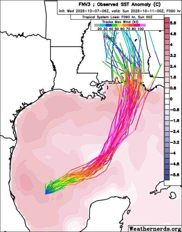
The Google DeepMind (GDM) AI ensemble also continues to support rapid intensification, with most of the members explicitly showing Isaias becoming a major hurricane in the next couple of days as it turns more northeast and north and moves toward the central Gulf Coast.
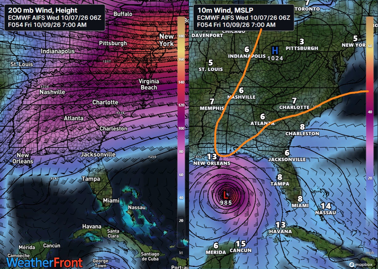
The AI guidance continues to support the idea of Isaias “riding” the right entrance region of the upper level jet over the eastern United States. In the graphic above, on the left I have the 200 millibar (~39,000 feet AGL) wind forecast for Friday morning where the bright colors are stronger winds. In this atmospheric setup, the area along the Gulf Coast is called the “entrance region” of the jet because it is where parcels of air are entering the jetstream from the south. The right side of this entrance region is particularly favorable for upward motion in the atmosphere and development of thunderstorms and low pressure. On the right I’ve sketched in the position of the upper level jet maximum in orange, and you can see how the model (European AI forecast system) shows Isaias intensifying in that right entrance region.
This atmospheric setup has supported a number of serious hurricane landfalls along the Gulf Coast during the latter part of the hurricane season in recent years. While it is possible that the favorable interaction between the jet stream and storm could break down as the storm approaches landfall and shear could begin to cause weakening, the timing of that transition is always tough to forecast, especially as there will also potentially be internal storm dynamics (e.g., eyewall replacement cycles) complicating the intensity as well.
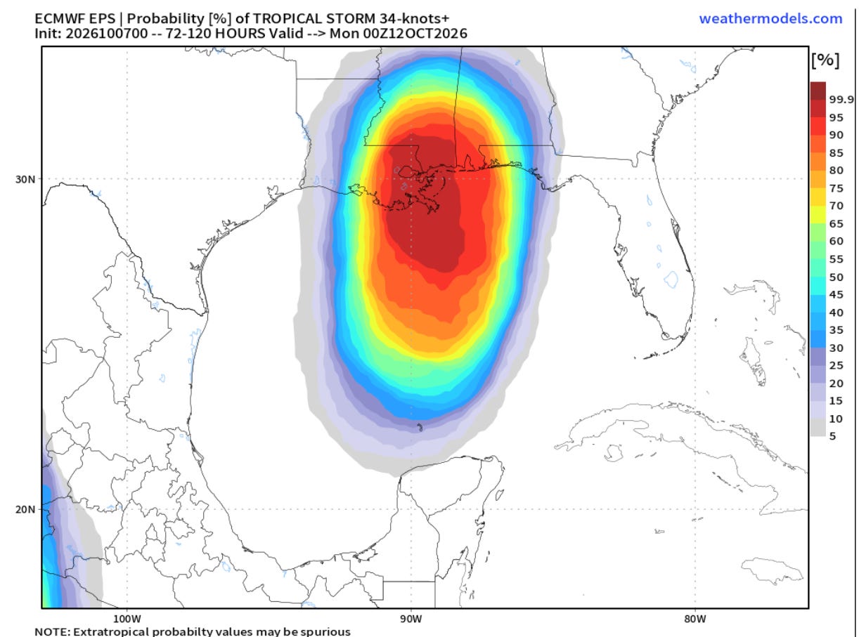
The physics based European model continues to insist on a weaker, slower and farther west scenario for Isaias, with landfall closer over southeast Louisiana or the Mississippi coast. As Isaias becomes better organized this scenario seems increasingly less likely, and the hurricane specific physics models have trended more toward the stronger AI model scenario (albeit a bit farther west than GDM AI).
![[Key Messages]](https://substackcdn.com/image/fetch/$s_!G_yc!,f_auto,q_auto:good,fl_progressive:steep/https%3A%2F%2Fsubstack-post-media.s3.amazonaws.com%2Fpublic%2Fimages%2Fdf4f68a0-aced-40c2-a5fd-905bebb8db10_897x736.png "[Key Messages]")
The bottom line is that for now uncertainty on the track and intensity remains, but that it is likely a significant hurricane will impact the northern Gulf Coast with serious storm surge, wind and flooding rains late this week. Regardless of potential weakening near landfall as I discussed above, the storm is expected to growing in size and moving rapidly, so impacts are likely to be felt over a large area.
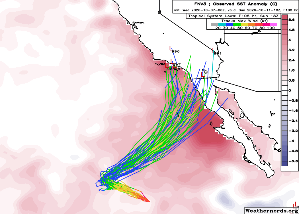
The Gulf Coast is not the only area that will be dealing with potential impacts from the tropics. As I discussed yesterday, the large area of upper level high pressure that has been supporting record heat across the West the last several days will be replaced by a strong upper level trough of low pressure this weekend. As this happens, weakening Hurricane Rachel is expected to pulled northeast toward northern Baja California and southern California.
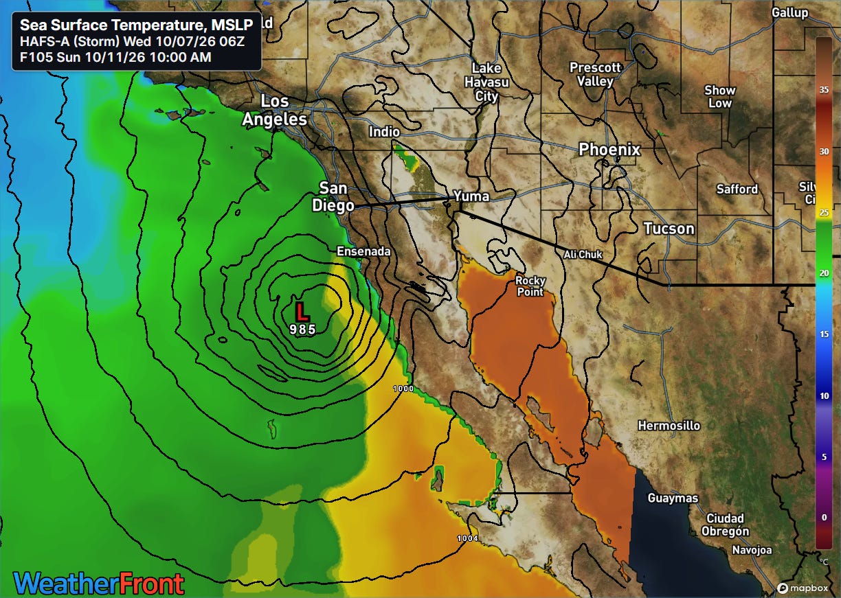
While Rachel should be weaker by this weekend, a combination of well above normal sea surface temperatures and a favorable interaction with the upper level trough could keep the storm more organized and stronger than we would ordinarily expect for a recurving eastern Pacific hurricane. The latest HAFS-A hurricane model above shows a rather intense surface low approaching the border US-Mexico border in California on Sunday.
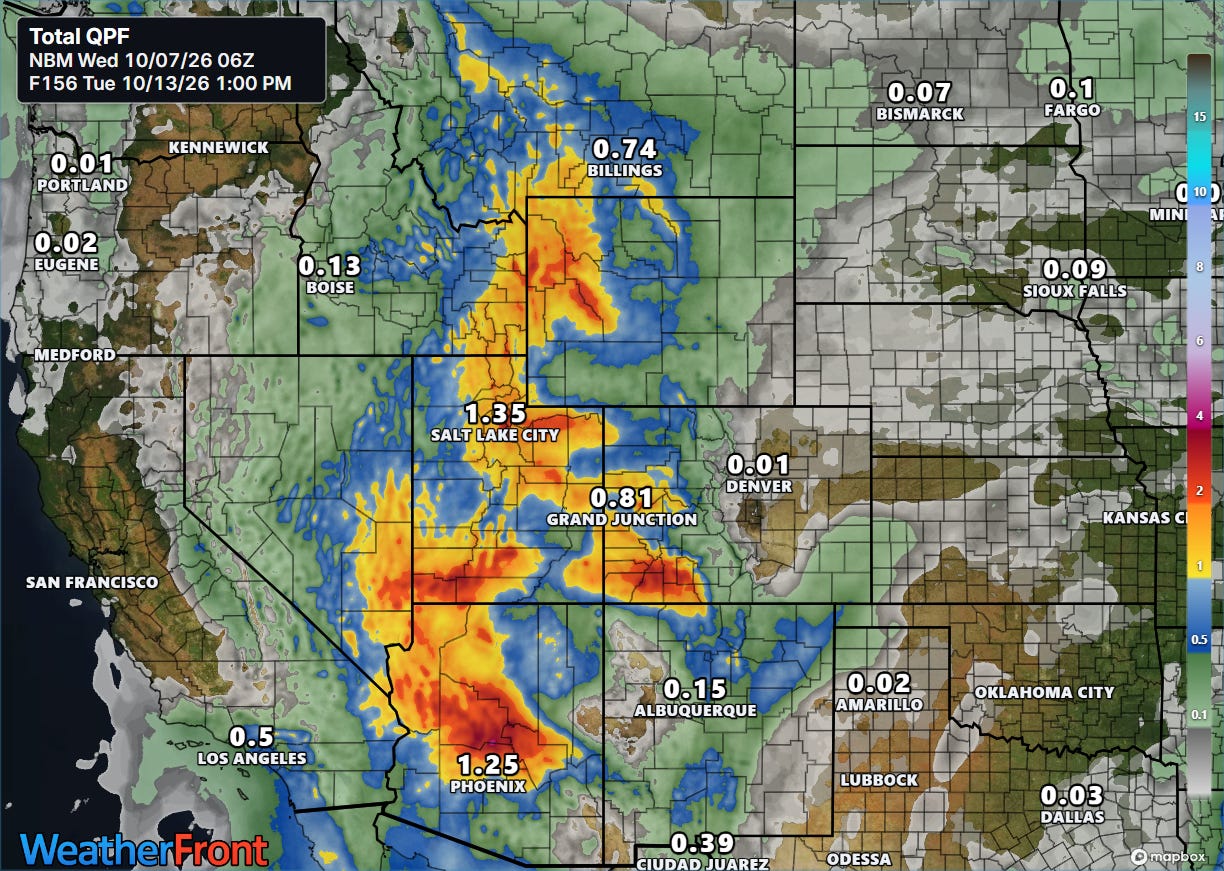
We will obviously be keeping a close eye on this situation as well over the next few days. At a minimum, tropical moisture will stream northeast ahead of Rachel and the upper level trough, producing heavy rains and potential flash flooding across parts of the Rockies and Four Corners regions.
I will be providing occasional updates about all of this between newsletters via social media, Substack Notes and Substack Chat (paid subscriber benefit).


Leave a comment