
Rachel expected to bring flooding and gusty winds to Southwest, while category 4 Simon could bring catastrophic impacts to coast of Mexico
2 minutes ago
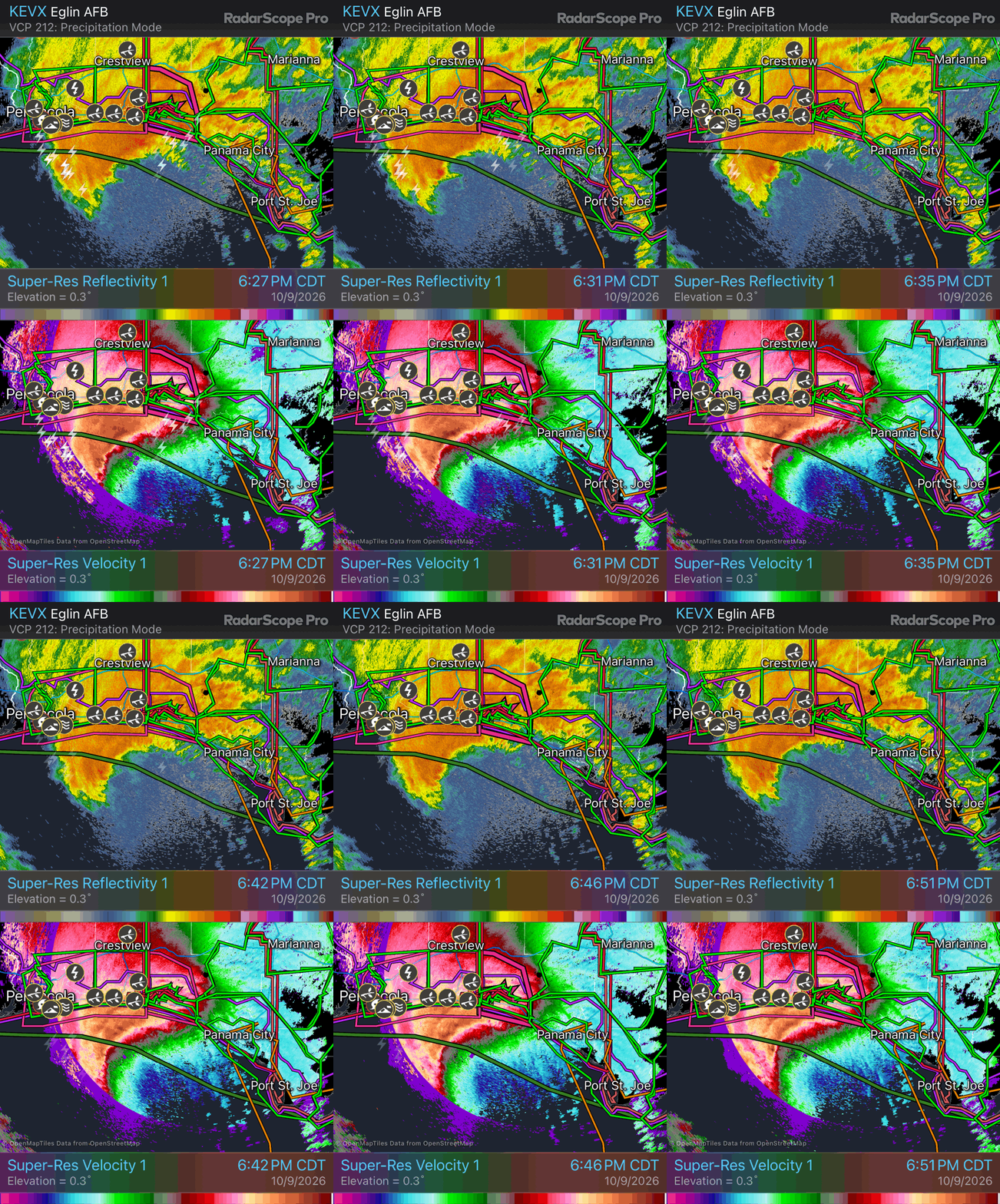
Isaias made landfall around 8:30 pm CT last night near Destin, FL as a category 2 hurricane with maximum sustained winds of 105 mph. This radar loop from the NEXRAD Doppler Radar at Eglin AFB, FL shows Isaias on its final approach to the coast. The hurricane maintained its structure and intensity as a major hurricane until the last few hours before landfall, when it rapidly became asymmetric with all of the intense convection north and northwest of the center. Reconnaissance aircraft also showed that the pressure rose significantly — about 10-15 millibars — as the eye approached landfall, signs that shear and drier air finally started taking its toll on the storm.
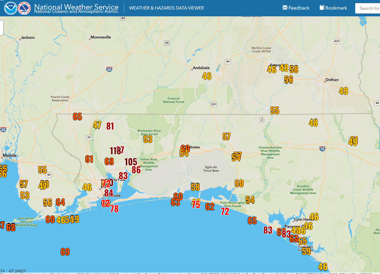
The weakening came too late though to avoid serious impacts in the Florida Panhandle, as winds gusts as high as 130 mph caused wind damage to a number of structures, downed many trees, and left about a half-million customers without power at one point. As I alluded to in some posts over the last couple of days, the structural changes of Isaias that occurred due to the storm’s interaction with the upper level jet to its north, meant that the north and northwest sides of the storm ended up with the greatest wind impacts. A number of my colleagues have been postulating that a “sting jet” likely contributed to the intense winds on the northwest side of Isaias.
The Pensacola metro area was hit particularly hard with a number of measured gusts over 100 mph. In total, about 900,000 customers were left without power at the peak across the Florida Panhandle, Alabama and Georgia — 800,000 customers remain without power at midday Saturday. The Weather Channel reported recently that nearly 90% of Walton County, FL are without power. Two people were also killed in separate incidents in Florida and Alabama where large trees fell on homes.
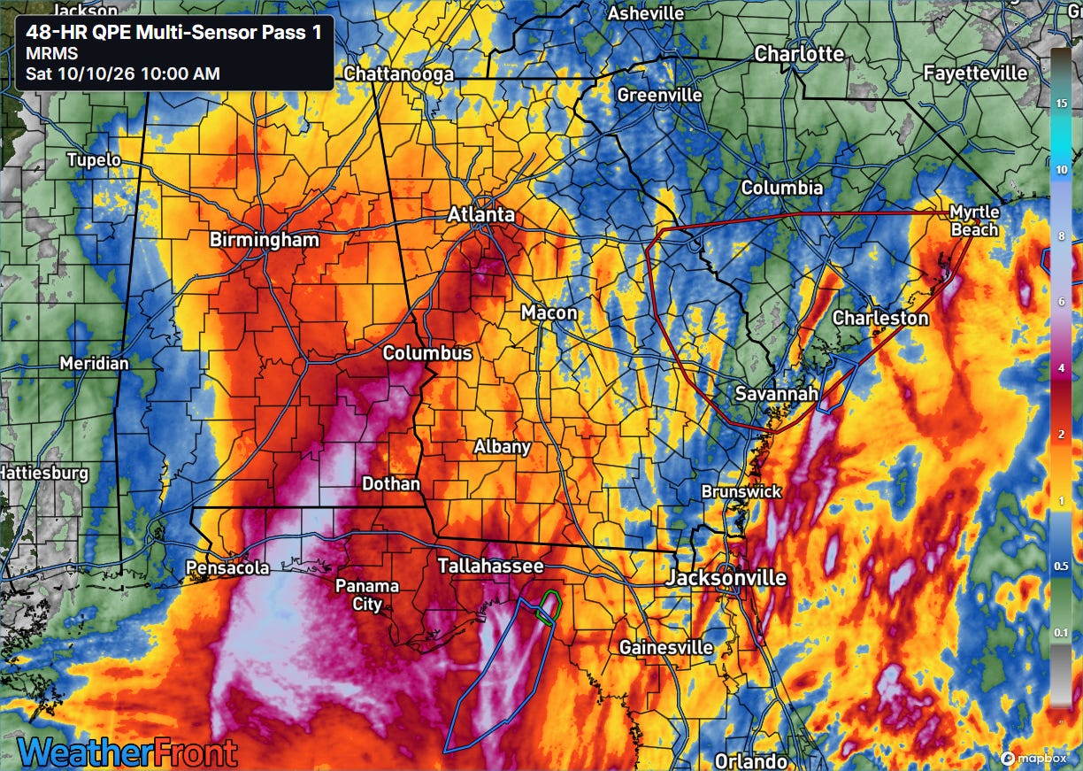
The heaviest rainfall was also in the area along and just north/northwest of the eye where the intense thunderstorm activity produced a swath of 6 to 8” of rain in a fairly short period of time across the western Florida Panhandle into southern Alabama.
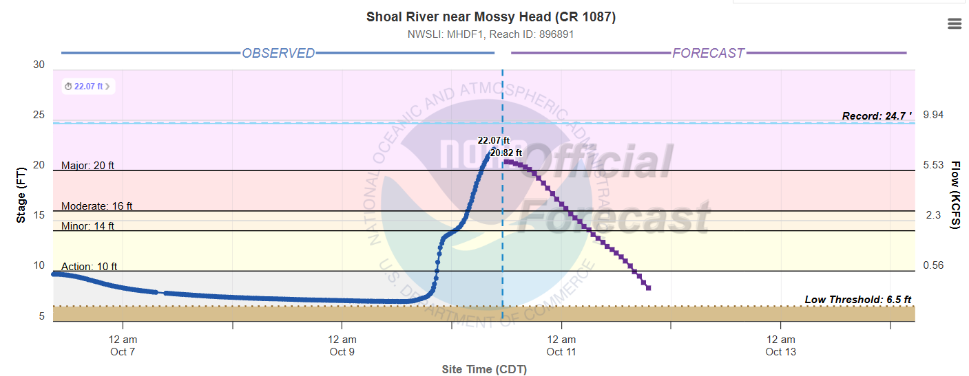
Flash flooding occurred, but the rapid movement of the storm limited extreme rainfall amounts and widespread major river flooding. However, the Shoal River at Mossy Head, FL is in major flood and per NWS impact statements numerous residences are flooded at this river level.
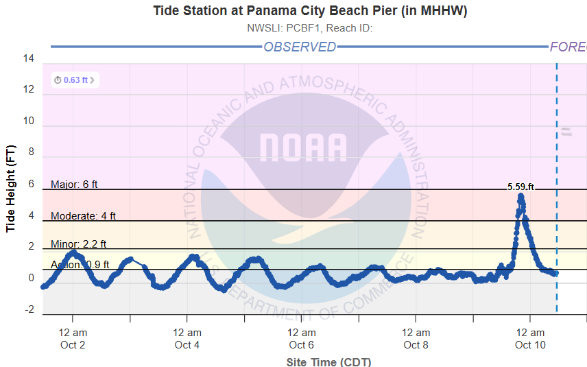
Storm surge appears to have peaked around the Panama City area, where the tidal gauge measured a surge value just over 5.5’.
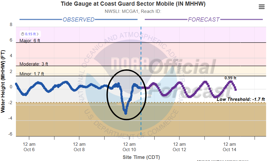
On the northwest side of the eye, the intense northwest winds caused a “blowout” tidal event in Mobile Bay — the tidal gauge dropped to more than -3 feet, below low threshold levels.
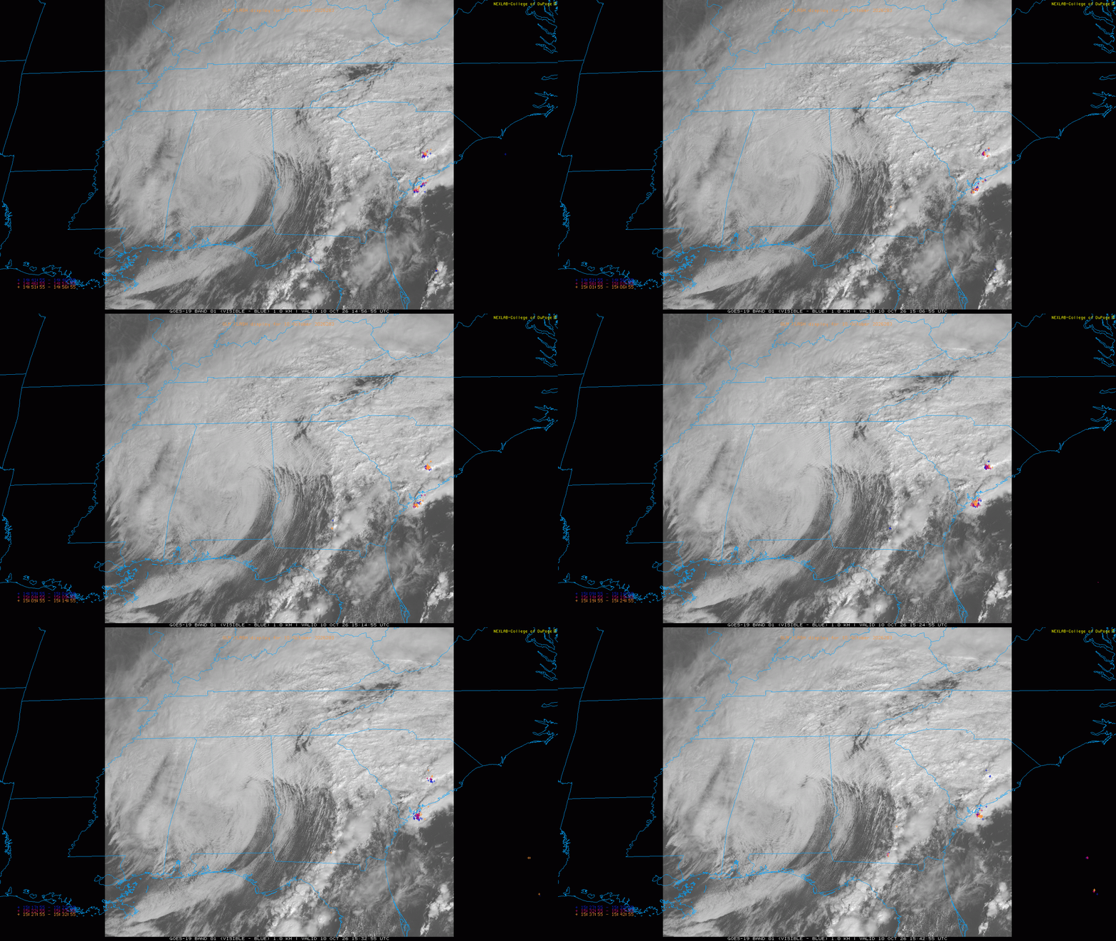
Isaias has weakened to a remnant low pressure center over central Alabama. Bands of showers and thunderstorms are moving north around the east side of the low from the Florida Big Bend north through the Carolinas and into the southern Appalachians.
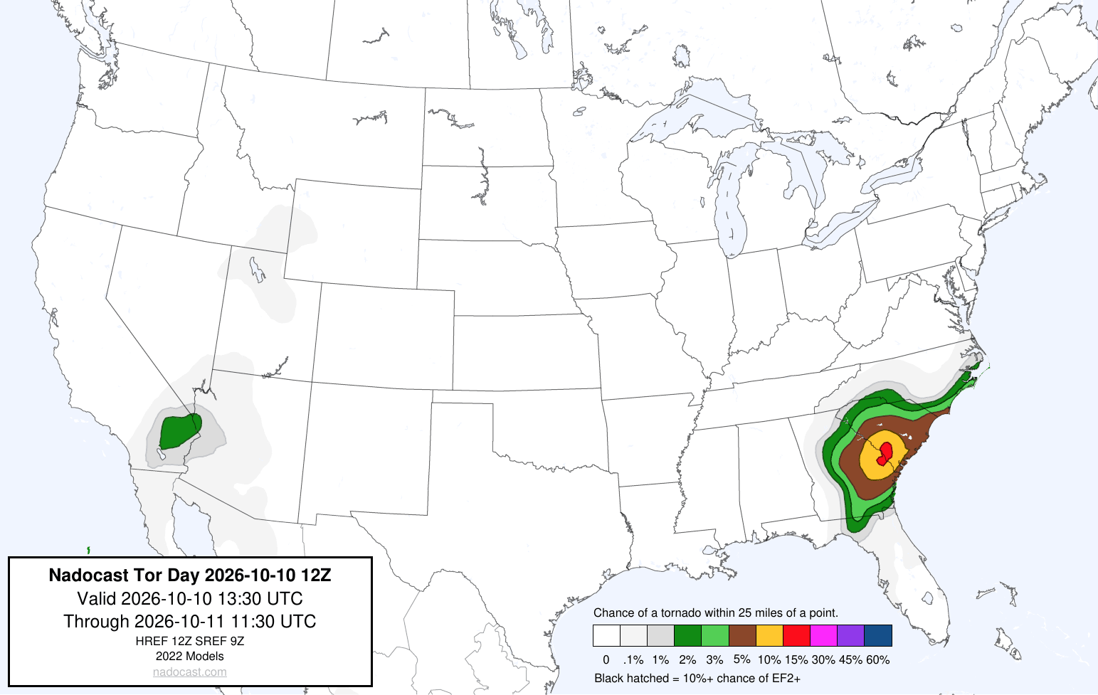
The visible satellite loop shows that some sunshine will help heat and destabilize the atmosphere and allow for the development of thunderstorms in parts of Georgia and South Carolina. The remnant strong low level wind shear in the region should support a rather significant tornado risk with these storms, maximized in the area to the southeast of Augusta.
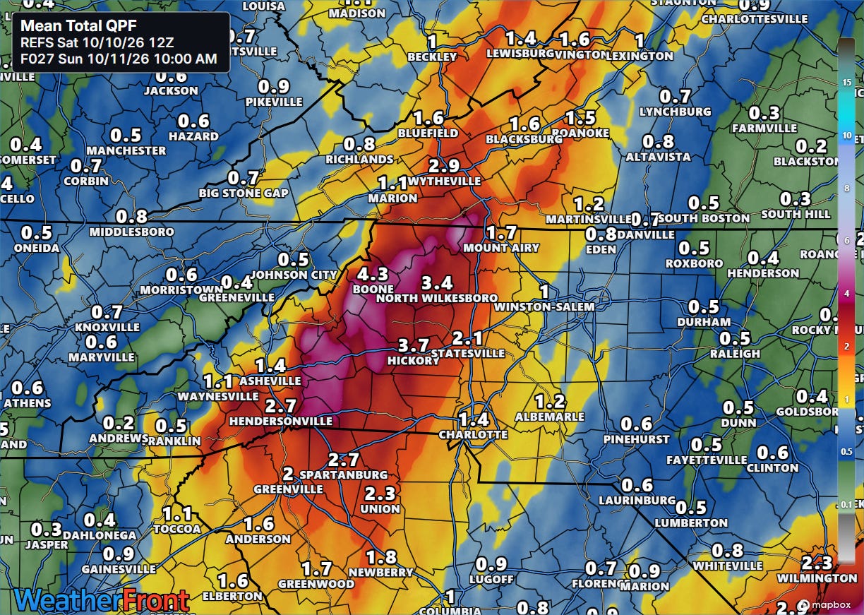
The forecast track of Isaias has shifted somewhat to the east in the last couple of days, and as a result upslope flow of tropical moisture will support showers and storms with heavy rainfall across the southern Appalachians. To be clear, this is not an event that is anywhere near the magnitude of Helene — but flash flooding is possible and the Weather Prediction Center has a moderate (level 3 of 4) risk of excessive rainfall through early Sunday in the area.
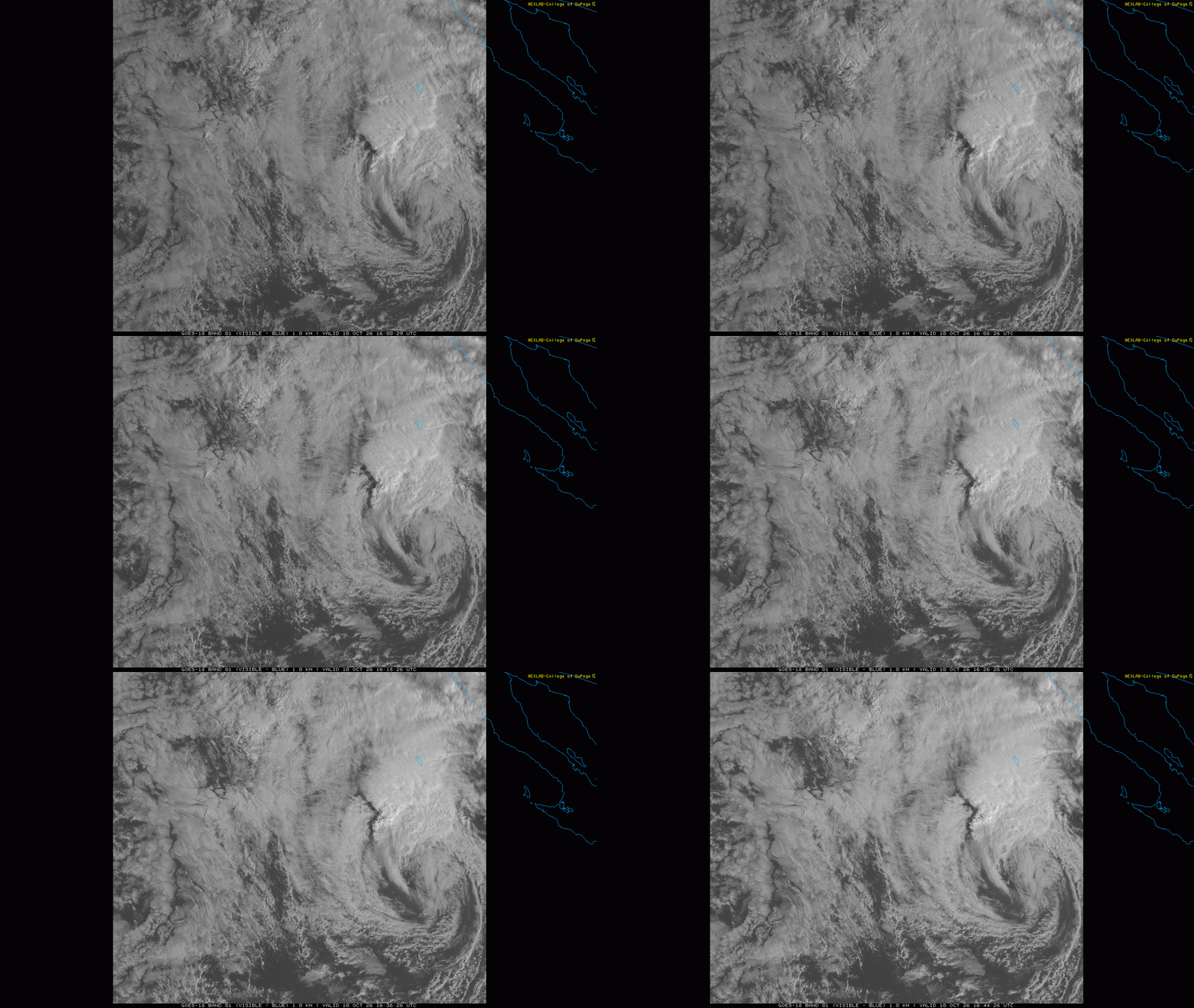
To the west, Tropical Storm Rachel is showing increasing signs of organization and intensity. However, similar to what evolved with Isaias, the interaction with the trough of low pressure is resulting in most of the convective activity evolving to the north and northwest of the low. Hence, while the storm system overall is likely to continue to intensify as it moves toward landfall, it now seems as if it will be more of a hybrid, extratropical low pressure center than a true tropical storm.
Regardless of the structure of the system, the low pressure center is expected to make landfall across northern Baja California and then move north-northwest across southeast California and into the Intermountain West.
Swells that have been generated by Rachel’s path over the eastern Pacific — along with elevated water levels along the California coast associated with the ongoing intense El Nino event — have already been causing coastal flooding in Southern California the last couple of days. The approach of Rachel should further exacerbate this situation, and coastal flood warnings for significant coastal flooding and beach erosion are in effect. Dangerous rip currents are also expected.
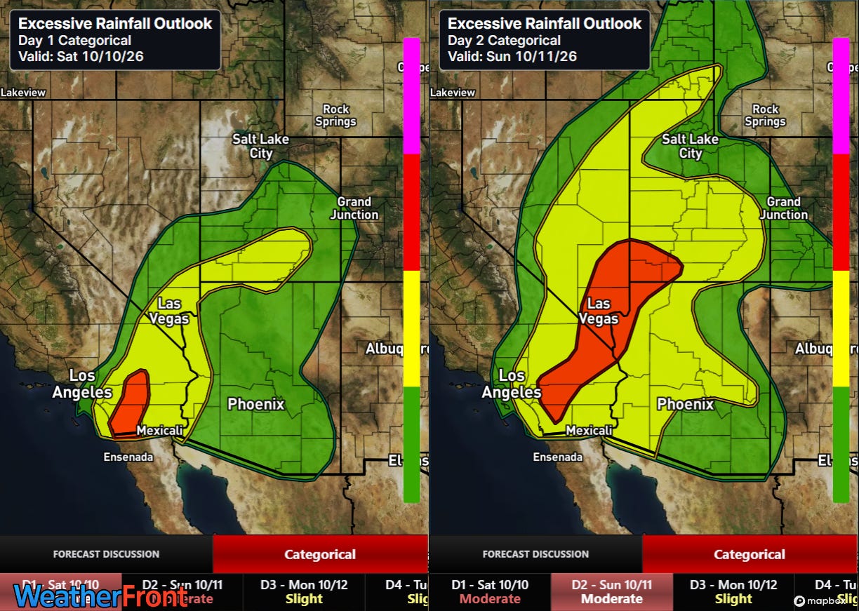
Serious flash flooding is also possible across the region. Tropical moisture levels will be high, and many parts of the Southwest have seen unusual amounts of rainfall in recent weeks, making soil conditions more prone to rapid runoff. Moderate risks (level 3 of 4, red) are now in place, along with large slight (level 2 of 4, yellow) risk areas.
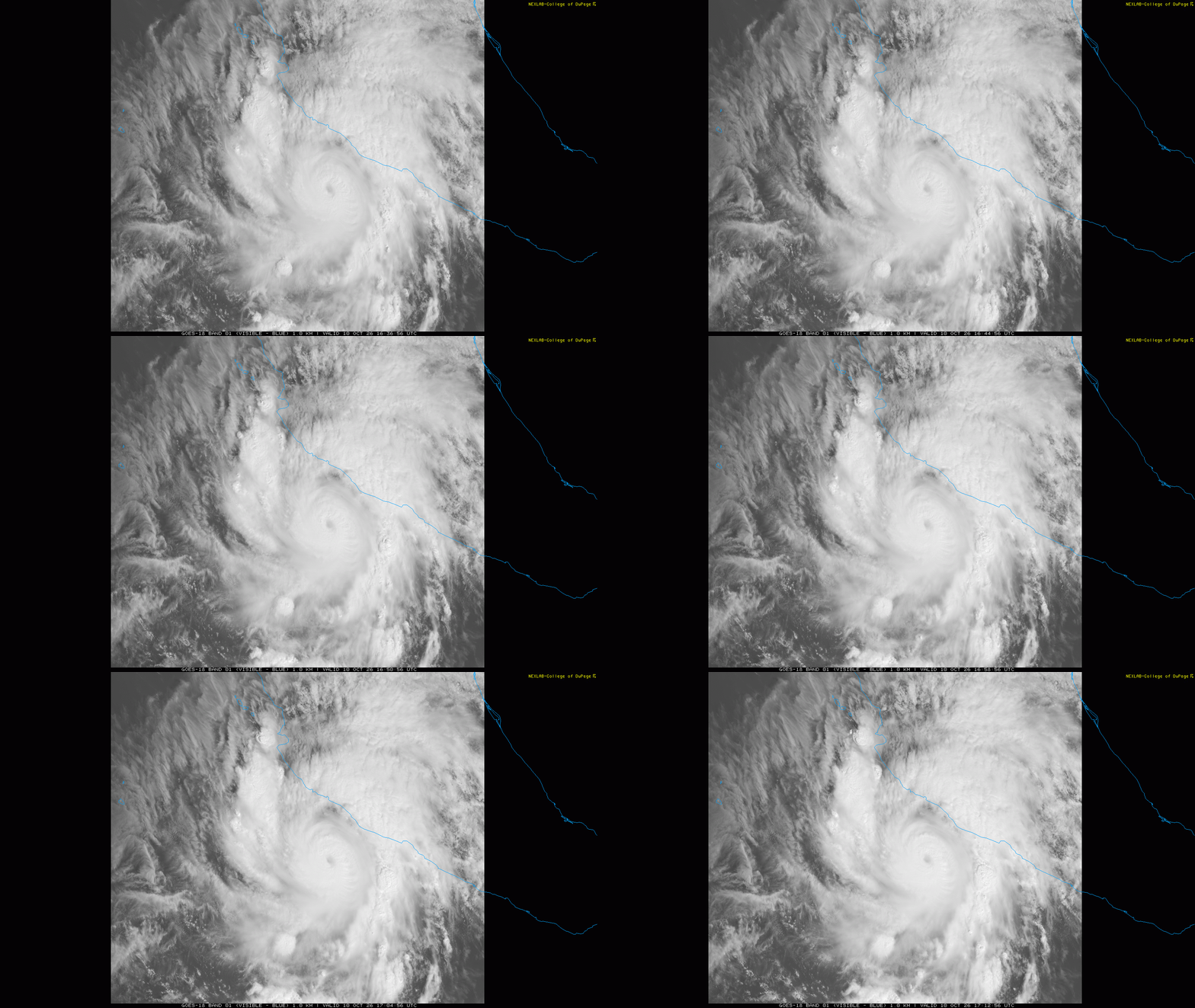
With all of the high impact weather the US is seeing, I do not want to completely overlook a potentially catastrophic event evolving along the Pacific Coast of Mexico with category 4 Hurricane Simon. As I discussed in yesterday’s newsletter, the forecast for Simon is quite uncertain and difficult due to the fact that the center of the hurricane will be moving right along the coast. A track farther west could keep the hurricane offshore, enabling a more intense hurricane to impact areas farther north — while a track farther east would result in the hurricane moving inland with catastrophic impacts along its path.
![[Key Messages]](https://substackcdn.com/image/fetch/$s_!gxHJ!,f_auto,q_auto:good,fl_progressive:steep/https%3A%2F%2Fsubstack-post-media.s3.amazonaws.com%2Fpublic%2Fimages%2Fbd0b2efe-6bcf-428c-b5e9-68f209ed00e5_897x736.png "[Key Messages]")
As of now, NHC is leaning toward a scenario where Simon moves just inland, as storms have a tendency to move farther east than model forecasts due to the terrain in the region. While the exact impacts and locations of those impacts will depend upon the ultimate track, major to catastrophic impacts from storm surge, rainfall/ flooding/mudslides, and wind are expected.
I will be providing periodic updates about all of this between newsletters via social media, Substack Notes and Substack Chat (paid subscriber benefit).


Leave a Reply