
Simon lashing the Pacific coast of Mexico with flooding rains and high winds; much of central and southeast US to see record heat next several days
2 minutes ago
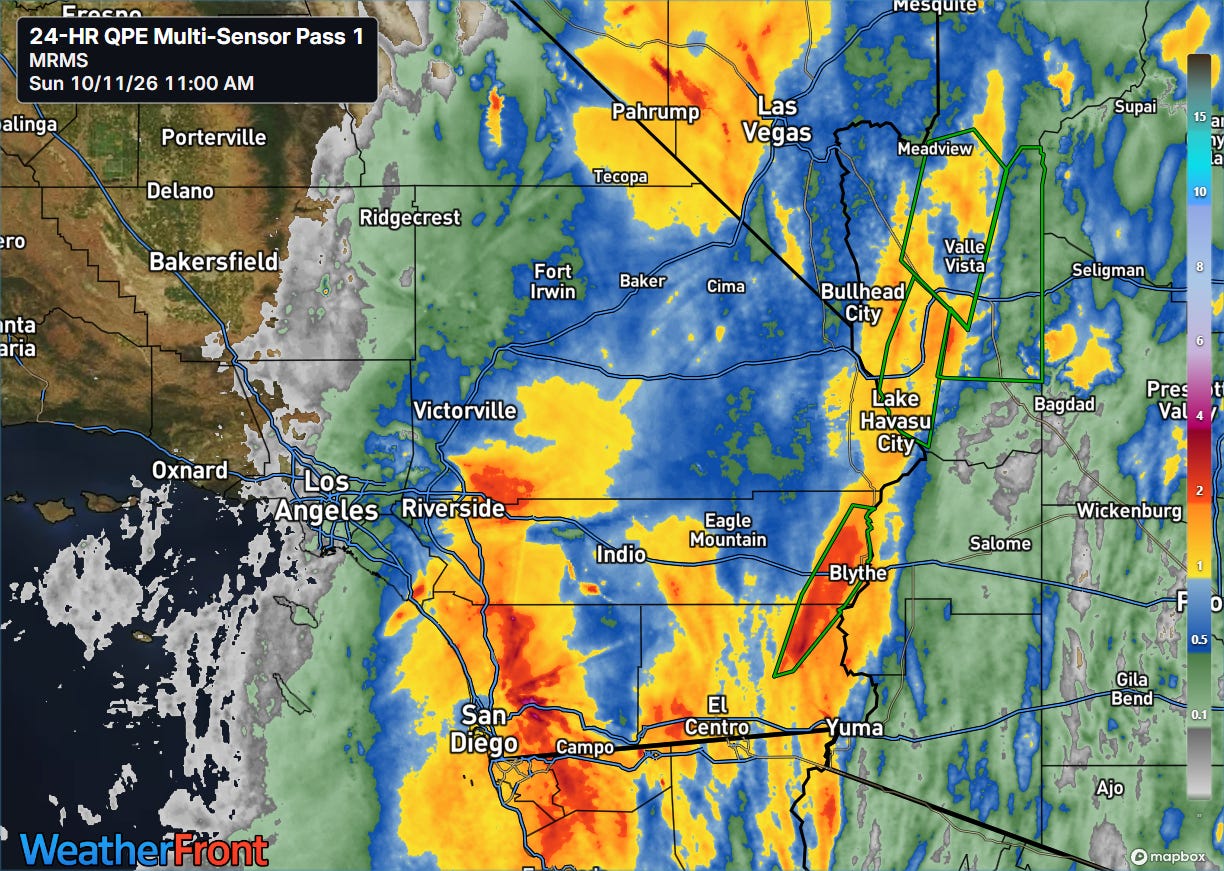
While Rachel transitioned into a post-tropical low pressure system overnight, its atmospheric dynamics and tropical moisture continued to move north and northeast into southern California, producing very heavy rainfall.
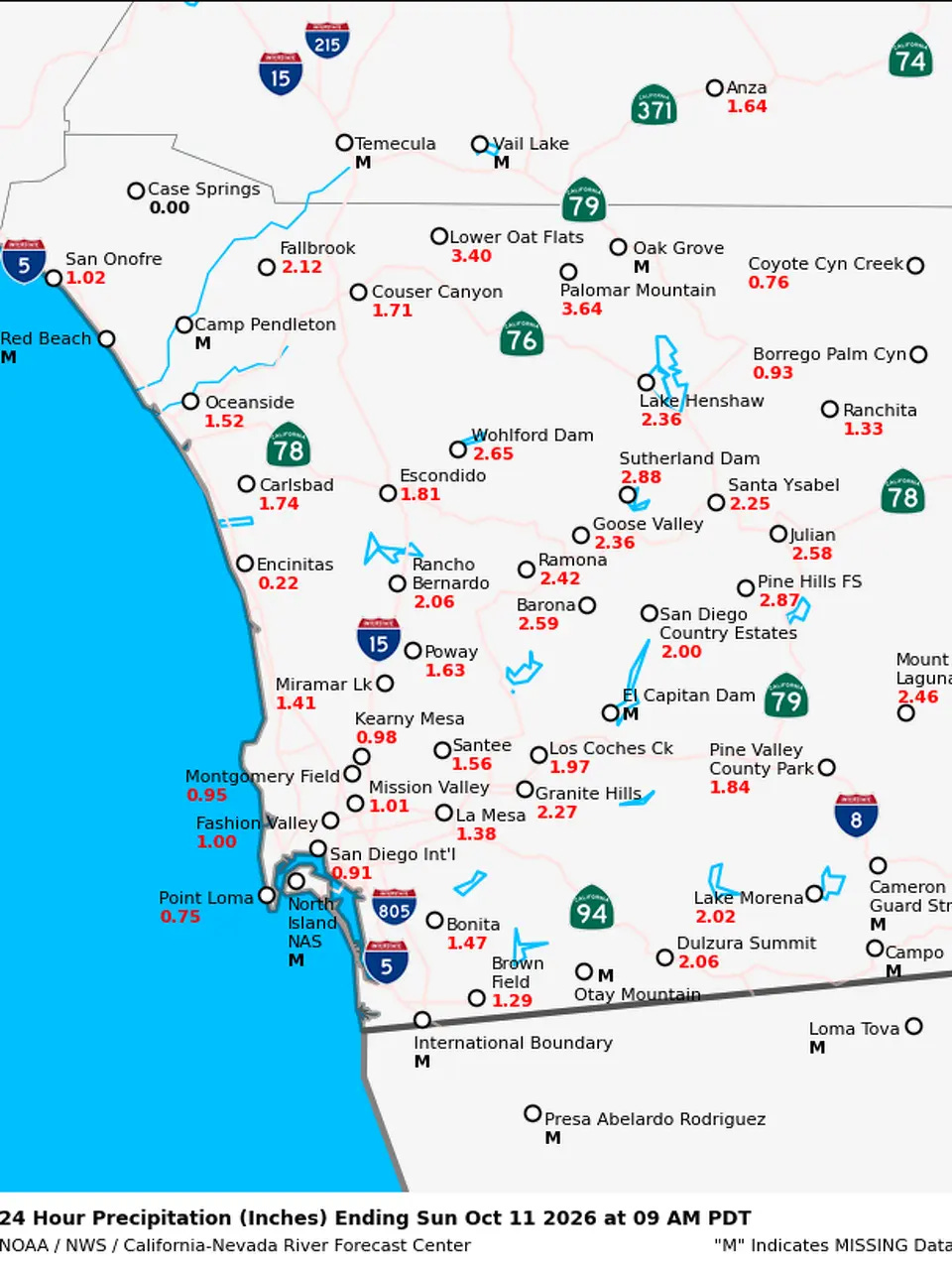
The storm system and its core moisture moved through San Diego County, producing as much as 4” of rainfall in higher elevations with Palomar Mountain reporting 3.64” — some flash flooding and debris flows were reported. Farther east, showers and storms with torrential rainfall rotating around the east side of Rachel produced unusually heavy rainfall and flash flooding in the lower Colorado River Valley. Blythe picked up 2.8” of rain, which was their wettest storm since 1965 per San Francisco Chronicle meteorologist Anthony Edwards.
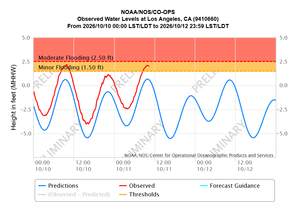
Meanwhile, swells from Rachel combined with elevated water levels due to El Nino resulted in significant coastal flooding impacts along the coasts of San Diego and Los Angeles counties with Saturday morning’s high tide. The tidal gauges at San Diego and Los Angeles (above) approached record levels, and similar (but just a hair lower) values are occurring with this morning’s high tide.
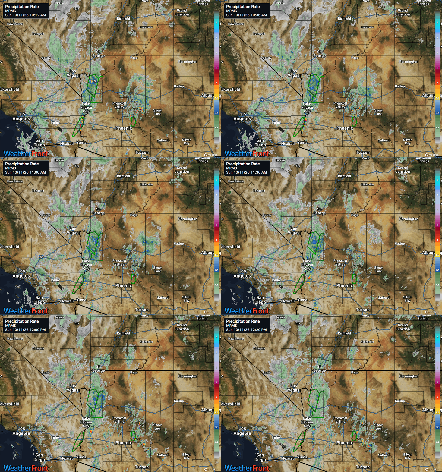
Bands of showers and thunderstorms will continue to rotate around the north and east sides of the remnants of Rachel, and with tropical moisture in place and atmospheric support from the strong upper level trough of low pressure in the region, very heavy rainfall and flash flooding — potentially significant — is likely to occur in some areas.
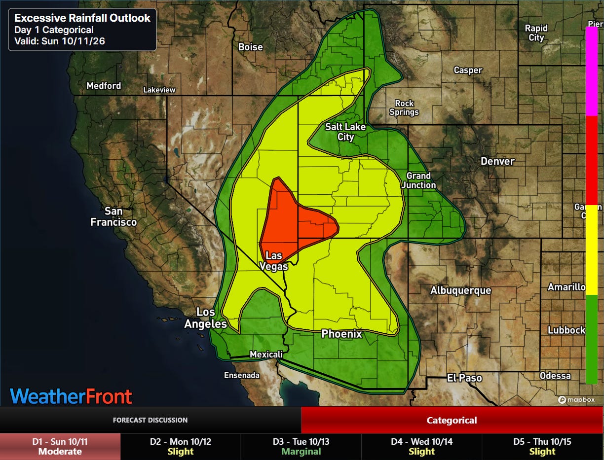
The NWS Weather Prediction Center excessive rainfall outlook highlights the areas with the greatest risks through Monday morning, including a moderate (level 3 of 4, red) area from the Las Vegas metro area northeast.
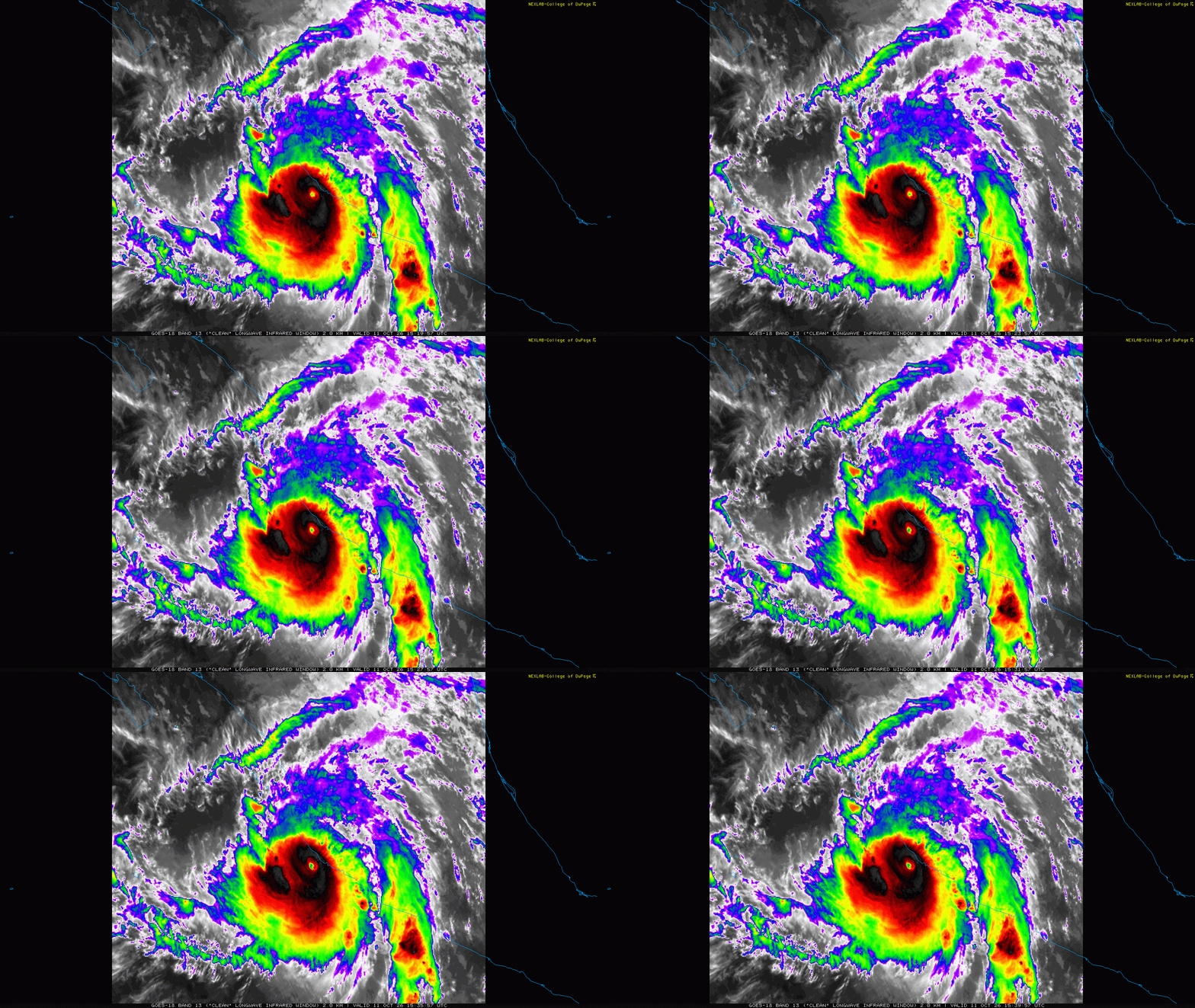
The other major eastern Pacific tropical impacts are occurring along the Mexican coast from Manzanillo to Puerto Vallarta, where category 4 Hurricane Simon is lashing the area. As we discussed yesterday, the forecast for Simon is particularly challenging as it moving nearly parallel to the coast and both the storm’s intensity and its resulting impacts hinge upon whether the track is inland or just offshore. So far, the eye of Simon has remained just offshore, but the particularly damaging east side of the hurricane is impacting the coastal areas in this region with potentially catastrophic high winds, storm surge and flash flooding.
![[Key Messages]](https://substackcdn.com/image/fetch/$s_!SUso!,f_auto,q_auto:good,fl_progressive:steep/https%3A%2F%2Fsubstack-post-media.s3.amazonaws.com%2Fpublic%2Fimages%2F95207f85-64b4-4c9d-9ab1-65975dd5867c_897x736.png "[Key Messages]")
NHC noted in their morning discussion how challenging the forecast remains given the uncertainty in how the track will interact with land, and that even without a direct landfall the complex terrain of western Mexico will likely interfere with the intensity of Simon in difficult to anticipate ways. Regardless, the hurricane is expected to continue to cause serious impacts as it passes near Puerto Vallarta and starts to slowly move north toward Mazatlan in the next couple of days.
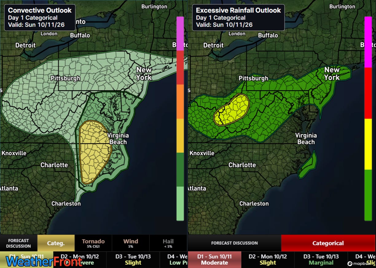
Heading east, the remnants of Isaias are now centered over eastern Kentucky, and will continue to produce a risk of flash flooding and severe weather across parts of the East. The greatest flash flooding risk (right graphic) should be over the central Appalachians where upslope flow could enhance rainfall intensity. The greatest risk for severe weather — including tornadoes and damaging straight line wind gusts — will be from the Tidewater region south toward Wilmington, NC.
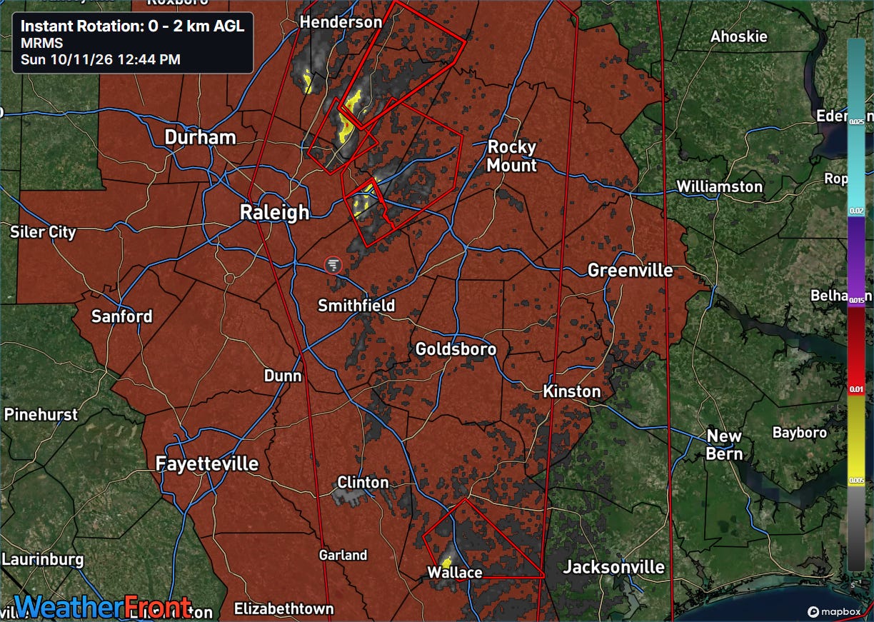
A number of severe thunderstorm and tornado warnings have been issued this morning across North Carolina, and at least one tornado occurred in Montgomery County where significant damage was reported to buildings. A tornado watch is in effect as shown above, and the Multi-radar Multi-sensor System (MRMS) rotation tracks product shows several areas of strong rotation within the band of thunderstorms moving across the region — several tornado warnings are in effect as shown by the red polygons. An additional tornado watch will likely be issued east of the current watch.
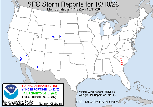
As I was talking about in real-time in the paid subscriber Substack Chat yesterday, Isaias produced a number of tornadoes yesterday from extreme eastern Georgia north into South Carolina. Several of these tornadoes looked quite impressive on radar and had defined tornadic debris signatures. Over 350,000 customers remain without power across the Florida Panhandle and southern Alabama from the intense winds Isaias brought to that region Friday night, and the death toll has risen to four.
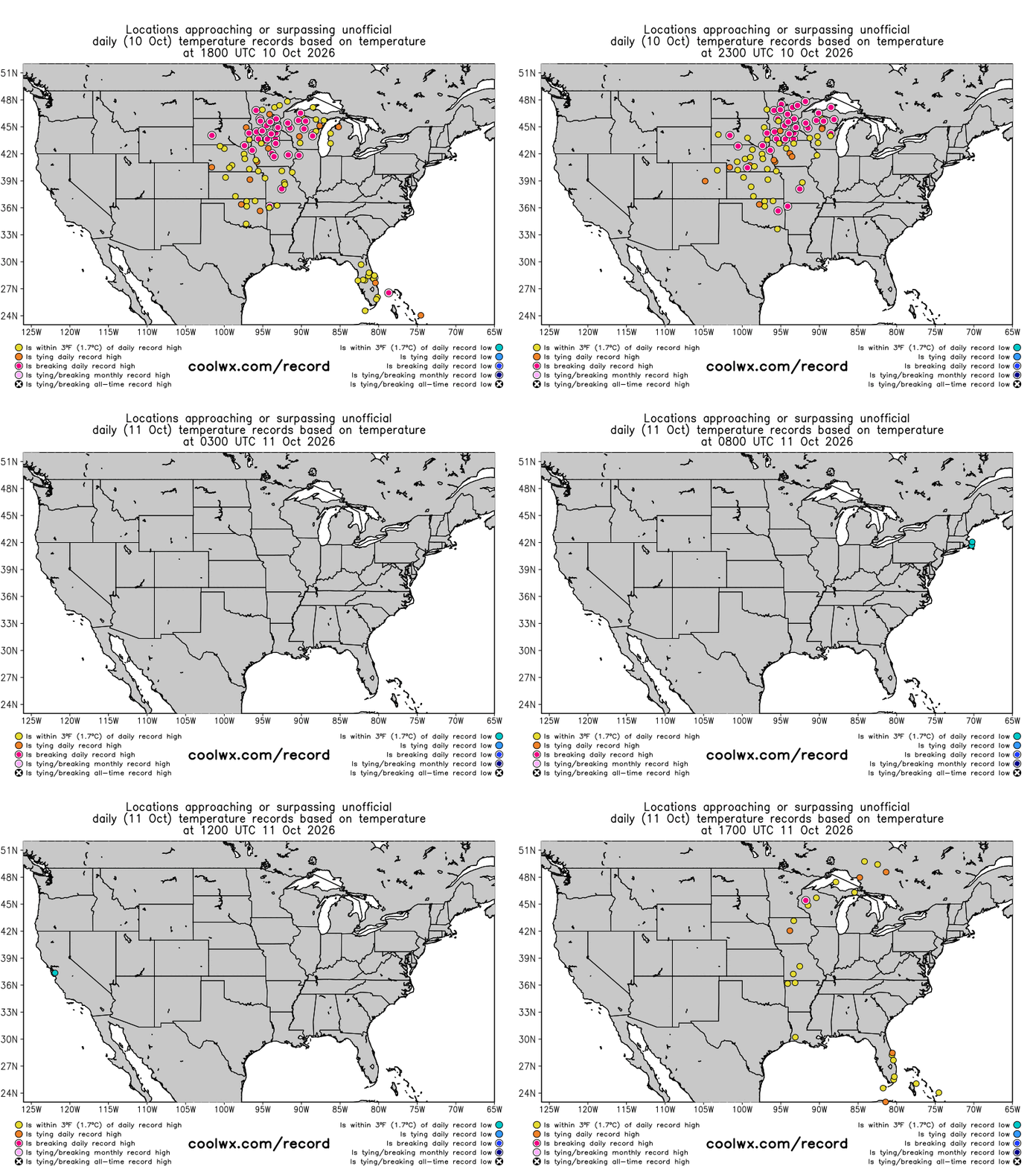
Finally, I have not really talked about the ongoing record warmth that has been occurring in the central part of the country, but even with everything else going on I have to highlight it as it is only going to intensify the next few days — and that will be after dozens of record high temperatures were set on Saturday as shown above.
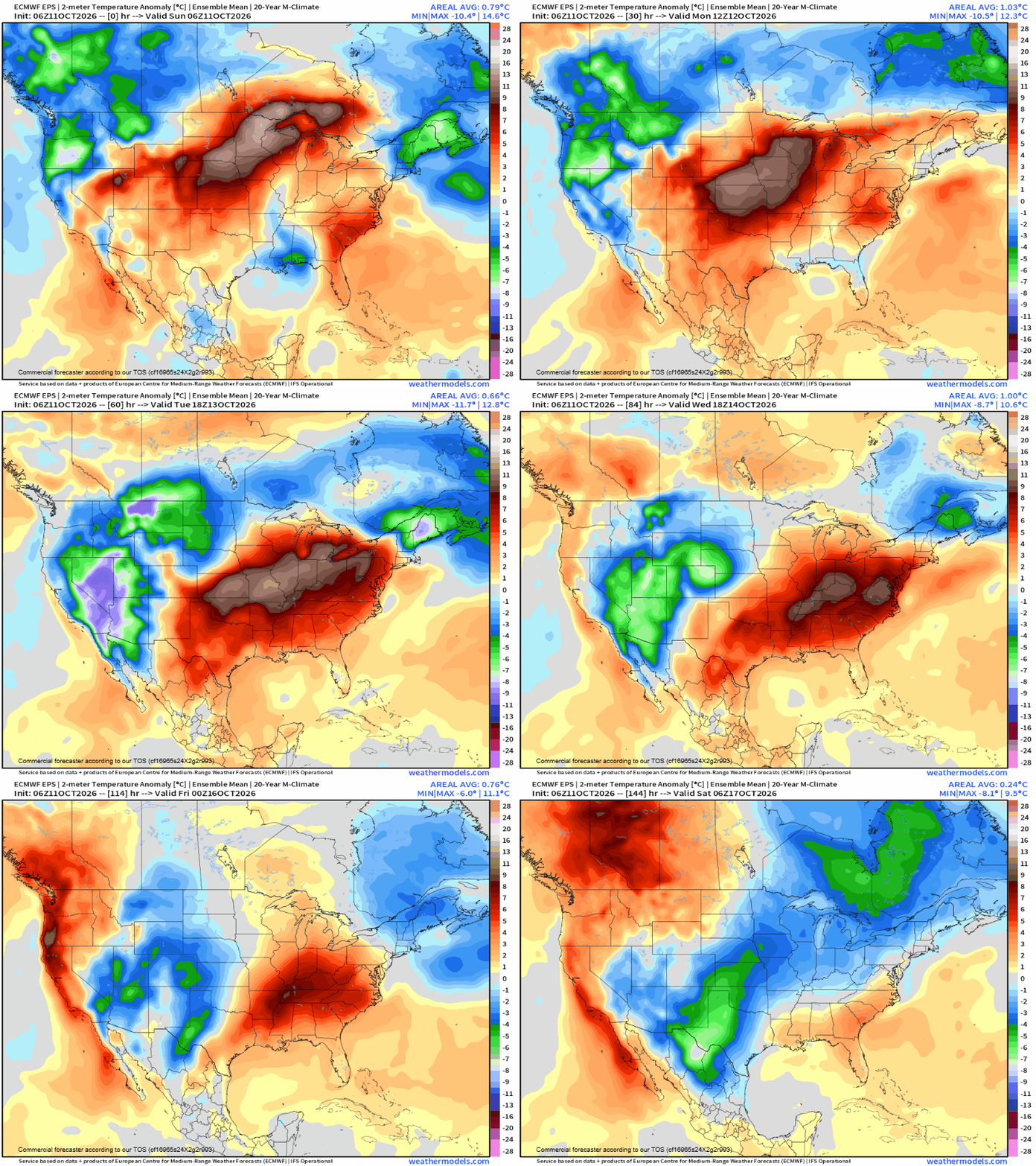
This animation of forecast surface temperature anomalies from the European ensemble shows how the anomalous warmth will build even further across the central United States into the middle of the week. Dozens of record warm temperatures — both maximums and minimums — are expected. Brainerd, MN tied their monthly record high temperature yesterday, and additional monthly record temperatures will be approached or set in the coming days.
I will be providing periodic updates about all of this between newsletters via social media, Substack Notes and Substack Chat (paid subscriber benefit).


Leave a Reply