
Another major hurricane looms in the eastern Pacific
2 minutes ago
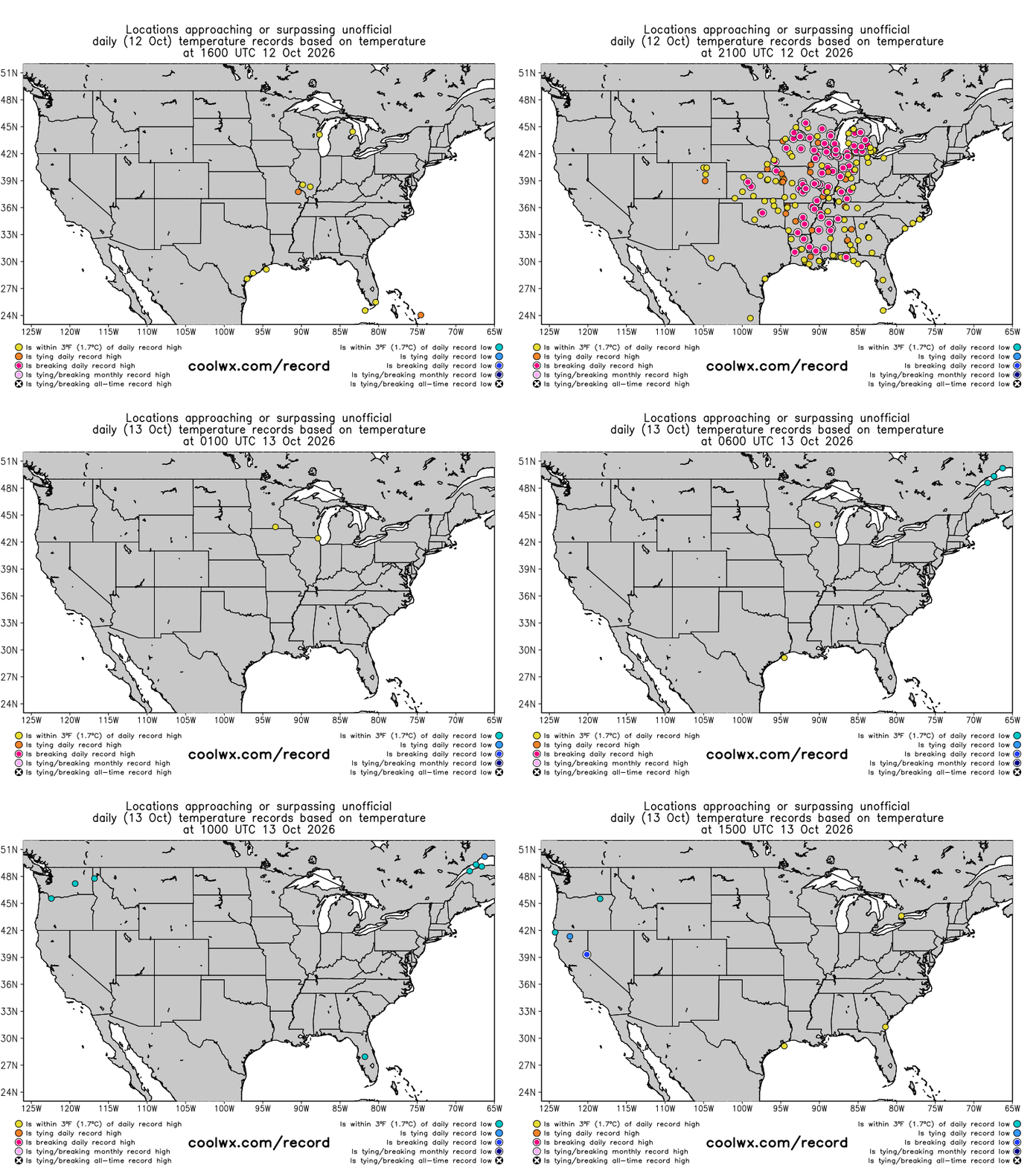
Monday was another very warm day across the central part of the nation, with numerous record warm temperatures — both highs and lows — set. The spatial breadth of the warmth was what was particularly impressive to me, with records set from the Great Lakes to the Gulf Coast. Long-time climate stations broke some very old records and/or broke their daily records by significant margins. 88F at Chicago broke a previous record of 84F set in 2008, 92F at St. Louis bested the previous record of 89F set in 1890, 91F at Nashville broke the prior record of 88F set in 1969, and Indianapolis hit 87F breaking the record of 86F set in 1879 (!).
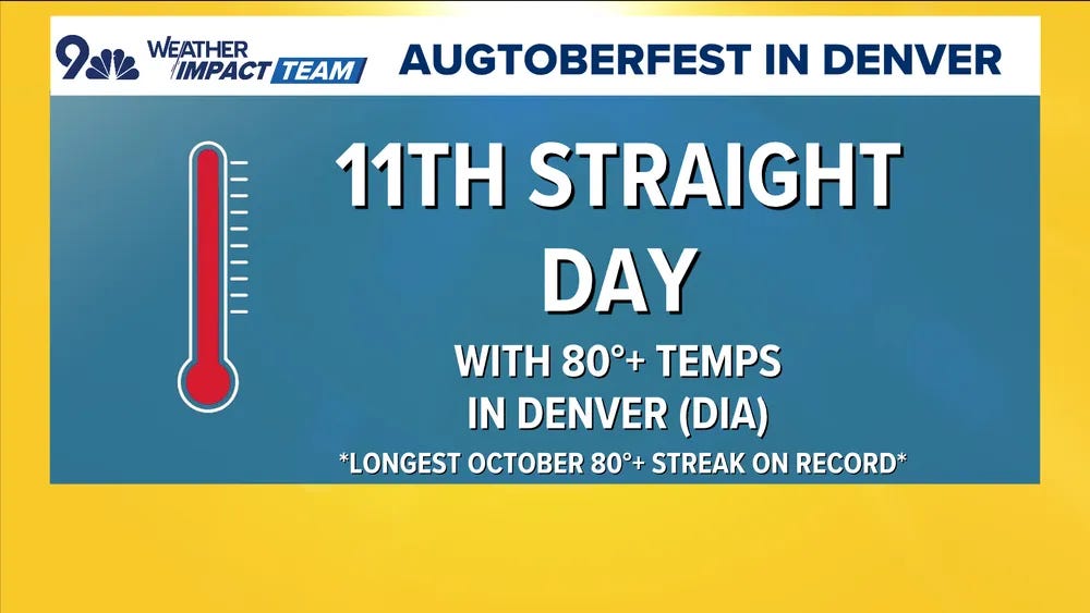
Denver hit 80F yesterday for the 11th straight day, the longest string of 80+ degree days on record (thanks to NBC Denver meteorologist Chris Bianchi for this factoid and graphic).
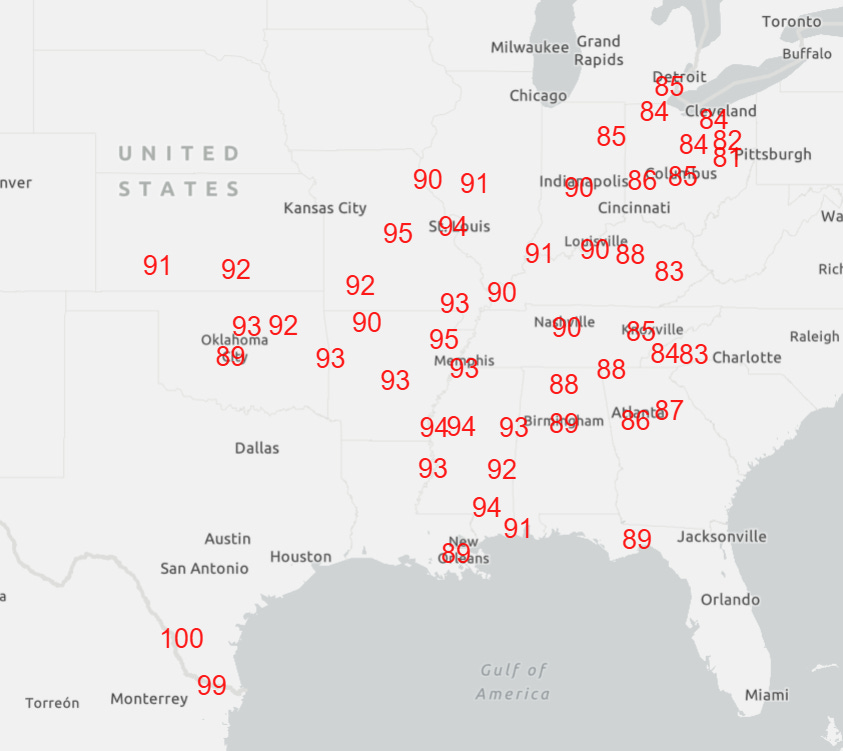
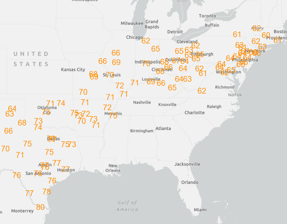
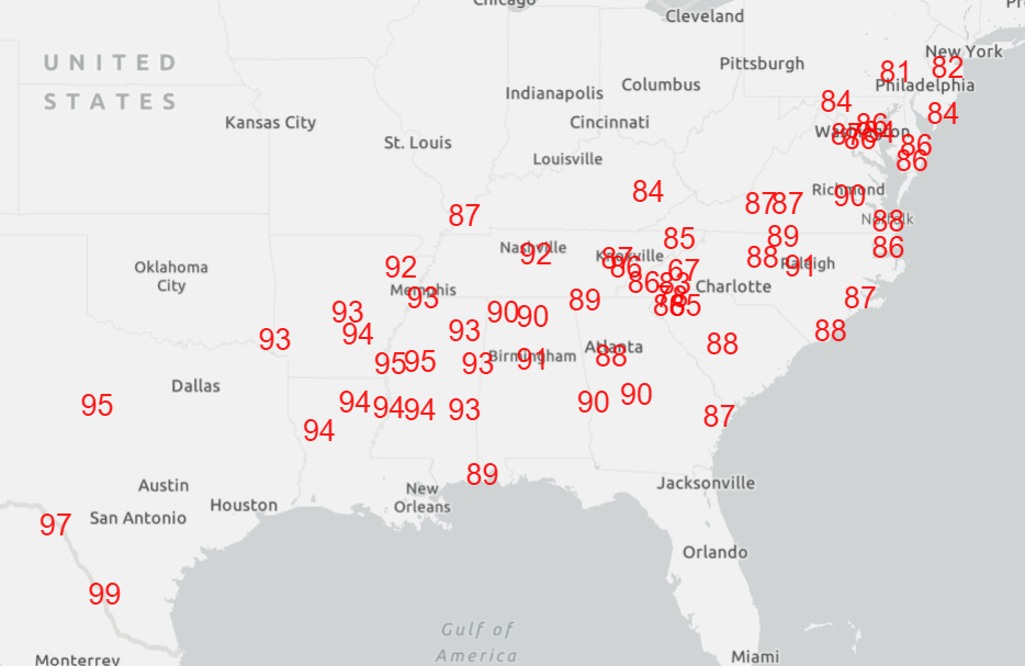
Expansive record warmth will continue the today and gradually shift/expand east and southeast into Wednesday.
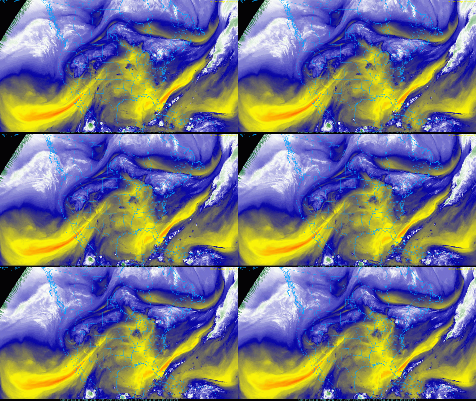
This morning’s animation of mid level water vapor satellite imagery shows how a change is brewing in the weather pattern across the country. A deep upper level trough of low pressure continues across the West, with an upper level low spinning across Utah and Colorado. To the east, we can clearly see moisture — the blue colors — being pulled northeast by this trough into the central United States from weakening Hurricane Simon southeast of Baja California.
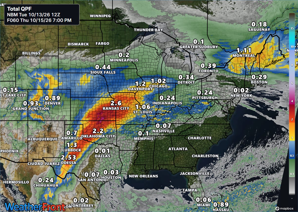
That moisture streaming north ahead of the trough will support widespread shower and thunderstorm from west Texas into the Midwest the next couple of days with moderate to heavy rainfall totals anticipated. Some risk of flash flooding will exist where storms move repeatedly over the same area — but much of the rainfall over Texas and Oklahoma will be welcome.
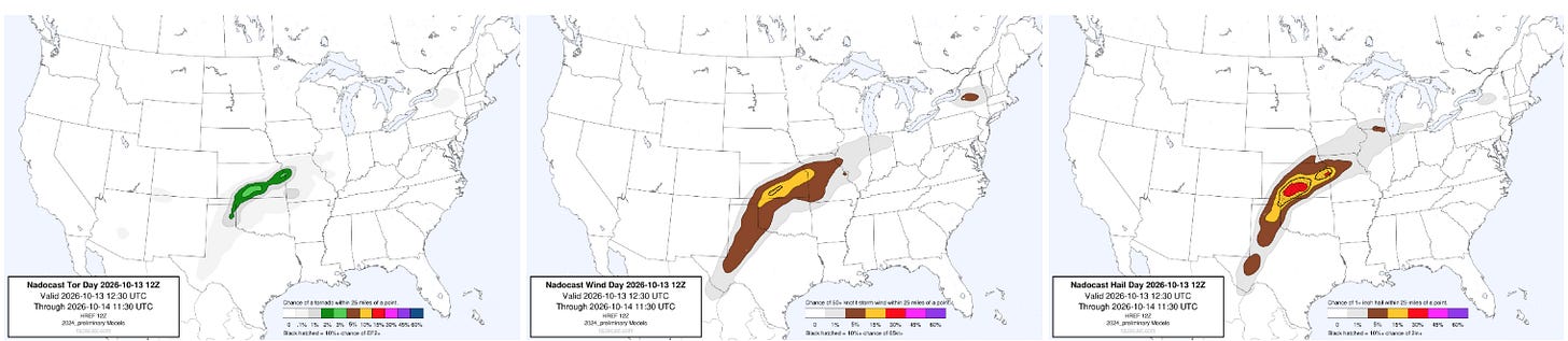
Strong upper level wind shear ahead of the trough will also support a risk of severe storms across the central part of the country into tonight.
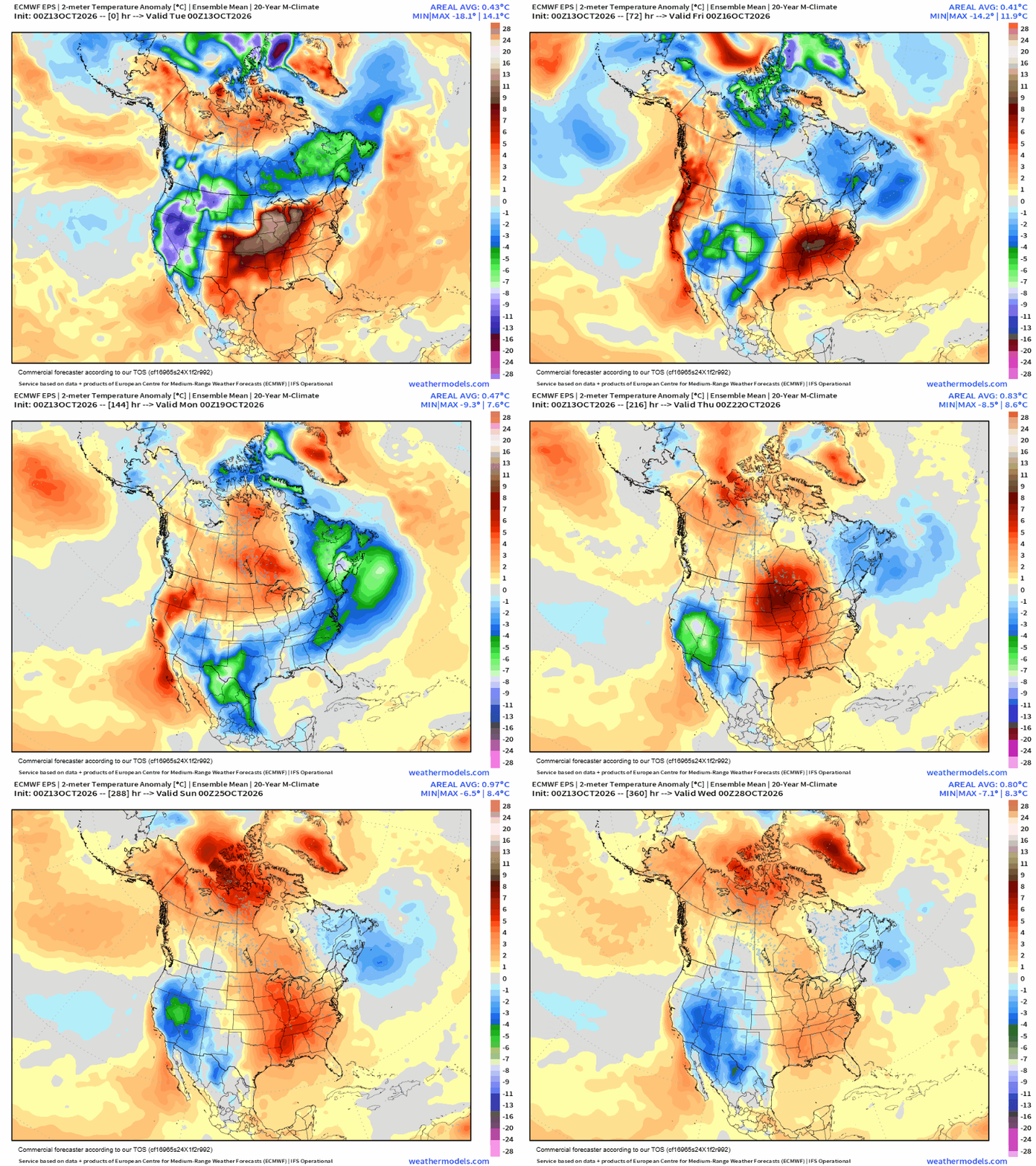
As the western trough finally shifts east and links up with an upper level trough dropping southeast out of Canada, cool air will drop east across the central and eastern parts of the United Stats. However, this looks to be a fairly temporary pattern shift, as unseasonably warm air will rebuild across western Canada and the northern Rockies and shift east into next week. This should result in a return to cooler and wetter weather in parts of the West and warmer than normal weather east of the Rockies next week.
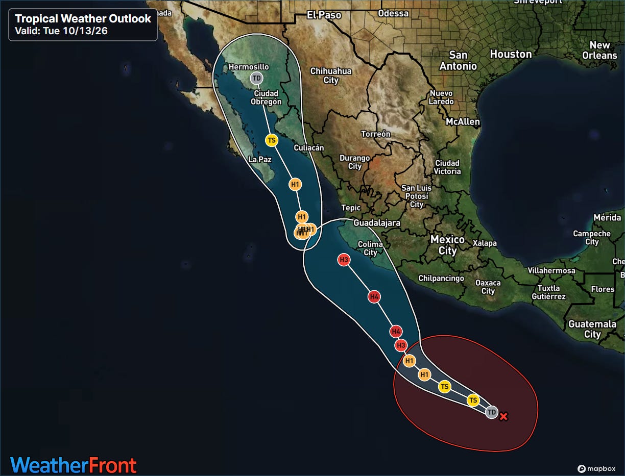
In the tropics, as usual this year the Atlantic is quiet and the Pacific is rocking. A farther west track of Hurricane Simon ended up panning out, and the slow movement of the hurricane and interaction with high terrain to its east has resulted in a weakening trend. The hurricane is expected to eventually be turned north by the trough of low pressure over the western United States, moving a weakening system into the Gulf of California as its moisture continues to stream north into the central US as discussed above. Meanwhile, Tropical Depression Twenty-one-E has formed southwest of the Guatemalan coast, and is expected to intensify into yet another intense, major hurricane and potentially threaten the Pacific coast of Mexico by this weekend.
I will be traveling on Wednesday so updates will be limited or missing. I will finally be back at home Thursday, and expect more normal posts to resume.


Leave a Reply