
More than 10” of rain in parts of Oklahoma leads to flash flooding. Critical fire danger in southern California the next couple of days.
3 minutes ago
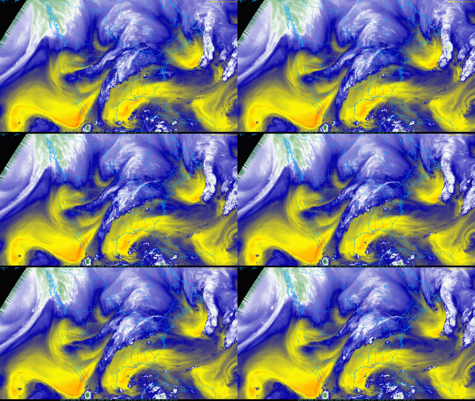
In Tuesday’s newsletter, I shared a continental mid-level water vapor infrared satellite loop showing how moisture was being pulled north-northeast from (then) Hurricane Simon into the central United States. This morning, that same animation is an even more compelling video, with an atmospheric river sort of feature clearly running from Simon north-northeast across the Southern Plains and into the upper Midwest.
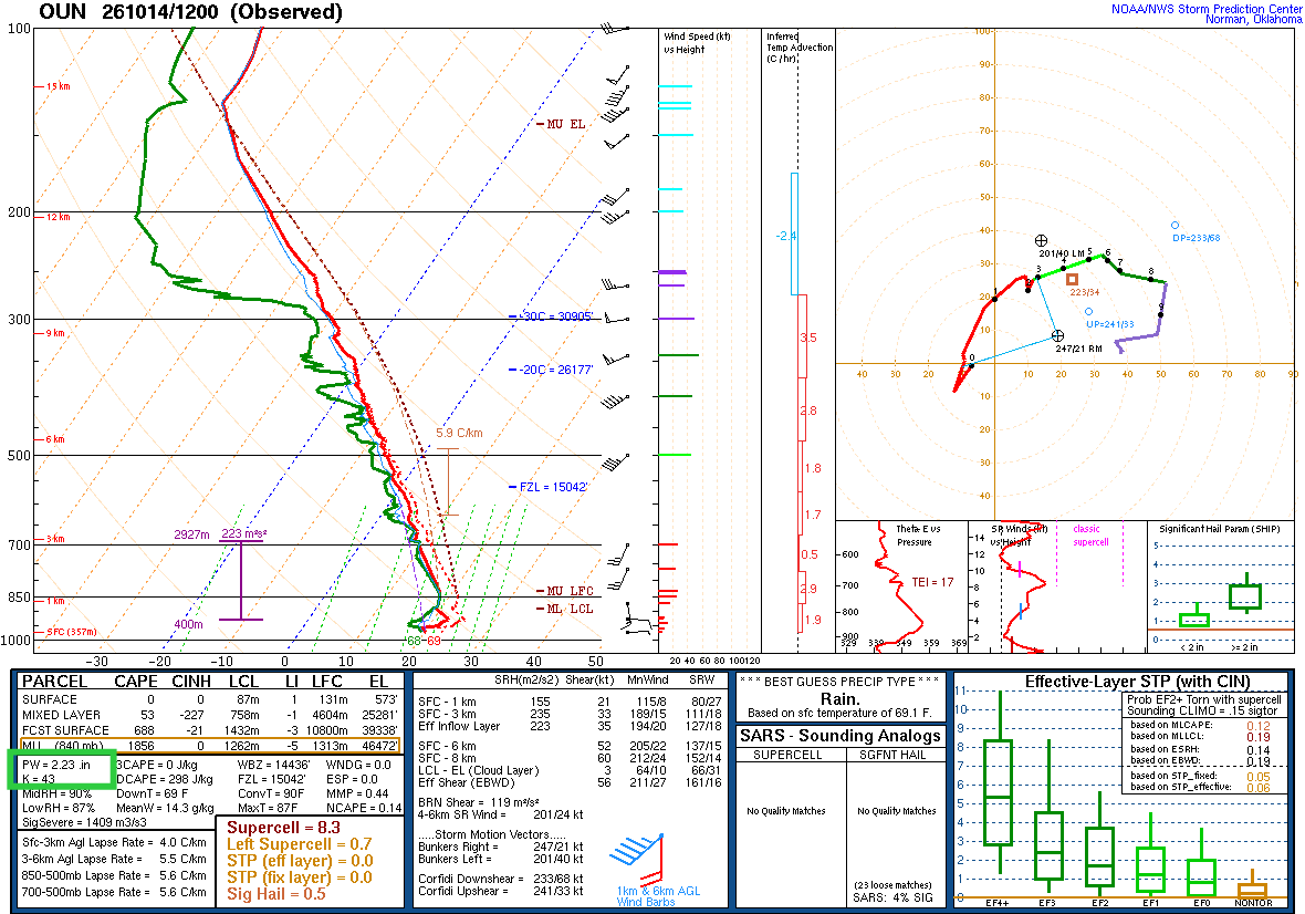
This has been a source of extreme tropical moisture for the region, with the Wednesday morning upper air balloon data from Norman, OK yielding an October record level of precipitable water (highlighted in green), the parameter that meteorologists use to quantify moisture through the depth of the atmosphere available for precipitation.
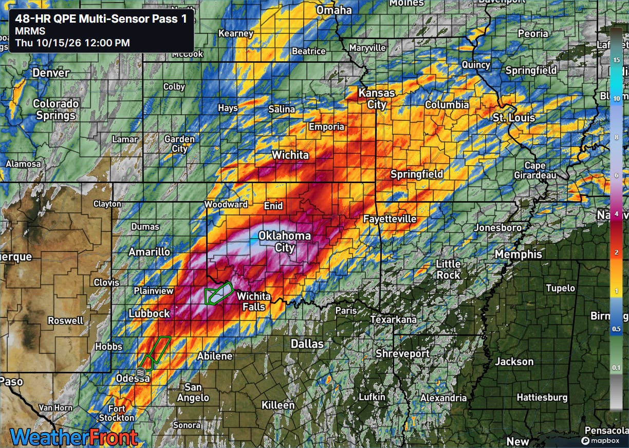
Not surprisingly, this tropical moisture has supported some impressive rainfall totals, with the Oklahoma Mesonet site at Hinton, OK west of Oklahoma City reporting 11.08” of rain in the last 2 days.
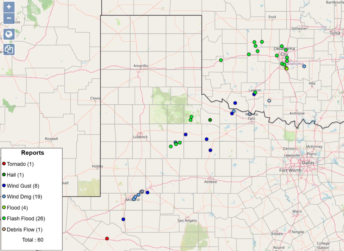
Most of that rain fell on Wednesday, when there were a number of reports of flash flooding from the OKC area west along the Interstate 40 corridor. A couple of complexes of severe storms also produced some wind damage and even a tornado southwest of Midland, TX.
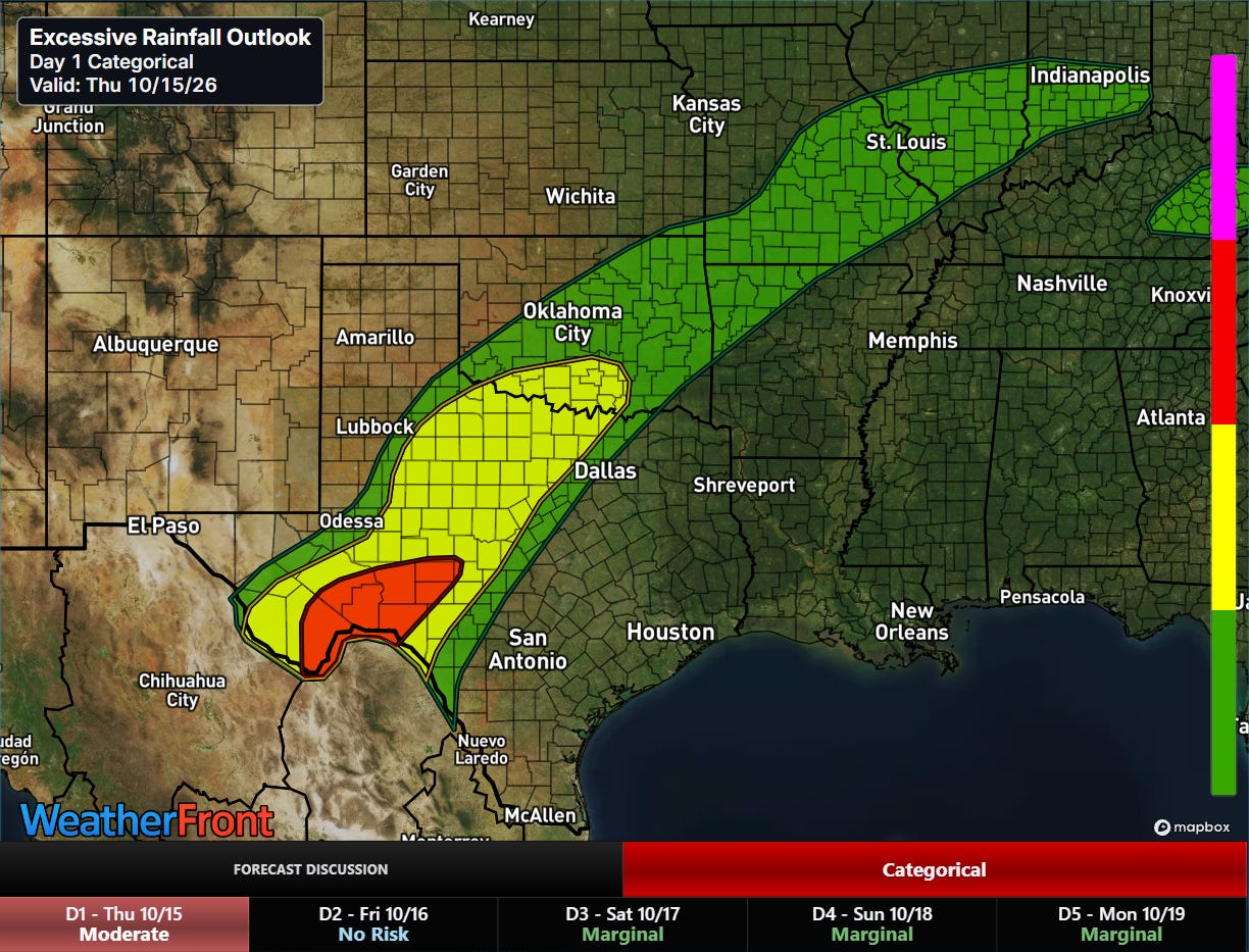
That stream of tropical moisture will continue to support heavy rainfall and potential flash flooding into tonight, with the greatest risk from the Red River southwest. A moderate (level 3 of 4) risk of flash flooding is in place for parts of southwest Texas.
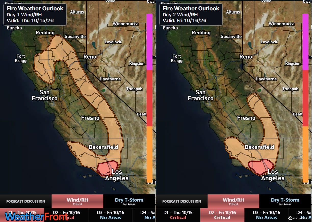
On the dry side of the moisture spectrum, strong and hot Santa Ana winds will cause elevated wildfire conditions across areas of California where significant rain did not occur last weekend with the remnants of Rachel. Of particular concern are areas on the northwest side of Los Angeles metro area including Oxnard and Santa Clarita where critical fire danger has been outlooked for the next couple of days by the Storm Prediction Center.
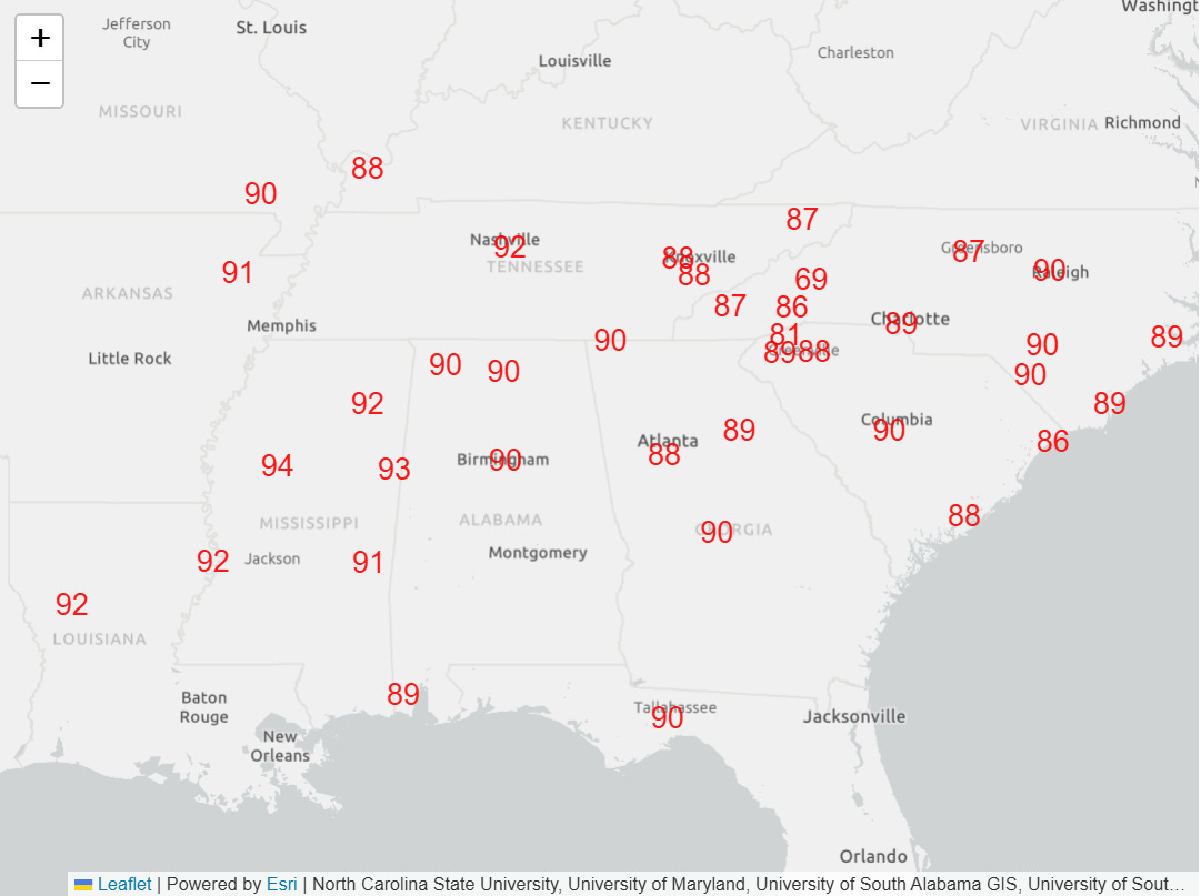
While a cold front was finally bringing an end to the prolonged period of record warmth across the central United States, numerous record high temperatures are expected ahead of the front again today across the Southeast.
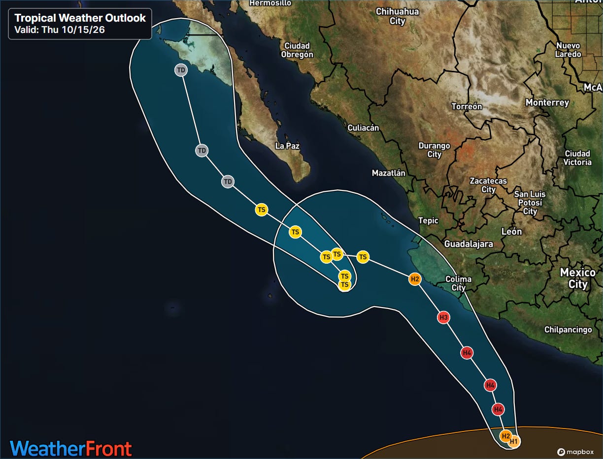
The Atlantic tropics remain quiet, although there are growing signs in the long range models that a subtropical or tropical system could evolve off the East Coast next week as discussed by my colleague Michael Lowry in his Substack post this morning. Trudy has been a bit slower to develop in the eastern Pacific than expected, but has now become a hurricane and is still expected to become an intense category 4 hurricane with potential impacts to the coast of Mexico. Simon has been a real forecast challenge the last few days — it is now a tropical storm and the forecast track has continued to shift west, with it expected to pass west of Baja California as a weakening system.


Leave a Reply