
CONUS weather quiet this weekend, but watching for potential subtropical development off the East Coast
3 minutes ago
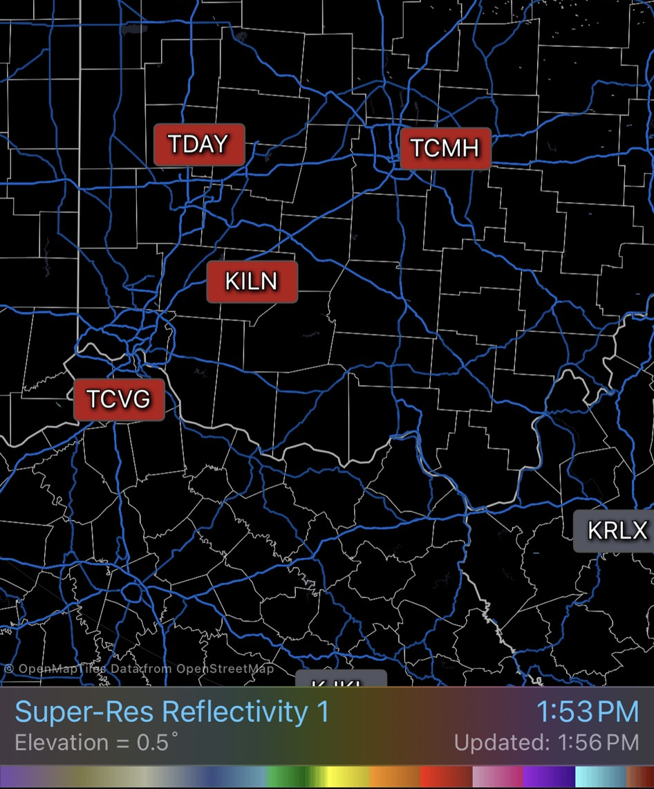
The NWS had another serious communications issue on Saturday. During the late morning the office at NWS Wilmington, OH lost communications and the ability to transmit products and data. The NEXRAD Doppler radar at Wilmington has been down for some sort of an actual maintenance issue since Thursday, but this comms issue also took out the capability for the office to transmit data from its three associated FAA Terminal Doppler Weather Radars and forced the NWS office in Jackson, KY to take over services for Wilmington.
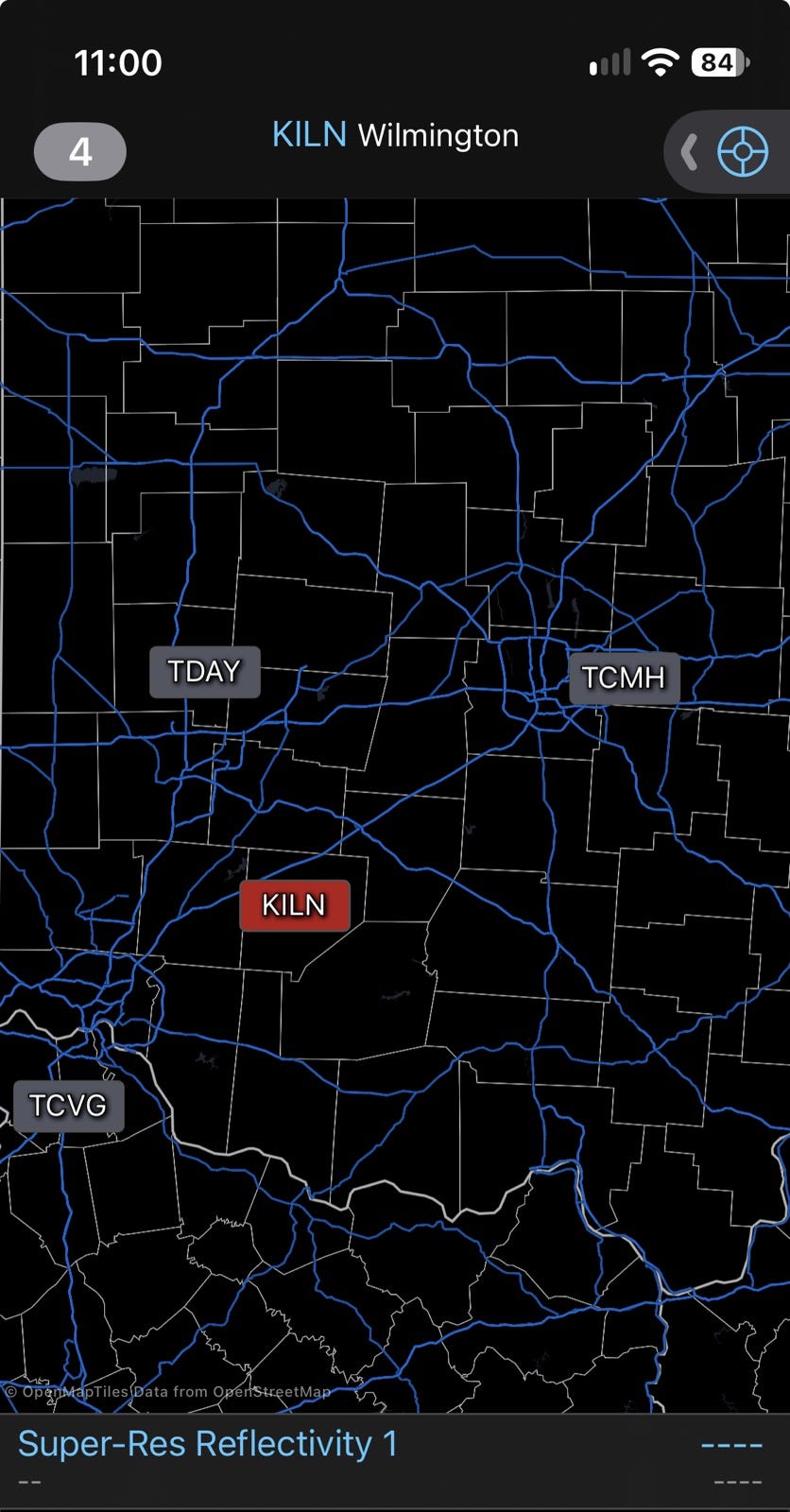
Based on the dataflow from the Terminal Doppler radars, it appears as though the comms issue was resolved sometime last evening. However, of course, the Wilmington radar data remains unavailable due to whatever problem is affecting the radar itself (shown by red KILN radar icon above). The Wilmington office appears to have some sort of a chronic problem with its network situation, as I have written about previous outages here including one in late March during a severe weather episode. Luckily, the weather yesterday was quiet, but along with the recent prolonged comms outage along the Gulf Coast just before Isaias all of this demonstrates ongoing NWS infrastructure issues.

3:37 PM · Oct 16, 2026 · 27.7K Views
2 Replies · 28 Reposts · 74 Likes
Another NWS issue was shared with me by a fellow retired colleague, as he sent me the above post from the X/Twitter account of the National Weather Service Eastern Region HQ.
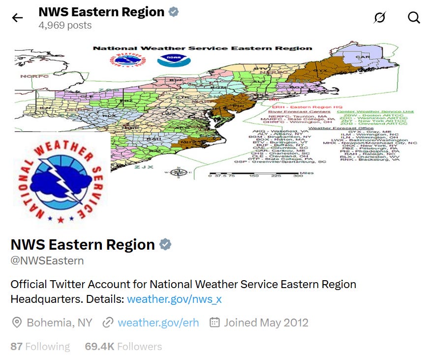
While such a post about an upcoming weather event from an NWS entity might seem unremarkable, the problem is that NWS Eastern Region HQ does not exist anymore. The NWS has been going through an ongoing reorganization in recent months and eliminated its regional headquarters offices. I have raised concerns in past posts about the lack of transparency about this reorganization, with a glaring example being the NWS still having a full website for the Central Pacific Hurricane Center in spite of the fact that center was (based on info from colleagues still in NWS) eliminated as part of this ongoing restructuring.
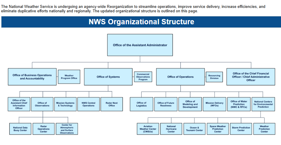
The NWS has posted on their NWS Headquarters website a high level organizational chart that provides some perspective on the new organization. While I certainly have no difficulty believing that ongoing staffing and organizational challenges made worse by DOGE/OMB cuts in the last 18 months are complicating NWS efforts to make all the necessary changes to websites this reorganization necessitates, the fact that they continue to post from and operate sites that would appear to be defunct is concerning.
As I have mentioned before, colleagues that still work for the NWS have shared concerns with me about the rushed nature of this reorganization, lack of communication about it even within the agency, and potential negative impacts on NWS operations. Given the challenges that are publicly apparent with this reorganization, these concerns seem hard to dispute. Hopefully the NWS will be able to work through these challenges quickly — the agency is critical to our public safety, and a potential long winter of impacts from a record El Nino looms.
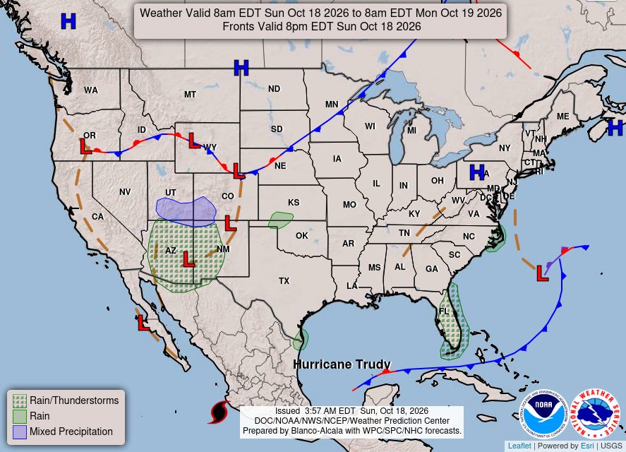
Luckily, we are not seeing any of that impactful weather today, as the NWS Weather Prediction Center forecast map today is as quiet as we have seen in a while.
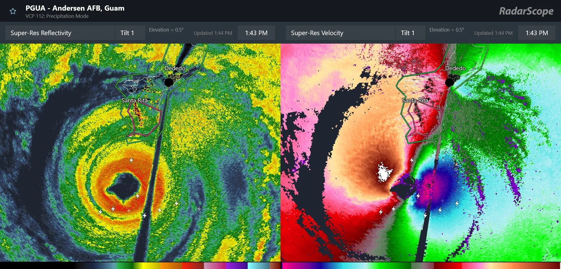
The eye of intense typhoon Champi did pass very close to the southern tip of Guam yesterday, but luckily it was just far enough south to keep the most intense conditions of the eyewall just offshore. This spared the island from catastrophic impacts, though high winds, power outages and heavy rainfall did still occur.
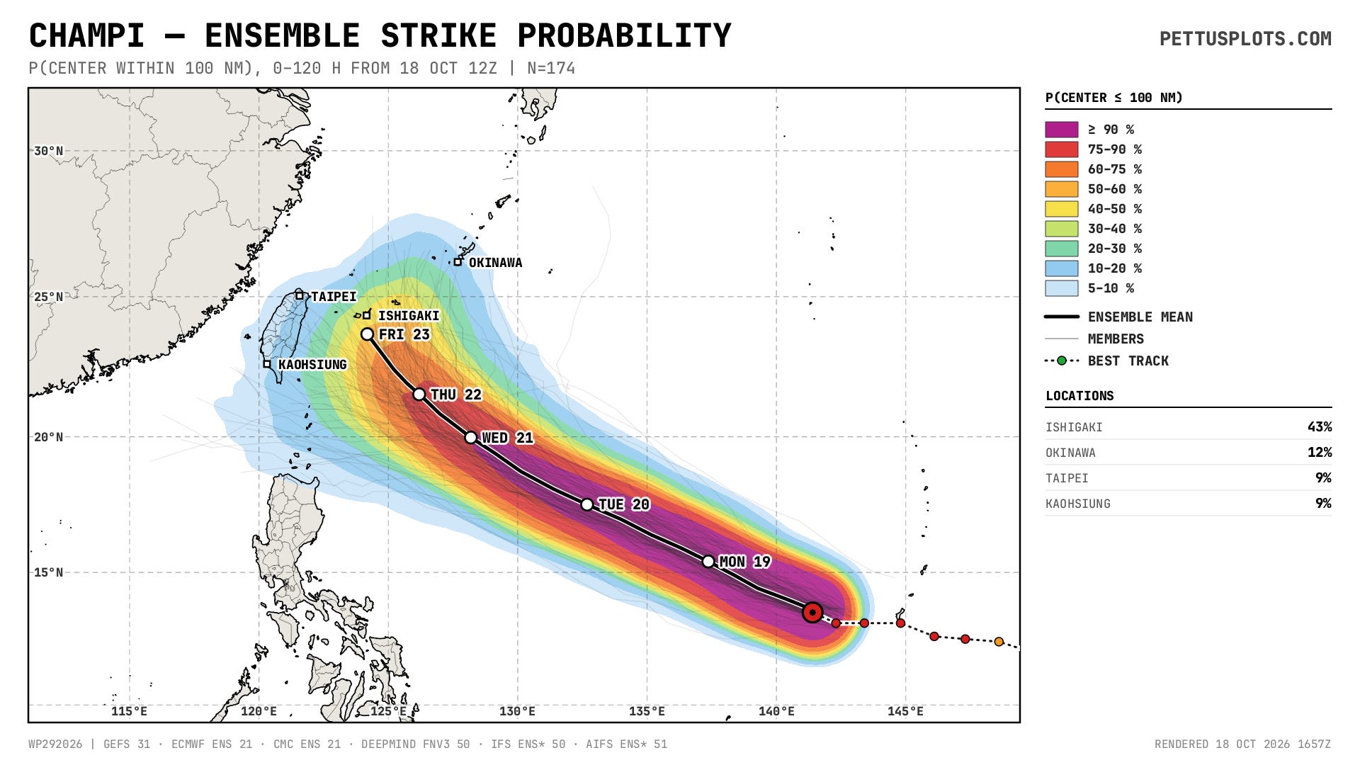
Champi is expected to remain an intense typhoon for the next several days as it moves west-northwest, with a bifurcation in track potential toward the end of the week, with one scenario continuing a west-northwest track toward Taiwan and China and another turning more north-northeast toward Japan. My colleague Dan Reilly has a great discussion of the scenarios in his post this morning.
![[Image of cumulative wind history]](https://substackcdn.com/image/fetch/$s_!yEqy!,f_auto,q_auto:good,fl_progressive:steep/https%3A%2F%2Fsubstack-post-media.s3.amazonaws.com%2Fpublic%2Fimages%2Faa967a40-8da1-4dc2-a8d7-c1bc59a403b9_897x656.png "[Image of cumulative wind history]")
Trudy is a 105 mph hurricane in the eastern Pacific and is making its closest approach to the coast of Mexico with strong winds, coastal flooding and heavy rainfall. It will begin to start moving farther away from the coast in the coming hours.
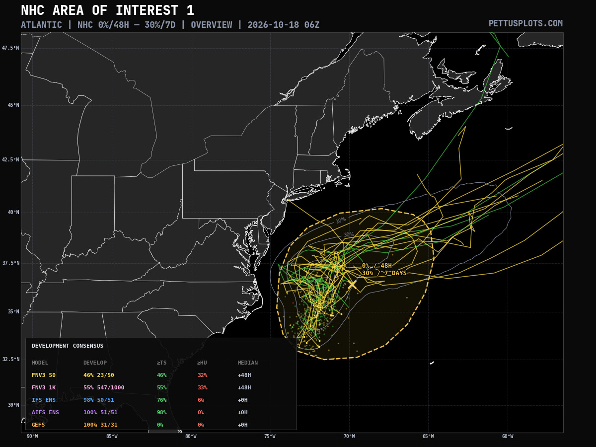
The National Hurricane Center is now highlighting the area off the East Coast that we have been discussing for potential tropical or subtropical development. This excellent graphic from PettusPlots.com shows that more than half of the 1000-member Google DeepMind AI ensemble show development of tropical or subtropical storm, with a significant number showing hurricane force winds.
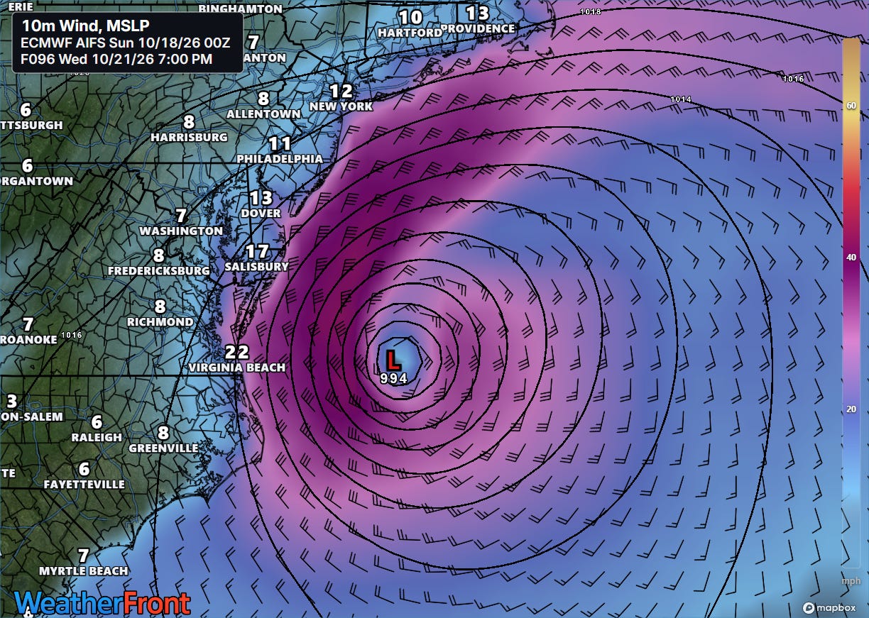
Even if this system obtains some tropical characteristics, it will likely be more of a hybrid type system with the strongest winds on the west and northwest side.
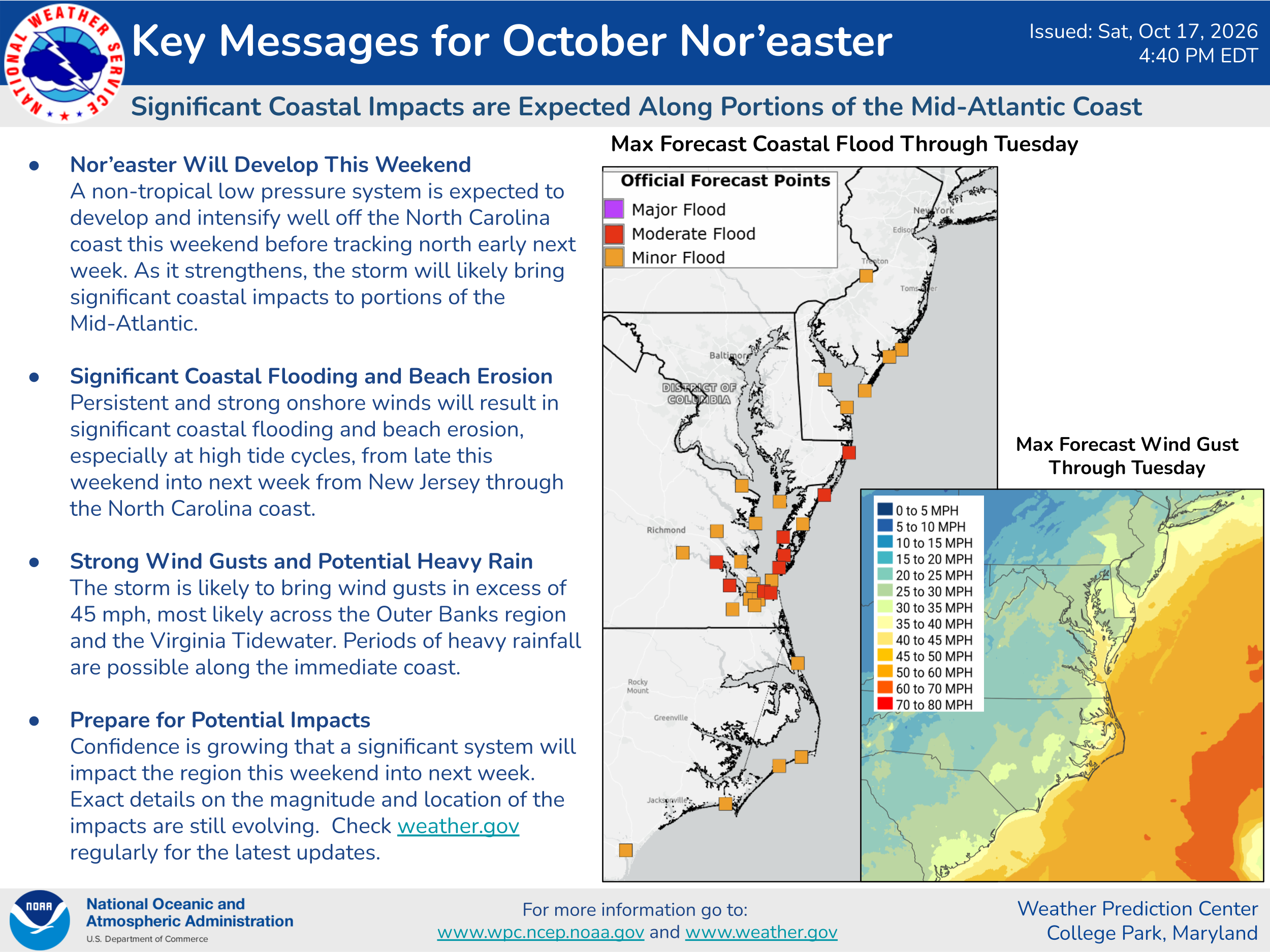
The exact impacts will depend on how intense the system gets and how close to land the track ends up being, with the peak in impacts likely to come toward midweek.


Leave a Reply