
Supercells produce several tornadoes and hail up to 2” in diameter
4 minutes ago
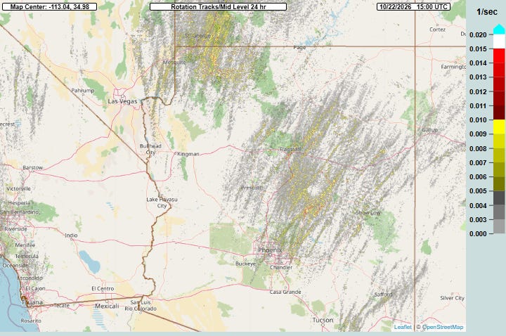
As anticipated, yesterday was a very active day of thunderstorms across Arizona and nearby areas. This 24 hour accumulation of rotation tracks from NSSL’s Multi-radar Multi-sensor System (MRMS) shows the path of numerous rotating supercell storms that moved across the state.
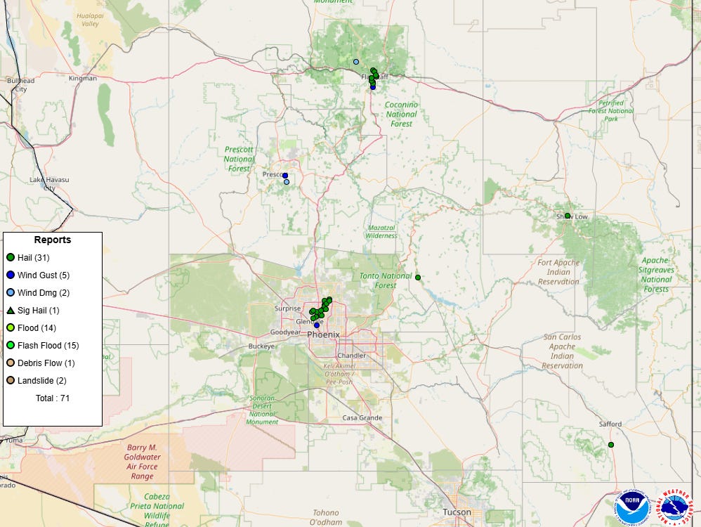
Rotating supercell severe storms are the most intense and organized type of thunderstorm, and the one that produces most of the tornadoes and very large hail across the country. Unsurprisingly, there were numerous reports of large hail Wednesday as supercell storms impacted the Phoenix and Flagstaff areas — and while there are no tornado reports currently on the official SPC reports map, chaser reports and radar data tell us that at least a few tornadoes occurred in Arizona on Wednesday and Wednesday night.
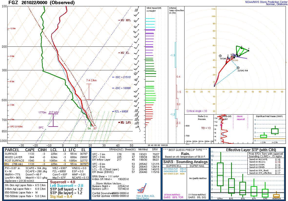
The evening upper air balloon data from Flagstaff showed a very favorable atmosphere for tornadic supercells, with relatively high levels of instability and strong low level wind shear. While supercells do occasionally occur over the western United States and particularly Arizona, such favorable conditions for tornadic supercells is rather rare. As I mentioned in yesterday’s post, the tornado watch over the northern Arizona was the first since October 2010, when an even more intense episode of supercells caused hail up to baseball size and the largest tornado outbreak ever west of the Continental Divide.
The tornadoes started early in the day as my colleague David Blanchard in Flagstaff shared this radar data from a confirmed tornado northwest of Flagstaff in the early morning hours.
Later in the day, supercells with hail up to 2” in diameter and strong winds impacted the Phoenix metro area, particularly the north and west sides of the region. Significant damage to vehicles and homes from the hail was reported.
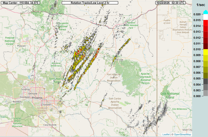
Supercells focused northeast of Phoenix Wednesday evening, as shown by the 2 hour MRMS rotation tracks product from 9:30 pm CT.
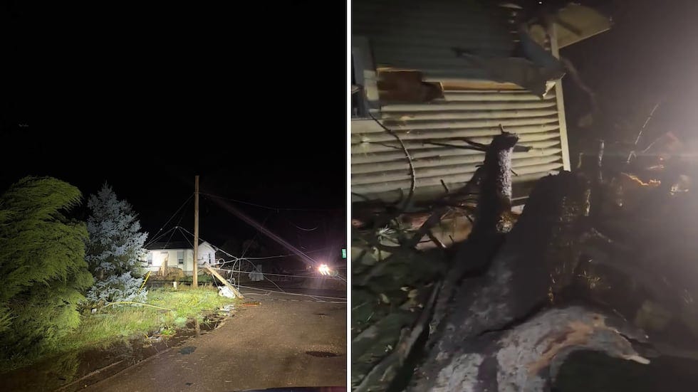
Unfortunately, one of these supercells took advantage of the favorable environment shown by the Flagstaff balloon data to produce a damaging tornado near the community of Heber-Overgaard. A number of homes and buildings suffered significant damage, and at least one person was injured.
One of the residents whose neighborhood was damaged said, “I had no warning whatsoever,” she said. “It was just this horrible sound of wind and flying debris crashing against the house. And that was my first warning.” While such comments are not uncommon with tornado events even when there are warnings, there was discussion on my post yesterday about the NWS warning quality including this writeup from colleague Mike Smith about the storms earlier in the day. Unfortunately the warnings for this particular storm were problematic as well.
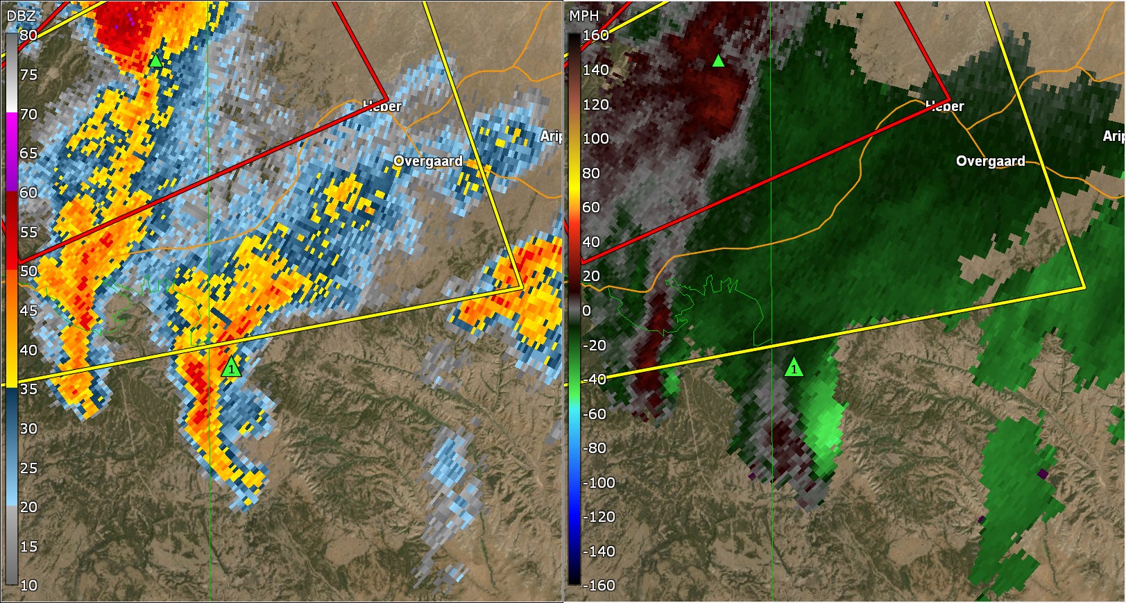
This is reflectivity and velocity data from the Flagstaff radar from 832 pm CT visualized in GRAnalyst software, and while there is a severe thunderstorm warning (yellow polygon) for Heber-Overgaard and a nearby tornado warning (red polygon), those are in effect for a different storm. The storm that would later produce the tornado in the community is the one to the southwest with the 1” green hail triangle icon near it.
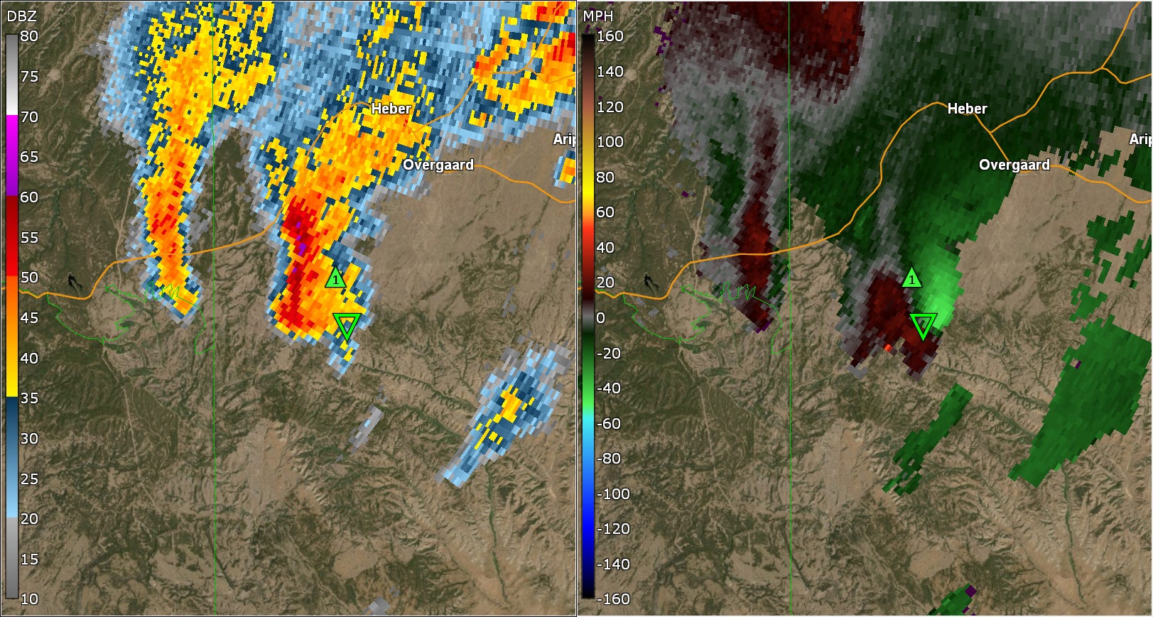
By 846 pm CT, those warnings have expired, and in spite of the fact that the storm approaching Heber-Overgaard from the southwest is clearly a strongly rotating supercell storm with GRAnalyst algorithms indicated a tornadic vortex signature and hail greater than 1” in diameter, there is no warning of any type in effect for the storm.
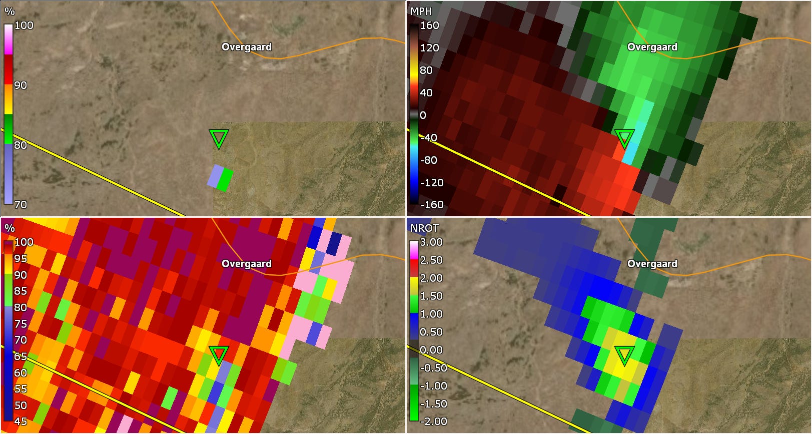
A severe thunderstorm warning was not issued until 858 pm CT as the storm was nearing Overgaard. This radar 4 panel at 859 pm shows intense rotation approaching Highway 260; the GRAnalyst Normalized Rotation product in the lower right shows values near 2, which are very high and indicative of the potential for a strong tornado. The correlation coefficient dual-polarization data in the lower left shows lower values coincident with the rotation, indicating that a tornado has likely already started and is lofting debris which the radar is detecting. The upper left panel is the GRAnalyst probability of tornadic debris, and has values of 70-80%.
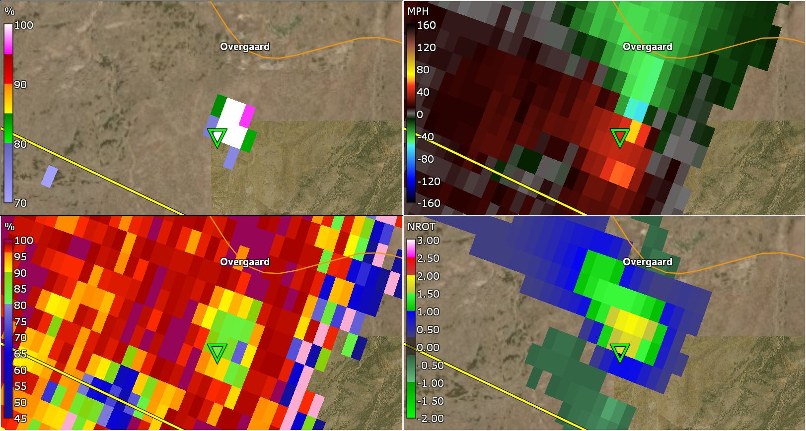
By looking at the next radar elevation up from the scan above, we can go forward a minute to 9 pm CT and see that now there is a clear tornadic debris signature with intense rotation showing a potentially strong tornado. The probability of tornadic debris in the upper left has reached 100%.
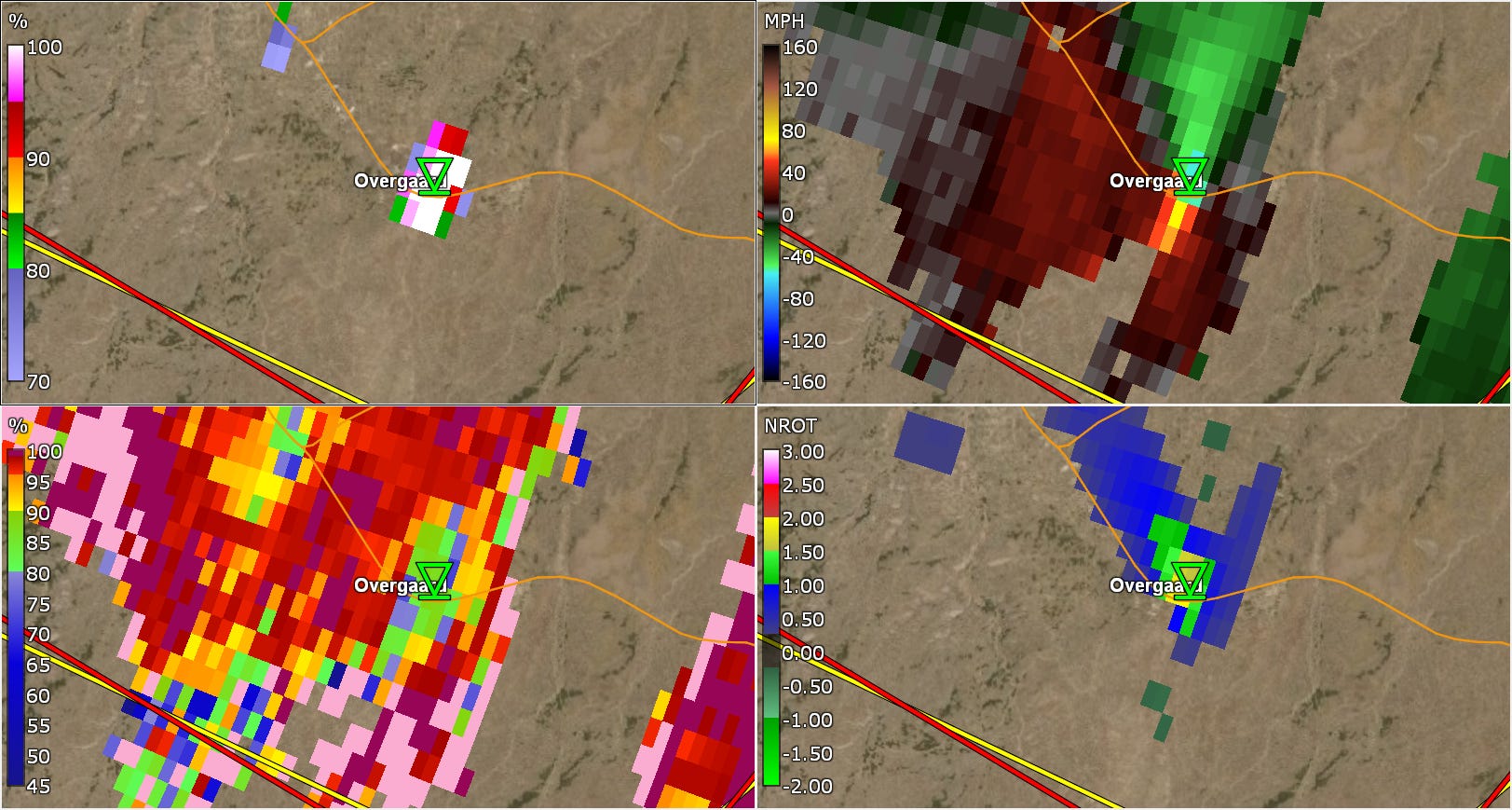
A tornado warning is finally issued at 902 pm CT, but by this time radar shows the tornado is already moving across Highway 260 in the Overgaard portion of the Heber-Overgaard community. It had already been in progress for at least 3-4 minutes based on radar data.
I have talked with some colleagues about yesterday’s warning situation in this region, and a common theme is that NWS offices in this part of the country rarely face such significant tornado threats and thus do not have much experience with warning operations for high end severe events. This is certainly true, and is something that I can remember being discussed when I was in the NWS in the early 2000s whenever rare events like this occurred. Back then, though, radar data was only available to the local offices and technology was much more limited. Today, the radar and observational data needed to issue quality warnings is ubiquitous, and the technology exists where NWS experts in any part of the country could issue warnings for a situation like this.
I know the NWS is utilizing a concept called “mutual aid” in which meteorologists in other offices help provide another set of eyes (for lack of a better term) by providing insight through online chat to meteorologists in NWS offices issuing warnings. My sense is that is helping things but clearly it was not sufficient to result in quality warnings yesterday. With today’s Wireless Emergency Alerts system and many government and private sector phone apps and services to notify people of tornado warnings, it has never been easier for people to receive tornado warnings, even in locations like Arizona where such warnings are rare. As a result, it is more important than ever for the NWS to provide quality, accurate warnings. I hope the agency looks closely at yesterday’s event in Arizona as an opportunity to take a deep look at their warning operations and make serious changes to ensure that every American has access to quality severe weather warnings when they need them.
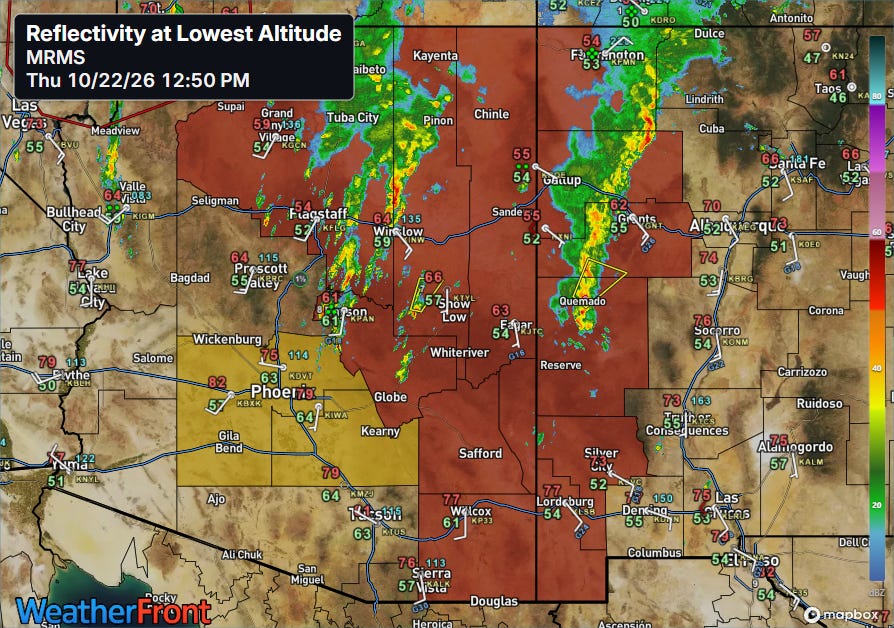
The impact weather in this region is not over yet, as conditions remain favorable for active thunderstorms, and tornado (red) and severe thunderstorm (orange) watches are in effect this afternoon.
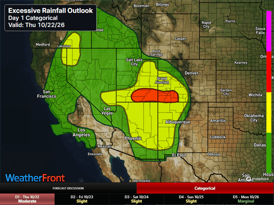
Flash flooding will also be a risk as well as moisture levels are unusually high with these storms.
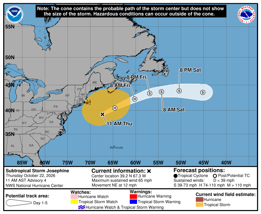
In the tropics, the system off the East Coast did in fact obtain enough tropical characteristics to become Subtropical Storm Josephine late yesterday. It will continue to move east-northeast away from the US coast and south of the Canadian maritimes the next few days.
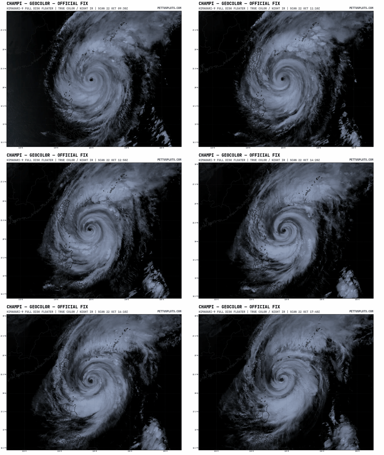
In the western Pacific, Champi has started to weaken. My colleague Dan Reilly has a great discussion of how that weakening will continue as the typhoon turns and passes north of Taiwan in what looks to be another significant “win” for AI hurricane guidance compared to the traditional physics-based models.
I will be sharing updates this afternoon and evening about the ongoing severe weather and tropical weather via Substack Chat (paid subscriber benefit) and on social media (Bluesky, Facebook and Substack Notes).


Leave a Reply