
How do we ensure top quality severe weather warnings?
10 minutes ago
I truly want to get to some of the actual high impact weather going on across the globe, and will do so later. First, I feel compelled to provide a bit more perspective about the issues I discussed in yesterday’s newsletter about issues with NWS severe weather warnings in the Southwest.
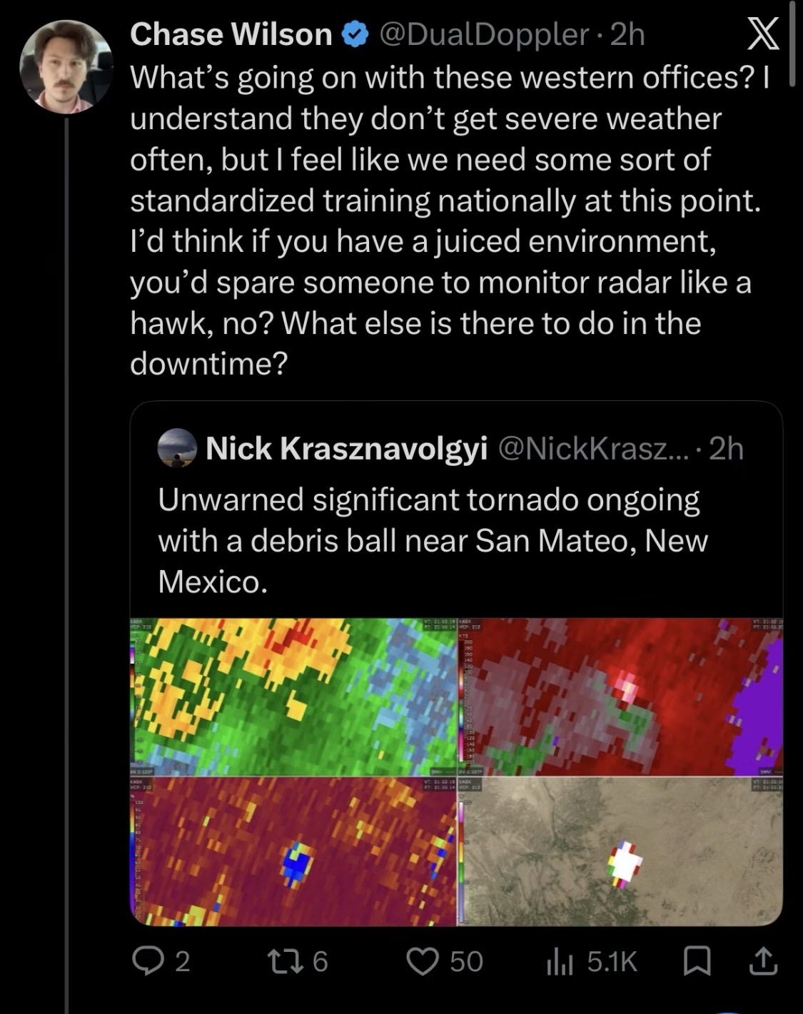
These issues have gotten a lot of attention around the meteorological and “weather enthusiast” community in the last 48 hours. I had a number of colleagues reach out to me yesterday with concerning examples other than the ones I analyzed and shared yesterday. There was a ton of social media conversation as well, including these posts about a clear tornadic debris signature on radar near San Mateo, NM that was unwarned.
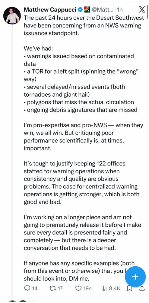
MyRadarWX senior meteorologist Matthew Cappucci posted this thread on X yesterday evening outlining his concerns about what he has been seeing. Given the ongoing conversation about the quality of NWS convective warnings (i.e., severe thunderstorm, tornado and flash floods), I want to make a few overarching points based on my experience.
First, these issues with NWS warnings are not specifically tied to the budget and staffing cuts of the last 2 years. As I discussed in a post back in March after the tornadoes in Michigan which raised concerns about NWS warning and forecast performance, a recent Department of Commerce Office of the Inspector General (OIG) report found that the NWS has “consistently fallen short of meeting performance goals for probability of detection and warning lead times” since 2011. While certainly the loss of experienced meteorologists due to the early retirements and buyouts of in 2025 did not help, the issues with NWS warning performance is not something that just started in the last few years.
I went into a lot of my concerns about the NWS warning program and why it has reached the state is in back in that March post, and I encourage you to go back to it if you want to learn more about that. For today, I just want to try to summarize two very high level agency problems that I think will need to be addressed if we want to see progress.
First, the NWS has to once again make short-fused warnings the absolute #1 focus of the agency. When I came into the NWS in the 1990s and the deployment of the new NEXRAD Doppler weather radar, I feel like there was no question that NWS leadership from the Director down made clear that the issuance of accurate, proactive tornado, severe thunderstorm and flash flood warnings was the top priority for the meteorologists — and that all of the support staff was there to help us meet that mission.
As warning quality improved through the early 2000s with the deployment of those new radars and the intense focus on training and research surrounding the Doppler radars and forecasts/warnings of short-fused hazardous weather, the priority on all of this started to slip. Other NWS operational priorities started to become the focus as the tornado warning program was “solved” — as I heard one very high ranking agency official say around this time.
The warning program continued doing fairly well living off the momentum of the 1990s and 2000s — but eventually if you no longer make something a priority, it starts to show. I sat in meetings late in my NOAA career and heard people say things like “we don’t have a requirement to improve tornado warnings.” Resources both for training new meteorologists on severe weather operations and keeping veteran meteorologists at the top of their game dwindled, and any tools to help improve warning operations were either slow to be implemented or sat on the shelf.
This brings me to my second point: the NWS operational structure of 122 forecast offices is no longer sustainable or even desirable. Back when the structure was implemented in the 1990s, there really was not a lot of choice: improving tornado and flash flood warnings was the priority, and the only way to leverage the new Doppler radar data that was coming online in support of that effort was to have warning and forecast offices located at or near those radars to utilize the data.
In 2026, that is no longer the case — the radar and observational data needed to issue high quality warnings is ubiquitous and fully available publicly. While knowledge of unique local weather phenomena and customers is obviously important and needs to be kept in the structure of the NWS, after 35 years in this business I am absolutely convinced that expertise is way more important in the issuance of quality warnings and forecasts than local knowledge. With our communications technology of today, there is no reason why the NWS cannot have an operational organization that keeps important local expertise and knowledge but also enables the development of cadres of true experts that can specialize in areas like severe thunderstorms, winter weather, fire weather, flash flooding, hurricanes, etc. We do not rely on general practitioner medical doctors to treat rare cancer, and there is no reason in 2026 we should be relying on general practitioner meteorologists to issue tornado warnings.
Finally, I want to comment on the fact that I have seen some of my colleagues commenting that people should not be publicly criticizing the NWS about these issues, but rather we should be trying to handle it internally. I appreciate this sentiment — but I have to say that based on my longtime experience in the federal government, I think this is a naive attitude. The reality is that senior government leaders prioritize what the public prioritizes, and if these issues remain “internal” to the weather community, they will not get addressed.
In my opinion, part of the reason why this issue has been allowed to fester as long as it has is that core NWS partners like emergency managers and broadcast meteorologists truly appreciate the NWS and its staff (as they should, the NWS is an incredible agency that I dedicated my professional career to and is filled with people from the top on down who truly care about their life-safety mission) and do not want to publicly criticize the NWS. But as the saying goes, “you get what you tolerate,” and without pointing out the shortfalls, they will continue.
I will conclude this by raising an analogy I truly think is appropriate. In my mind, NWS meteorologists issuing tornado and flash flood warnings are very similar — and just as important — as FAA air traffic controllers directing air traffic. Would we “tolerate” air traffic controllers not being able to do the basic aspects of their job to handle critical air traffic situations? I think the answer is clearly no — and I have to be honest that some of the warning issues I have seen not only in recent days but in recent months and years definitely rise to that level of concern.
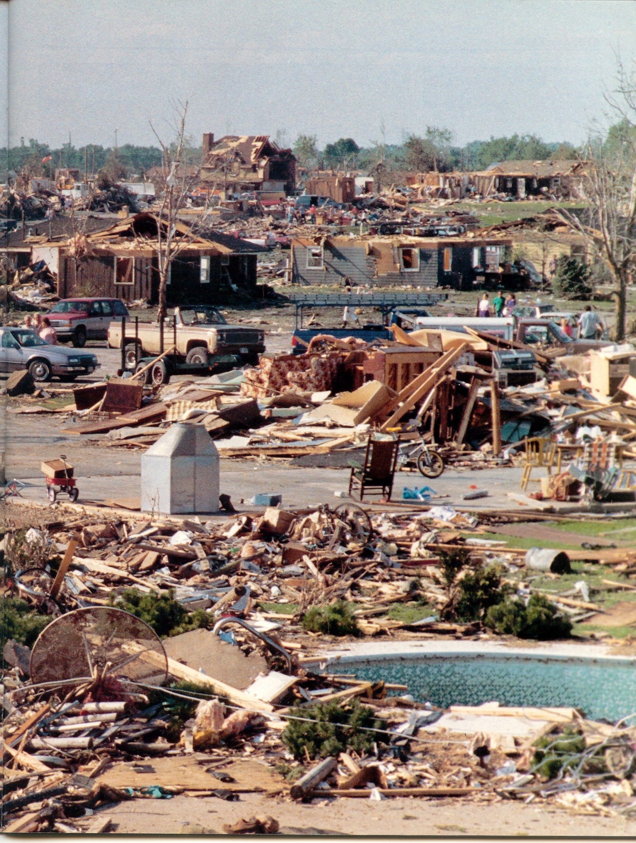
Back in 1990, an F-5 tornado struck Plainfield, IL, a Chicago suburb, without warning, killing 29 people. An NWS service assessment found numerous breakdowns in the warning program that day that led to this tragic loss of life — and many of the issues found in that assessment were addressed in the NWS modernization that came in the following decade. Myself and many of my colleagues are seeing alarming issues in the NWS warning program today. I think we should try to make people aware of them so they can be addressed proactively, rather than waiting for another event like Plainfield to force the needed changes and improvements.
I will have a weather focused post or video later today.


Leave a Reply