
Areas of north Georgia receive more than 8” of rain in 6 hours
just now
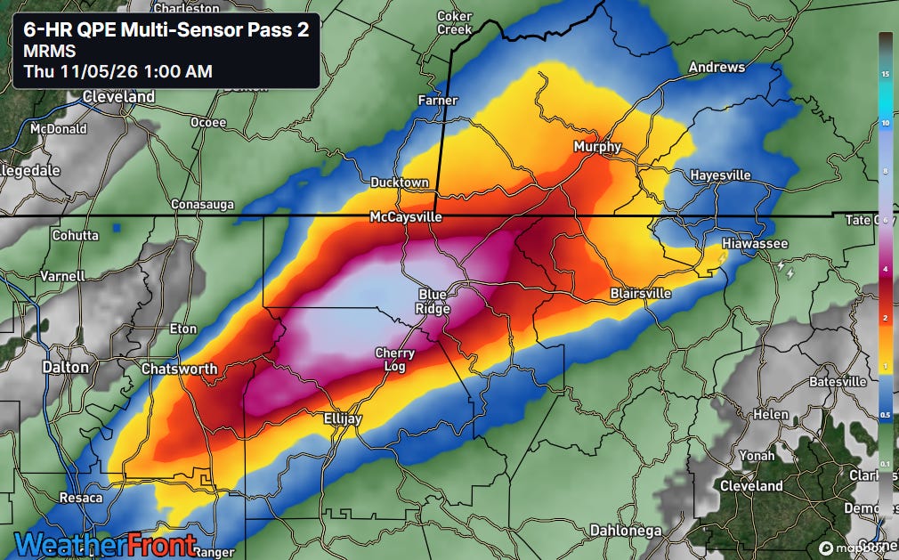
Another in what has been an ongoing series of record rainfall and flood events across the country occurred late Wednesday night into early Thursday morning, this time in the region where the borders of Georgia, Tennessee and North Carolina come together. A stalled out band of training thunderstorms produced more than 8” of rainfall in a small area of northern Georgia south of McCaysville.
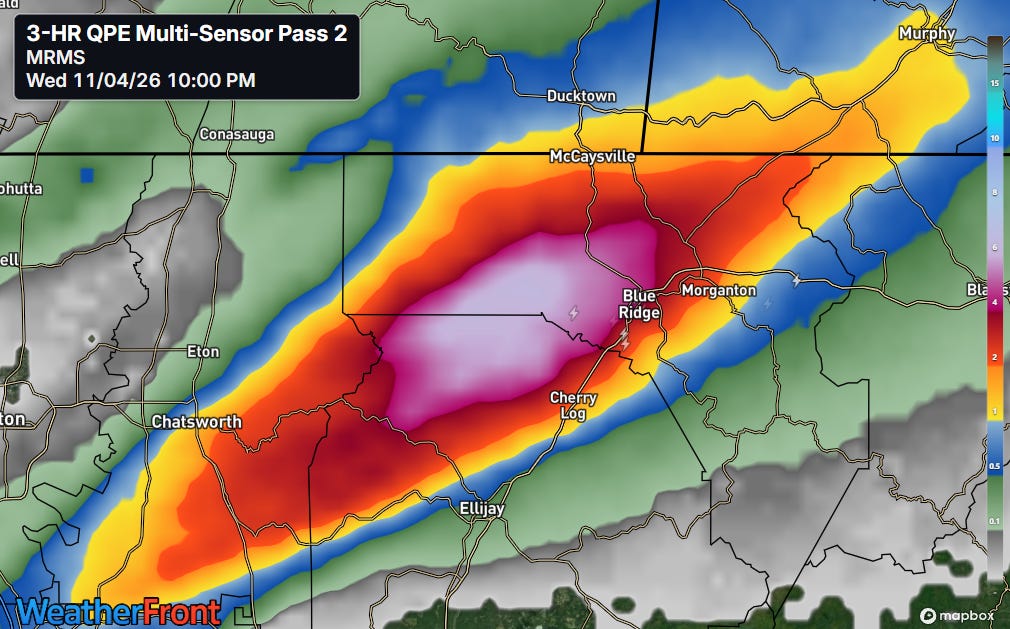
Most of the rain actually fell in a 3 hour period ending at 11 pm ET — NSSL MRMS multi-sensor estimates showed an area of a bit more than 6” of rain during the 8 to 11 pm ET period.
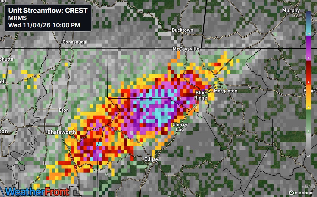
These intense rainfall rates over a few hours produced massive amounts of runoff as shown by the MRMS FLASH unit streamflow product which takes MRMS rainfall estimates and runs them through a hydrologic model to generate estimates of inundation. A large area of values greater than 10 — indicative of serious flash flooding — was collocated with the maximum rainfall estimates.
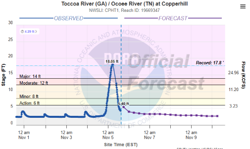
The Toccoa/Ocoee River basin (called Toccoa in Georgia, Ocoee in Tennessee) lies right in the heart of this rainfall, and river gauges demonstrate the unfortunate hydrologic response. The gauge at Copperhill shows a true flash flood, going from a base flow of 2.8’ at 6 pm before the rain started, to a record crest of 18.05’ less than 12 hours later.
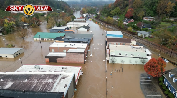
This resulted in catastrophic impacts in cities across the region including McCaysville and Blue Ridge in Georgia and Copperhill in Tennessee. Multiple water rescues by helicopter and swift water rescue teams have occurred, and response and recovery efforts are ongoing.
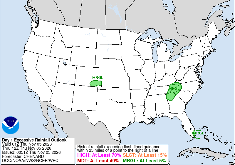
I mentioned in yesterday’s newsletter that there was a marginal risk of flash flooding in the Southeast, and indeed even as the heavy rainfall event was beginning, the Weather Prediction Center outlook only had a small marginal (level 1 of 4) risk of excessive rainfall and flash flooding in the area. However, it is important to realize that our severe weather and flash flood outlooks are probabilistic in nature, and low probability/high impact events can — and obviously did in this case — occur.
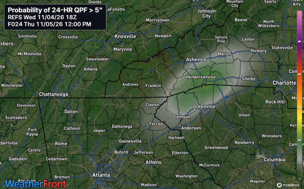
Looking back at some model forecasts, yesterday’s afternoon run of the REFS — the high resolution ensemble model the officially replaced the old HREF system earlier this week — did have a meaningful signal for 5” 24-hour rainfall probabilities in the general region. However, they were focused too far east, more in the Asheville-Greenville area.
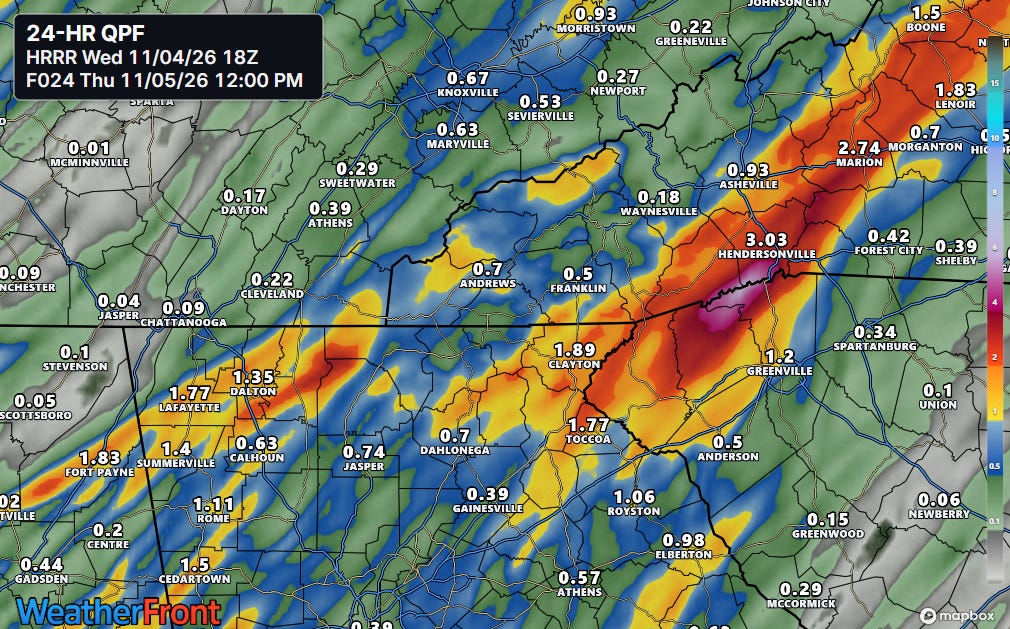
The deterministic version of the REFS — the RRFS — and the longer running High Resolution Rapid Refresh (HRRR) model (shown above) showed some localized heavy rainfall in the region of the flash flood. However, it was much less than what occurred, and like the REFS had the focus for heavy rainfall farther east along the border of the Carolinas.
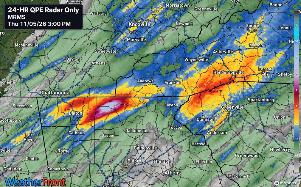
To be clear, heavy rainfall did occur in the area along the border of North and South Carolina, but the clear focus for the heaviest rain was farther west. In spite of the lack of a clear forecast signal, proactive flash flood warnings for life threatening flash flood impacts appear to have been issued by the responsible offices (Atlanta/Peachtree City and Knoxville/Morristown). Flash flood emergencies for catastrophic flooding were also issued for some of the affected areas in northern Georgia.
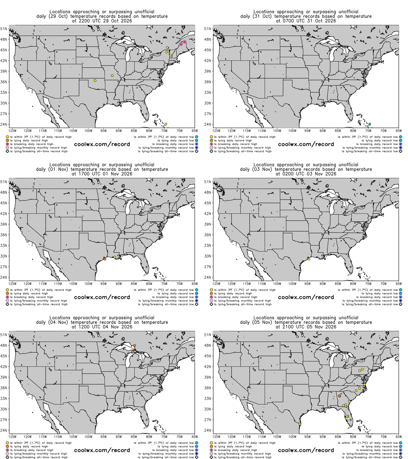
With all of the flooding that has been ongoing the last several days, I have not mentioned the record warmth that has been impacting parts of the Great Lakes and Northeast the last few days. Numerous record highs have been set with max temperatures reaching the 70s and 80s in some locations, including Barre, VT setting a November record with a high of 76F yesterday. Many record high minimums for the month were also set in this region and parts of eastern Canada.


Leave a Reply