
Central Pacific has yet another tropical storm
7 minutes ago
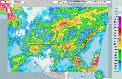
While major flooding in various parts of the country has been the dominant weather news story over the last week, it is important to realize that for many areas the heavy rain that fell was beneficial in helping with serious drought.
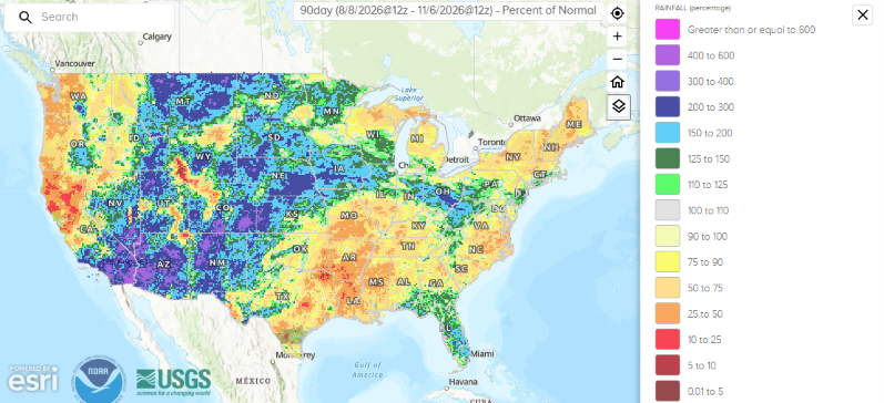
Much of the Four Corners and Intermountain West regions east into the upper Ohio Valley have seen much above normal precipitation over the last 3 months, along with Florida. Most of the rest of the country has been abnormally dry — even with some heavy rainfall this past week, the area from Texas to the Carolinas and Mid-Atlantic coast along with the upper Great Lakes, Northeast and much of the West Coast north of central California are well below normal for 90-day precipitation. The regions from south Texas to the Ozarks and Tennessee Valley as well as the West Coast are particularly dry, with large areas having received less than half of their normal precipitation.
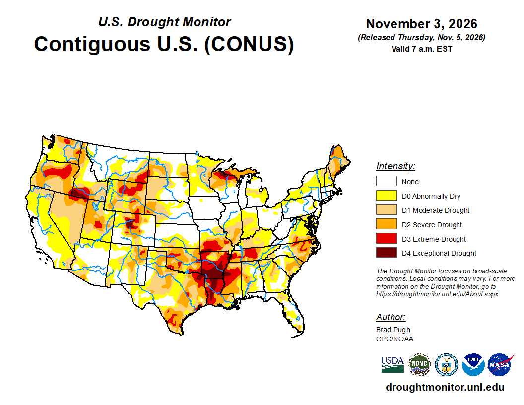
The most recent US Drought Monitor released Thursday shows the impacts of that ongoing below normal rainfall in the south-central United States, with widespread extreme to exceptional drought. Parts of the Carolinas and upper Great Lakes to Northeast are also suffering from severe to extreme drought. While the flooding rains have reduced the scale of drought in the Southwest, many areas of the Pacific Northwest and northern and central Rockies continue to see severe to extreme drought conditions.
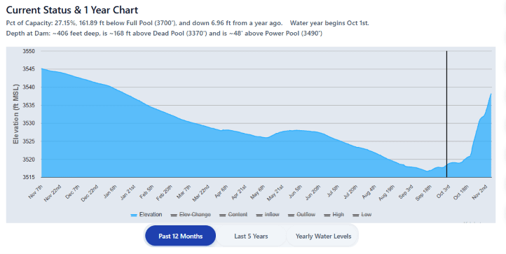
The flooding of rivers that run into the Colorado River is resulting in large — and very unusual for the time of year — surges in water levels for this parched basin, with Lake Powell up more than 13 feet in just the last two weeks. Even with this surge, though, the water level is still several feet lower than it was at this time last year due to the incredibly dry winter of 2025-6 — and of course the entire region continues to suffer from long term, chronic water shortages. Several scientists with a lot more expertise than me about this region have also pointed out that flooding brings huge amounts of sediment and debris into the river, which obviously brings its own problems. Bottom line: cycles of drought to historic flooding are suboptimal, particularly compared to normal springtime water level rises due to snowmelt.
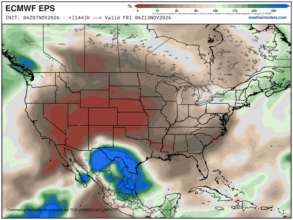
The next week look relatively inactive and dry for much of the country, with the exception of south Texas where a disturbance in the subtropical jetstream will bring some heavy rainfall and potential localized flash flooding this weekend.
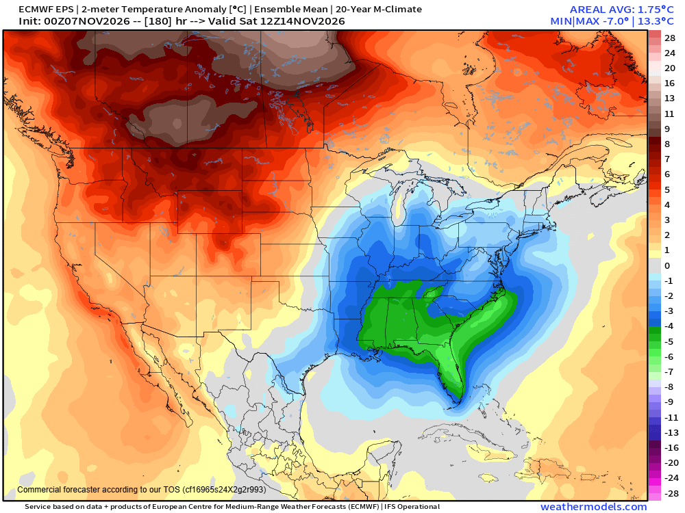
By late next week, an evolving upper level ridge of high pressure over the West and deep low pressure trough over the East will bring anomalous warmth and cold to these regions, respectively.
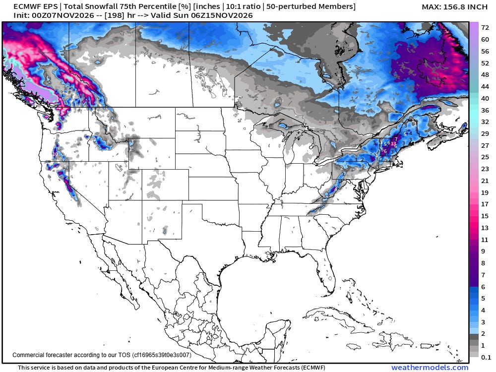
You may have heard some rumblings about a potential early season winter storm over the East by next weekend. While there are some signs in the models and forecast weather pattern, right now there is still a lot of uncertainty, and a reasonable high end snowfall forecast from the European ensemble model suggests that any significant snow would be confined to New England and higher elevations of the Appalachians. Obviously, this is something we will be keeping an eye on over the next several days.
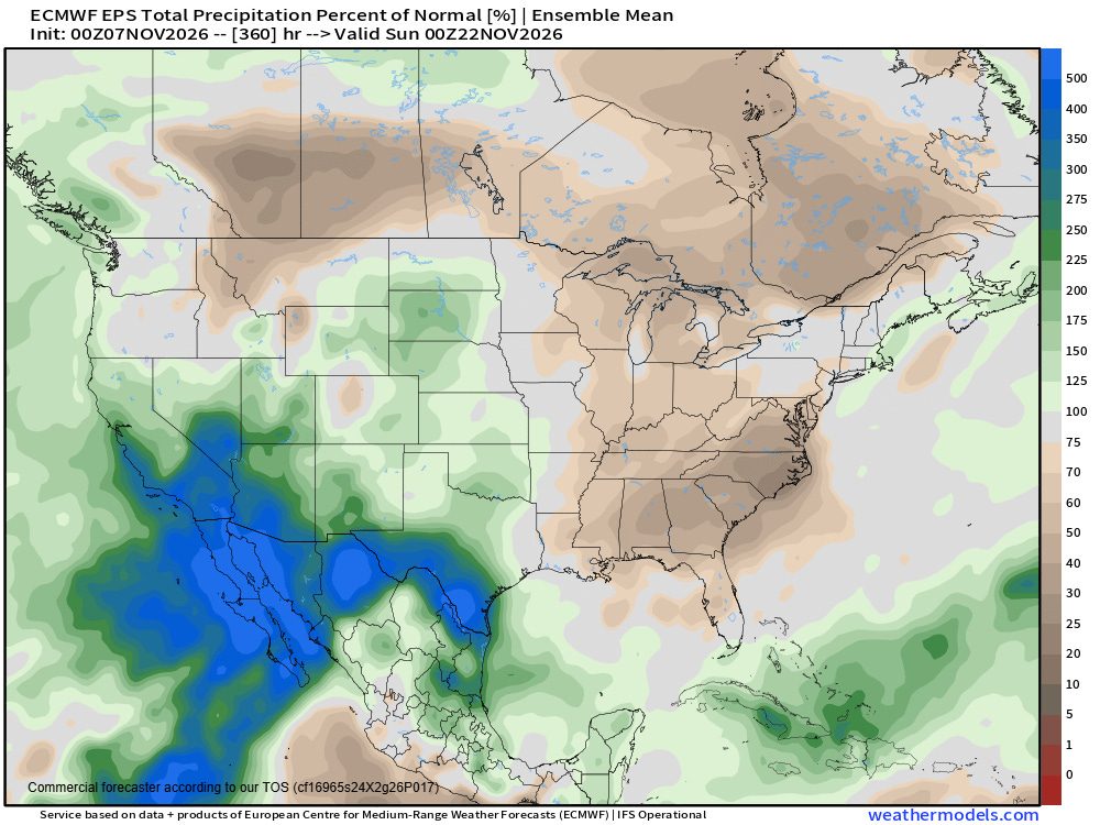
Long range models suggest an eventual return to the pattern of a wet Southwest and Intermountain West and dry Southeast and Great Lakes as we head toward the latter half of November.
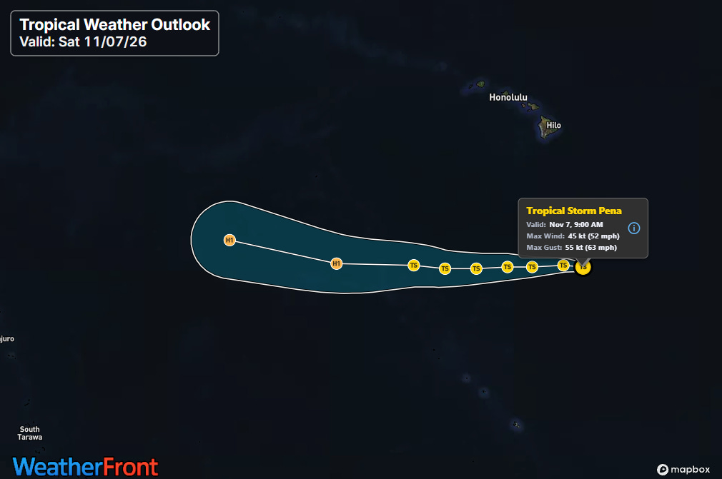
One final note for today is that we have yet another tropical storm in the central Pacific. Tropical Storm Pena developed yesterday and is located about 550 miles south of the southern tip of the Big Island of Hawai’i. It is expected to continue west well south of the islands — while NHC notes that the intensity forecast for Pena is lower confidence than normal, they do show it gradually strengthening to a hurricane as it approaches the International Date Line by the middle of next week.


Leave a Reply